Arkansas County Map
All 75 counties with county seats and major cities
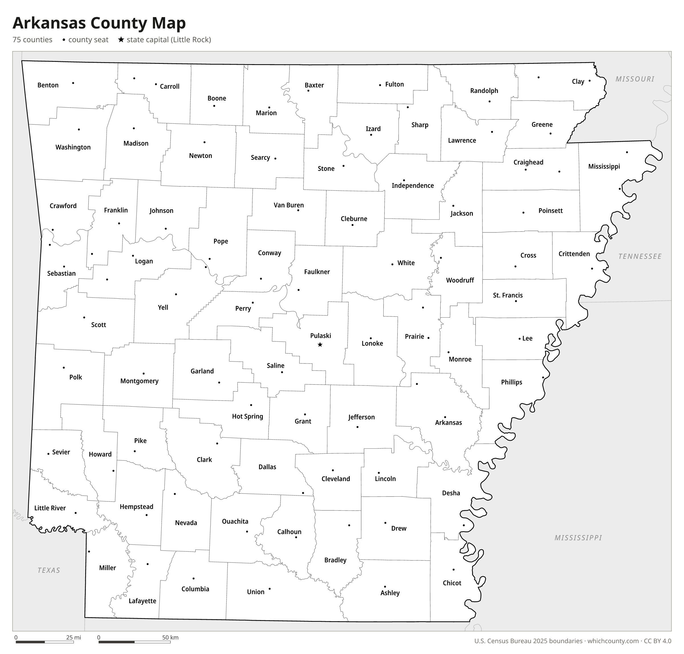
Arkansas has 75 counties, and Arkansas County, created in 1813, is older than the state itself. This map shows all 75 counties and their county seats. Tap a county for details, or download the free printable map below.

Updated October 4, 2026 · Boundaries: U.S. Census Bureau 2025 · Population: Census estimates for July 1, 2025
Arkansas county facts
- Number of counties
- 75
- Largest by land area
- Union County 1,039 sq mi
- Smallest by land area
- Lafayette County 529.5 sq mi
- Most people
- Pulaski County 404,611
- Fewest people
- Calhoun County 4,632
- Fastest growing since 2020
- Benton County +17%
- Highest median household income
- Benton County $93,506
- Oldest county
- Arkansas County est. 1813
- Newest county
- Cleburne County est. 1883
- State capital
- Little Rock Pulaski County
Ten counties have two county seats: Arkansas, Carroll, Clay, Craighead, Franklin, Logan, Mississippi, Prairie, Sebastian and Yell.
Miller County was first established in 1820 in an area also claimed by Mexico, abolished after Texas independence, and re-established in 1874 with Texarkana as county seat.
Logan County was first named Sarber County.
List of 75 Arkansas counties
Sorted A–Z. Click a column to sort, or a name to show it on the map. Download as CSV
| County | County seat | Population 2025 | Change since 2020 | Land area (sq mi) | Median income | Established | FIPS |
|---|---|---|---|---|---|---|---|
| Arkansas County | DeWitt, Stuttgart | 15,836 | −7.6% | 992 | $53,164 | 1813 | 05001 |
| Ashley County | Hamburg | 17,831 | −6.5% | 926 | $44,266 | 1848 | 05003 |
| Baxter County | Mountain Home | 42,982 | +3.2% | 554 | $48,452 | 1873 | 05005 |
| Benton County | Bentonville | 332,554 | +17% | 848 | $93,506 | 1836 | 05007 |
| Boone County | Harrison | 38,628 | +3.4% | 590 | $55,143 | 1869 | 05009 |
| Bradley County | Warren | 9,828 | −6.9% | 649 | $41,476 | 1840 | 05011 |
| Calhoun County | Hampton | 4,632 | −2.3% | 629 | $66,809 | 1850 | 05013 |
| Carroll County | Berryville, Eureka Springs | 29,263 | +3.6% | 630 | $54,230 | 1833 | 05015 |
| Chicot County | Lake Village | 9,107 | −10.8% | 637 | $39,045 | 1823 | 05017 |
| Clark County | Arkadelphia | 20,938 | −2.4% | 866 | $52,034 | 1818 | 05019 |
| Clay County | Corning, Piggott | 14,052 | −3.4% | 639 | $51,481 | 1873 | 05021 |
| Cleburne County | Heber Springs | 25,672 | +3.9% | 554 | $55,798 | 1883 | 05023 |
| Cleveland County | Rison | 7,224 | −4.3% | 598 | $54,794 | 1873 | 05025 |
| Columbia County | Magnolia | 21,894 | −4% | 766 | $55,334 | 1852 | 05027 |
| Conway County | Morrilton | 21,393 | +3.3% | 552 | $54,187 | 1825 | 05029 |
| Craighead County | Jonesboro, Lake City | 116,957 | +5.1% | 707 | $59,548 | 1859 | 05031 |
| Crawford County | Van Buren | 62,657 | +4.2% | 595 | $64,132 | 1820 | 05033 |
| Crittenden County | Marion | 46,210 | −4.1% | 612 | $55,358 | 1825 | 05035 |
| Cross County | Wynne | 16,186 | −3.9% | 616 | $50,863 | 1862 | 05037 |
| Dallas County | Fordyce | 6,011 | −7.2% | 667 | $42,500 | 1845 | 05039 |
| Desha County | Arkansas City | 9,984 | −12.4% | 741 | $37,662 | 1838 | 05041 |
| Drew County | Monticello | 17,054 | −1.7% | 829 | $42,824 | 1846 | 05043 |
| Faulkner County | Conway | 133,979 | +8.5% | 647 | $67,289 | 1873 | 05045 |
| Franklin County | Charleston, Ozark | 17,725 | +3.7% | 609 | $55,886 | 1837 | 05047 |
| Fulton County | Salem | 12,492 | +3.5% | 618 | $42,241 | 1842 | 05049 |
| Garland County | Hot Springs | 99,695 | −0.5% | 678 | $57,181 | 1873 | 05051 |
| Grant County | Sheridan | 18,756 | +4.4% | 632 | $71,549 | 1869 | 05053 |
| Greene County | Paragould | 47,411 | +3.7% | 577 | $57,839 | 1833 | 05055 |
| Hempstead County | Hope | 19,080 | −4.9% | 727 | $46,787 | 1818 | 05057 |
| Hot Spring County | Malvern | 33,451 | +1.2% | 615 | $55,405 | 1829 | 05059 |
| Howard County | Nashville | 12,306 | −3.8% | 587 | $45,603 | 1873 | 05061 |
| Independence County | Batesville | 38,785 | +2.3% | 764 | $56,609 | 1820 | 05063 |
| Izard County | Melbourne | 14,405 | +6.1% | 580 | $49,405 | 1825 | 05065 |
| Jackson County | Newport | 16,741 | −0.1% | 634 | $44,218 | 1829 | 05067 |
| Jefferson County | Pine Bluff | 62,987 | −6.3% | 872 | $51,096 | 1829 | 05069 |
| Johnson County | Clarksville | 26,225 | +1.9% | 661 | $45,995 | 1833 | 05071 |
| Lafayette County | Lewisville | 5,888 | −6.6% | 530 | $41,278 | 1827 | 05073 |
| Lawrence County | Walnut Ridge | 16,273 | +0.3% | 588 | $44,882 | 1815 | 05075 |
| Lee County | Marianna | 8,029 | −7.2% | 600 | $34,375 | 1873 | 05077 |
| Lincoln County | Star City | 12,764 | −1.4% | 560 | $51,778 | 1871 | 05079 |
| Little River County | Ashdown | 11,763 | −2.2% | 531 | $53,344 | 1867 | 05081 |
| Logan County | Booneville, Paris | 21,633 | +2.4% | 709 | $58,555 | 1871 | 05083 |
| Lonoke County | Lonoke | 76,664 | +3.6% | 772 | $72,828 | 1873 | 05085 |
| Madison County | Huntsville | 18,410 | +11.4% | 834 | $56,798 | 1836 | 05087 |
| Marion County | Yellville | 17,593 | +4.6% | 597 | $48,619 | 1835 | 05089 |
| Miller County | Texarkana | 42,357 | −0.6% | 624 | $48,836 | 1874 | 05091 |
| Mississippi County | Blytheville, Osceola | 37,828 | −7% | 902 | $52,548 | 1833 | 05093 |
| Monroe County | Clarendon | 6,244 | −8.1% | 608 | $43,214 | 1829 | 05095 |
| Montgomery County | Mount Ida | 8,579 | +1.2% | 781 | $48,906 | 1842 | 05097 |
| Nevada County | Prescott | 7,942 | −4.5% | 618 | $53,886 | 1871 | 05099 |
| Newton County | Jasper | 7,026 | −2.7% | 821 | $48,986 | 1842 | 05101 |
| Ouachita County | Camden | 21,731 | −4.1% | 733 | $49,268 | 1842 | 05103 |
| Perry County | Perryville | 10,309 | +2.9% | 551 | $55,764 | 1840 | 05105 |
| Phillips County | Helena-West Helena | 14,255 | −13.7% | 690 | $40,134 | 1820 | 05107 |
| Pike County | Murfreesboro | 9,964 | −2% | 600 | $49,269 | 1833 | 05109 |
| Poinsett County | Harrisburg | 22,483 | −2.1% | 758 | $46,707 | 1838 | 05111 |
| Polk County | Mena | 19,486 | +1.4% | 857 | $49,191 | 1844 | 05113 |
| Pope County | Russellville | 64,976 | +2.5% | 811 | $57,344 | 1829 | 05115 |
| Prairie County | DeValls Bluff, Des Arc | 7,923 | −4.4% | 648 | $51,646 | 1846 | 05117 |
| Pulaski County | Little Rock | 404,611 | +1.4% | 758 | $62,873 | 1818 | 05119 |
| Randolph County | Pocahontas | 18,876 | +1.6% | 652 | $50,911 | 1835 | 05121 |
| Saline County | Benton | 133,288 | +8% | 724 | $79,046 | 1835 | 05125 |
| Scott County | Waldron | 9,965 | +1.4% | 893 | $43,270 | 1833 | 05127 |
| Searcy County | Marshall | 7,848 | +0.2% | 666 | $44,426 | 1838 | 05129 |
| Sebastian County | Fort Smith, Greenwood | 130,641 | +2.2% | 531 | $57,790 | 1851 | 05131 |
| Sevier County | De Queen | 15,758 | −0.5% | 564 | $53,527 | 1828 | 05133 |
| Sharp County | Ash Flat | 18,122 | +4.9% | 605 | $44,637 | 1868 | 05135 |
| St. Francis County | Forrest City | 21,800 | −5.6% | 635 | $42,574 | 1827 | 05123 |
| Stone County | Mountain View | 12,703 | +2.8% | 606 | $40,943 | 1873 | 05137 |
| Union County | El Dorado | 36,926 | −5.5% | 1,039 | $55,259 | 1829 | 05139 |
| Van Buren County | Clinton | 16,238 | +2.8% | 710 | $50,354 | 1833 | 05141 |
| Washington County | Fayetteville | 271,213 | +10.3% | 942 | $70,639 | 1828 | 05143 |
| White County | Searcy | 80,085 | +4.2% | 1,034 | $55,249 | 1835 | 05145 |
| Woodruff County | Augusta | 5,710 | −8.9% | 586 | $48,158 | 1862 | 05147 |
| Yell County | Danville, Dardanelle | 19,956 | −1.5% | 930 | $55,934 | 1840 | 05149 |
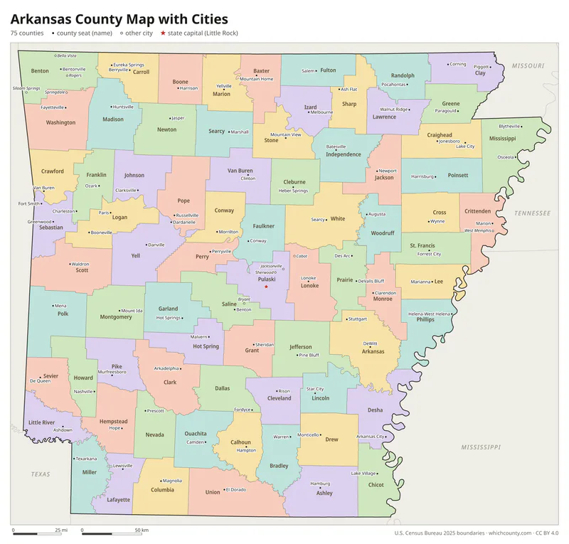
Arkansas county map with cities
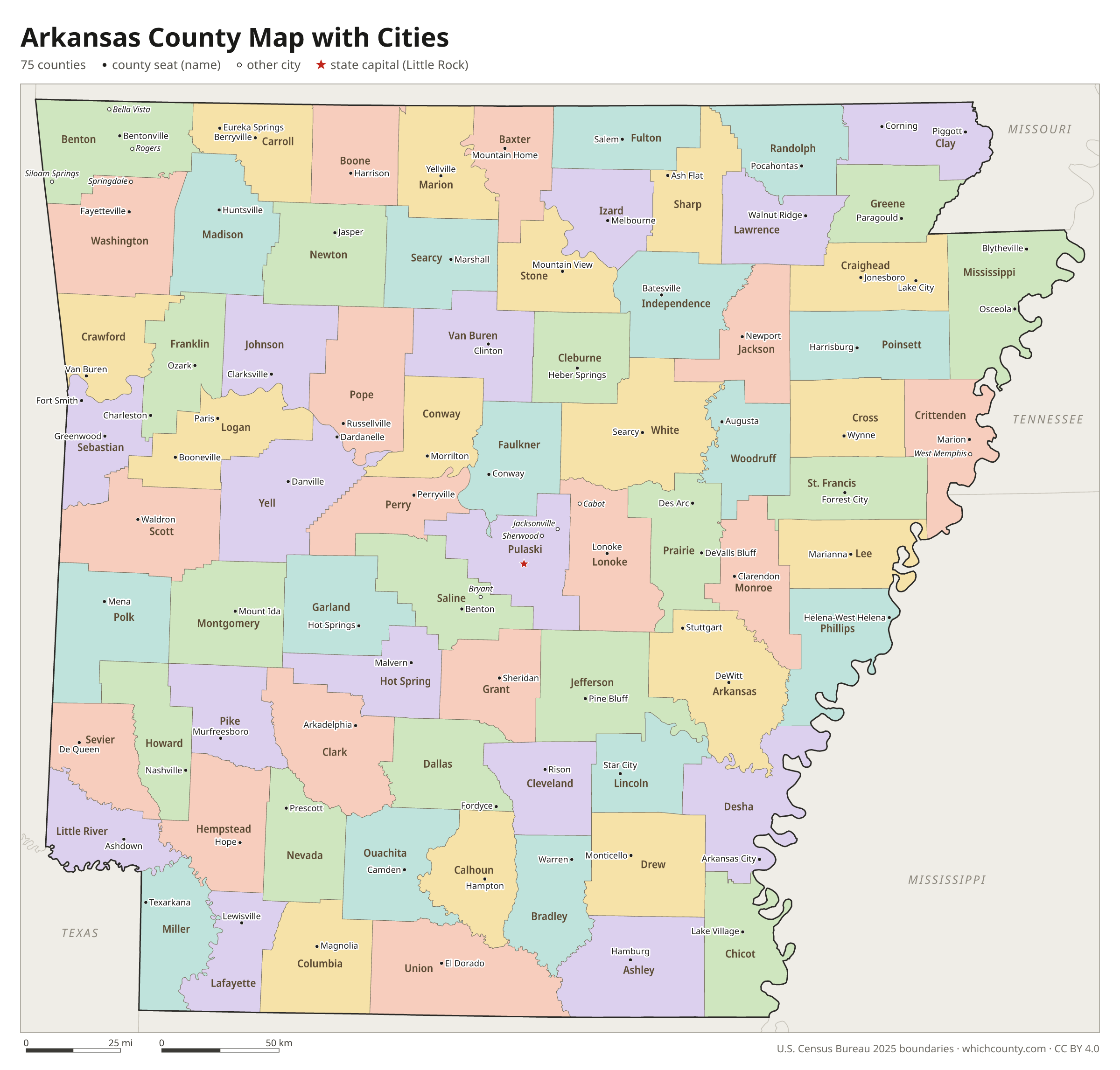
The largest cities in Arkansas and the counties they are in. Cities that cross a county line list every county, the main one first. To find any smaller town, use the search box above.
| City | County | Population 2025 |
|---|---|---|
| Little Rock | Pulaski County | 206,427 |
| Fayetteville | Washington County | 106,623 |
| Fort Smith | Sebastian County | 90,855 |
| Springdale | Washington and Benton counties | 90,685 |
| Jonesboro | Craighead County | 83,296 |
| Rogers | Benton County | 76,956 |
| Conway | Faulkner County | 72,328 |
| North Little Rock | Pulaski County | 65,120 |
| Bentonville | Benton County | 63,057 |
| Benton | Saline County | 38,898 |
| Pine Bluff | Jefferson County | 38,213 |
| Hot Springs | Garland County | 37,979 |
| Bella Vista | Benton County | 34,518 |
| Sherwood | Pulaski County | 33,620 |
| Paragould | Greene County | 31,135 |
| Russellville | Pope County | 29,521 |
| Jacksonville | Pulaski County | 29,460 |
| Texarkana | Miller County | 29,123 |
| Cabot | Lonoke County | 27,711 |
| Centerton | Benton County | 27,176 |
| Van Buren | Crawford County | 24,556 |
| Searcy | White County | 24,351 |
| West Memphis | Crittenden County | 23,336 |
| Bryant | Saline County | 22,815 |
| Siloam Springs | Benton County | 21,298 |
| Maumelle | Pulaski County | 19,780 |
| El Dorado | Union County | 16,609 |
| Harrison | Boone County | 13,802 |
| Marion | Crittenden County | 13,378 |
| Mountain Home | Baxter County | 13,373 |
Printable Arkansas county maps (free PDF, PNG, SVG)
Every map is free to print and share. The PDFs are vector files with real text, so they stay sharp at any size and you can search them for a county name. Use 11×17 (tabloid) for the most readable labels.
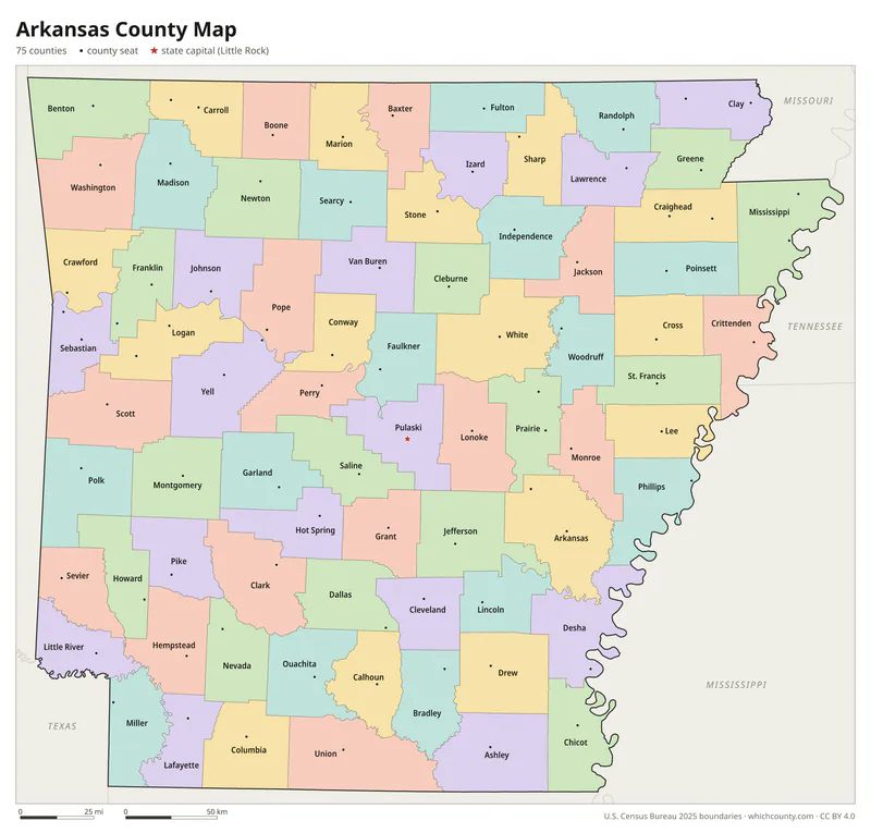
Color map with names
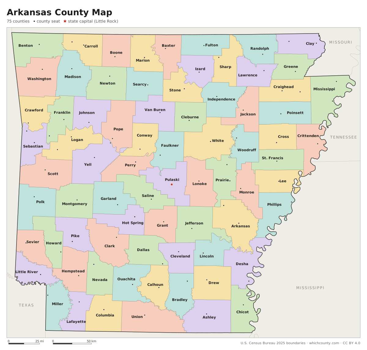
All 75 counties labeled, county seats marked. Letter and 11×17 PDF, high-resolution PNG, editable SVG.
Map with cities
Counties with their county seat towns and major cities.
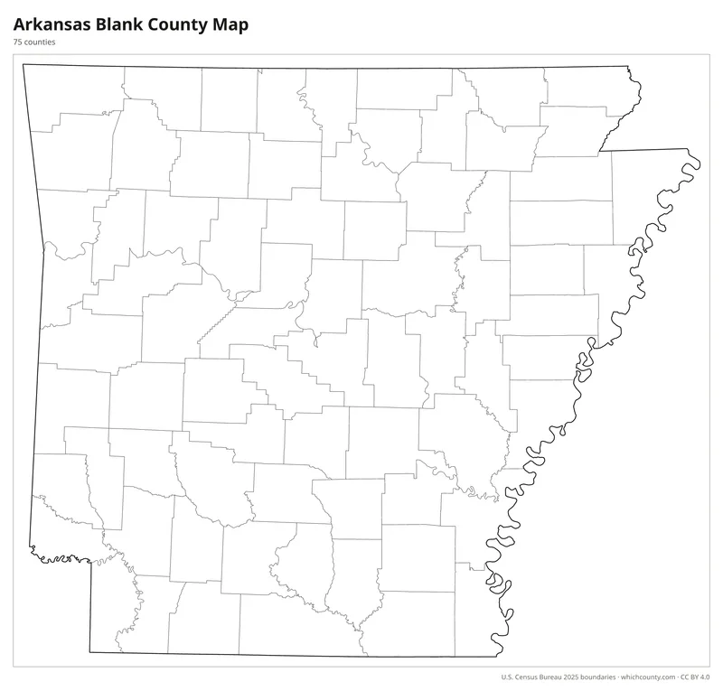
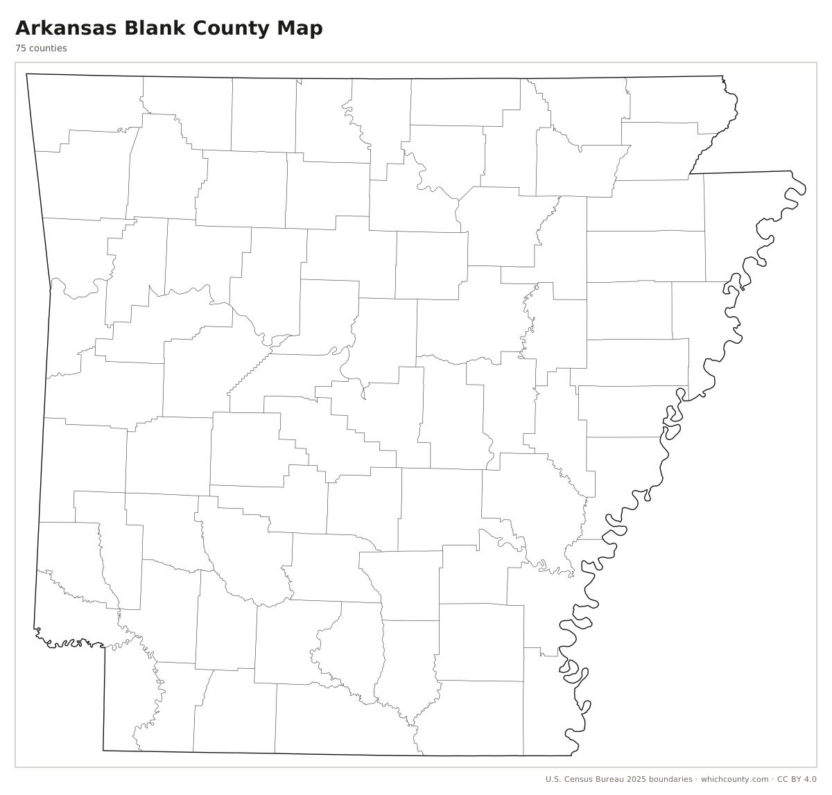
Blank outline map
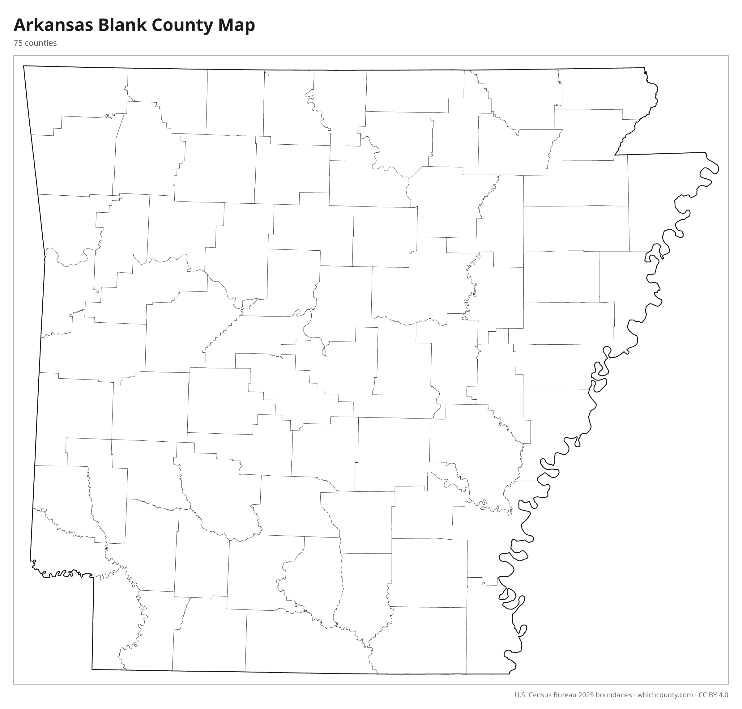
County lines only, no names. For quizzes, coloring and your own notes.
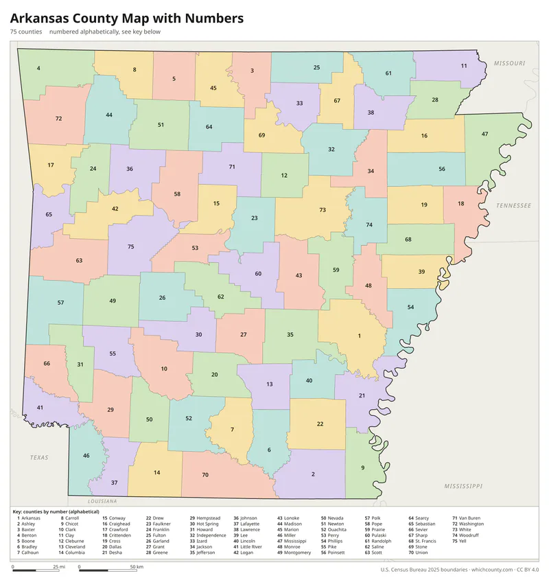
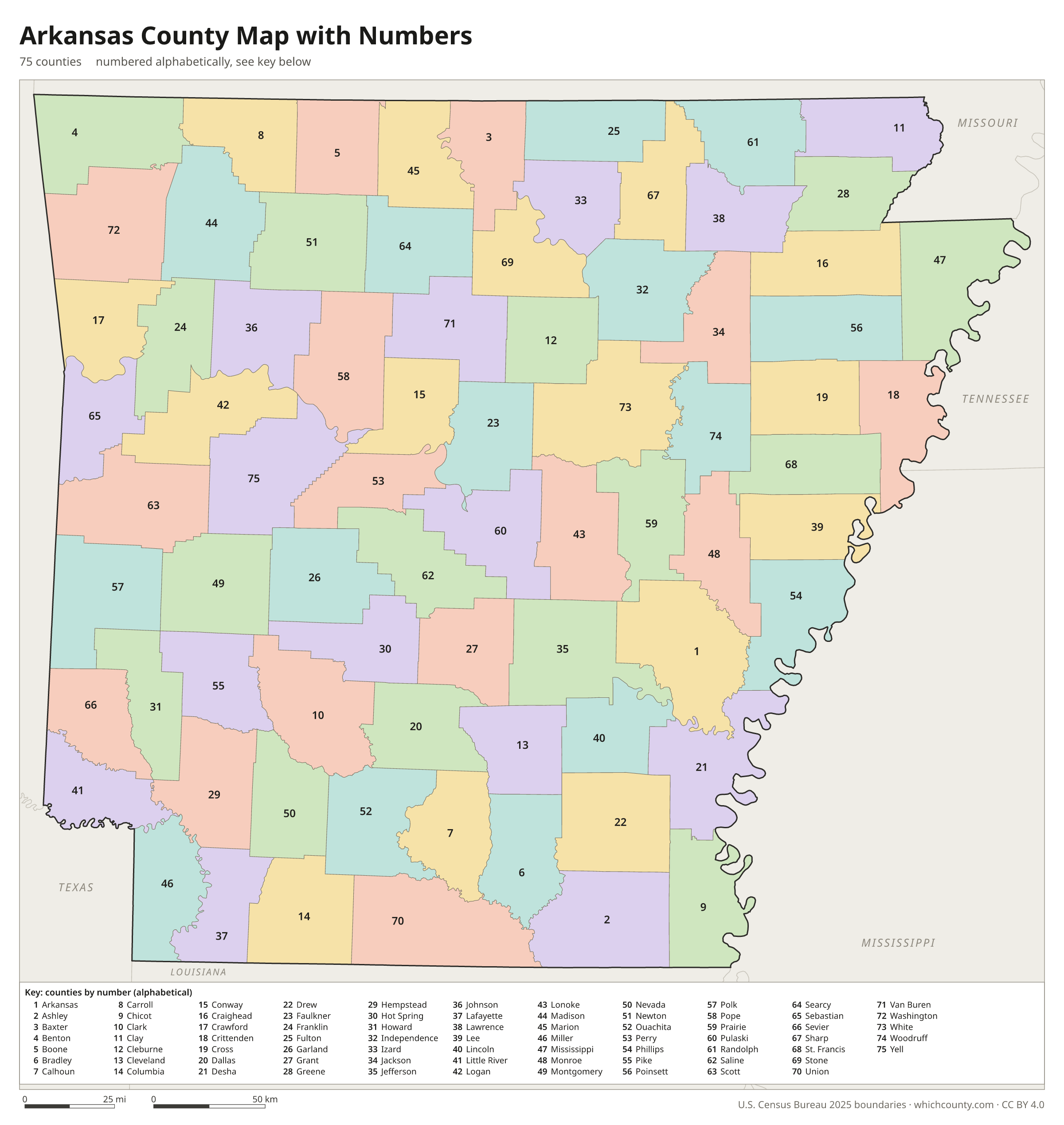
Numbered map with key
A number in every county with an alphabetical key.
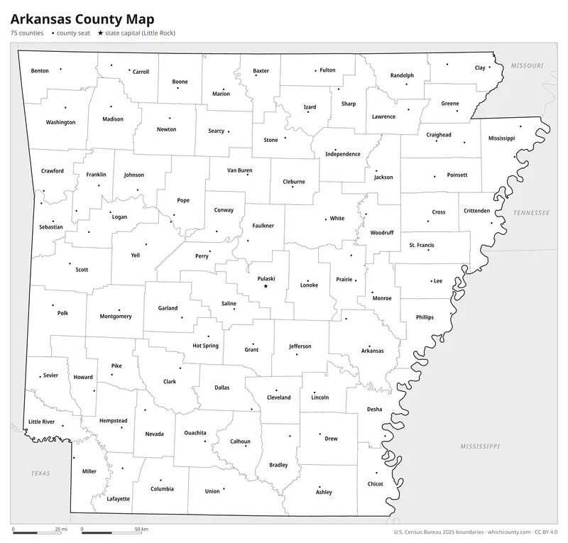
Black and white
Labeled map that prints well on any printer.
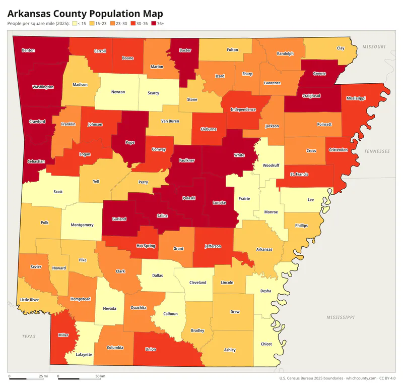
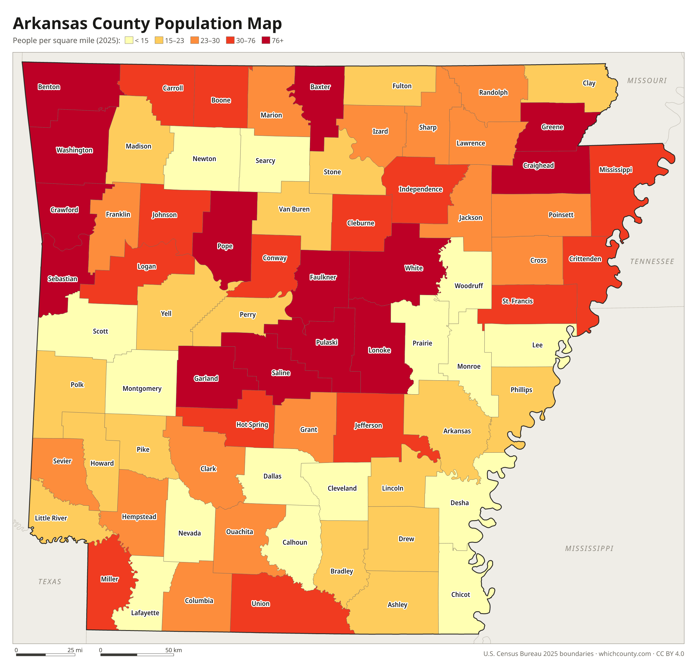
Population map
Counties shaded by population density (2025 estimates).
Data and GIS files
The county table as CSV, and the boundaries as GeoJSON and KML (Google Earth, Google My Maps).
Where Arkansas's 75 counties came from
Arkansas County came first. The Missouri Territory legislature created it in 1813, and it covered about two-thirds of present Arkansas plus part of eastern Oklahoma. More than half of today's counties were later formed from it. Arkansas Territory started with five counties, and they were divided into smaller and smaller units as the population grew. The 1874 constitution, still in force, set limits: a new county needs at least 600 square miles and 5,000 inhabitants, and land can move to another county only with the consent of a majority of the voters living on it. In 1883, after ten years without a new county, the legislature formed Cleburne County, the last one created. The Encyclopedia of Arkansas explains the state's dual county seats as a response to travel problems, for example in counties split by a river.
County numbers: The Department of Finance and Administration numbers the counties 01–75 in alphabetical order for sales and use tax codes.
County maps of neighboring states
 Louisiana county map
 Mississippi county map
 Missouri county map
 Oklahoma county map
 Tennessee county map
 Texas county map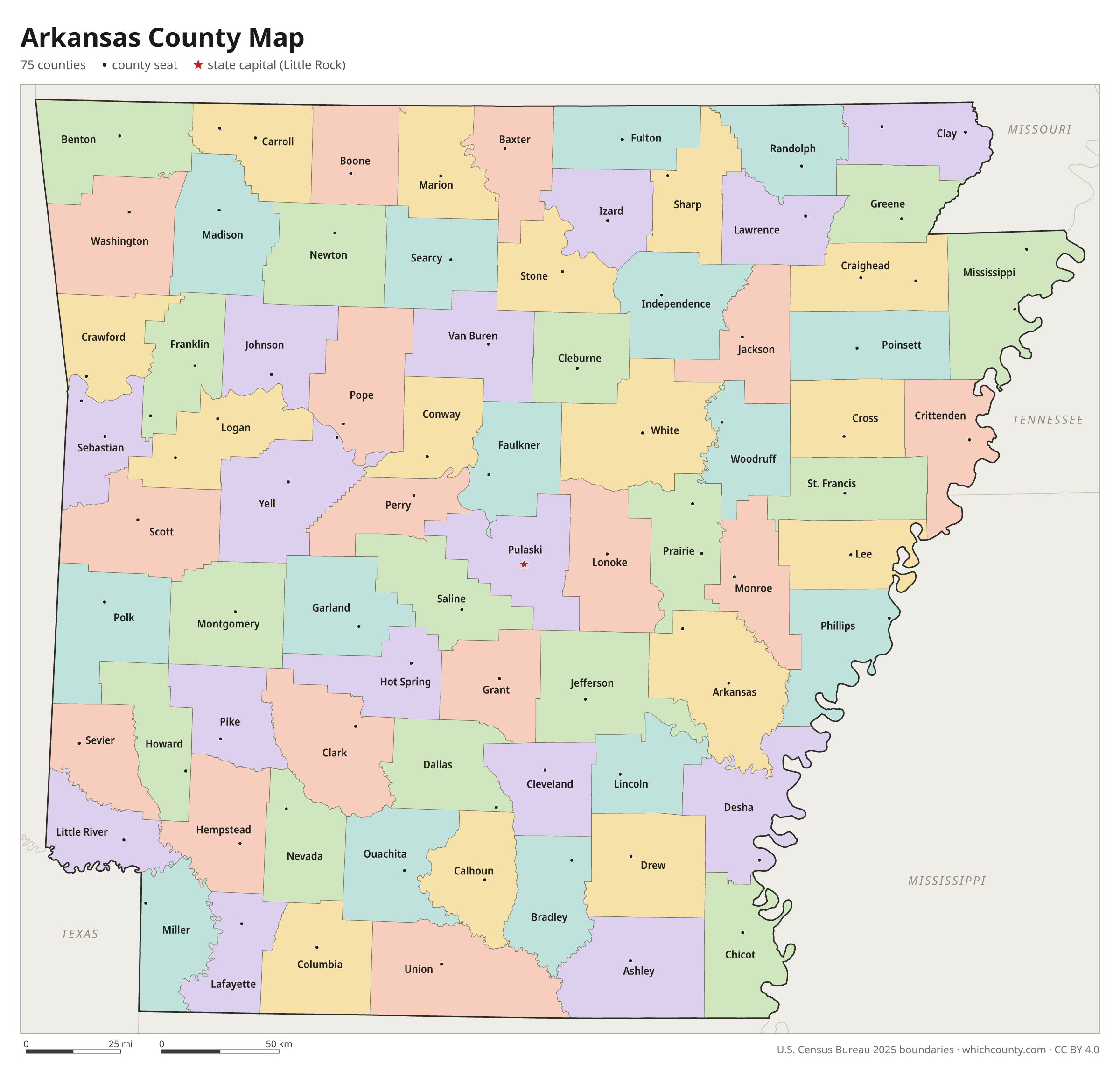
Arkansas counties: questions and answers
- How many counties are in Arkansas?
- Arkansas has 75 counties.
- What is the largest county in Arkansas?
- By land area, Union County is the largest (1,039 sq mi). By population, Pulaski County is the largest, with 404,611 people (2025 estimate).
- What is the smallest county in Arkansas?
- Lafayette County is the smallest by land area (529.5 sq mi). Calhoun County has the fewest people: 4,632 (2025 estimate).
- What is the wealthiest county in Arkansas?
- By median household income, Benton County ranks first with $93,506 (American Community Survey 2020–2024). The lowest is Lee County at $34,375.
- What county is Little Rock in?
- Little Rock is in Pulaski County.
- What county is Fayetteville in?
- Fayetteville is in Washington County.
- What county is Fort Smith in?
- Fort Smith is in Sebastian County.
- How can I see county lines on Google Maps?
- Google Maps does not draw county lines. Download the KML file from the printable maps section above and import it into Google My Maps (Create a new map › Import) or open it in Google Earth to see every Arkansas county boundary on top of Google's map.
- Can I use this map for free?
- Yes. The maps and files on this page are free to print, share and use in your own work, including commercial projects, under the CC BY 4.0 licence. Please credit “WhichCounty (whichcounty.com)”.
Use this map on your site
You may copy, print and publish these maps, also commercially, as long as you credit WhichCounty with a link (licence details). Paste this code to embed the map:
Sources and methodology
- Boundaries: U.S. Census Bureau, 2025 Cartographic Boundary Files (1:500,000), simplified for display. Projection: Lambert conformal conic fitted to Arkansas.
- Population: Census Bureau county estimates, Vintage 2025 (July 1, 2025), compared with the April 1, 2020 estimates base.
- Land area: Census Bureau 2026 Gazetteer files. Median household income: American Community Survey 2020–2024 5-year estimates.
- County seats and founding years: Wikidata (CC0), checked against state lists by WhichCounty. Cities: Census Bureau city and town estimates, Vintage 2025.
- Counties (CALS Encyclopedia of Arkansas)
- Arkansas County (CALS Encyclopedia of Arkansas)
- Cleburne County (CALS Encyclopedia of Arkansas)
- Miller County (CALS Encyclopedia of Arkansas)
- Atlas of Historical County Boundaries: Arkansas (Newberry Library)
Found an error? Tell us. Last data update: October 4, 2026.