North Carolina County Map
All 100 counties with county seats and major cities
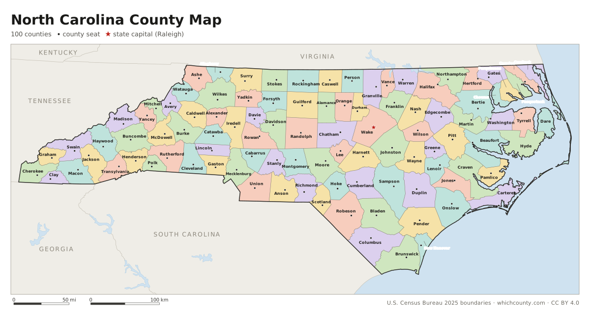
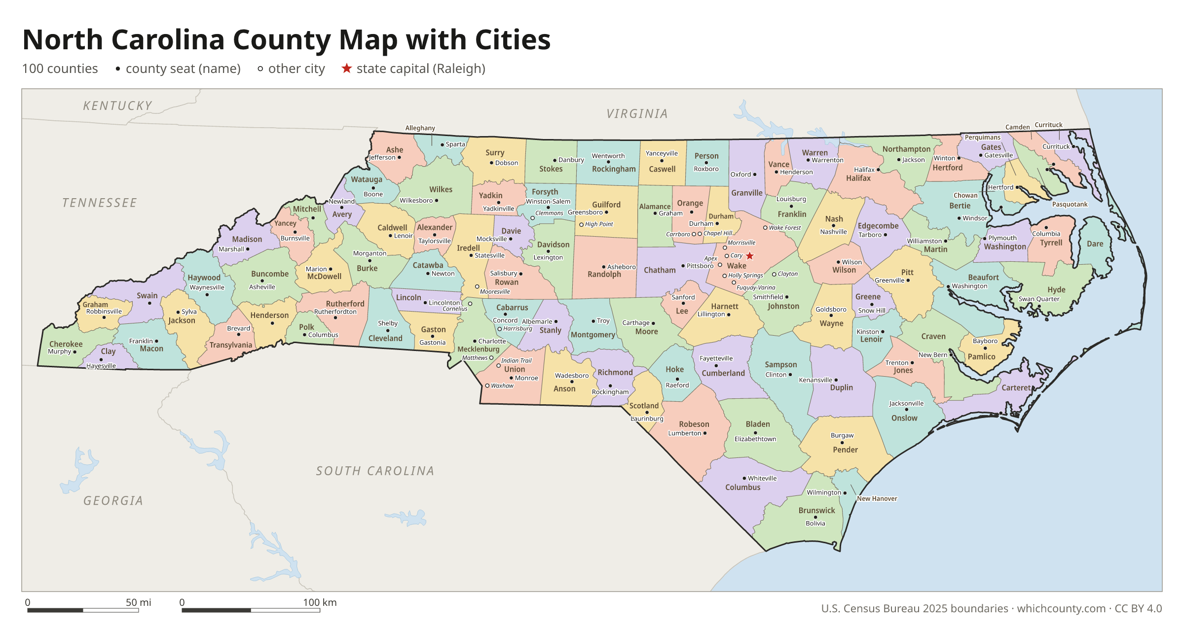
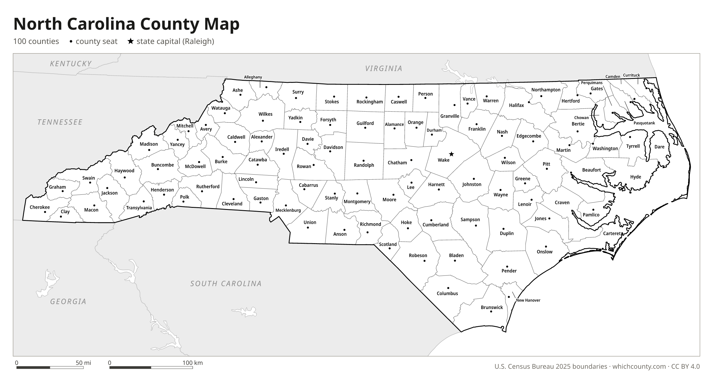
North Carolina has 100 counties, the eighth-highest number of any state. This map shows all 100 counties and their county seats. Tap a county for details, or download the free printable map below.

Updated October 4, 2026 · Boundaries: U.S. Census Bureau 2025 · Population: Census estimates for July 1, 2025
North Carolina county facts
- Number of counties
- 100
- Largest by land area
- Robeson County 947 sq mi
- Smallest by land area
- Chowan County 172.7 sq mi
- Most people
- Wake County 1,257,235
- Fewest people
- Tyrrell County 3,537
- Fastest growing since 2020
- Brunswick County +27.8%
- Highest median household income
- Wake County $105,768
- Oldest county
- Craven County est. 1705
- Newest county
- Avery County est. 1911
- State capital
- Raleigh Wake County
List of 100 North Carolina counties
Sorted A–Z. Click a column to sort, or a name to show it on the map. Download as CSV
| County | County seat | Population 2025 | Change since 2020 | Land area (sq mi) | Median income | Established | FIPS |
|---|---|---|---|---|---|---|---|
| Alamance County | Graham | 186,177 | +8.6% | 424 | $65,651 | 1849 | 37001 |
| Alexander County | Taylorsville | 36,958 | +1.4% | 260 | $65,354 | 1847 | 37003 |
| Alleghany County | Sparta | 11,479 | +5.5% | 235 | $47,172 | 1859 | 37005 |
| Anson County | Wadesboro | 21,758 | −1.4% | 532 | $47,302 | 1750 | 37007 |
| Ashe County | Jefferson | 27,514 | +3.5% | 426 | $56,866 | 1799 | 37009 |
| Avery County | Newland | 18,110 | +1.7% | 247 | $61,428 | 1911 | 37011 |
| Beaufort County | Washington | 44,670 | +0% | 833 | $58,357 | – | 37013 |
| Bertie County | Windsor | 17,086 | −4.7% | 699 | $48,750 | 1722 | 37015 |
| Bladen County | Elizabethtown | 30,007 | +1.3% | 875 | $42,422 | 1734 | 37017 |
| Brunswick County | Bolivia | 174,702 | +27.8% | 850 | $77,024 | 1764 | 37019 |
| Buncombe County | Asheville | 277,417 | +3% | 657 | $74,436 | 1791 | 37021 |
| Burke County | Morganton | 88,655 | +1.2% | 506 | $58,592 | 1777 | 37023 |
| Cabarrus County | Concord | 249,725 | +10.6% | 361 | $89,005 | 1792 | 37025 |
| Caldwell County | Lenoir | 81,105 | +0.5% | 472 | $56,425 | 1841 | 37027 |
| Camden County | Camden | 11,315 | +9.3% | 240 | $91,078 | 1777 | 37029 |
| Carteret County | Beaufort | 70,469 | +4.1% | 508 | $72,322 | 1722 | 37031 |
| Caswell County | Yanceyville | 22,563 | −0.8% | 426 | $59,755 | 1777 | 37033 |
| Catawba County | Newton | 170,172 | +5.9% | 401 | $67,864 | 1842 | 37035 |
| Chatham County | Pittsboro | 85,111 | +11.6% | 682 | $94,317 | 1771 | 37037 |
| Cherokee County | Murphy | 30,830 | +7.2% | 456 | $53,628 | 1839 | 37039 |
| Chowan County | Edenton | 14,082 | +2.7% | 173 | $53,864 | – | 37041 |
| Clay County | Hayesville | 12,239 | +10.4% | 215 | $56,971 | 1861 | 37043 |
| Cleveland County | Shelby | 103,325 | +3.8% | 464 | $58,534 | 1841 | 37045 |
| Columbus County | Whiteville | 50,487 | −0.3% | 938 | $49,442 | 1808 | 37047 |
| Craven County | New Bern | 105,025 | +4.3% | 707 | $65,873 | 1705 | 37049 |
| Cumberland County | Fayetteville | 338,473 | +1.1% | 653 | $61,291 | 1754 | 37051 |
| Currituck County | Currituck | 33,158 | +18% | 262 | $93,511 | – | 37053 |
| Dare County | Manteo | 38,245 | +3.6% | 383 | $88,994 | 1870 | 37055 |
| Davidson County | Lexington | 180,182 | +6.7% | 553 | $64,172 | 1822 | 37057 |
| Davie County | Mocksville | 45,855 | +7.3% | 264 | $75,057 | 1836 | 37059 |
| Duplin County | Kenansville | 51,571 | +5.9% | 815 | $55,148 | 1750 | 37061 |
| Durham County | Durham | 347,240 | +6.9% | 288 | $82,316 | 1881 | 37063 |
| Edgecombe County | Tarboro | 49,121 | +0.5% | 505 | $51,265 | 1741 | 37065 |
| Forsyth County | Winston-Salem | 401,718 | +5% | 408 | $67,165 | 1849 | 37067 |
| Franklin County | Louisburg | 82,037 | +19.5% | 492 | $74,240 | 1779 | 37069 |
| Gaston County | Gastonia | 246,558 | +8.2% | 356 | $67,478 | 1846 | 37071 |
| Gates County | Gatesville | 10,234 | −2.3% | 341 | $66,333 | 1779 | 37073 |
| Graham County | Robbinsville | 8,190 | +2% | 292 | $49,684 | 1872 | 37075 |
| Granville County | Oxford | 61,421 | +0.7% | 532 | $71,111 | 1746 | 37077 |
| Greene County | Snow Hill | 20,700 | +1.2% | 267 | $53,244 | – | 37079 |
| Guilford County | Greensboro | 562,234 | +3.9% | 646 | $68,642 | 1771 | 37081 |
| Halifax County | Halifax | 46,534 | −4.3% | 724 | $45,590 | 1758 | 37083 |
| Harnett County | Lillington | 150,137 | +12.4% | 595 | $71,287 | 1855 | 37085 |
| Haywood County | Waynesville | 63,369 | +2.1% | 554 | $61,912 | 1808 | 37087 |
| Henderson County | Hendersonville | 122,375 | +5.2% | 373 | $68,187 | 1838 | 37089 |
| Hertford County | Winton | 19,015 | −11.8% | 353 | $45,537 | 1759 | 37091 |
| Hoke County | Raeford | 56,939 | +9.3% | 390 | $64,912 | 1911 | 37093 |
| Hyde County | Swan Quarter | 4,554 | −0.7% | 612 | $53,713 | – | 37095 |
| Iredell County | Statesville | 211,798 | +13.5% | 575 | $81,419 | 1788 | 37097 |
| Jackson County | Sylva | 45,039 | +4.5% | 491 | $55,815 | 1851 | 37099 |
| Johnston County | Smithfield | 256,448 | +18.7% | 792 | $83,384 | 1746 | 37101 |
| Jones County | Trenton | 9,575 | +4.4% | 471 | $59,641 | 1779 | 37103 |
| Lee County | Sanford | 70,258 | +11% | 255 | $65,387 | 1907 | 37105 |
| Lenoir County | Kinston | 55,837 | +1.3% | 399 | $45,143 | 1791 | 37107 |
| Lincoln County | Lincolnton | 98,654 | +13.7% | 296 | $80,016 | 1779 | 37109 |
| Macon County | Franklin | 39,232 | +6% | 516 | $59,061 | 1828 | 37113 |
| Madison County | Marshall | 22,553 | +6.4% | 450 | $58,531 | 1851 | 37115 |
| Martin County | Williamston | 21,601 | −2% | 456 | $48,578 | 1774 | 37117 |
| McDowell County | Marion | 45,198 | +1.4% | 440 | $57,168 | 1842 | 37111 |
| Mecklenburg County | Charlotte | 1,233,383 | +10.6% | 524 | $87,005 | 1762 | 37119 |
| Mitchell County | Bakersville | 15,062 | +1.1% | 221 | $57,602 | 1861 | 37121 |
| Montgomery County | Troy | 26,403 | +2.6% | 492 | $57,766 | 1779 | 37123 |
| Moore County | Carthage | 110,619 | +10.9% | 698 | $86,080 | 1784 | 37125 |
| Nash County | Nashville | 99,365 | +4.7% | 540 | $62,426 | 1777 | 37127 |
| New Hanover County | Wilmington | 245,959 | +9% | 192 | $75,166 | 1729 | 37129 |
| Northampton County | Jackson | 16,491 | −5.6% | 537 | $50,086 | 1741 | 37131 |
| Onslow County | Jacksonville | 217,175 | +6.2% | 762 | $68,148 | 1734 | 37133 |
| Orange County | Hillsborough | 152,498 | +2.6% | 398 | $90,089 | 1752 | 37135 |
| Pamlico County | Bayboro | 12,758 | +4% | 337 | $59,717 | 1872 | 37137 |
| Pasquotank County | Elizabeth City | 42,201 | +4% | 227 | $66,589 | – | 37139 |
| Pender County | Burgaw | 72,111 | +19.8% | 871 | $80,396 | 1875 | 37141 |
| Perquimans County | Hertford | 13,490 | +3.7% | 247 | $67,917 | – | 37143 |
| Person County | Roxboro | 40,636 | +4% | 392 | $63,300 | 1791 | 37145 |
| Pitt County | Greenville | 182,936 | +6.5% | 652 | $58,188 | 1760 | 37147 |
| Polk County | Columbus | 20,533 | +6.3% | 238 | $67,758 | 1855 | 37149 |
| Randolph County | Asheboro | 149,516 | +3.7% | 782 | $61,022 | 1779 | 37151 |
| Richmond County | Rockingham | 42,041 | −2.1% | 474 | $44,883 | 1779 | 37153 |
| Robeson County | Lumberton | 119,941 | +2.9% | 947 | $41,978 | 1787 | 37155 |
| Rockingham County | Wentworth | 94,195 | +3.4% | 566 | $57,053 | 1785 | 37157 |
| Rowan County | Salisbury | 155,096 | +5.6% | 512 | $65,725 | 1753 | 37159 |
| Rutherford County | Rutherfordton | 65,745 | +2% | 565 | $51,410 | 1779 | 37161 |
| Sampson County | Clinton | 61,504 | +4.2% | 946 | $52,432 | 1784 | 37163 |
| Scotland County | Laurinburg | 33,322 | −2.5% | 319 | $45,730 | – | 37165 |
| Stanly County | Albemarle | 68,830 | +10.1% | 395 | $60,704 | 1841 | 37167 |
| Stokes County | Danbury | 46,126 | +3.6% | 449 | $62,969 | 1789 | 37169 |
| Surry County | Dobson | 72,287 | +1.3% | 533 | $55,656 | 1771 | 37171 |
| Swain County | Bryson City | 14,024 | −0.6% | 528 | $52,349 | 1871 | 37173 |
| Transylvania County | Brevard | 34,211 | +3.7% | 378 | $66,184 | 1861 | 37175 |
| Tyrrell County | Columbia | 3,537 | +9% | 391 | $41,685 | 1729 | 37177 |
| Union County | Monroe | 267,674 | +12.4% | 633 | $102,900 | 1842 | 37179 |
| Vance County | Henderson | 42,638 | +0.1% | 252 | $50,465 | 1881 | 37181 |
| Wake County | Raleigh | 1,257,235 | +11.3% | 835 | $105,768 | 1771 | 37183 |
| Warren County | Warrenton | 18,898 | +1.4% | 429 | $50,638 | 1779 | 37185 |
| Washington County | Plymouth | 10,638 | −3.3% | 347 | $41,813 | 1799 | 37187 |
| Watauga County | Boone | 54,786 | +1.3% | 312 | $51,693 | 1849 | 37189 |
| Wayne County | Goldsboro | 122,278 | +4.2% | 554 | $59,733 | 1779 | 37191 |
| Wilkes County | Wilkesboro | 66,233 | +0.4% | 754 | $51,721 | 1778 | 37193 |
| Wilson County | Wilson | 81,150 | +2.4% | 368 | $56,423 | 1855 | 37195 |
| Yadkin County | Yadkinville | 38,325 | +3% | 335 | $62,932 | 1850 | 37197 |
| Yancey County | Burnsville | 19,084 | +3.3% | 313 | $58,709 | 1833 | 37199 |
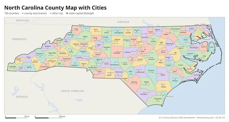
North Carolina county map with cities
The largest cities in North Carolina and the counties they are in. Cities that cross a county line list every county, the main one first. To find any smaller town, use the search box above.
| City | County | Population 2025 |
|---|---|---|
| Charlotte | Mecklenburg County | 964,784 |
| Raleigh | Wake and Durham counties | 506,306 |
| Greensboro | Guilford County | 308,667 |
| Durham | Durham, Wake and Orange counties | 305,561 |
| Winston-Salem | Forsyth County | 257,271 |
| Fayetteville | Cumberland County | 209,120 |
| Cary | Wake, Chatham and Durham counties | 183,582 |
| Wilmington | New Hanover County | 126,809 |
| High Point | Guilford, Davidson, Forsyth and Randolph counties | 120,571 |
| Concord | Cabarrus and Mecklenburg counties | 114,598 |
| Greenville | Pitt County | 96,443 |
| Asheville | Buncombe County | 93,523 |
| Gastonia | Gaston County | 87,067 |
| Apex | Wake and Chatham counties | 80,419 |
| Jacksonville | Onslow County | 72,732 |
| Huntersville | Mecklenburg County | 68,535 |
| Chapel Hill | Orange and Durham counties | 63,565 |
| Kannapolis | Cabarrus and Rowan counties | 61,708 |
| Burlington | Alamance and Guilford counties | 61,496 |
| Wake Forest | Wake and Franklin counties | 58,147 |
| Mooresville | Iredell County | 55,842 |
| Rocky Mount | Nash and Edgecombe counties | 55,120 |
| Holly Springs | Wake County | 50,288 |
| Wilson | Wilson County | 49,572 |
| Fuquay-Varina | Wake and Harnett counties | 48,536 |
| Hickory | Catawba, Burke and Caldwell counties | 45,975 |
| Indian Trail | Union County | 44,303 |
| Monroe | Union County | 42,644 |
| Garner | Wake County | 41,562 |
| Salisbury | Rowan County | 36,879 |
Printable North Carolina county maps (free PDF, PNG, SVG)
Every map is free to print and share. The PDFs are vector files with real text, so they stay sharp at any size and you can search them for a county name. Use 11×17 (tabloid) for the most readable labels.
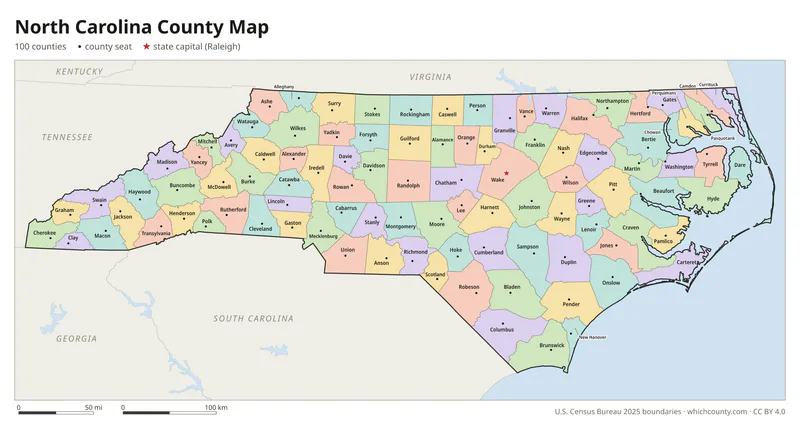
Color map with names
All 100 counties labeled, county seats marked. Letter and 11×17 PDF, high-resolution PNG, editable SVG.
Map with cities
Counties with their county seat towns and major cities.
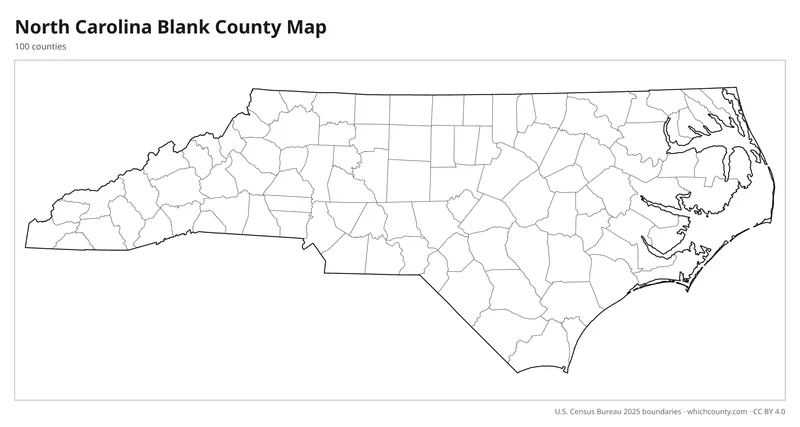
Blank outline map
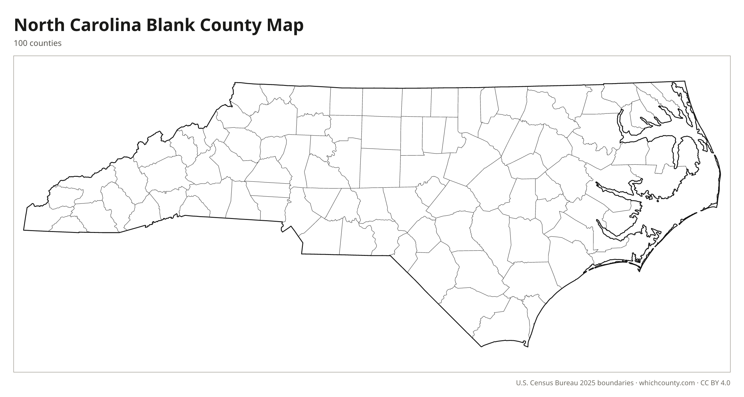
County lines only, no names. For quizzes, coloring and your own notes.
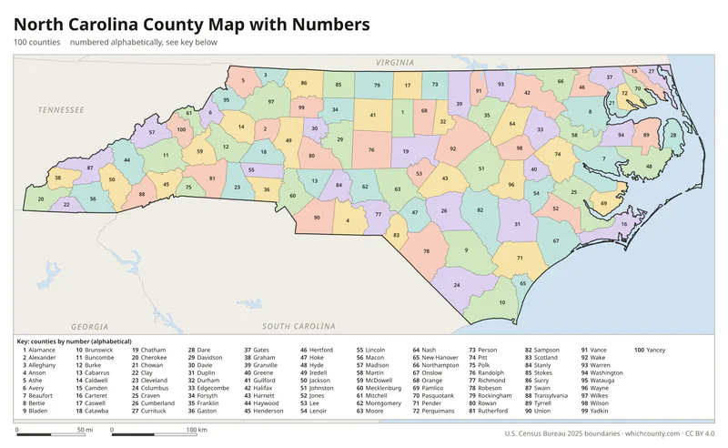
Numbered map with key
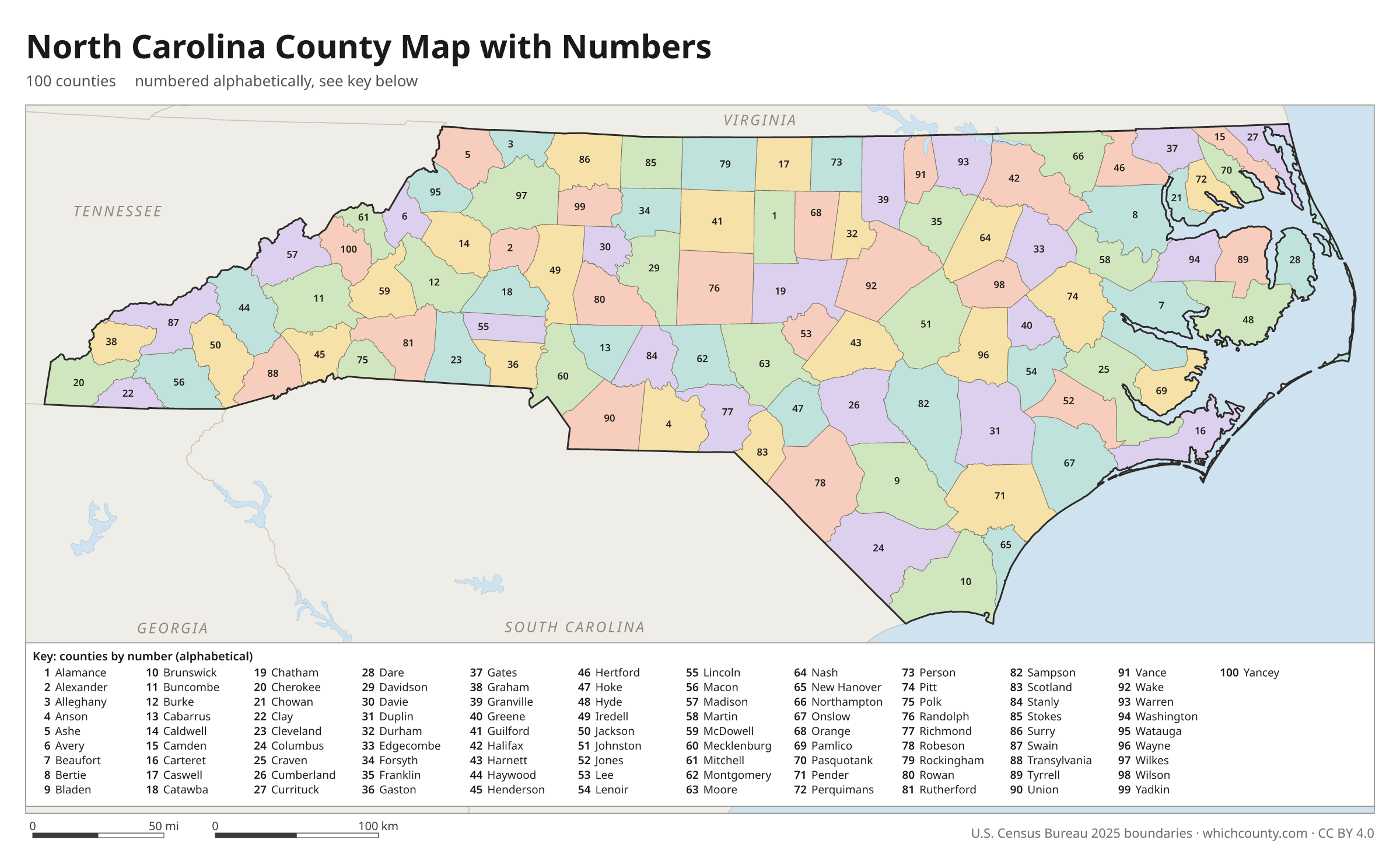
A number in every county with an alphabetical key.
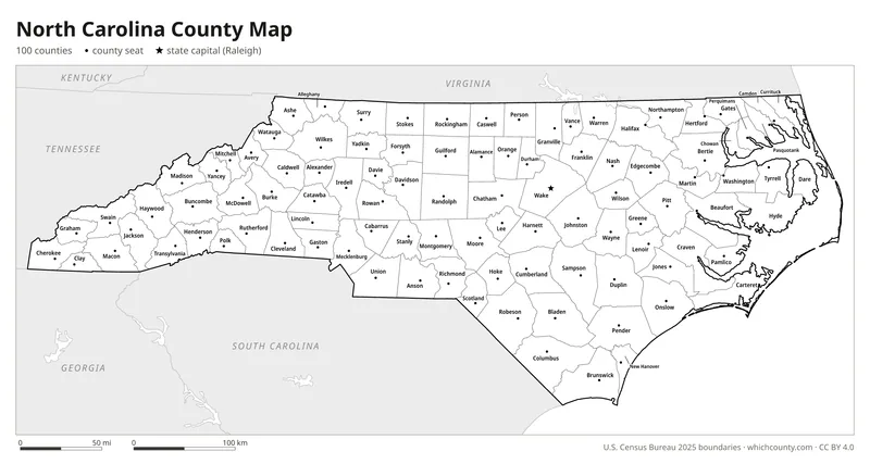
Black and white
Labeled map that prints well on any printer.
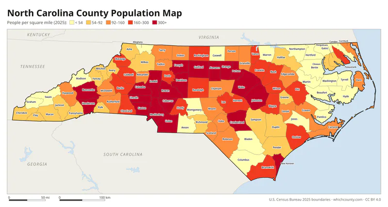
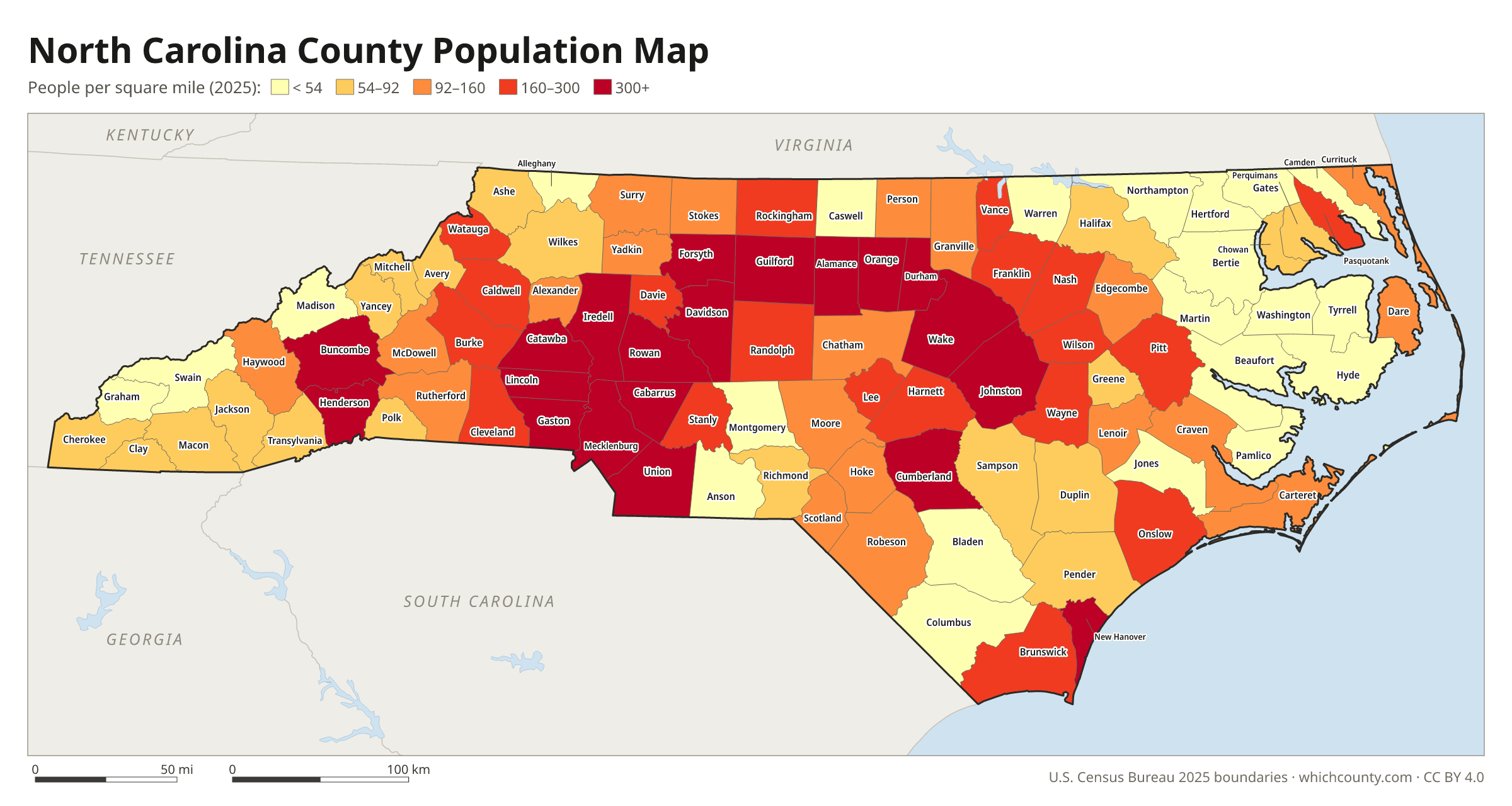
Population map
Counties shaded by population density (2025 estimates).
Data and GIS files
The county table as CSV, and the boundaries as GeoJSON and KML (Google Earth, Google My Maps).
How North Carolina reached 100 counties
North Carolina's counties began with the Lords Proprietors, who in 1664 created Albemarle County and divided it into four precincts: Currituck, Perquimans, Pasquotank and Chowan. Counties gave residents a nearby place to record deeds and wills and to attend court, and gave the sheriff a base for collecting taxes and keeping order. By 1738 the 14 precincts then in existence had become counties. As settlement spread west, older counties were divided, and by 1800 there were 59. Splitting counties was often a political fight: eastern counties were divided to keep the east's majority in the legislature against the growing Piedmont and mountain regions. The total reached 100 in 1911 with Avery and Hoke counties. A 1933 law allows counties to consolidate with voter approval, but as of the early 2000s none had.
County numbers: The Department of Revenue numbers the counties 1–100 in alphabetical order for county sales tax reporting.
Regions of North Carolina
North Carolina's counties grouped into the 8 Prosperity Zones of North Carolina (source).
Western Region
Buncombe, Cherokee, Clay, Graham, Haywood, Henderson, Jackson, Macon, Madison, Polk, Rutherford, Swain, Transylvania
Northwest Region
Alexander, Alleghany, Ashe, Avery, Burke, Caldwell, Catawba, McDowell, Mitchell, Watauga, Wilkes, Yancey
Southwest Region
Anson, Cabarrus, Cleveland, Gaston, Iredell, Lincoln, Mecklenburg, Rowan, Stanly, Union
Piedmont-Triad (Central) Region
Alamance, Caswell, Davidson, Davie, Forsyth, Guilford, Randolph, Rockingham, Stokes, Surry, Yadkin
North Central Region
Chatham, Durham, Edgecombe, Franklin, Granville, Harnett, Johnston, Lee, Nash, Orange, Person, Vance, Wake, Warren, Wilson
Sandhills (South Central) Region
Bladen, Columbus, Cumberland, Hoke, Montgomery, Moore, Richmond, Robeson, Sampson, Scotland
Northeast Region
Beaufort, Bertie, Camden, Chowan, Currituck, Dare, Gates, Halifax, Hertford, Hyde, Martin, Northampton, Pasquotank, Perquimans, Pitt, Tyrrell, Washington
Southeast Region
Brunswick, Carteret, Craven, Duplin, Greene, Jones, Lenoir, New Hanover, Onslow, Pamlico, Pender, Wayne
County maps of neighboring states
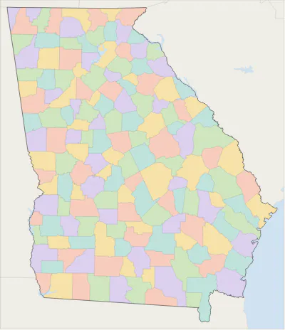 Georgia county map
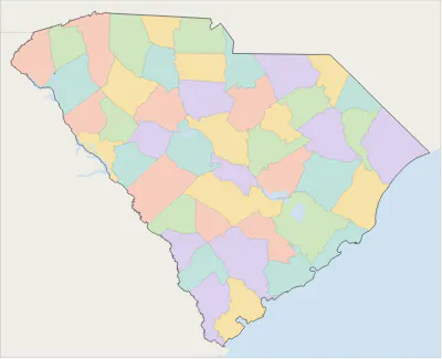 South Carolina county map
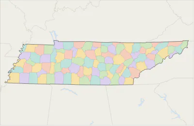 Tennessee county map
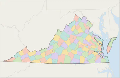 Virginia county map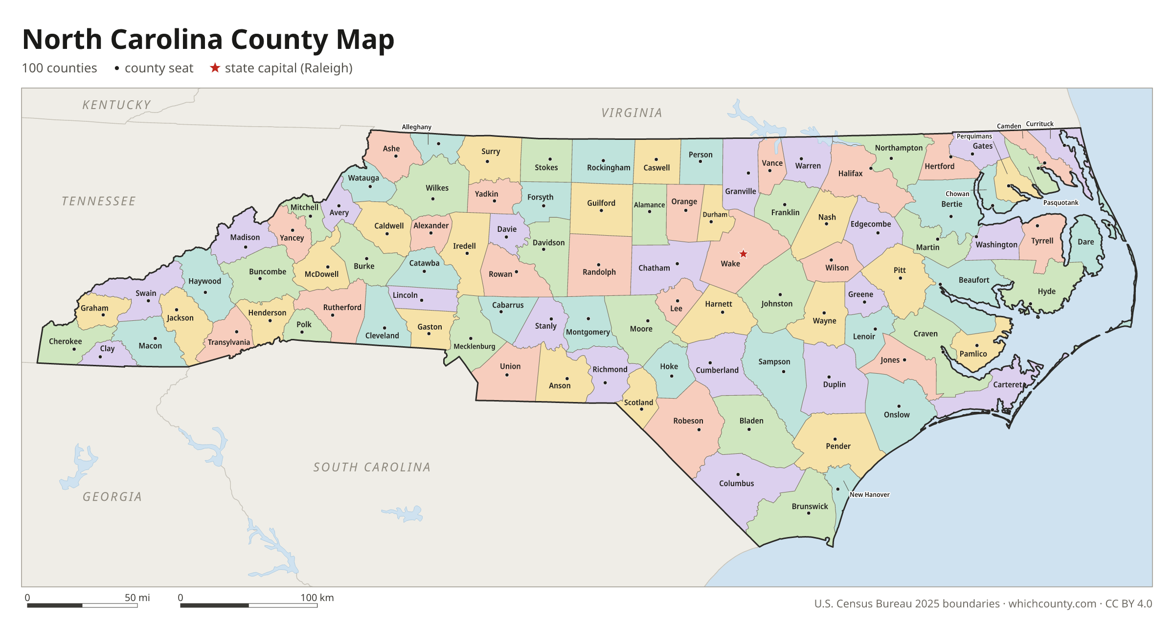
North Carolina counties: questions and answers
- How many counties are in North Carolina?
- North Carolina has 100 counties.
- What is the largest county in North Carolina?
- By land area, Robeson County is the largest (947 sq mi). By population, Wake County is the largest, with 1,257,235 people (2025 estimate).
- What is the smallest county in North Carolina?
- Chowan County is the smallest by land area (172.7 sq mi). Tyrrell County has the fewest people: 3,537 (2025 estimate).
- What is the wealthiest county in North Carolina?
- By median household income, Wake County ranks first with $105,768 (American Community Survey 2020–2024). The lowest is Tyrrell County at $41,685.
- What county is Charlotte in?
- Charlotte is in Mecklenburg County.
- What county is Raleigh in?
- Raleigh is mostly in Wake County, with smaller parts in Durham County.
- What county is Greensboro in?
- Greensboro is in Guilford County.
- How can I see county lines on Google Maps?
- Google Maps does not draw county lines. Download the KML file from the printable maps section above and import it into Google My Maps (Create a new map › Import) or open it in Google Earth to see every North Carolina county boundary on top of Google's map.
- Can I use this map for free?
- Yes. The maps and files on this page are free to print, share and use in your own work, including commercial projects, under the CC BY 4.0 licence. Please credit “WhichCounty (whichcounty.com)”.
Use this map on your site
You may copy, print and publish these maps, also commercially, as long as you credit WhichCounty with a link (licence details). Paste this code to embed the map:
Sources and methodology
- Boundaries: U.S. Census Bureau, 2025 Cartographic Boundary Files (1:500,000), simplified for display. Projection: Lambert conformal conic fitted to North Carolina.
- Population: Census Bureau county estimates, Vintage 2025 (July 1, 2025), compared with the April 1, 2020 estimates base.
- Land area: Census Bureau 2026 Gazetteer files. Median household income: American Community Survey 2020–2024 5-year estimates.
- County seats and founding years: Wikidata (CC0), checked against state lists by WhichCounty. Cities: Census Bureau city and town estimates, Vintage 2025.
- Counties (NCpedia, State Library of North Carolina; from the Encyclopedia of North Carolina)
- North Carolina County Development (State Library of North Carolina)
- Avery County (NCpedia)
- Hoke County (NCpedia)
Found an error? Tell us. Last data update: October 4, 2026.