Kansas County Map
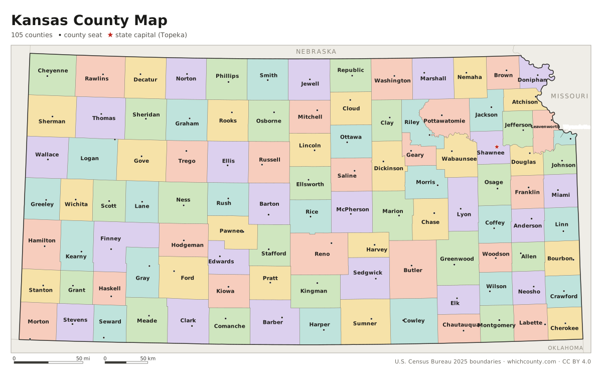
All 105 counties with county seats and major cities
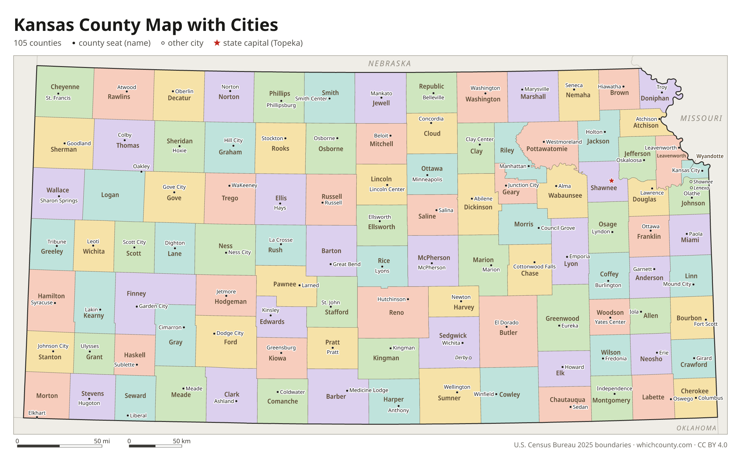
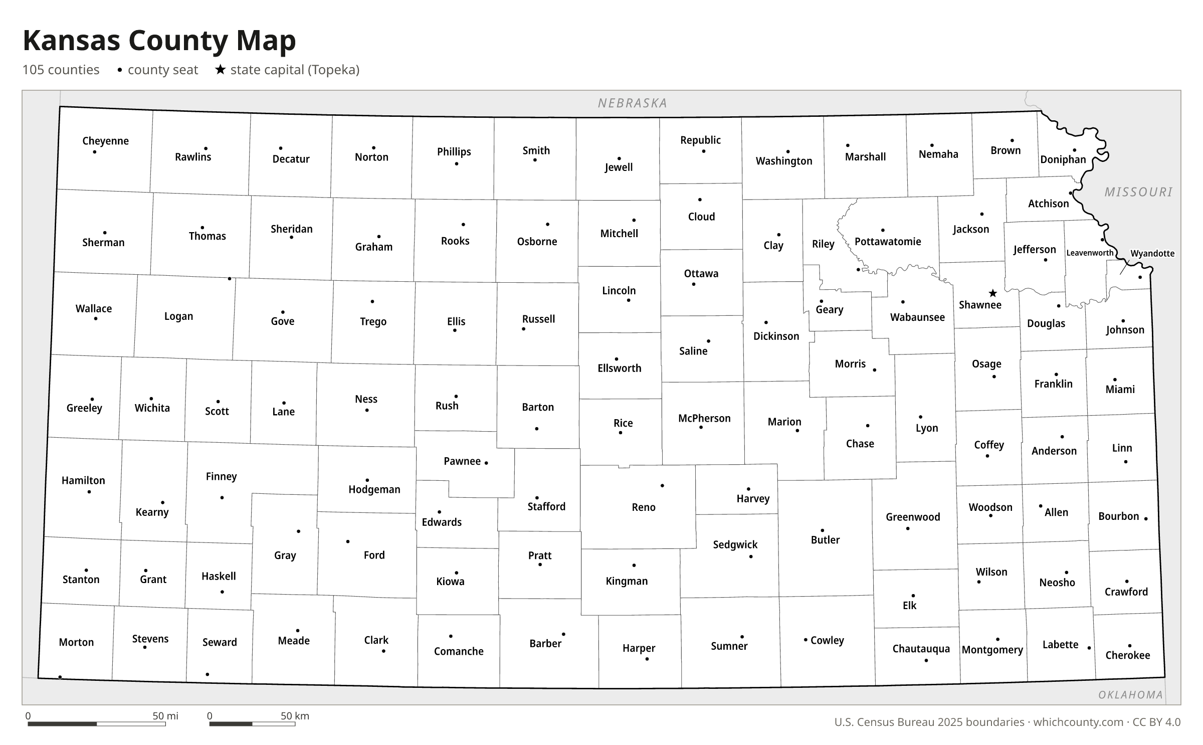
Kansas has 105 counties, the sixth-highest count of any state. This map shows all 105 counties and their county seats. Tap a county for details, or download the free printable map below.

Updated October 4, 2026 · Boundaries: U.S. Census Bureau 2025 · Population: Census estimates for July 1, 2025
Kansas county facts
- Number of counties
- 105
- Largest by land area
- Butler County 1,430 sq mi
- Smallest by land area
- Wyandotte County 151.6 sq mi
- Most people
- Johnson County 636,906
- Fewest people
- Greeley County 1,182
- Fastest growing since 2020
- Pottawatomie County +7.2%
- Highest median household income
- Johnson County $109,208
- Oldest county
- Allen County est. 1855
- Newest county
- Gray County est. 1887
- State capital
- Topeka Shawnee County
Kansas City, Kansas, and Wyandotte County have had a single consolidated government, the Unified Government of Wyandotte County and Kansas City, Kansas, since 1997.
Wyandotte County covers only 151 square miles, well under the 432-square-mile minimum, because its borders were set before the 1859 constitution.
List of 105 Kansas counties
Sorted A–Z. Click a column to sort, or a name to show it on the map. Download as CSV
| County | County seat | Population 2025 | Change since 2020 | Land area (sq mi) | Median income | Established | FIPS |
|---|---|---|---|---|---|---|---|
| Allen County | Iola | 12,302 | −1.8% | 500 | $60,689 | 1855 | 20001 |
| Anderson County | Garnett | 8,018 | +2.3% | 580 | $70,614 | 1855 | 20003 |
| Atchison County | Atchison | 16,172 | −1.1% | 431 | $61,112 | 1855 | 20005 |
| Barber County | Medicine Lodge | 4,083 | −3.6% | 1,134 | $61,926 | 1867 | 20007 |
| Barton County | Great Bend | 24,790 | −2.8% | 895 | $58,851 | 1867 | 20009 |
| Bourbon County | Fort Scott | 14,319 | −0.3% | 636 | $59,238 | 1855 | 20011 |
| Brown County | Hiawatha | 9,104 | −4.3% | 571 | $62,233 | 1855 | 20013 |
| Butler County | El Dorado | 69,484 | +3.1% | 1,430 | $81,610 | 1855 | 20015 |
| Chase County | Cottonwood Falls | 2,572 | −0.2% | 773 | $56,484 | 1859 | 20017 |
| Chautauqua County | Sedan | 3,321 | −1.8% | 639 | $56,438 | 1875 | 20019 |
| Cherokee County | Columbus | 19,105 | −1.3% | 588 | $57,668 | 1855 | 20021 |
| Cheyenne County | St. Francis | 2,604 | −0.4% | 1,020 | $55,429 | 1873 | 20023 |
| Clark County | Ashland | 1,900 | −4.5% | 975 | $63,043 | 1885 | 20025 |
| Clay County | Clay Center | 7,990 | −1.5% | 645 | $66,176 | 1857 | 20027 |
| Cloud County | Concordia | 8,833 | −2.2% | 715 | $58,770 | 1866 | 20029 |
| Coffey County | Burlington | 8,467 | +1.3% | 627 | $70,346 | 1855 | 20031 |
| Comanche County | Coldwater | 1,673 | −0.8% | 788 | $54,545 | 1867 | 20033 |
| Cowley County | Winfield | 34,382 | −0.5% | 1,126 | $57,878 | 1867 | 20035 |
| Crawford County | Girard | 39,008 | +0.1% | 590 | $52,844 | 1867 | 20037 |
| Decatur County | Oberlin | 2,716 | −1.8% | 894 | $53,870 | 1873 | 20039 |
| Dickinson County | Abilene | 18,637 | +1.2% | 847 | $68,417 | 1857 | 20041 |
| Doniphan County | Troy | 7,594 | +1.2% | 394 | $74,028 | 1855 | 20043 |
| Douglas County | Lawrence | 120,920 | +1.8% | 456 | $69,746 | 1855 | 20045 |
| Edwards County | Kinsley | 2,640 | −9.2% | 622 | $52,692 | 1874 | 20047 |
| Elk County | Howard | 2,458 | −1.1% | 644 | $64,609 | 1875 | 20049 |
| Ellis County | Hays | 29,075 | +0.5% | 900 | $63,084 | 1867 | 20051 |
| Ellsworth County | Ellsworth | 6,257 | −1.9% | 716 | $65,560 | 1867 | 20053 |
| Finney County | Garden City | 37,505 | −2.5% | 1,302 | $73,009 | 1883 | 20055 |
| Ford County | Dodge City | 33,993 | −0.9% | 1,098 | $70,781 | 1867 | 20057 |
| Franklin County | Ottawa | 26,299 | +1.2% | 572 | $77,207 | 1855 | 20059 |
| Geary County | Junction City | 36,338 | −1.1% | 385 | $59,317 | 1855 | 20061 |
| Gove County | Gove City | 2,631 | −3.3% | 1,072 | $66,029 | 1868 | 20063 |
| Graham County | Hill City | 2,371 | −1.8% | 899 | $50,650 | 1867 | 20065 |
| Grant County | Ulysses | 7,028 | −4.4% | 575 | $66,476 | 1873 | 20067 |
| Gray County | Cimarron | 5,652 | ±0% | 869 | $79,122 | 1887 | 20069 |
| Greeley County | Tribune | 1,182 | −7.9% | 778 | $80,565 | 1873 | 20071 |
| Greenwood County | Eureka | 5,826 | −2.9% | 1,143 | $60,042 | 1855 | 20073 |
| Hamilton County | Syracuse | 2,500 | −0.8% | 997 | $70,250 | 1873 | 20075 |
| Harper County | Anthony | 5,370 | −2.2% | 801 | $53,488 | 1867 | 20077 |
| Harvey County | Newton | 33,580 | −1.3% | 540 | $74,368 | 1872 | 20079 |
| Haskell County | Sublette | 3,599 | −4.8% | 578 | $66,162 | 1887 | 20081 |
| Hodgeman County | Jetmore | 1,619 | −6.1% | 860 | $59,955 | 1867 | 20083 |
| Jackson County | Holton | 13,438 | +1.6% | 656 | $75,215 | 1855 | 20085 |
| Jefferson County | Oskaloosa | 18,296 | −0.4% | 533 | $81,278 | 1855 | 20087 |
| Jewell County | Mankato | 2,830 | −3.4% | 910 | $52,634 | 1867 | 20089 |
| Johnson County | Olathe | 636,906 | +4.4% | 474 | $109,208 | 1855 | 20091 |
| Kearny County | Lakin | 3,888 | −2.5% | 871 | $89,135 | 1887 | 20093 |
| Kingman County | Kingman | 7,029 | −6% | 863 | $59,842 | 1872 | 20095 |
| Kiowa County | Greensburg | 2,432 | −1.3% | 723 | $75,539 | 1886 | 20097 |
| Labette County | Oswego | 19,685 | −2.5% | 645 | $56,325 | 1867 | 20099 |
| Lane County | Dighton | 1,508 | −4.1% | 717 | $54,526 | 1873 | 20101 |
| Leavenworth County | Leavenworth | 84,590 | +3.3% | 463 | $89,218 | 1855 | 20103 |
| Lincoln County | Lincoln Center | 2,861 | −2.7% | 719 | $57,500 | 1867 | 20105 |
| Linn County | Mound City | 9,950 | +3.7% | 594 | $59,069 | 1855 | 20107 |
| Logan County | Oakley | 2,661 | −3.6% | 1,073 | $75,662 | – | 20109 |
| Lyon County | Emporia | 32,266 | +0.3% | 848 | $59,912 | 1855 | 20111 |
| Marion County | Marion | 11,634 | −1.7% | 944 | $64,695 | 1855 | 20115 |
| Marshall County | Marysville | 9,852 | −1.8% | 900 | $68,419 | 1855 | 20117 |
| McPherson County | McPherson | 30,064 | −0.6% | 898 | $78,851 | 1867 | 20113 |
| Meade County | Meade | 3,852 | −5.1% | 978 | $71,852 | 1885 | 20119 |
| Miami County | Paola | 36,240 | +6% | 576 | $89,000 | 1855 | 20121 |
| Mitchell County | Beloit | 5,590 | −3.5% | 702 | $64,246 | 1867 | 20123 |
| Montgomery County | Independence | 30,177 | −4.2% | 644 | $55,697 | 1867 | 20125 |
| Morris County | Council Grove | 5,348 | −0.7% | 695 | $58,686 | 1855 | 20127 |
| Morton County | Elkhart | 2,470 | −8.4% | 730 | $66,447 | 1886 | 20129 |
| Nemaha County | Seneca | 10,054 | −2.2% | 717 | $77,348 | 1855 | 20131 |
| Neosho County | Erie | 15,637 | −1.7% | 572 | $56,618 | 1855 | 20133 |
| Ness County | Ness City | 2,617 | −2.4% | 1,075 | $68,616 | 1867 | 20135 |
| Norton County | Norton | 5,288 | −3.1% | 878 | $54,050 | 1867 | 20137 |
| Osage County | Lyndon | 15,693 | −0.5% | 706 | $74,467 | 1855 | 20139 |
| Osborne County | Osborne | 3,285 | −5.9% | 893 | $63,011 | 1867 | 20141 |
| Ottawa County | Minneapolis | 5,744 | +0.3% | 721 | $74,018 | 1860 | 20143 |
| Pawnee County | Larned | 5,991 | −4.1% | 754 | $63,517 | 1867 | 20145 |
| Phillips County | Phillipsburg | 4,728 | −5.1% | 886 | $62,123 | 1867 | 20147 |
| Pottawatomie County | Westmoreland | 27,186 | +7.2% | 841 | $92,325 | 1857 | 20149 |
| Pratt County | Pratt | 9,117 | −0.4% | 735 | $66,022 | 1867 | 20151 |
| Rawlins County | Atwood | 2,431 | −5.1% | 1,069 | $67,742 | 1873 | 20153 |
| Reno County | Hutchinson | 61,539 | −0.6% | 1,255 | $60,645 | 1867 | 20155 |
| Republic County | Belleville | 4,640 | −0.9% | 717 | $56,833 | 1860 | 20157 |
| Rice County | Lyons | 9,266 | −1.6% | 726 | $63,925 | 1867 | 20159 |
| Riley County | Manhattan | 72,598 | +0.9% | 610 | $61,098 | 1855 | 20161 |
| Rooks County | Stockton | 4,646 | −5.4% | 891 | $62,500 | 1867 | 20163 |
| Rush County | La Crosse | 2,845 | −3.7% | 718 | $59,970 | 1867 | 20165 |
| Russell County | Russell | 6,581 | −1.6% | 886 | $62,392 | 1867 | 20167 |
| Saline County | Salina | 53,377 | −1.7% | 720 | $65,422 | 1860 | 20169 |
| Scott County | Scott City | 4,815 | −6.6% | 718 | $68,839 | 1873 | 20171 |
| Sedgwick County | Wichita | 538,433 | +2.8% | 997 | $69,365 | 1867 | 20173 |
| Seward County | Liberal | 21,073 | −4.1% | 640 | $63,827 | 1873 | 20175 |
| Shawnee County | Topeka | 178,607 | −0.2% | 544 | $67,104 | 1855 | 20177 |
| Sheridan County | Hoxie | 2,427 | −0.7% | 896 | $73,750 | 1873 | 20179 |
| Sherman County | Goodland | 5,763 | −2.9% | 1,056 | $61,750 | 1873 | 20181 |
| Smith County | Smith Center | 3,566 | −0.2% | 896 | $59,135 | 1867 | 20183 |
| Stafford County | St. John | 4,005 | −1.7% | 792 | $64,226 | 1867 | 20185 |
| Stanton County | Johnson City | 1,986 | −4.6% | 680 | $71,700 | 1887 | 20187 |
| Stevens County | Hugoton | 4,984 | −5% | 727 | $64,178 | 1886 | 20189 |
| Sumner County | Wellington | 22,312 | −0.3% | 1,182 | $63,951 | 1867 | 20191 |
| Thomas County | Colby | 7,725 | −2.5% | 1,075 | $71,325 | 1873 | 20193 |
| Trego County | WaKeeney | 2,740 | −2.5% | 890 | $81,528 | 1867 | 20195 |
| Wabaunsee County | Alma | 7,018 | +2% | 794 | $76,908 | 1855 | 20197 |
| Wallace County | Sharon Springs | 1,441 | −4.7% | 914 | $63,207 | 1868 | 20199 |
| Washington County | Washington | 5,533 | −0.2% | 895 | $65,482 | 1857 | 20201 |
| Wichita County | Leoti | 2,031 | −5.7% | 719 | $79,063 | 1873 | 20203 |
| Wilson County | Fredonia | 8,299 | −3.8% | 570 | $60,677 | 1855 | 20205 |
| Woodson County | Yates Center | 3,118 | −0% | 498 | $50,326 | 1855 | 20207 |
| Wyandotte County | Kansas City | 170,597 | +0.8% | 152 | $63,631 | 1859 | 20209 |
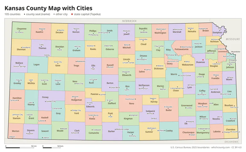
Kansas county map with cities
The largest cities in Kansas and the counties they are in. Cities that cross a county line list every county, the main one first. To find any smaller town, use the search box above.
| City | County | Population 2025 |
|---|---|---|
| Wichita | Sedgwick County | 400,987 |
| Overland Park | Johnson County | 203,677 |
| Kansas City | Wyandotte County | 157,805 |
| Olathe | Johnson County | 150,025 |
| Topeka | Shawnee County | 125,795 |
| Lawrence | Douglas County | 96,367 |
| Shawnee | Johnson County | 69,848 |
| Lenexa | Johnson County | 60,506 |
| Manhattan | Riley and Pottawatomie counties | 54,673 |
| Salina | Saline County | 46,094 |
| Hutchinson | Reno County | 39,595 |
| Leavenworth | Leavenworth County | 37,012 |
| Leawood | Johnson County | 34,093 |
| Dodge City | Ford County | 27,653 |
| Garden City | Finney County | 27,402 |
| Derby | Sedgwick County | 26,606 |
| Gardner | Johnson County | 26,154 |
| Emporia | Lyon County | 24,137 |
| Prairie Village | Johnson County | 23,008 |
| Junction City | Geary County | 22,583 |
| Hays | Ellis County | 21,258 |
| Pittsburg | Crawford County | 20,569 |
| Liberal | Seward County | 19,010 |
| Newton | Harvey County | 18,353 |
| Andover | Butler County | 17,370 |
| Great Bend | Barton County | 14,266 |
| McPherson | McPherson County | 13,918 |
| Ottawa | Franklin County | 12,716 |
| El Dorado | Butler County | 12,696 |
| Arkansas City | Cowley County | 11,800 |
Printable Kansas county maps (free PDF, PNG, SVG)
Every map is free to print and share. The PDFs are vector files with real text, so they stay sharp at any size and you can search them for a county name. Use 11×17 (tabloid) for the most readable labels.
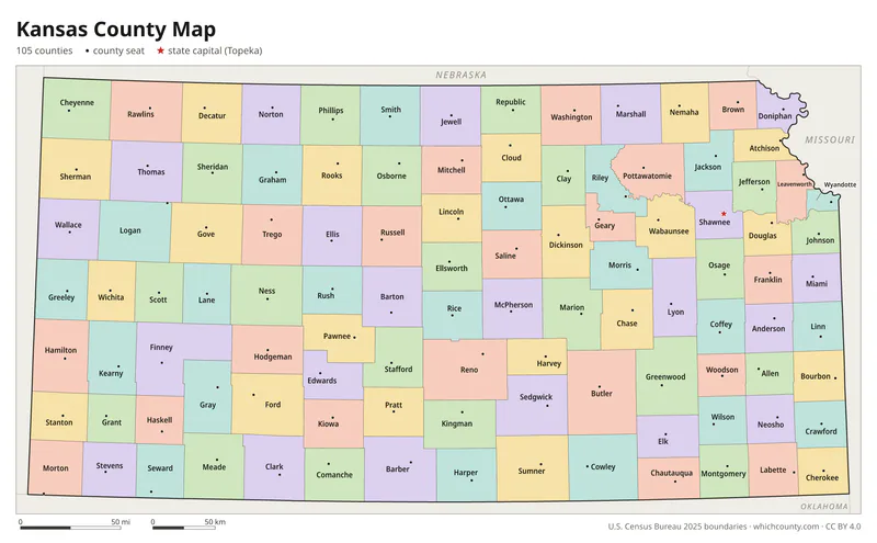
Color map with names
All 105 counties labeled, county seats marked. Letter and 11×17 PDF, high-resolution PNG, editable SVG.
Map with cities
Counties with their county seat towns and major cities.
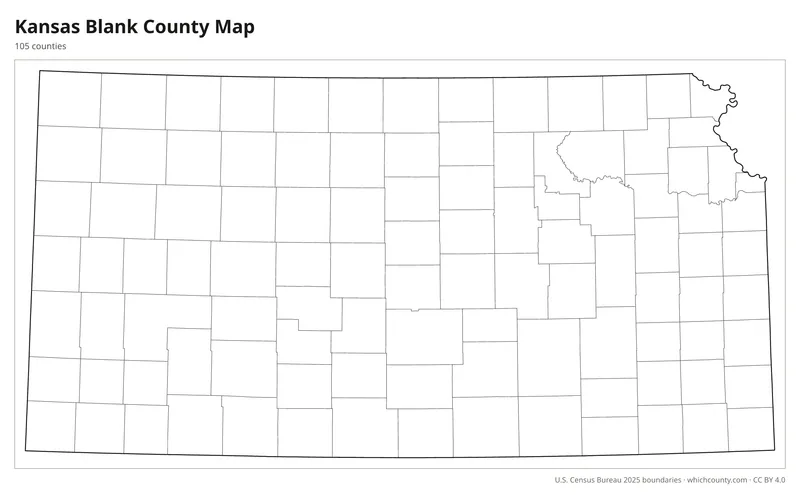
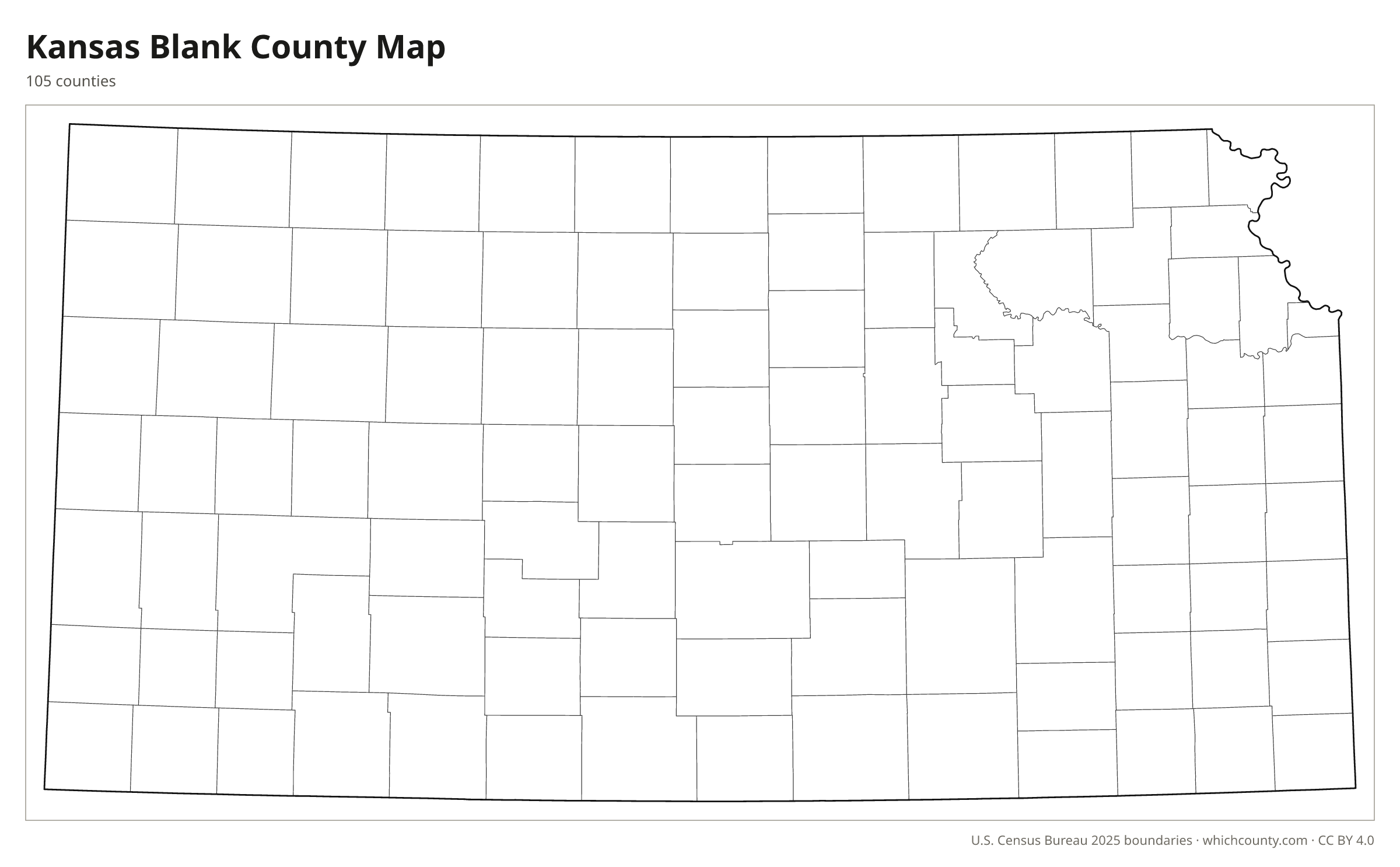
Blank outline map
County lines only, no names. For quizzes, coloring and your own notes.
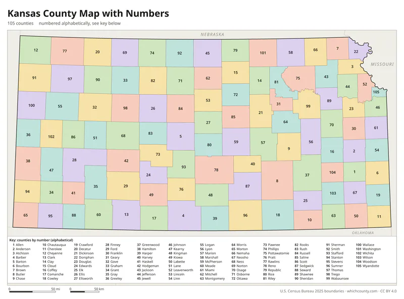
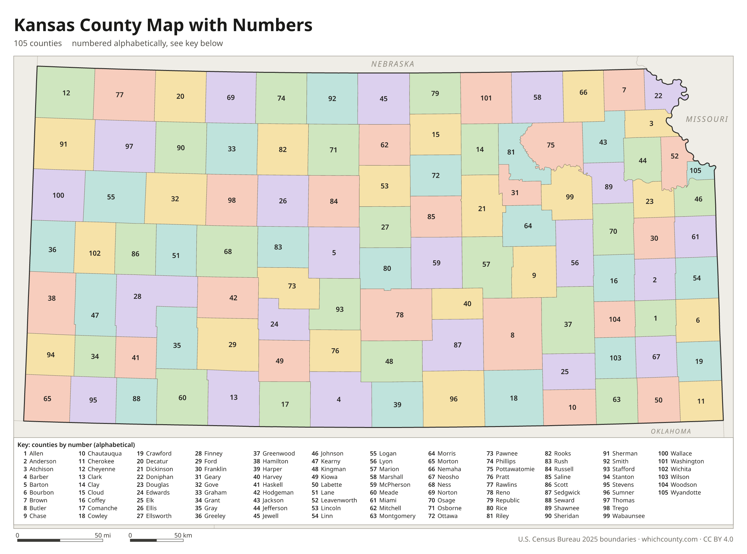
Numbered map with key
A number in every county with an alphabetical key.
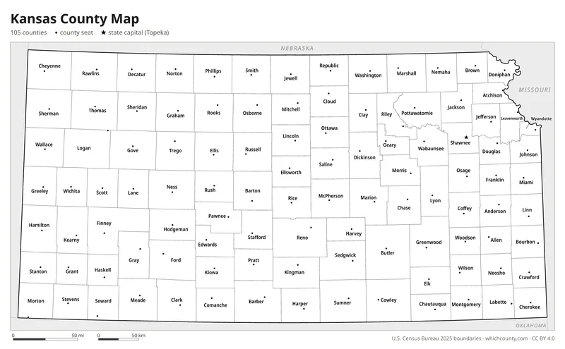
Black and white
Labeled map that prints well on any printer.
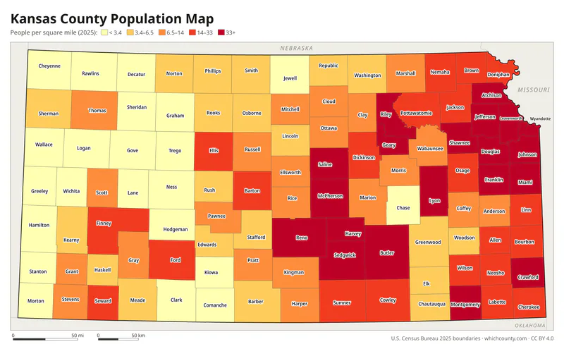
Population map
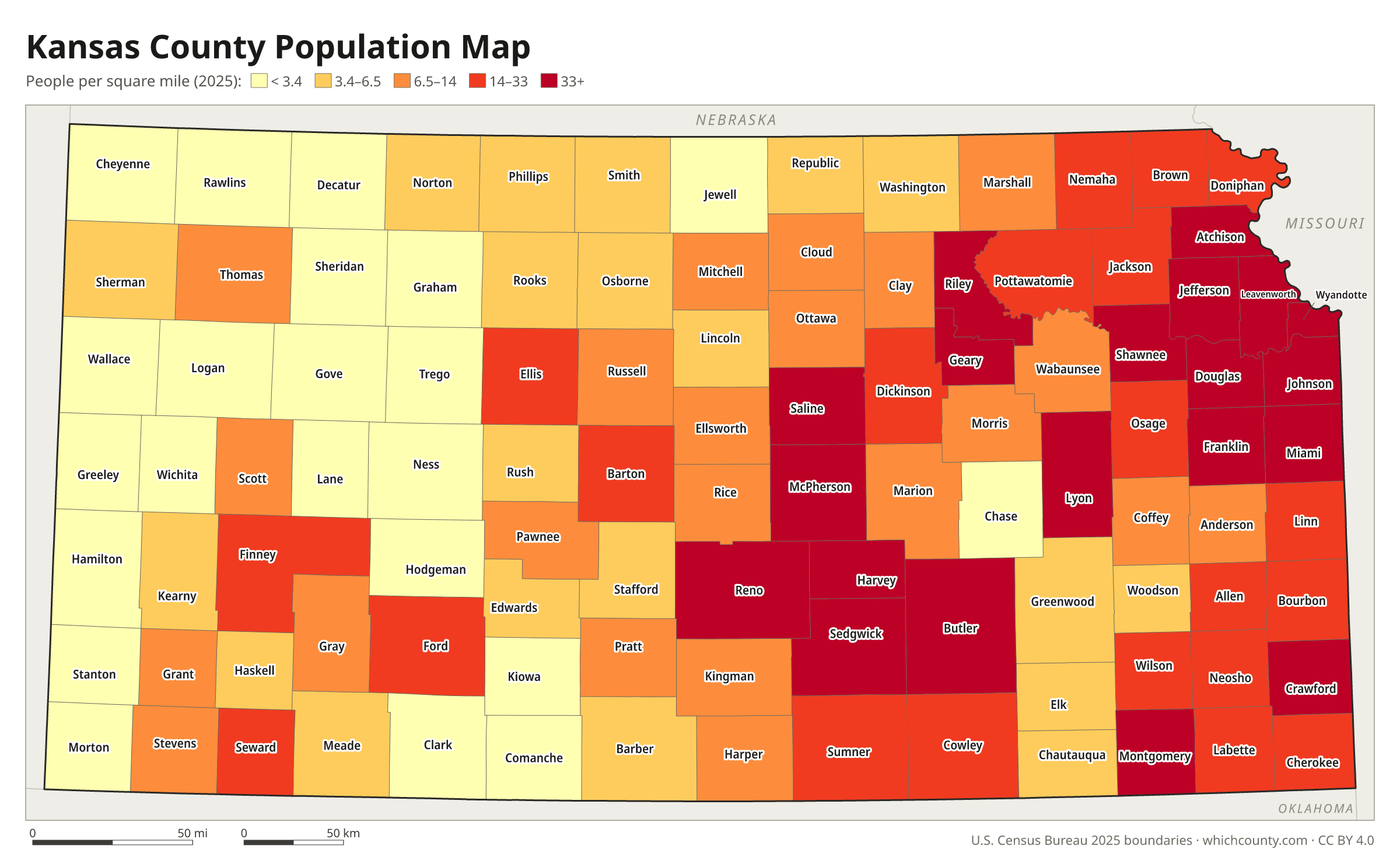
Counties shaded by population density (2025 estimates).
Data and GIS files
The county table as CSV, and the boundaries as GeoJSON and KML (Google Earth, Google My Maps).
Why Kansas has 105 counties
The first Kansas territorial legislature set out 33 counties in 1855. The legislature set each county's name and boundaries, but a county was organized only when it formed a government and proved at least 600 residents. The 1859 state constitution required at least 432 square miles per county. One act of March 20, 1873 drew counties across much of western Kansas, most of them not yet organized. The count rose with settlement, from 53 counties in 1860 to 83 in 1870 and 104 in 1880. Towns fought hard to become county seats, because the courthouse brought roads, bridges and sometimes a railroad. These county seat wars brought bribery and ballot fraud, and in Stevens County six men were killed. In 1893 Garfield County was dissolved into Finney after the state Supreme Court found it smaller than 432 square miles, leaving 105.
County maps of neighboring states
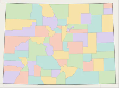 Colorado county map
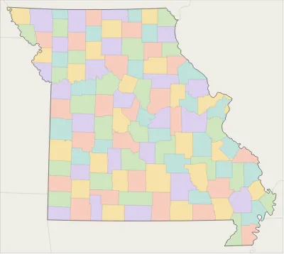 Missouri county map
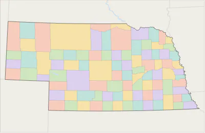 Nebraska county map
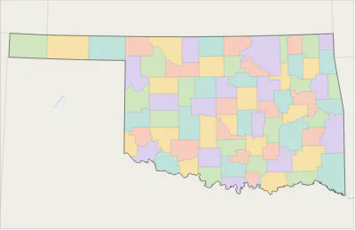 Oklahoma county map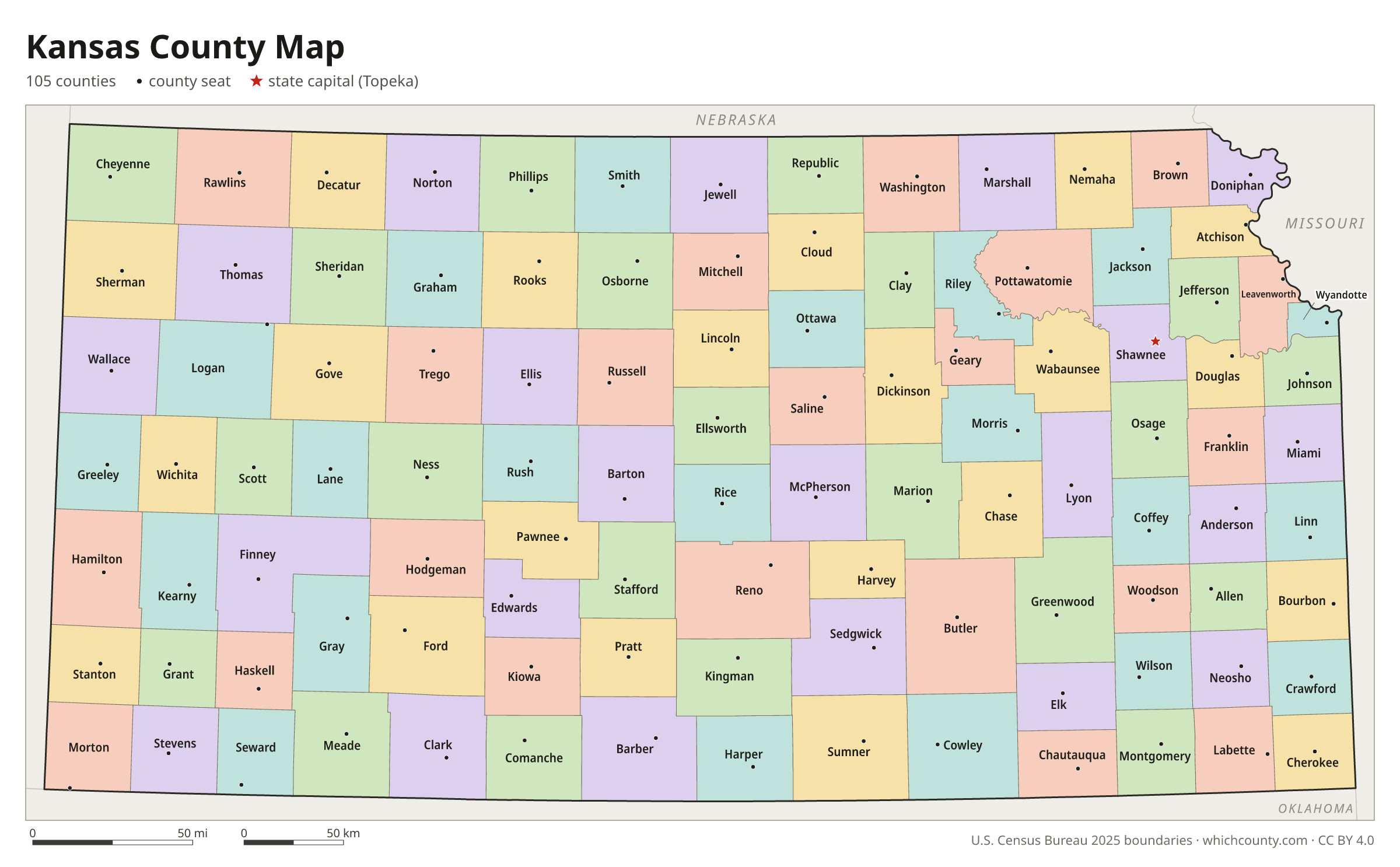
Kansas counties: questions and answers
- How many counties are in Kansas?
- Kansas has 105 counties.
- What is the largest county in Kansas?
- By land area, Butler County is the largest (1,430 sq mi). By population, Johnson County is the largest, with 636,906 people (2025 estimate).
- What is the smallest county in Kansas?
- Wyandotte County is the smallest by land area (151.6 sq mi). Greeley County has the fewest people: 1,182 (2025 estimate).
- What is the wealthiest county in Kansas?
- By median household income, Johnson County ranks first with $109,208 (American Community Survey 2020–2024). The lowest is Woodson County at $50,326.
- What county is Wichita in?
- Wichita is in Sedgwick County.
- What county is Overland Park in?
- Overland Park is in Johnson County.
- What county is Kansas City in?
- Kansas City is in Wyandotte County.
- What county is Topeka in?
- Topeka, the state capital, is in Shawnee County.
- How can I see county lines on Google Maps?
- Google Maps does not draw county lines. Download the KML file from the printable maps section above and import it into Google My Maps (Create a new map › Import) or open it in Google Earth to see every Kansas county boundary on top of Google's map.
- Can I use this map for free?
- Yes. The maps and files on this page are free to print, share and use in your own work, including commercial projects, under the CC BY 4.0 licence. Please credit “WhichCounty (whichcounty.com)”.
Use this map on your site
You may copy, print and publish these maps, also commercially, as long as you credit WhichCounty with a link (licence details). Paste this code to embed the map:
Sources and methodology
- Boundaries: U.S. Census Bureau, 2025 Cartographic Boundary Files (1:500,000), simplified for display. Projection: Lambert conformal conic fitted to Kansas.
- Population: Census Bureau county estimates, Vintage 2025 (July 1, 2025), compared with the April 1, 2020 estimates base.
- Land area: Census Bureau 2026 Gazetteer files. Median household income: American Community Survey 2020–2024 5-year estimates.
- County seats and founding years: Wikidata (CC0), checked against state lists by WhichCounty. Cities: Census Bureau city and town estimates, Vintage 2025.
- Kansas Counties (Kansas Historical Society)
- County Seat Wars (Kansapedia, Kansas Historical Society)
- Clerk's Office, City Division (Unified Government of Wyandotte County and Kansas City, Kansas)
- Atlas of Historical County Boundaries: Kansas (Newberry Library)
Found an error? Tell us. Last data update: October 4, 2026.