Virginia County Map
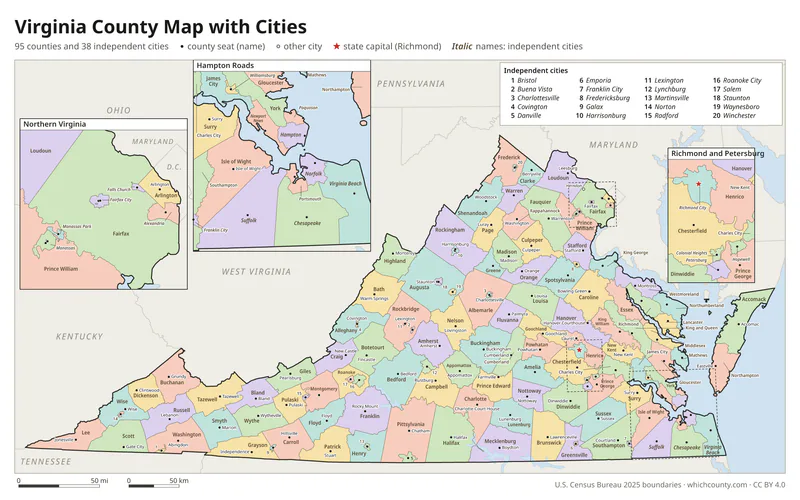
All 133 counties and independent cities with county seats and major cities
Virginia has 95 counties and 38 independent cities, 133 county-equivalents in all, the third-highest total after Texas and Georgia. This map shows all 133 counties and independent cities and their county seats. Tap a county for details, or download the free printable map below.

Updated October 4, 2026 · Boundaries: U.S. Census Bureau 2025 · Population: Census estimates for July 1, 2025
Virginia county facts
- Number of counties and independent cities
- 133
- Largest by land area
- Pittsylvania County 969 sq mi
- Smallest by land area
- Falls Church city 2 sq mi
- Most people
- Fairfax County 1,167,873
- Fewest people
- Highland County 2,318
- Fastest growing since 2020
- New Kent County +22.1%
- Highest median household income
- Loudoun County $181,765
- Oldest county
- Charles City County est. 1634
- Newest county
- Manassas city est. 1975
- State capital
- Richmond Richmond city
Virginia's 38 independent cities, including Richmond, Norfolk and Virginia Beach, are not part of any county.
South Boston (1995), Clifton Forge (2001) and Bedford (2013) gave up city status and rejoined the counties around them as towns.
List of 133 Virginia counties and independent cities
Sorted A–Z. Click a column to sort, or a name to show it on the map. Download as CSV
| County | County seat | Population 2025 | Change since 2020 | Land area (sq mi) | Median income | Established | FIPS |
|---|---|---|---|---|---|---|---|
| Accomack County | Accomac | 33,859 | +1.3% | 449 | $58,993 | 1663 | 51001 |
| Albemarle County | Charlottesville | 118,356 | +5.3% | 721 | $104,392 | 1744 | 51003 |
| Alexandria city | Alexandria | 160,662 | +0.8% | 15 | $119,681 | – | 51510 |
| Alleghany County | Covington | 14,546 | −4.4% | 447 | $56,188 | 1822 | 51005 |
| Amelia County | Amelia Court House | 13,632 | +2.8% | 358 | $76,717 | 1735 | 51007 |
| Amherst County | Amherst | 31,962 | +2.1% | 474 | $68,724 | 1761 | 51009 |
| Appomattox County | Appomattox | 17,172 | +6.6% | 334 | $62,853 | 1845 | 51011 |
| Arlington County | Arlington | 243,931 | +2.2% | 26 | $142,114 | 1846 | 51013 |
| Augusta County | Staunton | 78,940 | +1.9% | 967 | $82,049 | 1738 | 51015 |
| Bath County | Warm Springs | 4,076 | −3.1% | 529 | $56,184 | 1791 | 51017 |
| Bedford County | Bedford | 83,059 | +4.5% | 760 | $78,937 | 1754 | 51019 |
| Bland County | Bland | 6,151 | −1.9% | 358 | $61,216 | 1861 | 51021 |
| Botetourt County | Fincastle | 34,144 | +1.7% | 541 | $81,213 | 1770 | 51023 |
| Bristol city | Bristol | 16,418 | −4.8% | 13 | $50,404 | – | 51520 |
| Brunswick County | Lawrenceville | 15,727 | −0.8% | 566 | $53,084 | 1720 | 51025 |
| Buchanan County | Grundy | 18,492 | −9.1% | 503 | $42,886 | 1858 | 51027 |
| Buckingham County | Buckingham | 17,137 | +1.8% | 580 | $60,828 | 1761 | 51029 |
| Buena Vista city | Buena Vista | 6,672 | +0.6% | 6 | $57,833 | 1892 | 51530 |
| Campbell County | Rustburg | 55,629 | −0% | 503 | $66,165 | 1782 | 51031 |
| Caroline County | Bowling Green | 34,413 | +11.4% | 527 | $87,407 | 1728 | 51033 |
| Carroll County | Hillsville | 29,299 | +0.5% | 475 | $54,484 | 1842 | 51035 |
| Charles City County | Charles City | 6,623 | −2.2% | 183 | $75,417 | 1634 | 51036 |
| Charlotte County | Charlotte Court House | 11,401 | −1.1% | 475 | $58,000 | 1765 | 51037 |
| Charlottesville city | Charlottesville | 44,388 | −4.6% | 10 | $74,824 | – | 51540 |
| Chesapeake city | Chesapeake | 255,332 | +2.4% | 339 | $95,373 | 1963 | 51550 |
| Chesterfield County | Chesterfield Court House | 397,148 | +9.1% | 424 | $101,931 | 1749 | 51041 |
| Clarke County | Berryville | 15,609 | +5.5% | 176 | $117,111 | 1836 | 51043 |
| Colonial Heights city | Colonial Heights | 18,738 | +3.3% | 8 | $76,505 | – | 51570 |
| Covington city | Covington | 5,680 | −1.2% | 6 | $41,944 | 1952 | 51580 |
| Craig County | New Castle | 4,800 | −1.9% | 328 | $69,057 | 1851 | 51045 |
| Culpeper County | Culpeper | 57,666 | +9.7% | 379 | $100,049 | 1749 | 51047 |
| Cumberland County | Cumberland | 10,352 | +6.8% | 298 | $55,325 | 1749 | 51049 |
| Danville city | Danville | 41,647 | −2.2% | 43 | $44,423 | – | 51590 |
| Dickenson County | Clintwood | 13,236 | −6.3% | 330 | $47,254 | 1880 | 51051 |
| Dinwiddie County | Dinwiddie | 28,896 | +3.4% | 504 | $83,704 | 1752 | 51053 |
| Emporia city | Emporia | 5,447 | −5.3% | 7 | $51,899 | 1967 | 51595 |
| Essex County | Tappahannock | 10,654 | +0.5% | 257 | $56,520 | 1692 | 51057 |
| Fairfax County | Fairfax | 1,167,873 | +1.5% | 391 | $153,637 | 1742 | 51059 |
| Fairfax city | Fairfax | 26,772 | +10.9% | 6 | $132,348 | 1961 | 51600 |
| Falls Church city | Falls Church | 15,159 | +3.4% | 2 | $143,262 | 1948 | 51610 |
| Fauquier County | Warrenton | 76,503 | +4.8% | 648 | $130,189 | 1759 | 51061 |
| Floyd County | Floyd | 15,789 | +2% | 381 | $62,191 | 1831 | 51063 |
| Fluvanna County | Palmyra | 28,975 | +6.3% | 286 | $96,768 | 1777 | 51065 |
| Franklin County | Rocky Mount | 55,526 | +2% | 691 | $68,849 | 1786 | 51067 |
| Franklin city | Franklin | 8,478 | +3.7% | 8 | $63,245 | 1961 | 51620 |
| Frederick County | Winchester | 99,955 | +9.3% | 413 | $97,606 | 1738 | 51069 |
| Fredericksburg city | Fredericksburg | 30,393 | +8.6% | 10 | $86,071 | – | 51630 |
| Galax city | Galax | 6,670 | −0.8% | 8 | $38,675 | 1953 | 51640 |
| Giles County | Pearisburg | 16,564 | −1.4% | 357 | $65,691 | 1806 | 51071 |
| Gloucester County | Gloucester Courthouse | 40,097 | +3.6% | 218 | $84,306 | 1651 | 51073 |
| Goochland County | Goochland | 29,187 | +18% | 283 | $118,931 | 1728 | 51075 |
| Grayson County | Independence | 15,230 | −0.7% | 442 | $47,730 | 1793 | 51077 |
| Greene County | Stanardsville | 21,958 | +6.9% | 156 | $89,808 | 1838 | 51079 |
| Greensville County | Emporia | 11,181 | −1.9% | 295 | $54,668 | 1781 | 51081 |
| Halifax County | Halifax | 33,447 | −1.7% | 818 | $52,013 | 1752 | 51083 |
| Hampton city | Hampton | 137,315 | +0.1% | 52 | $69,621 | 1908 | 51650 |
| Hanover County | Hanover Courthouse | 116,423 | +5.9% | 468 | $112,805 | 1721 | 51085 |
| Harrisonburg city | Harrisonburg | 50,839 | −1.9% | 17 | $62,254 | 1916 | 51660 |
| Henrico County | Laurel | 342,775 | +2.3% | 234 | $88,783 | 1634 | 51087 |
| Henry County | Martinsville | 49,242 | −3.3% | 382 | $50,760 | 1777 | 51089 |
| Highland County | Monterey | 2,318 | +3.8% | 415 | $65,625 | 1847 | 51091 |
| Hopewell city | Hopewell | 23,261 | +1% | 10 | $54,729 | 1916 | 51670 |
| Isle of Wight County | Isle of Wight | 41,321 | +7% | 316 | $95,241 | 1634 | 51093 |
| James City County | Williamsburg | 83,326 | +6.5% | 142 | $109,985 | 1634 | 51095 |
| King George County | King George | 29,646 | +11% | 180 | $116,884 | 1721 | 51099 |
| King William County | King William | 19,617 | +10.2% | 274 | $86,056 | 1702 | 51101 |
| King and Queen County | King and Queen Court House | 6,743 | +2.1% | 315 | $70,469 | 1691 | 51097 |
| Lancaster County | Lancaster | 10,995 | +0.7% | 133 | $69,713 | 1651 | 51103 |
| Lee County | Jonesville | 21,642 | −2.4% | 435 | $41,827 | 1793 | 51105 |
| Lexington city | Lexington | 7,769 | +6.3% | 3 | $84,517 | 1966 | 51678 |
| Loudoun County | Leesburg | 449,749 | +6.8% | 516 | $181,765 | 1757 | 51107 |
| Louisa County | Louisa | 42,924 | +14.2% | 495 | $86,689 | 1742 | 51109 |
| Lunenburg County | Lunenburg | 12,058 | +1% | 432 | $54,842 | 1746 | 51111 |
| Lynchburg city | Lynchburg | 81,347 | +3% | 49 | $57,947 | 1786 | 51680 |
| Madison County | Madison | 14,237 | +2.9% | 321 | $84,323 | 1793 | 51113 |
| Manassas city | Manassas | 44,332 | +3.6% | 10 | $113,590 | 1975 | 51683 |
| Manassas Park city | Manassas Park | 16,560 | −3.8% | 3 | $103,250 | 1975 | 51685 |
| Martinsville city | Martinsville | 13,849 | +2.7% | 11 | $46,727 | 1928 | 51690 |
| Mathews County | Mathews | 8,529 | −0.1% | 86 | $75,880 | 1791 | 51115 |
| Mecklenburg County | Boydton | 30,747 | +1.4% | 625 | $57,045 | 1765 | 51117 |
| Middlesex County | Saluda | 10,841 | +2.1% | 130 | $75,060 | – | 51119 |
| Montgomery County | Christiansburg | 98,434 | −1.3% | 387 | $72,715 | – | 51121 |
| Nelson County | Lovingston | 14,920 | +1% | 471 | $72,589 | 1808 | 51125 |
| New Kent County | New Kent | 28,022 | +22.1% | 210 | $123,314 | 1654 | 51127 |
| Newport News city | Newport News | 183,230 | −1.6% | 69 | $69,634 | – | 51700 |
| Norfolk city | Norfolk | 231,013 | −3% | 53 | $66,109 | – | 51710 |
| Northampton County | Eastville | 11,879 | −3.3% | 212 | $61,632 | 1634 | 51131 |
| Northumberland County | Heathsville | 12,557 | +6.1% | 191 | $66,480 | 1648 | 51133 |
| Norton city | Norton | 3,477 | −5.9% | 8 | $41,495 | 1954 | 51720 |
| Nottoway County | Nottoway | 15,796 | +1% | 312 | $63,261 | 1789 | 51135 |
| Orange County | Orange | 40,083 | +10.8% | 341 | $94,008 | 1734 | 51137 |
| Page County | Luray | 23,762 | +0.2% | 310 | $57,037 | 1831 | 51139 |
| Patrick County | Stuart | 17,424 | −1% | 483 | $53,038 | 1791 | 51141 |
| Petersburg city | Petersburg | 33,734 | +0.8% | 23 | $50,698 | – | 51730 |
| Pittsylvania County | Chatham | 59,490 | −1.7% | 969 | $54,085 | 1767 | 51143 |
| Poquoson city | Poquoson | 13,292 | +6.7% | 15 | $120,972 | 1975 | 51735 |
| Portsmouth city | Portsmouth | 96,777 | −1.2% | 33 | $60,491 | – | 51740 |
| Powhatan County | Powhatan | 32,591 | +7.4% | 260 | $110,537 | 1777 | 51145 |
| Prince Edward County | Farmville | 22,391 | +2.5% | 350 | $56,315 | 1754 | 51147 |
| Prince George County | Prince George | 43,936 | +2.2% | 265 | $84,897 | 1703 | 51149 |
| Prince William County | Manassas | 502,966 | +4.3% | 335 | $131,402 | 1731 | 51153 |
| Pulaski County | Pulaski | 33,586 | −0.6% | 320 | $62,028 | 1839 | 51155 |
| Radford city | Radford | 17,243 | +7.3% | 10 | $57,348 | – | 51750 |
| Rappahannock County | Washington | 7,439 | +1.2% | 266 | $83,380 | 1833 | 51157 |
| Richmond County | Warsaw | 9,294 | +4.2% | 192 | $66,304 | 1692 | 51159 |
| Richmond city | Richmond | 237,257 | +4.7% | 60 | $64,587 | – | 51760 |
| Roanoke County | Salem | 97,150 | +0.2% | 251 | $83,709 | 1838 | 51161 |
| Roanoke city | Roanoke | 99,111 | −0.9% | 43 | $55,378 | – | 51770 |
| Rockbridge County | Lexington | 22,663 | −0% | 597 | $65,469 | 1778 | 51163 |
| Rockingham County | Harrisonburg | 89,316 | +6.6% | 850 | $80,693 | 1778 | 51165 |
| Russell County | Lebanon | 25,332 | −1.8% | 474 | $50,012 | 1786 | 51167 |
| Salem city | Salem | 25,816 | +1.9% | 15 | $66,725 | 1968 | 51775 |
| Scott County | Gate City | 21,200 | −1.7% | 536 | $46,349 | 1814 | 51169 |
| Shenandoah County | Woodstock | 45,839 | +3.8% | 508 | $67,191 | 1772 | 51171 |
| Smyth County | Marion | 28,882 | −3.1% | 451 | $49,883 | 1832 | 51173 |
| Southampton County | Courtland | 18,110 | +0.6% | 599 | $70,795 | 1749 | 51175 |
| Spotsylvania County | Spotsylvania Courthouse | 155,388 | +10.9% | 402 | $112,738 | 1721 | 51177 |
| Stafford County | Stafford | 170,803 | +8.8% | 269 | $137,807 | 1664 | 51179 |
| Staunton city | Staunton | 26,801 | +4.1% | 20 | $65,581 | – | 51790 |
| Suffolk city | Suffolk | 104,699 | +10.9% | 399 | $92,666 | 1910 | 51800 |
| Surry County | Surry | 6,603 | +0.7% | 279 | $78,041 | 1652 | 51181 |
| Sussex County | Sussex | 10,755 | −0.8% | 490 | $63,530 | 1754 | 51183 |
| Tazewell County | Tazewell | 38,635 | −4.5% | 519 | $47,313 | 1800 | 51185 |
| Virginia Beach city | Virginia Beach | 453,737 | −1.2% | 245 | $92,968 | – | 51810 |
| Warren County | Front Royal | 42,740 | +5% | 215 | $84,682 | 1836 | 51187 |
| Washington County | Abingdon | 53,898 | −0.1% | 561 | $64,552 | 1776 | 51191 |
| Waynesboro city | Waynesboro | 23,951 | +7.9% | 15 | $59,994 | 1948 | 51820 |
| Westmoreland County | Montross | 19,715 | +6.7% | 229 | $63,398 | 1653 | 51193 |
| Williamsburg city | Williamsburg | 15,861 | +2.9% | 9 | $75,604 | 1902 | 51830 |
| Winchester city | Winchester | 28,272 | +0.6% | 9 | $63,974 | – | 51840 |
| Wise County | Wise | 34,824 | −3.6% | 403 | $52,943 | 1856 | 51195 |
| Wythe County | Wytheville | 27,983 | −1.1% | 462 | $57,745 | 1790 | 51197 |
| York County | Yorktown | 71,374 | +1.9% | 105 | $109,956 | 1634 | 51199 |
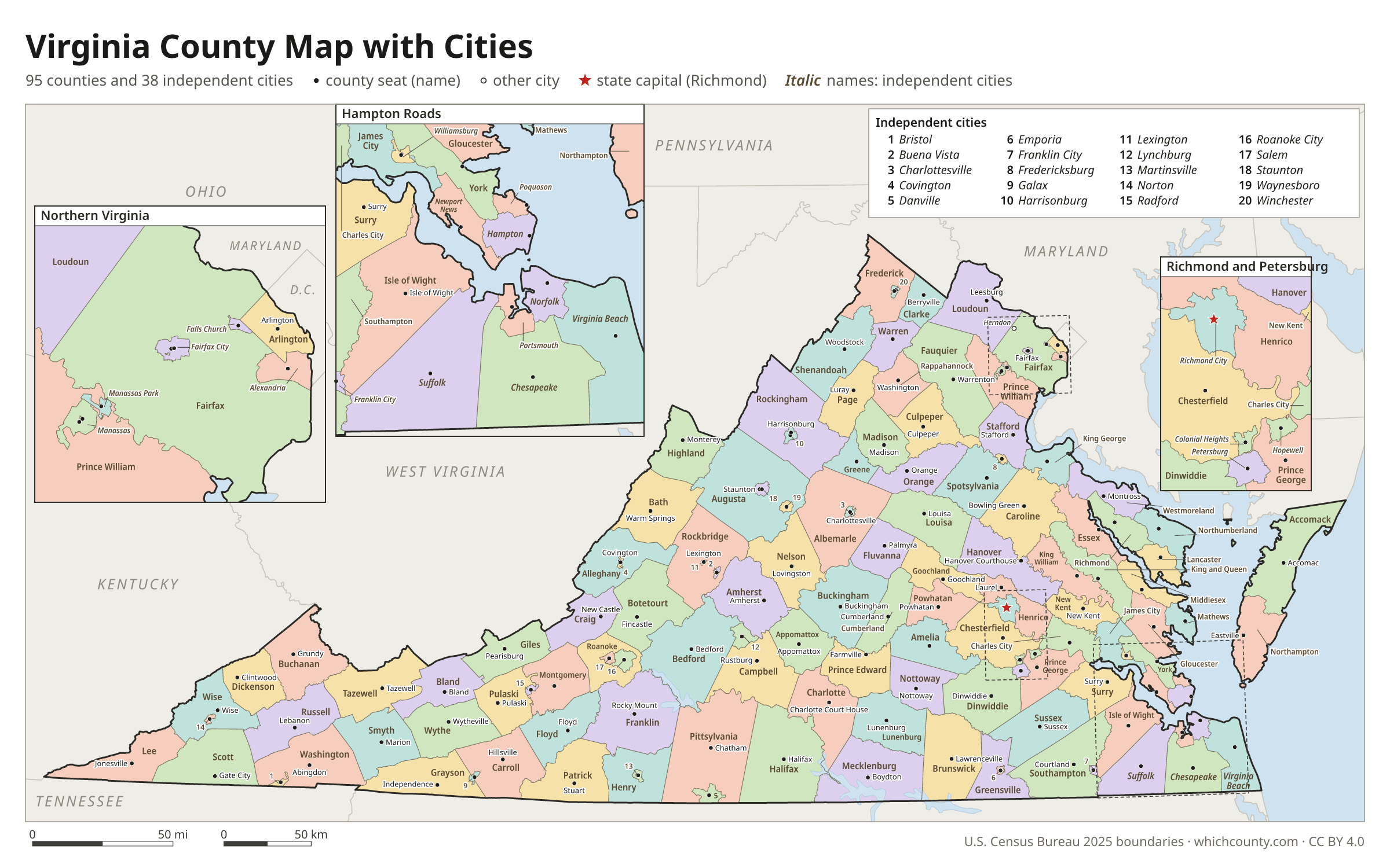
Virginia county map with cities
The largest cities in Virginia and the counties and independent cities they are in. Cities that cross a county line list every county, the main one first. To find any smaller town, use the search box above.
| City | County | Population 2025 |
|---|---|---|
| Virginia Beach | Virginia Beach city | 453,737 |
| Chesapeake | Chesapeake city | 255,332 |
| Richmond | Richmond city | 237,257 |
| Norfolk | Norfolk city | 231,013 |
| Newport News | Newport News city | 183,230 |
| Alexandria | Alexandria city | 160,662 |
| Hampton | Hampton city | 137,315 |
| Suffolk | Suffolk city | 104,699 |
| Roanoke | Roanoke city | 99,111 |
| Portsmouth | Portsmouth city | 96,777 |
| Lynchburg | Lynchburg city | 81,347 |
| Harrisonburg | Harrisonburg city | 50,839 |
| Leesburg | Loudoun County | 49,917 |
| Blacksburg | Montgomery County | 45,104 |
| Charlottesville | Charlottesville city | 44,388 |
| Manassas | Manassas city | 44,332 |
| Danville | Danville city | 41,647 |
| Petersburg | Petersburg city | 33,734 |
| Fredericksburg | Fredericksburg city | 30,393 |
| Winchester | Winchester city | 28,272 |
| Staunton | Staunton city | 26,801 |
| Fairfax | Fairfax city | 26,772 |
| Salem | Salem city | 25,816 |
| Herndon | Fairfax and Loudoun counties | 25,506 |
| Waynesboro | Waynesboro city | 23,951 |
| Hopewell | Hopewell city | 23,261 |
| Christiansburg | Montgomery County | 22,442 |
| Culpeper | Culpeper County | 22,074 |
| Colonial Heights | Colonial Heights city | 18,738 |
| Radford | Radford city | 17,243 |
Printable Virginia county maps (free PDF, PNG, SVG)
Every map is free to print and share. The PDFs are vector files with real text, so they stay sharp at any size and you can search them for a county name. Use 11×17 (tabloid) for the most readable labels.
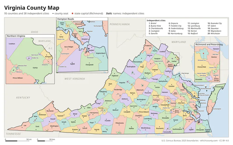
Color map with names
All 133 counties and independent cities labeled, county seats marked. Letter and 11×17 PDF, high-resolution PNG, editable SVG.
Map with cities
Counties and independent cities with their county seat towns and major cities.
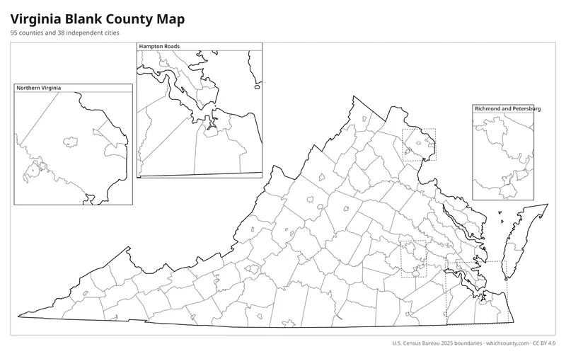
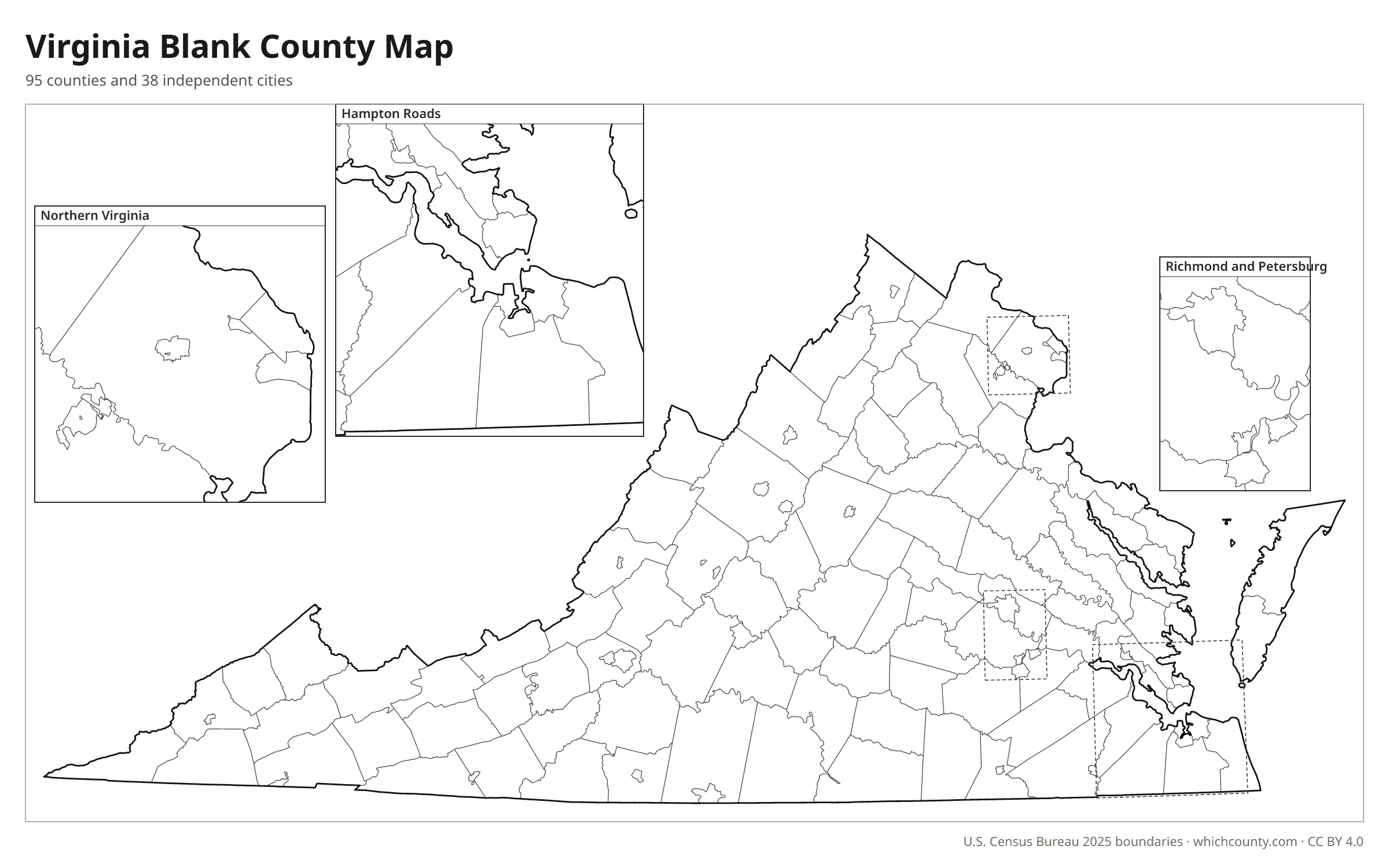
Blank outline map
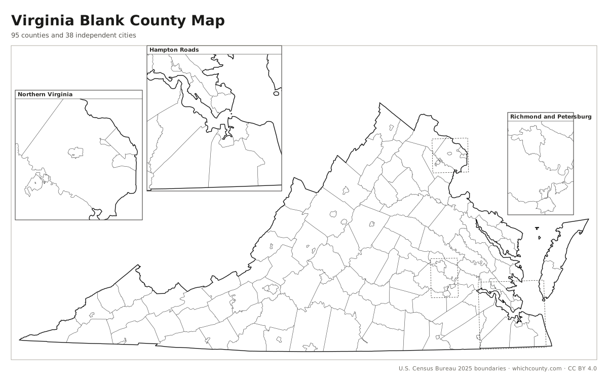
County lines only, no names. For quizzes, coloring and your own notes.
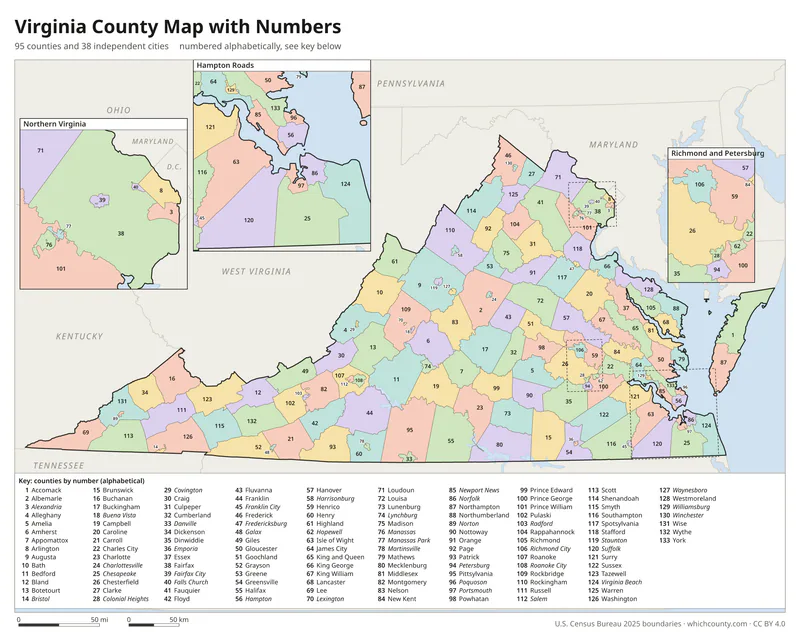
Numbered map with key
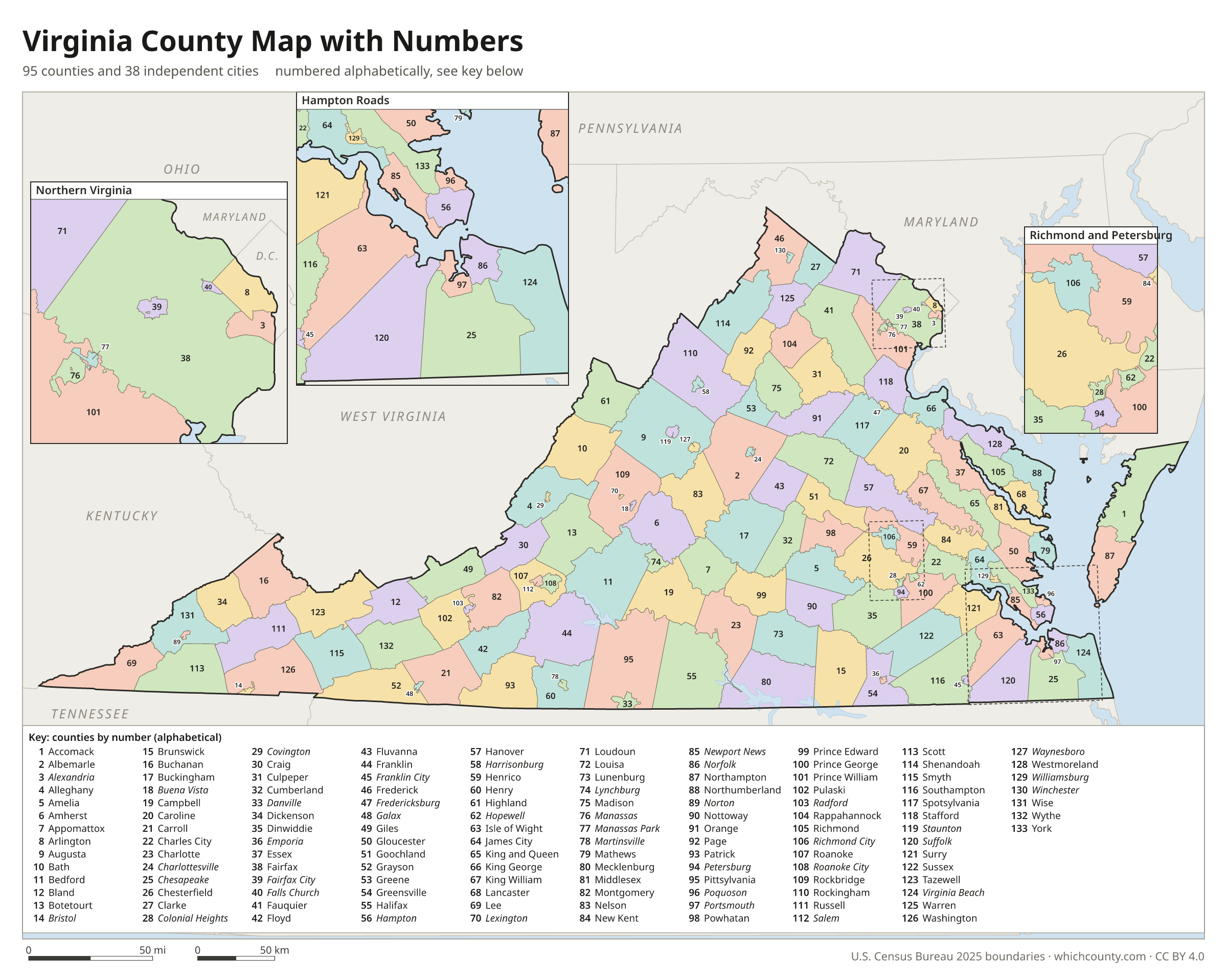
A number in every county with an alphabetical key.
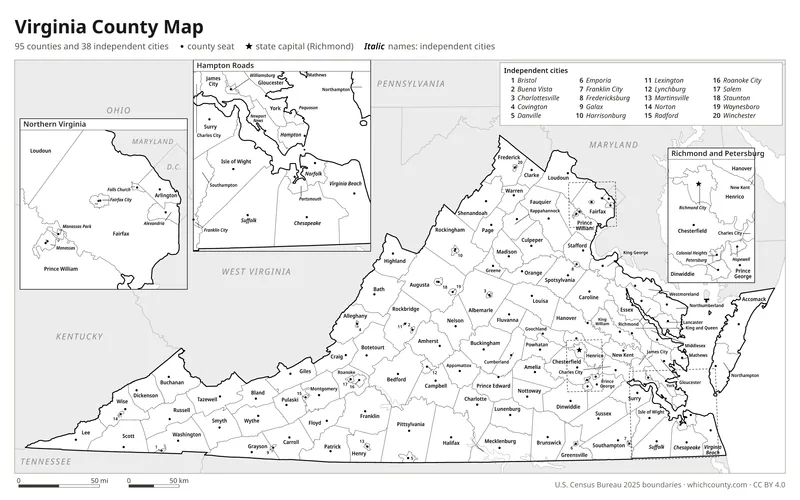
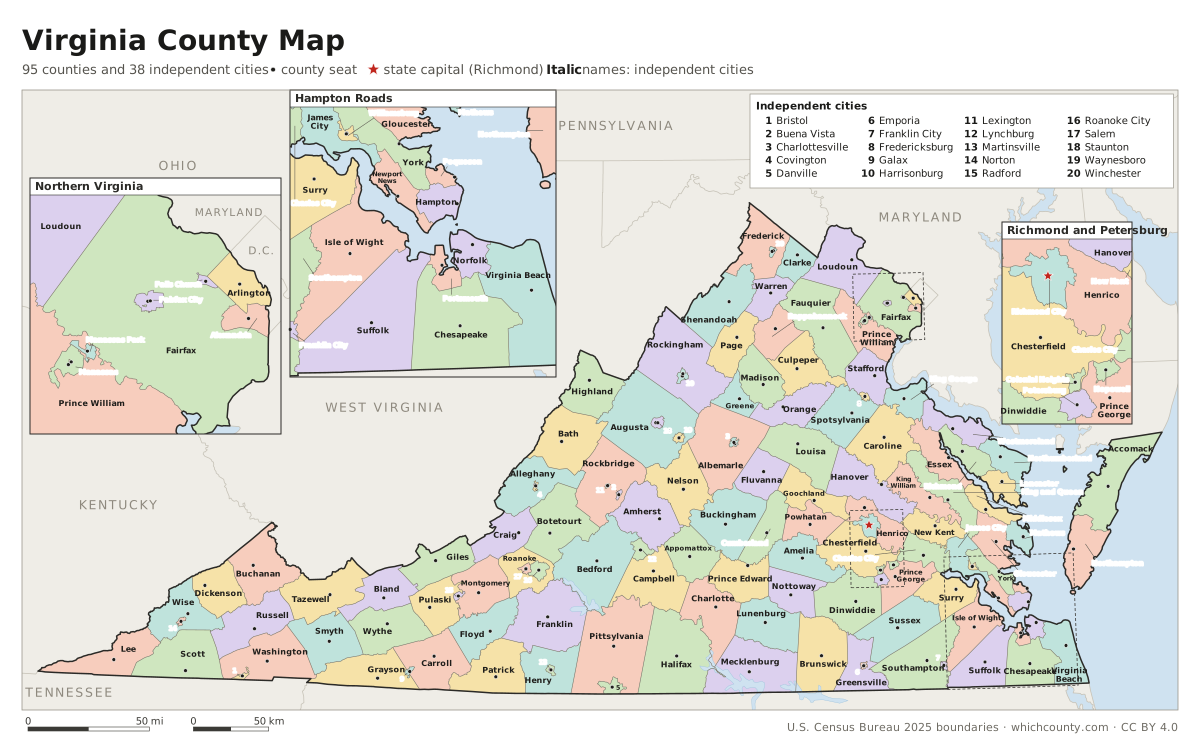
Black and white
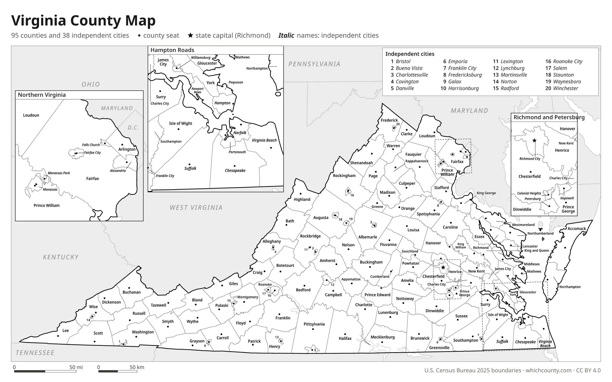
Labeled map that prints well on any printer.
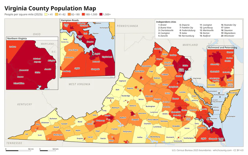
Population map
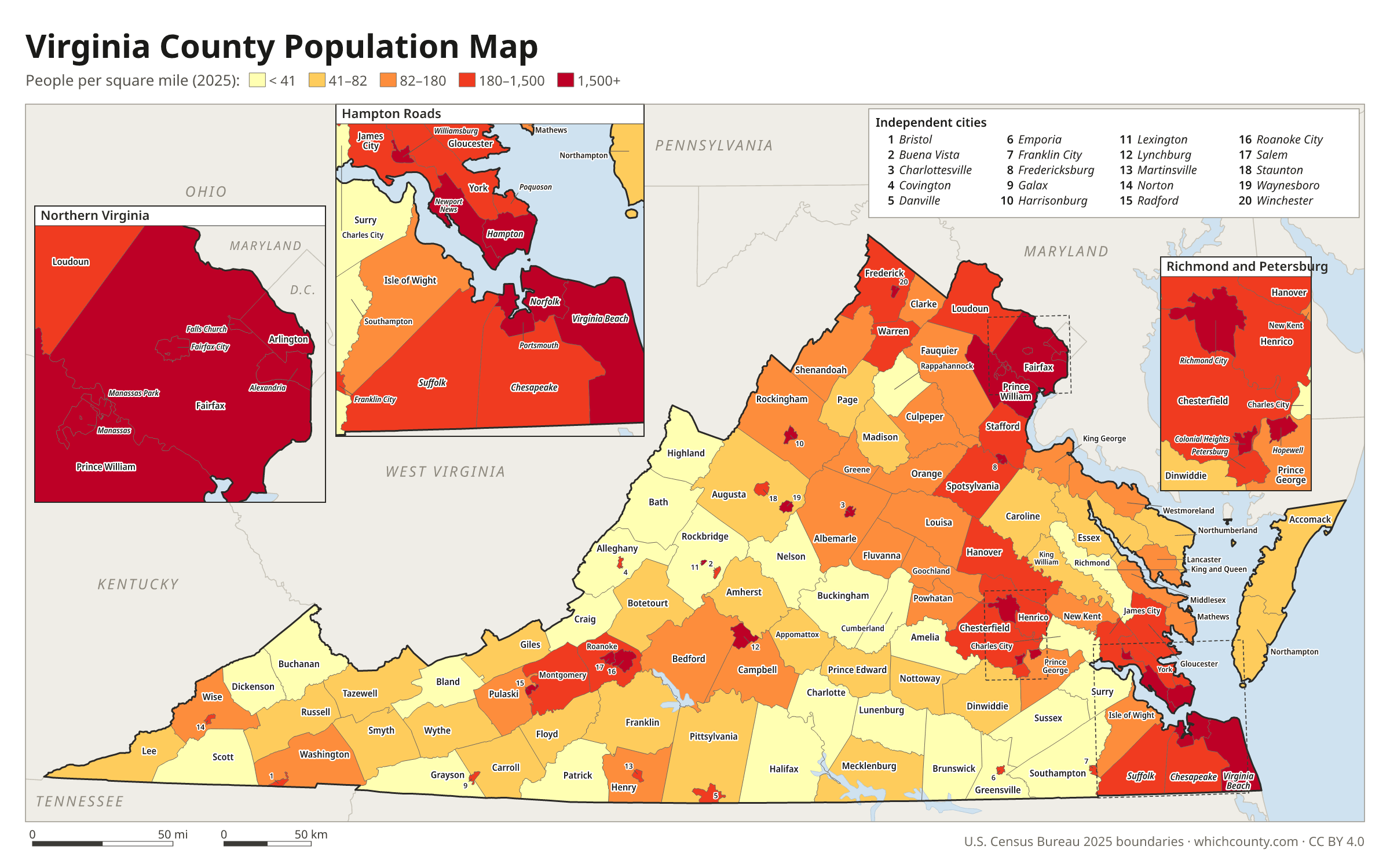
Counties and independent cities shaded by population density (2025 estimates).
Data and GIS files
The county table as CSV, and the boundaries as GeoJSON and KML (Google Earth, Google My Maps).
Why Virginia has 95 counties and 38 independent cities
Virginia's counties go back to 1634, when the colony was divided into eight shires to be governed like the shires of England. Six of them survive as counties: Charles City, Henrico, Isle of Wight, James City, Northampton and York. The other 89 counties were formed later, the last being Dickenson County in 1880. Virginia's 38 independent cities are politically and administratively separate from the counties around them, an arrangement with no statewide parallel elsewhere in the United States. The separation grew slowly after Williamsburg became the first city in 1722. The Constitution of 1869 first recognized separate cities and counties, and the Constitution of 1971 codified the cities' independent status. A 1988 law lets cities of under 50,000 people revert to towns, and South Boston, Clifton Forge and Bedford have done so.
Regions of Virginia
Virginia's counties and independent cities grouped into the 21 Planning District Commissions of Virginia (source).
LENOWISCO Planning District Commission (PD 1)
Lee, Scott, Wise, Norton city
Cumberland Plateau Planning District Commission (PD 2)
Buchanan, Dickenson, Russell, Tazewell
Mount Rogers Planning District Commission (PD 3)
Bland, Carroll, Grayson, Smyth, Washington, Wythe, Bristol city, Galax city
New River Valley Regional Commission (PD 4)
Floyd, Giles, Montgomery, Pulaski, Radford city
Roanoke Valley-Alleghany Regional Commission (PD 5)
Alleghany, Botetourt, Craig, Roanoke, Covington city, Roanoke city, Salem city
Central Shenandoah Planning District Commission (PD 6)
Augusta, Bath, Highland, Rockbridge, Rockingham, Buena Vista city, Harrisonburg city, Lexington city, Staunton city, Waynesboro city
Northern Shenandoah Valley Regional Commission (PD 7)
Clarke, Frederick, Page, Shenandoah, Warren, Winchester city
Northern Virginia Regional Commission (PD 8)
Arlington, Fairfax, Loudoun, Prince William, Alexandria city, Fairfax city, Falls Church city, Manassas city, Manassas Park city
Rappahannock-Rapidan Regional Commission (PD 9)
Culpeper, Fauquier, Madison, Orange, Rappahannock
Thomas Jefferson Planning District Commission (PD 10)
Albemarle, Fluvanna, Greene, Louisa, Nelson, Charlottesville city
Central Virginia Planning District Commission (PD 11)
Amherst, Appomattox, Bedford, Campbell, Lynchburg city
West Piedmont Planning District Commission (PD 12)
Franklin, Henry, Patrick, Pittsylvania, Danville city, Martinsville city
Southside Planning District Commission (PD 13)
Brunswick, Halifax, Mecklenburg
Commonwealth Regional Council (PD 14)
Amelia, Buckingham, Charlotte, Cumberland, Lunenburg, Nottoway, Prince Edward
PlanRVA, Richmond Regional Planning District Commission (PD 15)
Charles City, Chesterfield, Goochland, Hanover, Henrico, New Kent, Powhatan, Richmond city
George Washington Regional Commission (PD 16)
Caroline, King George, Spotsylvania, Stafford, Fredericksburg city
Northern Neck Planning District Commission (PD 17)
Lancaster, Northumberland, Richmond, Westmoreland
Middle Peninsula Planning District Commission (PD 18)
Essex, Gloucester, King and Queen, King William, Mathews, Middlesex
Crater Planning District Commission (PD 19)
Dinwiddie, Greensville, Prince George, Surry, Sussex, Colonial Heights city, Emporia city, Hopewell city, Petersburg city
Accomack-Northampton Planning District Commission (PD 22)
Accomack, Northampton
Hampton Roads Planning District Commission (PD 23)
Isle of Wight, James City, Southampton, York, Chesapeake city, Franklin city, Hampton city, Newport News city, Norfolk city, Poquoson city, Portsmouth city, Suffolk city, Virginia Beach city, Williamsburg city
County maps of neighboring states
 District of Columbia county map
 Kentucky county map
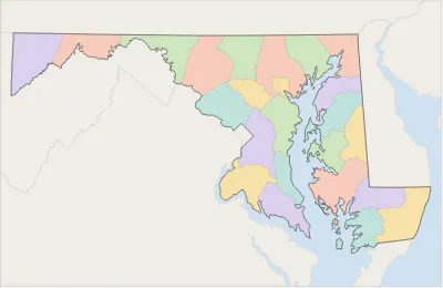 Maryland county map
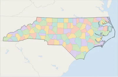 North Carolina county map
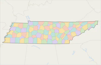 Tennessee county map
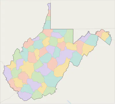 West Virginia county map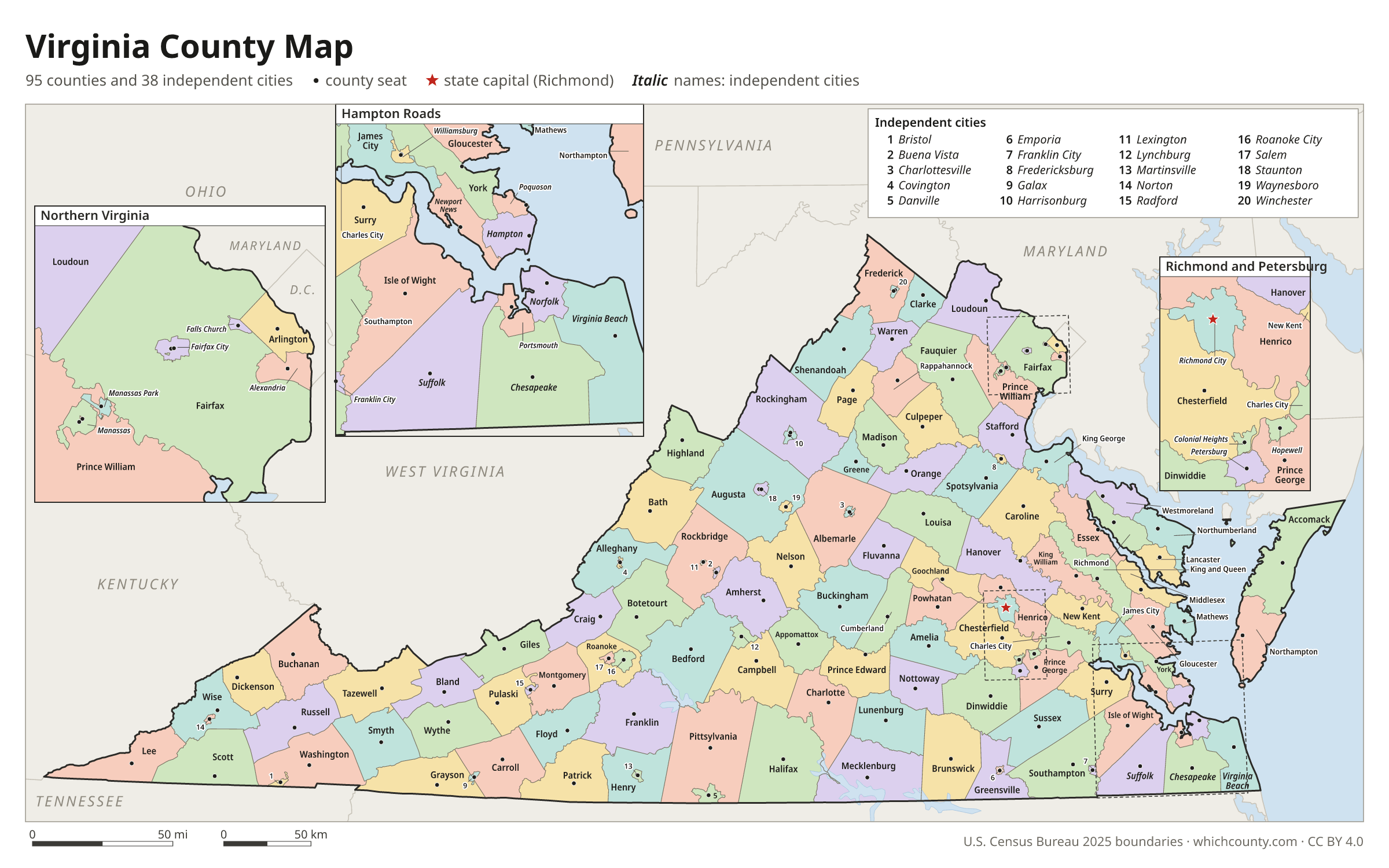
Virginia counties and independent cities: questions and answers
- How many counties and independent cities are in Virginia?
- Virginia has 133 counties and independent cities. Virginia has 95 counties and 38 independent cities. The Census Bureau treats each independent city as a county-equivalent, so the official total is 133.
- What is the largest county in Virginia?
- By land area, Pittsylvania County is the largest (969 sq mi). By population, Fairfax County is the largest, with 1,167,873 people (2025 estimate).
- What is the smallest county in Virginia?
- Falls Church city is the smallest by land area (2 sq mi). Highland County has the fewest people: 2,318 (2025 estimate).
- What is the wealthiest county in Virginia?
- By median household income, Loudoun County ranks first with $181,765 (American Community Survey 2020–2024). The lowest is Galax city at $38,675.
- What county is Virginia Beach in?
- Virginia Beach is in Virginia Beach city.
- What county is Chesapeake in?
- Chesapeake is in Chesapeake city.
- What county is Richmond in?
- Richmond is in Richmond city.
- How can I see county lines on Google Maps?
- Google Maps does not draw county lines. Download the KML file from the printable maps section above and import it into Google My Maps (Create a new map › Import) or open it in Google Earth to see every Virginia county boundary on top of Google's map.
- Can I use this map for free?
- Yes. The maps and files on this page are free to print, share and use in your own work, including commercial projects, under the CC BY 4.0 licence. Please credit “WhichCounty (whichcounty.com)”.
Use this map on your site
You may copy, print and publish these maps, also commercially, as long as you credit WhichCounty with a link (licence details). Paste this code to embed the map:
Sources and methodology
- Boundaries: U.S. Census Bureau, 2025 Cartographic Boundary Files (1:500,000), simplified for display. Projection: Lambert conformal conic fitted to Virginia.
- Population: Census Bureau county estimates, Vintage 2025 (July 1, 2025), compared with the April 1, 2020 estimates base.
- Land area: Census Bureau 2026 Gazetteer files. Median household income: American Community Survey 2020–2024 5-year estimates.
- County seats and founding years: Wikidata (CC0), checked against state lists by WhichCounty. Cities: Census Bureau city and town estimates, Vintage 2025.
- County Formation during the Colonial Period (Encyclopedia Virginia, Virginia Humanities)
- Cities of Virginia (Encyclopedia Virginia, Virginia Humanities)
- County and City Formations and Records Availability (Library of Virginia)
- Substantial Changes to Counties and County Equivalent Entities: 2010s (U.S. Census Bureau)
- Atlas of Historical County Boundaries: Virginia (Newberry Library)
Found an error? Tell us. Last data update: October 4, 2026.