Oklahoma County Map
All 77 counties with county seats and major cities
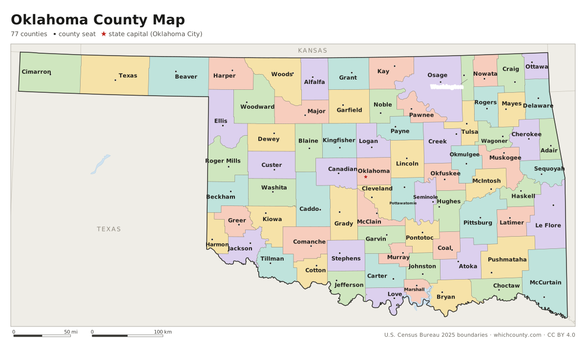
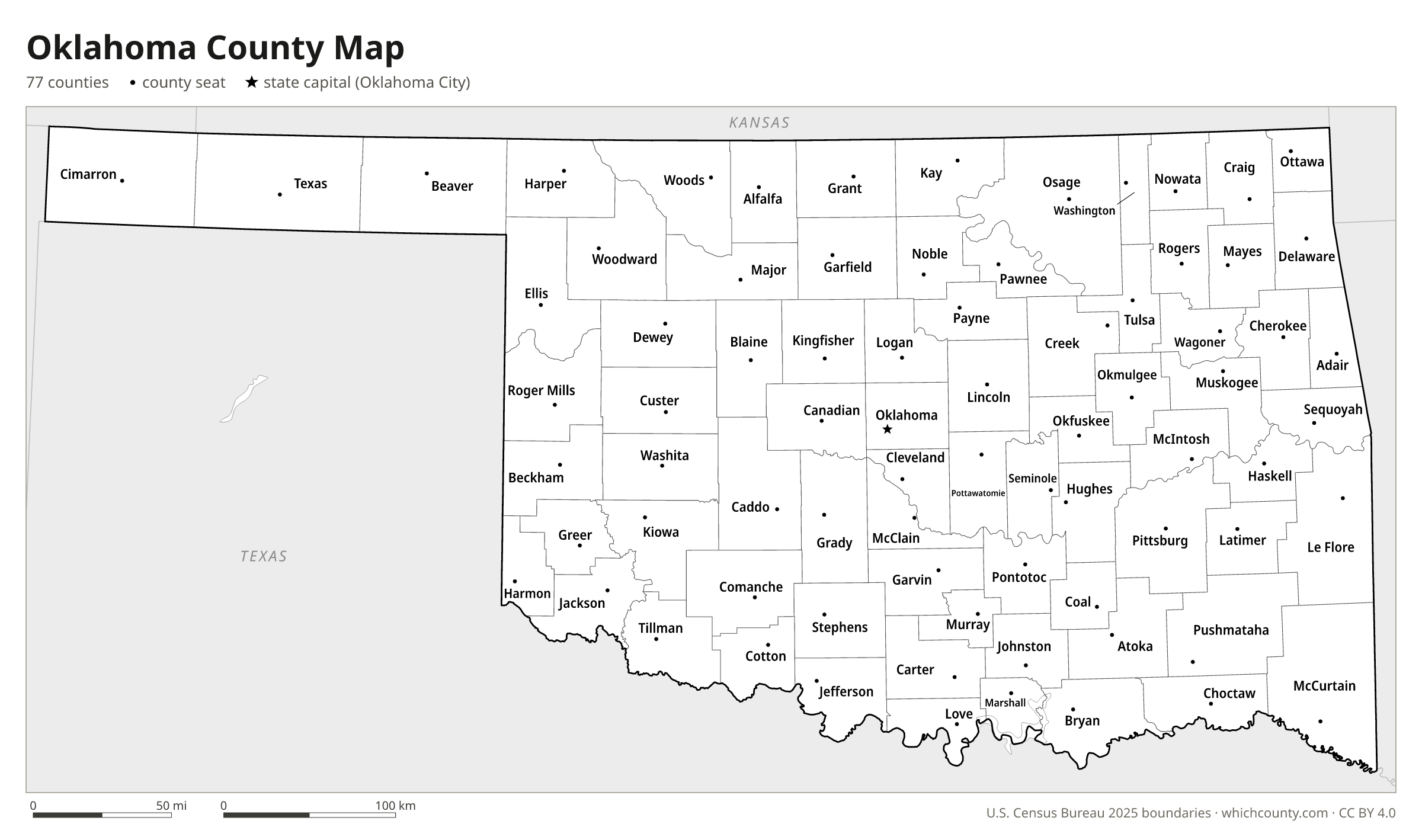
Of Oklahoma's 77 counties, 75 were laid out for statehood in 1907. This map shows all 77 counties and their county seats. Tap a county for details, or download the free printable map below.

Updated October 4, 2026 · Boundaries: U.S. Census Bureau 2025 · Population: Census estimates for July 1, 2025
Oklahoma county facts
- Number of counties
- 77
- Largest by land area
- Osage County 2,247 sq mi
- Smallest by land area
- Marshall County 371.5 sq mi
- Most people
- Oklahoma County 822,125
- Fewest people
- Cimarron County 2,059
- Fastest growing since 2020
- Canadian County +21.4%
- Highest median household income
- Canadian County $87,751
- Oldest county
- Beaver County est. 1890
- Newest county
- Cotton County est. 1912
- State capital
- Oklahoma City Oklahoma County
Greer County was created by Texas in 1860 in land between the forks of the Red River. The U.S. Supreme Court ruled in 1896 that the area belonged to Oklahoma Territory, and the 1906 constitutional convention divided it into Beckham, Jackson and Greer counties.
The Panhandle, once called No Man's Land, formed a single county in 1890 (Beaver); Texas and Cimarron counties were cut from it at statehood in 1907.
A 1930 U.S. Supreme Court ruling moved the Texas line along the 100th meridian, shrinking Harmon County.
List of 77 Oklahoma counties
Sorted A–Z. Click a column to sort, or a name to show it on the map. Download as CSV
| County | County seat | Population 2025 | Change since 2020 | Land area (sq mi) | Median income | Established | FIPS |
|---|---|---|---|---|---|---|---|
| Adair County | Stilwell | 19,828 | +1.7% | 574 | $48,041 | 1907 | 40001 |
| Alfalfa County | Cherokee | 5,649 | −1% | 867 | $64,615 | 1907 | 40003 |
| Atoka County | Atoka | 14,609 | +3.3% | 976 | $54,785 | 1907 | 40005 |
| Beaver County | Beaver | 4,882 | −3.3% | 1,815 | $64,276 | 1890 | 40007 |
| Beckham County | Sayre | 22,159 | −1.1% | 902 | $53,328 | 1907 | 40009 |
| Blaine County | Watonga | 8,515 | −2.5% | 929 | $61,642 | – | 40011 |
| Bryan County | Durant | 51,367 | +11.5% | 904 | $57,225 | 1907 | 40013 |
| Caddo County | Anadarko | 26,130 | −3% | 1,278 | $55,353 | 1901 | 40015 |
| Canadian County | El Reno | 187,189 | +21.4% | 897 | $87,751 | 1890 | 40017 |
| Carter County | Ardmore | 48,910 | +1.9% | 822 | $60,723 | 1907 | 40019 |
| Cherokee County | Tahlequah | 49,196 | +4.5% | 749 | $53,218 | 1907 | 40021 |
| Choctaw County | Hugo | 14,059 | −1% | 770 | $44,081 | 1907 | 40023 |
| Cimarron County | Boise City | 2,059 | −10.1% | 1,835 | $62,188 | 1907 | 40025 |
| Cleveland County | Norman | 303,973 | +2.9% | 539 | $77,068 | 1890 | 40027 |
| Coal County | Coalgate | 5,436 | +3.3% | 517 | $50,423 | 1907 | 40029 |
| Comanche County | Lawton | 122,158 | +0.9% | 1,069 | $60,761 | 1901 | 40031 |
| Cotton County | Walters | 5,432 | −1.7% | 633 | $58,425 | 1912 | 40033 |
| Craig County | Vinita | 14,518 | +2.9% | 761 | $51,922 | 1907 | 40035 |
| Creek County | Sapulpa | 74,967 | +4.5% | 950 | $62,338 | 1907 | 40037 |
| Custer County | Arapaho | 28,175 | −1.2% | 989 | $59,738 | 1892 | 40039 |
| Delaware County | Jay | 41,910 | +3.8% | 738 | $56,676 | 1907 | 40041 |
| Dewey County | Taloga | 4,207 | −6.2% | 1,000 | $62,569 | 1892 | 40043 |
| Ellis County | Arnett | 3,613 | −3.7% | 1,232 | $61,016 | 1907 | 40045 |
| Garfield County | Enid | 61,779 | −1.7% | 1,059 | $66,182 | 1893 | 40047 |
| Garvin County | Pauls Valley | 26,377 | +2.8% | 802 | $58,556 | 1907 | 40049 |
| Grady County | Chickasha | 59,128 | +7.9% | 1,101 | $75,419 | 1907 | 40051 |
| Grant County | Medford | 4,067 | −2.6% | 1,001 | $60,758 | 1893 | 40053 |
| Greer County | Mangum | 5,373 | −2.2% | 639 | $59,406 | – | 40055 |
| Harmon County | Hollis | 2,327 | −6.6% | 537 | $43,333 | 1909 | 40057 |
| Harper County | Buffalo | 3,172 | −2.9% | 1,039 | $64,053 | 1907 | 40059 |
| Haskell County | Stigler | 11,787 | +1.9% | 577 | $49,806 | 1907 | 40061 |
| Hughes County | Holdenville | 13,455 | +0.7% | 805 | $51,581 | 1907 | 40063 |
| Jackson County | Altus | 24,764 | −0.1% | 803 | $62,799 | 1907 | 40065 |
| Jefferson County | Waurika | 5,431 | +1.9% | 759 | $48,668 | 1907 | 40067 |
| Johnston County | Tishomingo | 10,448 | +1.7% | 643 | $52,688 | 1907 | 40069 |
| Kay County | Newkirk | 43,490 | −0.5% | 920 | $58,423 | 1893 | 40071 |
| Kingfisher County | Kingfisher | 15,795 | +4% | 898 | $71,975 | 1890 | 40073 |
| Kiowa County | Hobart | 8,181 | −3.8% | 1,015 | $44,962 | 1901 | 40075 |
| Latimer County | Wilburton | 9,645 | +2.2% | 722 | $41,405 | 1907 | 40077 |
| Le Flore County | Poteau | 50,196 | +4.3% | 1,589 | $51,565 | 1907 | 40079 |
| Lincoln County | Chandler | 35,278 | +5.4% | 952 | $62,216 | 1891 | 40081 |
| Logan County | Guthrie | 55,473 | +12% | 744 | $83,899 | 1890 | 40083 |
| Love County | Marietta | 10,780 | +6.3% | 514 | $66,580 | 1907 | 40085 |
| Major County | Fairview | 7,536 | −3.2% | 955 | $71,266 | 1907 | 40093 |
| Marshall County | Madill | 16,255 | +6.3% | 372 | $57,245 | 1907 | 40095 |
| Mayes County | Pryor Creek | 40,416 | +3.5% | 655 | $60,305 | 1907 | 40097 |
| McClain County | Purcell | 49,647 | +19.1% | 571 | $84,552 | 1907 | 40087 |
| McCurtain County | Idabel | 30,744 | −0.2% | 1,851 | $51,929 | 1907 | 40089 |
| McIntosh County | Eufaula | 19,758 | +4.3% | 618 | $46,281 | 1907 | 40091 |
| Murray County | Sulphur | 13,805 | −0.7% | 416 | $66,322 | 1907 | 40099 |
| Muskogee County | Muskogee | 66,708 | +0.6% | 811 | $53,619 | 1907 | 40101 |
| Noble County | Perry | 10,899 | −0.2% | 732 | $66,365 | 1893 | 40103 |
| Nowata County | Nowata | 9,522 | +2.2% | 566 | $54,333 | 1907 | 40105 |
| Okfuskee County | Okemah | 11,451 | +1.2% | 619 | $48,363 | 1907 | 40107 |
| Oklahoma County | Oklahoma City | 822,125 | +3.2% | 709 | $66,679 | 1890 | 40109 |
| Okmulgee County | Okmulgee | 37,241 | +1.5% | 697 | $54,029 | 1907 | 40111 |
| Osage County | Pawhuska | 46,794 | +2.1% | 2,247 | $62,847 | 1907 | 40113 |
| Ottawa County | Miami | 30,438 | +0.5% | 471 | $49,947 | 1907 | 40115 |
| Pawnee County | Pawnee | 16,029 | +3.1% | 568 | $58,738 | 1893 | 40117 |
| Payne County | Stillwater | 83,889 | +2.8% | 685 | $49,809 | 1890 | 40119 |
| Pittsburg County | McAlester | 43,320 | −1% | 1,306 | $55,310 | 1907 | 40121 |
| Pontotoc County | Ada | 38,528 | +1.2% | 720 | $63,017 | 1907 | 40123 |
| Pottawatomie County | Shawnee | 75,102 | +3.7% | 788 | $61,398 | 1891 | 40125 |
| Pushmataha County | Antlers | 10,807 | −0.1% | 1,396 | $47,940 | 1907 | 40127 |
| Roger Mills County | Cheyenne | 3,259 | −5.3% | 1,141 | $66,094 | – | 40129 |
| Rogers County | Claremore | 102,197 | +7.3% | 676 | $80,067 | 1907 | 40131 |
| Seminole County | Wewoka | 23,441 | −0.5% | 633 | $48,062 | 1907 | 40133 |
| Sequoyah County | Sallisaw | 40,842 | +4% | 674 | $51,093 | 1907 | 40135 |
| Stephens County | Duncan | 44,310 | +3.4% | 870 | $61,620 | 1907 | 40137 |
| Texas County | Guymon | 20,322 | −5% | 2,041 | $60,069 | 1907 | 40139 |
| Tillman County | Frederick | 6,780 | −2.7% | 871 | $48,939 | 1907 | 40141 |
| Tulsa County | Tulsa | 698,782 | +4.4% | 570 | $69,009 | 1907 | 40143 |
| Wagoner County | Wagoner | 93,263 | +15.2% | 562 | $81,207 | 1907 | 40145 |
| Washington County | Bartlesville | 54,037 | +3% | 416 | $60,162 | 1907 | 40147 |
| Washita County | New Cordell | 10,884 | −0.3% | 1,003 | $63,501 | – | 40149 |
| Woods County | Alva | 8,443 | −2.1% | 1,287 | $53,275 | 1893 | 40151 |
| Woodward County | Woodward | 19,827 | −3.1% | 1,243 | $61,417 | 1893 | 40153 |
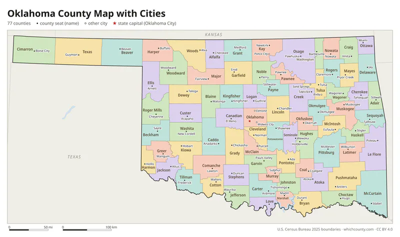
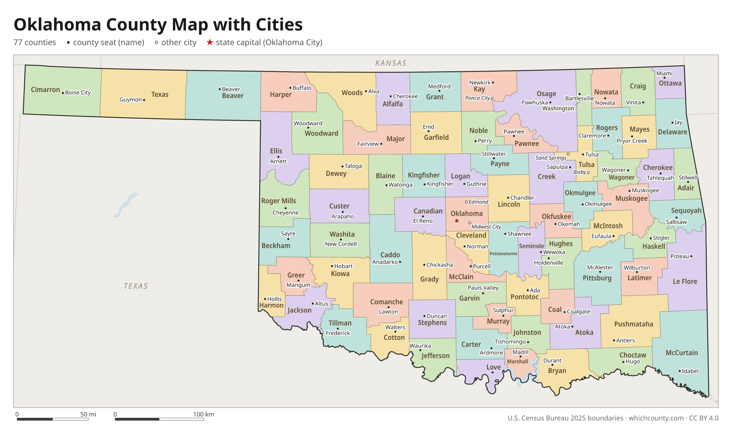
Oklahoma county map with cities
The largest cities in Oklahoma and the counties they are in. Cities that cross a county line list every county, the main one first. To find any smaller town, use the search box above.
| City | County | Population 2025 |
|---|---|---|
| Oklahoma City | Oklahoma, Canadian, Cleveland and Pottawatomie counties | 719,849 |
| Tulsa | Tulsa, Osage, Wagoner and Rogers counties | 416,209 |
| Norman | Cleveland County | 130,943 |
| Broken Arrow | Tulsa and Wagoner counties | 124,991 |
| Edmond | Oklahoma County | 100,479 |
| Lawton | Comanche County | 90,503 |
| Moore | Cleveland County | 63,609 |
| Midwest City | Oklahoma County | 58,799 |
| Enid | Garfield County | 50,297 |
| Stillwater | Payne County | 50,046 |
| Owasso | Tulsa and Rogers counties | 43,117 |
| Bartlesville | Washington and Osage counties | 38,278 |
| Muskogee | Muskogee County | 36,760 |
| Bixby | Tulsa and Wagoner counties | 32,766 |
| Shawnee | Pottawatomie County | 32,474 |
| Jenks | Tulsa County | 28,175 |
| Yukon | Canadian County | 27,615 |
| Ardmore | Carter County | 24,956 |
| Mustang | Canadian County | 24,571 |
| Ponca City | Kay County | 24,225 |
| Sapulpa | Creek and Tulsa counties | 23,695 |
| Duncan | Stephens County | 23,238 |
| Durant | Bryan County | 21,552 |
| Del City | Oklahoma County | 21,138 |
| El Reno | Canadian County | 20,730 |
| Claremore | Rogers County | 20,681 |
| Sand Springs | Tulsa and Osage counties | 20,397 |
| Bethany | Oklahoma County | 20,315 |
| Altus | Jackson County | 18,707 |
| McAlester | Pittsburg County | 18,044 |
Printable Oklahoma county maps (free PDF, PNG, SVG)
Every map is free to print and share. The PDFs are vector files with real text, so they stay sharp at any size and you can search them for a county name. Use 11×17 (tabloid) for the most readable labels.
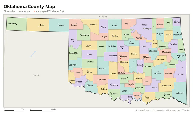
Color map with names
All 77 counties labeled, county seats marked. Letter and 11×17 PDF, high-resolution PNG, editable SVG.
Map with cities
Counties with their county seat towns and major cities.
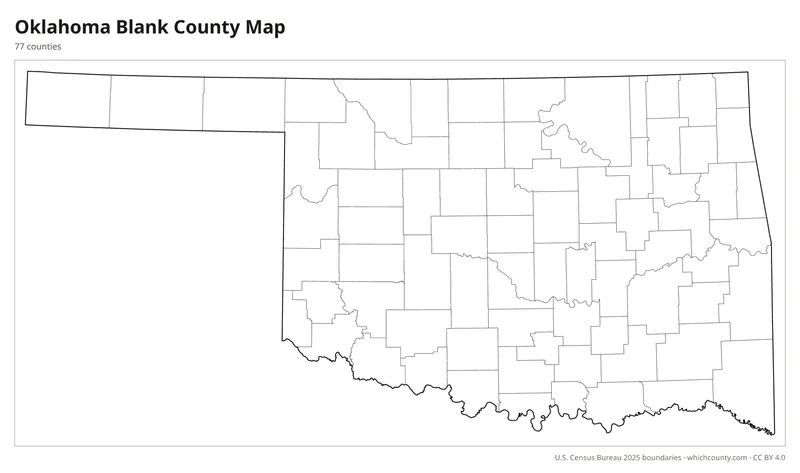
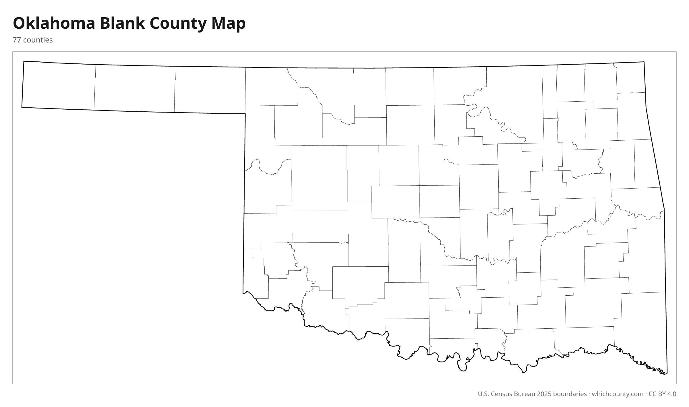
Blank outline map
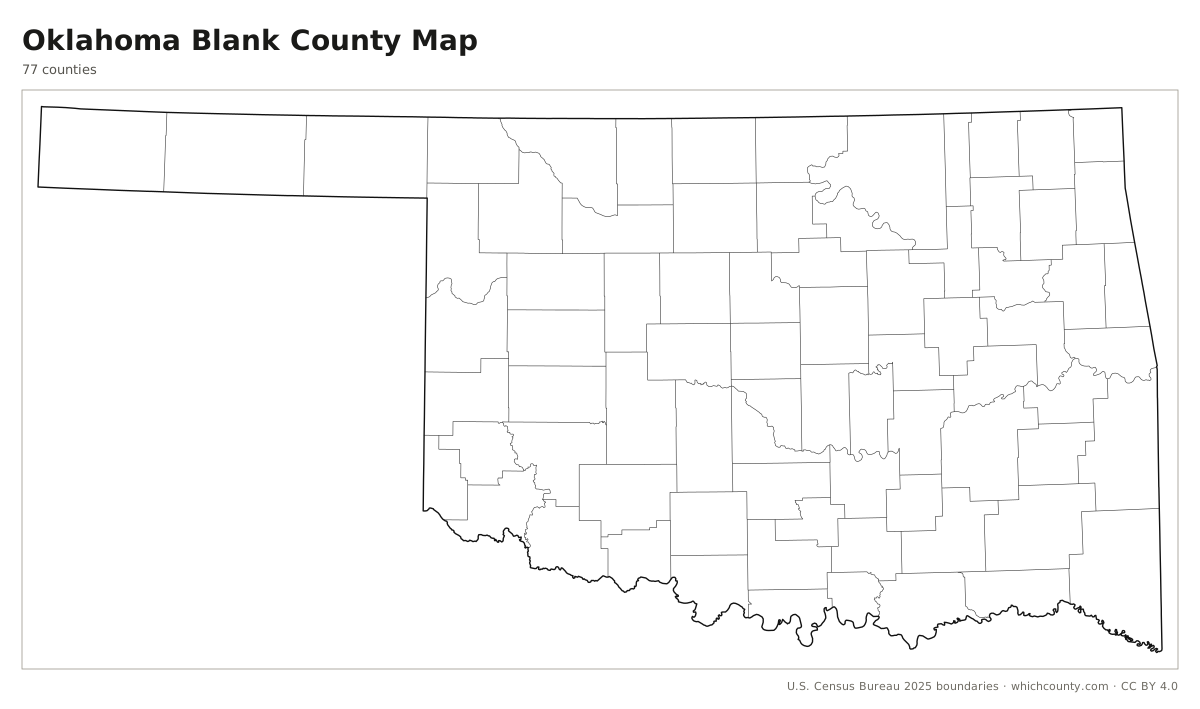
County lines only, no names. For quizzes, coloring and your own notes.
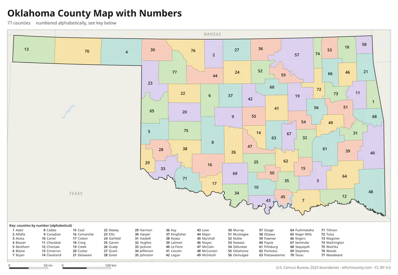
Numbered map with key
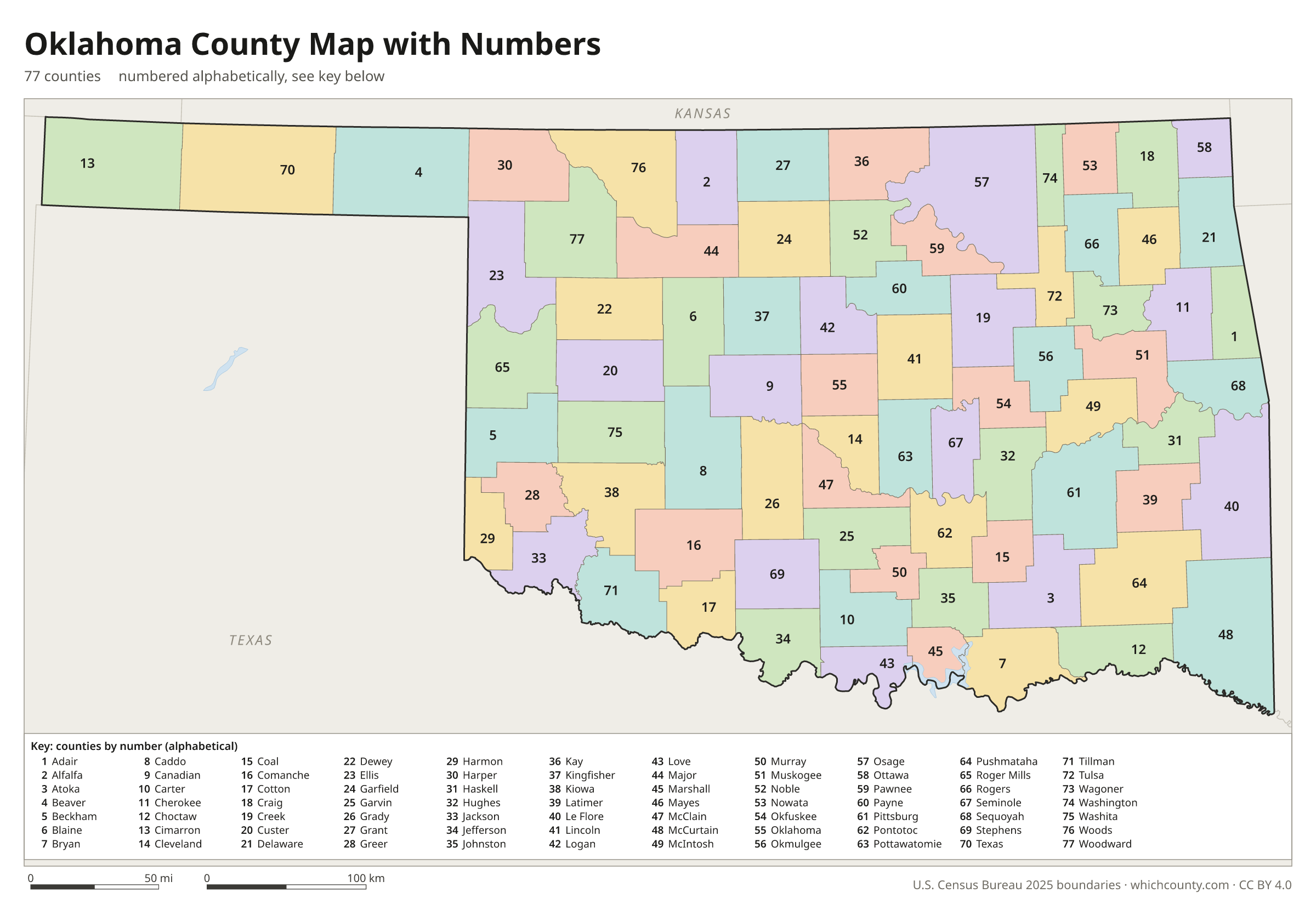
A number in every county with an alphabetical key.
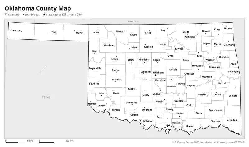
Black and white
Labeled map that prints well on any printer.
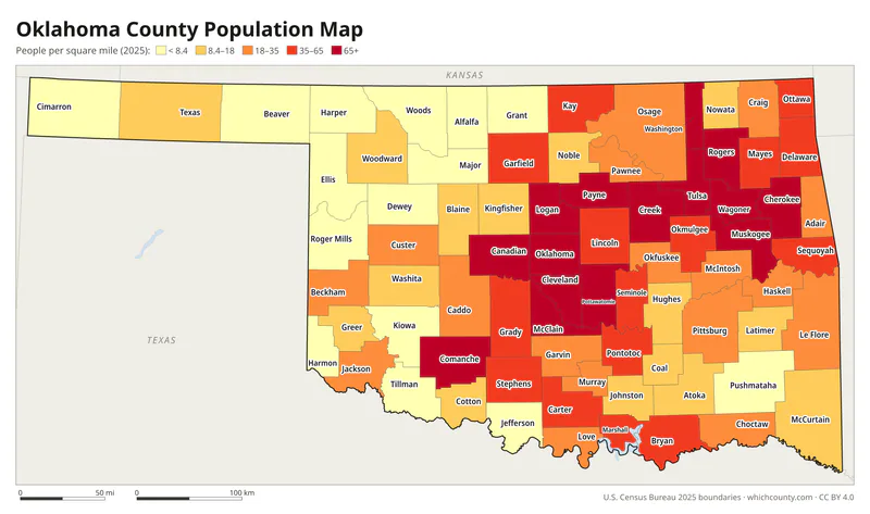
Population map
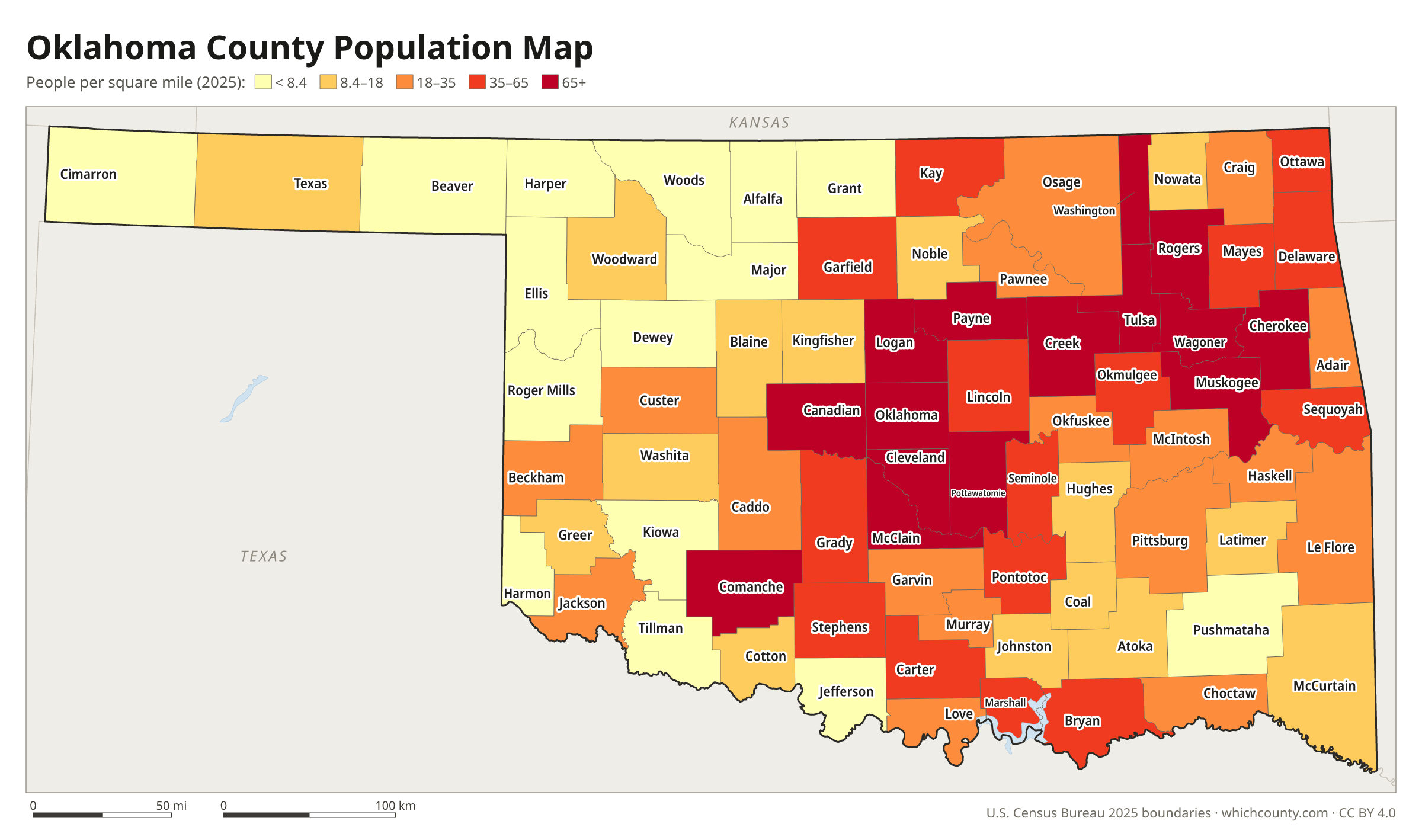
Counties shaded by population density (2025 estimates).
Data and GIS files
The county table as CSV, and the boundaries as GeoJSON and KML (Google Earth, Google My Maps).
How two territories became Oklahoma's 77 counties
Oklahoma's counties come from two territories with very different pasts. Oklahoma Territory began in 1890 with seven counties: six in the Unassigned Lands, opened by the land run of April 1889, and a seventh covering No Man's Land, the present Panhandle. The territory grew as reservation lands were allotted and opened to settlers, and by 1906 it had 26 counties. Indian Territory had none. At the 1906 constitutional convention, delegates from Indian Territory started from the 48 counties drawn for the proposed State of Sequoyah and cut them to 40. Oklahoma Territory delegates split some very large counties, adding nine for a total of 35. The state entered the Union on November 16, 1907, with those 75 counties. Local voters later added two more: Harmon, from Greer County, in 1909 and Cotton, from Comanche County, in 1912.
County numbers: The Tax Commission numbers the counties 01–77 in alphabetical order (Mc names filed as Mac) for sales tax codes.
County maps of neighboring states
 Arkansas county map
 Colorado county map
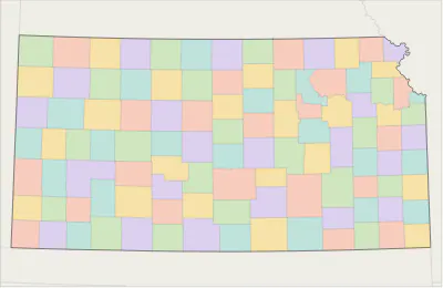 Kansas county map
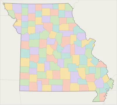 Missouri county map
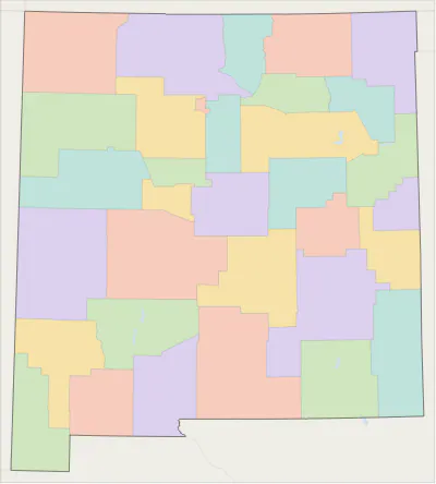 New Mexico county map
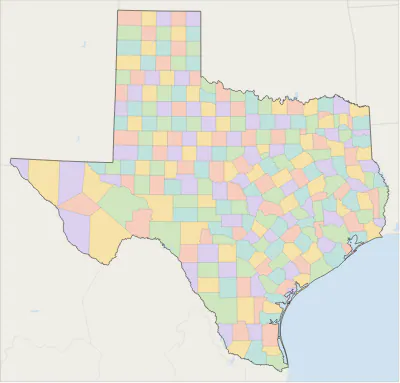 Texas county map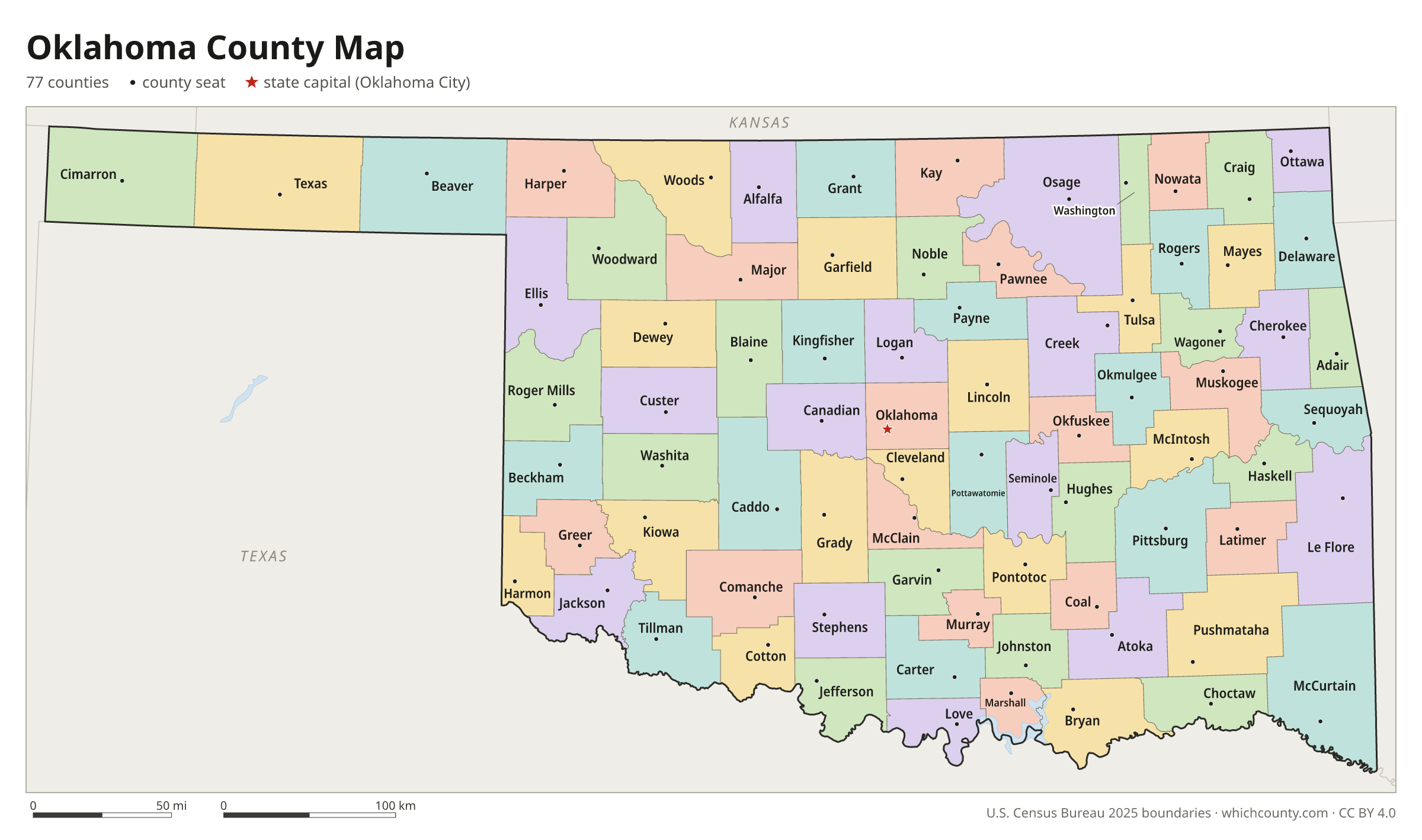
Oklahoma counties: questions and answers
- How many counties are in Oklahoma?
- Oklahoma has 77 counties.
- What is the largest county in Oklahoma?
- By land area, Osage County is the largest (2,247 sq mi). By population, Oklahoma County is the largest, with 822,125 people (2025 estimate).
- What is the smallest county in Oklahoma?
- Marshall County is the smallest by land area (371.5 sq mi). Cimarron County has the fewest people: 2,059 (2025 estimate).
- What is the wealthiest county in Oklahoma?
- By median household income, Canadian County ranks first with $87,751 (American Community Survey 2020–2024). The lowest is Latimer County at $41,405.
- What county is Oklahoma City in?
- Oklahoma City is mostly in Oklahoma County, with smaller parts in Canadian, Cleveland and Pottawatomie counties.
- What county is Tulsa in?
- Tulsa is mostly in Tulsa County, with smaller parts in Osage, Wagoner and Rogers counties.
- What county is Norman in?
- Norman is in Cleveland County.
- How can I see county lines on Google Maps?
- Google Maps does not draw county lines. Download the KML file from the printable maps section above and import it into Google My Maps (Create a new map › Import) or open it in Google Earth to see every Oklahoma county boundary on top of Google's map.
- Can I use this map for free?
- Yes. The maps and files on this page are free to print, share and use in your own work, including commercial projects, under the CC BY 4.0 licence. Please credit “WhichCounty (whichcounty.com)”.
Use this map on your site
You may copy, print and publish these maps, also commercially, as long as you credit WhichCounty with a link (licence details). Paste this code to embed the map:
Sources and methodology
- Boundaries: U.S. Census Bureau, 2025 Cartographic Boundary Files (1:500,000), simplified for display. Projection: Lambert conformal conic fitted to Oklahoma.
- Population: Census Bureau county estimates, Vintage 2025 (July 1, 2025), compared with the April 1, 2020 estimates base.
- Land area: Census Bureau 2026 Gazetteer files. Median household income: American Community Survey 2020–2024 5-year estimates.
- County seats and founding years: Wikidata (CC0), checked against state lists by WhichCounty. Cities: Census Bureau city and town estimates, Vintage 2025.
- Oklahoma Territory (Encyclopedia of Oklahoma History and Culture, Oklahoma Historical Society)
- Oklahoma County Boundary Descriptions with Annotations (Oklahoma House of Representatives)
- Harmon County (Encyclopedia of Oklahoma History and Culture)
- Cotton County (Encyclopedia of Oklahoma History and Culture)
- Atlas of Historical County Boundaries: Oklahoma (Newberry Library)
Found an error? Tell us. Last data update: October 4, 2026.