Michigan County Map
All 83 counties with county seats and major cities
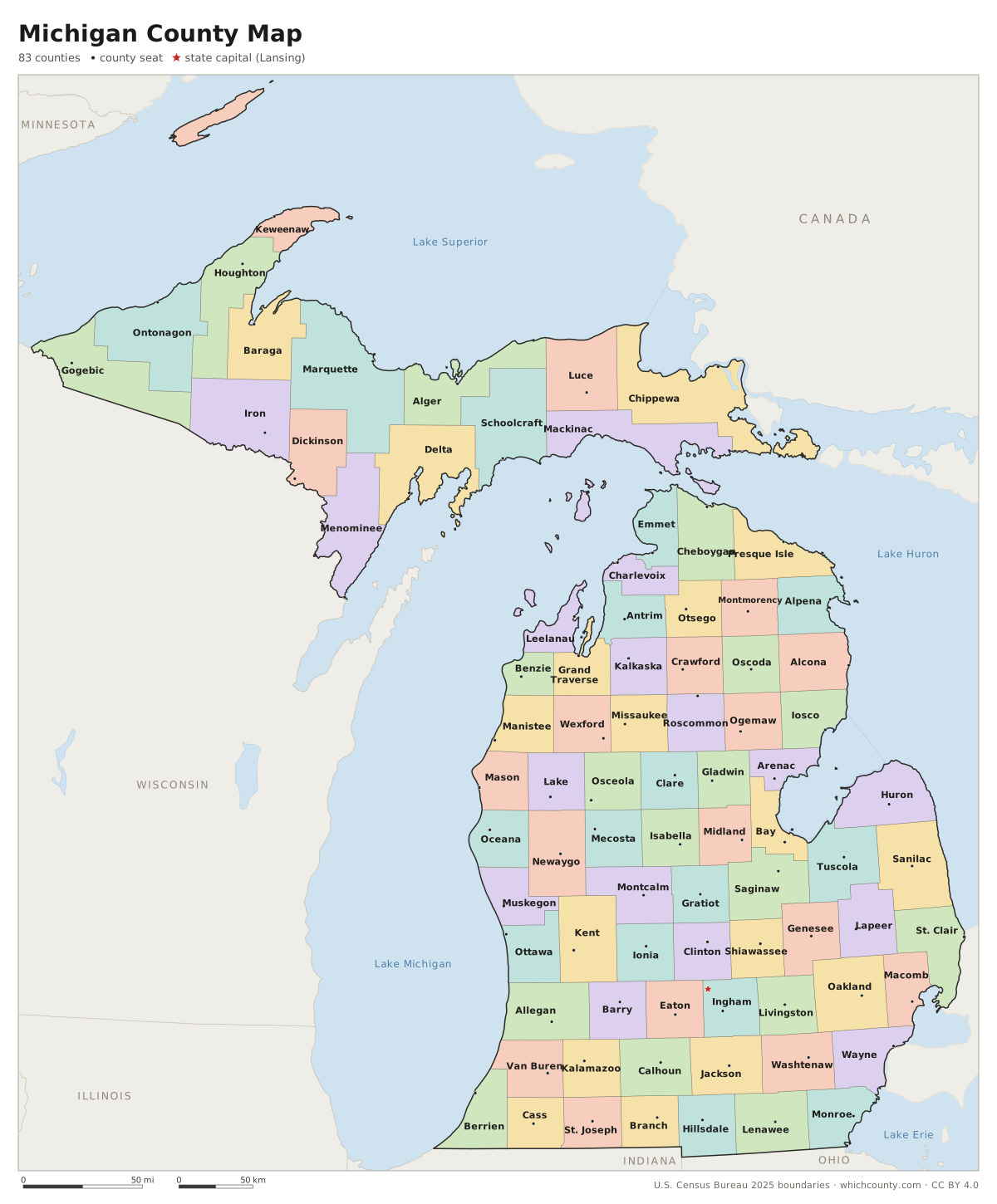
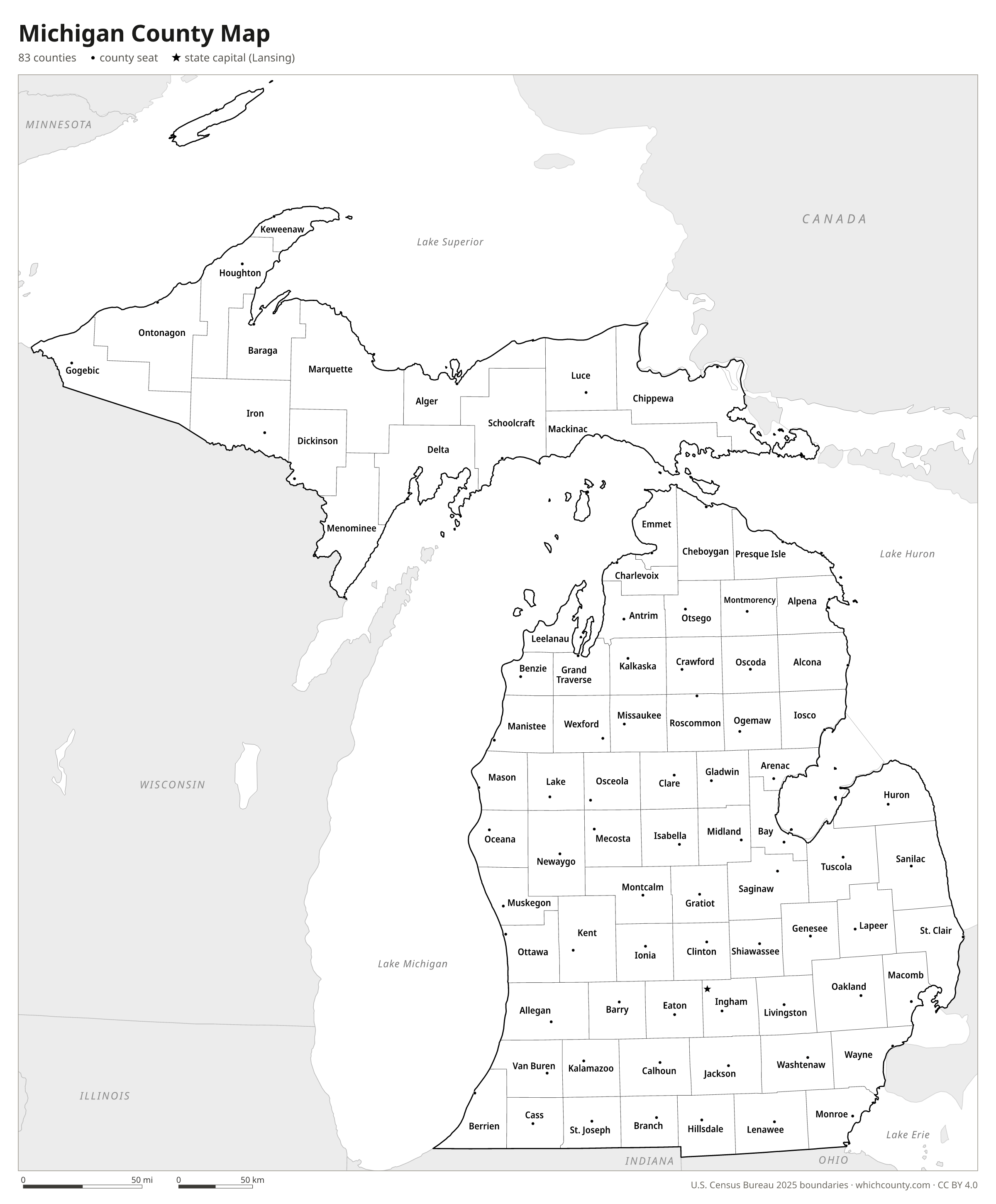
Michigan has 83 counties: 68 in the Lower Peninsula and 15 in the Upper Peninsula. This map shows all 83 counties and their county seats. Tap a county for details, or download the free printable map below.

Updated October 4, 2026 · Boundaries: U.S. Census Bureau 2025 · Population: Census estimates for July 1, 2025
Michigan county facts
- Number of counties
- 83
- Largest by land area
- Marquette County 1,809 sq mi
- Smallest by land area
- Benzie County 319.7 sq mi
- Most people
- Wayne County 1,769,038
- Fewest people
- Keweenaw County 2,186
- Fastest growing since 2020
- Lake County +9%
- Highest median household income
- Livingston County $103,039
- Oldest county
- Wayne County est. 1815
- Newest county
- Dickinson County est. 1891
- State capital
- Lansing Ingham County
List of 83 Michigan counties
Sorted A–Z. Click a column to sort, or a name to show it on the map. Download as CSV
| County | County seat | Population 2025 | Change since 2020 | Land area (sq mi) | Median income | Established | FIPS |
|---|---|---|---|---|---|---|---|
| Alcona County | Harrisville | 10,556 | +3.9% | 675 | $54,993 | 1840 | 26001 |
| Alger County | Munising | 8,641 | −2.2% | 915 | $61,286 | 1885 | 26003 |
| Allegan County | Allegan | 123,188 | +2.2% | 825 | $83,283 | 1831 | 26005 |
| Alpena County | Alpena | 28,853 | −0.2% | 572 | $53,950 | 1840 | 26007 |
| Antrim County | Bellaire | 24,698 | +5.5% | 476 | $72,054 | 1840 | 26009 |
| Arenac County | Standish | 15,068 | +0.5% | 363 | $58,811 | 1883 | 26011 |
| Baraga County | L'Anse | 8,169 | +0.2% | 898 | $55,327 | 1875 | 26013 |
| Barry County | Hastings | 63,991 | +2.5% | 553 | $77,500 | 1829 | 26015 |
| Bay County | Bay City | 102,123 | −1.7% | 442 | $61,763 | 1857 | 26017 |
| Benzie County | Beulah | 18,568 | +3.3% | 320 | $74,834 | 1863 | 26019 |
| Berrien County | St. Joseph | 152,444 | −1.4% | 568 | $65,425 | 1829 | 26021 |
| Branch County | Coldwater | 45,993 | +2.5% | 506 | $63,724 | 1829 | 26023 |
| Calhoun County | Marshall | 133,408 | −0.7% | 706 | $63,177 | 1829 | 26025 |
| Cass County | Cassopolis | 51,677 | +0.2% | 490 | $70,443 | 1829 | 26027 |
| Charlevoix County | Charlevoix | 26,036 | −0.1% | 416 | $76,531 | 1869 | 26029 |
| Cheboygan County | Cheboygan | 25,793 | +0.9% | 715 | $62,875 | 1840 | 26031 |
| Chippewa County | Sault Ste. Marie | 36,081 | −1.9% | 1,559 | $62,217 | 1827 | 26033 |
| Clare County | Harrison | 31,543 | +2.2% | 564 | $49,384 | 1840 | 26035 |
| Clinton County | St. Johns | 80,432 | +1.7% | 567 | $88,210 | 1831 | 26037 |
| Crawford County | Grayling | 13,722 | +5.7% | 556 | $60,392 | 1840 | 26039 |
| Delta County | Escanaba | 36,582 | −0.9% | 1,171 | $57,809 | 1843 | 26041 |
| Dickinson County | Iron Mountain | 25,827 | −0.5% | 761 | $65,156 | 1891 | 26043 |
| Eaton County | Charlotte | 109,581 | +0.4% | 575 | $79,597 | 1829 | 26045 |
| Emmet County | Petoskey | 33,775 | −1% | 468 | $78,112 | 1840 | 26047 |
| Genesee County | Flint | 401,093 | −1.3% | 637 | $62,281 | 1835 | 26049 |
| Gladwin County | Gladwin | 26,077 | +2.8% | 502 | $55,349 | 1831 | 26051 |
| Gogebic County | Bessemer | 14,285 | −0.7% | 1,102 | $52,732 | 1887 | 26053 |
| Grand Traverse County | Traverse City | 96,729 | +1.6% | 464 | $81,647 | 1851 | 26055 |
| Gratiot County | Ithaca | 41,190 | −1.4% | 568 | $63,556 | 1831 | 26057 |
| Hillsdale County | Hillsdale | 45,738 | −0% | 598 | $64,242 | 1829 | 26059 |
| Houghton County | Houghton | 37,842 | +1.3% | 1,009 | $58,899 | 1845 | 26061 |
| Huron County | Bad Axe | 30,530 | −2.8% | 836 | $58,870 | 1840 | 26063 |
| Ingham County | Mason | 289,709 | +1.6% | 556 | $65,526 | 1829 | 26065 |
| Ionia County | Ionia | 66,557 | −0.4% | 571 | $75,611 | 1831 | 26067 |
| Iosco County | Tawas City | 25,266 | +0.1% | 550 | $50,066 | 1840 | 26069 |
| Iron County | Crystal Falls | 11,757 | +1.1% | 1,166 | $55,940 | 1885 | 26071 |
| Isabella County | Mount Pleasant | 64,691 | +0.5% | 573 | $55,237 | 1831 | 26073 |
| Jackson County | Jackson | 159,552 | −0.5% | 702 | $66,073 | 1829 | 26075 |
| Kalamazoo County | Kalamazoo | 263,795 | +0.8% | 562 | $72,532 | 1829 | 26077 |
| Kalkaska County | Kalkaska | 18,693 | +4.2% | 560 | $68,578 | 1840 | 26079 |
| Kent County | Grand Rapids | 675,232 | +2.6% | 850 | $82,631 | 1831 | 26081 |
| Keweenaw County | Eagle River | 2,186 | +6.8% | 540 | $52,583 | 1861 | 26083 |
| Lake County | Baldwin | 13,182 | +9% | 568 | $50,805 | 1840 | 26085 |
| Lapeer County | Lapeer | 89,516 | +1% | 648 | $77,306 | 1822 | 26087 |
| Leelanau County | Suttons Bay Township | 22,982 | +3.1% | 347 | $99,422 | 1840 | 26089 |
| Lenawee County | Adrian | 97,779 | −1.7% | 750 | $70,518 | 1822 | 26091 |
| Livingston County | Howell | 197,315 | +1.8% | 565 | $103,039 | 1833 | 26093 |
| Luce County | Newberry | 6,339 | −1.2% | 899 | $54,893 | 1887 | 26095 |
| Mackinac County | St. Ignace | 11,236 | +3.7% | 1,022 | $63,909 | 1818 | 26097 |
| Macomb County | Mount Clemens | 886,221 | +0.6% | 479 | $77,837 | 1818 | 26099 |
| Manistee County | Manistee | 25,656 | +2.5% | 542 | $63,516 | 1840 | 26101 |
| Marquette County | Marquette | 68,064 | +2.3% | 1,809 | $65,429 | 1843 | 26103 |
| Mason County | Ludington | 29,040 | −0.1% | 495 | $64,748 | 1840 | 26105 |
| Mecosta County | Big Rapids | 42,320 | +4.9% | 555 | $60,951 | 1840 | 26107 |
| Menominee County | Menominee | 22,941 | −2.4% | 1,044 | $56,435 | 1861 | 26109 |
| Midland County | Midland | 83,754 | +0.3% | 518 | $77,705 | 1831 | 26111 |
| Missaukee County | Lake City | 15,274 | +1.4% | 565 | $66,194 | 1840 | 26113 |
| Monroe County | Monroe | 156,004 | +0.8% | 549 | $77,335 | 1817 | 26115 |
| Montcalm County | Stanton | 69,406 | +4.2% | 705 | $67,344 | 1831 | 26117 |
| Montmorency County | Atlanta | 9,842 | +7.5% | 547 | $49,756 | 1840 | 26119 |
| Muskegon County | Muskegon | 177,901 | +1.8% | 504 | $65,024 | 1859 | 26121 |
| Newaygo County | White Cloud | 51,622 | +3.3% | 839 | $63,304 | 1840 | 26123 |
| Oakland County | Pontiac | 1,288,337 | +1.1% | 867 | $97,760 | 1820 | 26125 |
| Oceana County | Hart | 27,177 | +1.9% | 538 | $62,417 | 1831 | 26127 |
| Ogemaw County | West Branch | 21,121 | +1.7% | 564 | $54,666 | 1840 | 26129 |
| Ontonagon County | Ontonagon | 5,823 | +0.3% | 1,311 | $54,398 | 1843 | 26131 |
| Osceola County | Reed City | 23,516 | +2.8% | 566 | $58,267 | 1840 | 26133 |
| Oscoda County | Mio | 8,723 | +6.1% | 566 | $49,515 | 1840 | 26135 |
| Otsego County | Gaylord | 26,080 | +3.9% | 515 | $68,183 | 1840 | 26137 |
| Ottawa County | Grand Haven | 308,459 | +4.1% | 564 | $90,502 | 1831 | 26139 |
| Presque Isle County | Rogers City | 13,128 | +1.1% | 659 | $59,321 | 1840 | 26141 |
| Roscommon County | Roscommon | 23,914 | +2% | 520 | $55,246 | 1840 | 26143 |
| Saginaw County | Saginaw | 187,688 | −1.3% | 801 | $60,622 | 1822 | 26145 |
| Sanilac County | Sandusky | 40,083 | −1.3% | 963 | $58,863 | 1822 | 26151 |
| Schoolcraft County | Manistique | 8,187 | +1.8% | 1,172 | $56,782 | 1843 | 26153 |
| Shiawassee County | Corunna | 67,681 | −0.6% | 531 | $67,404 | 1822 | 26155 |
| St. Clair County | Port Huron | 160,486 | +0.1% | 722 | $71,270 | 1820 | 26147 |
| St. Joseph County | Centreville | 60,968 | +0.1% | 501 | $66,425 | 1829 | 26149 |
| Tuscola County | Caro | 52,680 | −1.2% | 805 | $63,811 | 1840 | 26157 |
| Van Buren County | Paw Paw | 76,071 | +0.6% | 608 | $68,114 | 1829 | 26159 |
| Washtenaw County | Ann Arbor | 370,214 | −0.6% | 706 | $89,180 | 1822 | 26161 |
| Wayne County | Detroit | 1,769,038 | −1.4% | 612 | $60,539 | 1815 | 26163 |
| Wexford County | Cadillac | 34,445 | +2.3% | 565 | $61,085 | 1840 | 26165 |
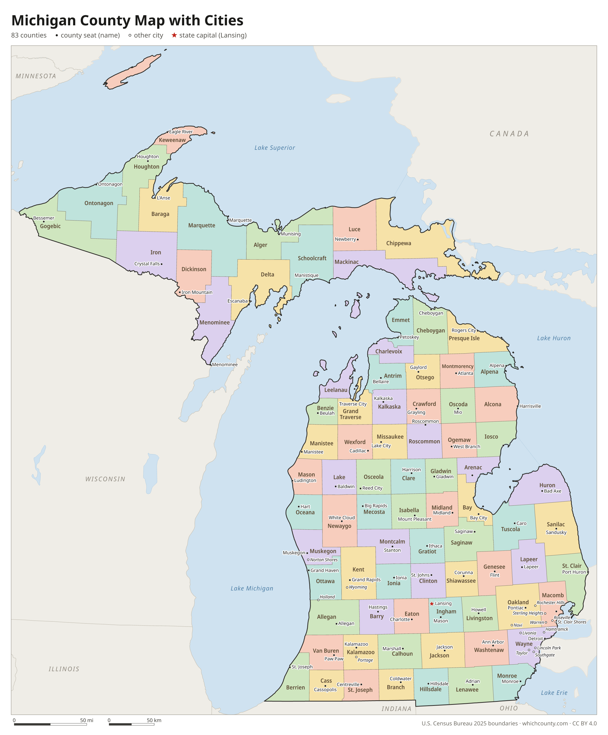
Michigan county map with cities
The largest cities in Michigan and the counties they are in. Cities that cross a county line list every county, the main one first. To find any smaller town, use the search box above.
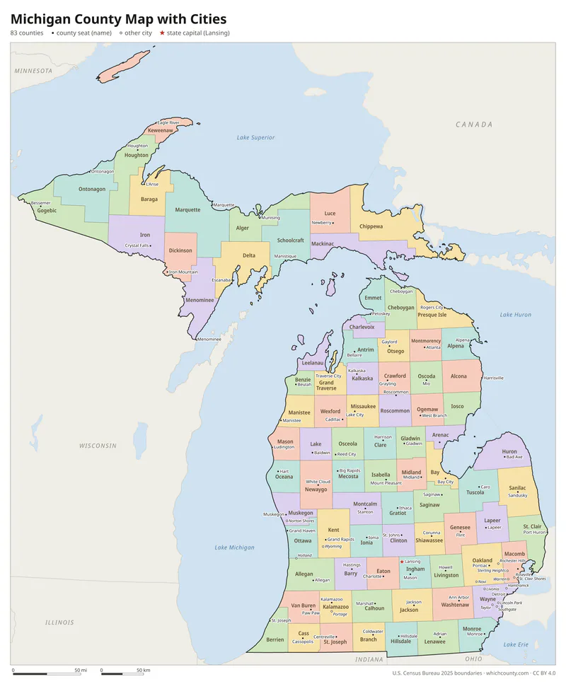
| City | County | Population 2025 |
|---|---|---|
| Detroit | Wayne County | 649,095 |
| Grand Rapids | Kent County | 201,183 |
| Warren | Macomb County | 137,138 |
| Sterling Heights | Macomb County | 133,931 |
| Ann Arbor | Washtenaw County | 122,233 |
| Lansing | Ingham, Eaton and Clinton counties | 113,884 |
| Dearborn | Wayne County | 105,611 |
| Livonia | Wayne County | 92,603 |
| Troy | Oakland County | 88,733 |
| Farmington Hills | Oakland County | 83,291 |
| Westland | Wayne County | 82,333 |
| Flint | Genesee County | 79,306 |
| Wyoming | Kent County | 78,588 |
| Rochester Hills | Oakland County | 77,539 |
| Southfield | Oakland County | 76,111 |
| Kalamazoo | Kalamazoo County | 72,683 |
| Novi | Oakland County | 67,319 |
| Pontiac | Oakland County | 62,077 |
| Taylor | Wayne County | 61,279 |
| Dearborn Heights | Wayne County | 60,664 |
| St. Clair Shores | Macomb County | 57,872 |
| Royal Oak | Oakland County | 57,583 |
| Kentwood | Kent County | 54,776 |
| Battle Creek | Calhoun County | 52,021 |
| Portage | Kalamazoo County | 49,862 |
| East Lansing | Ingham and Clinton counties | 49,355 |
| Roseville | Macomb County | 46,863 |
| Saginaw | Saginaw County | 42,863 |
| Midland | Midland and Bay counties | 42,806 |
| Lincoln Park | Wayne County | 38,529 |
Printable Michigan county maps (free PDF, PNG, SVG)
Every map is free to print and share. The PDFs are vector files with real text, so they stay sharp at any size and you can search them for a county name. Use 11×17 (tabloid) for the most readable labels.
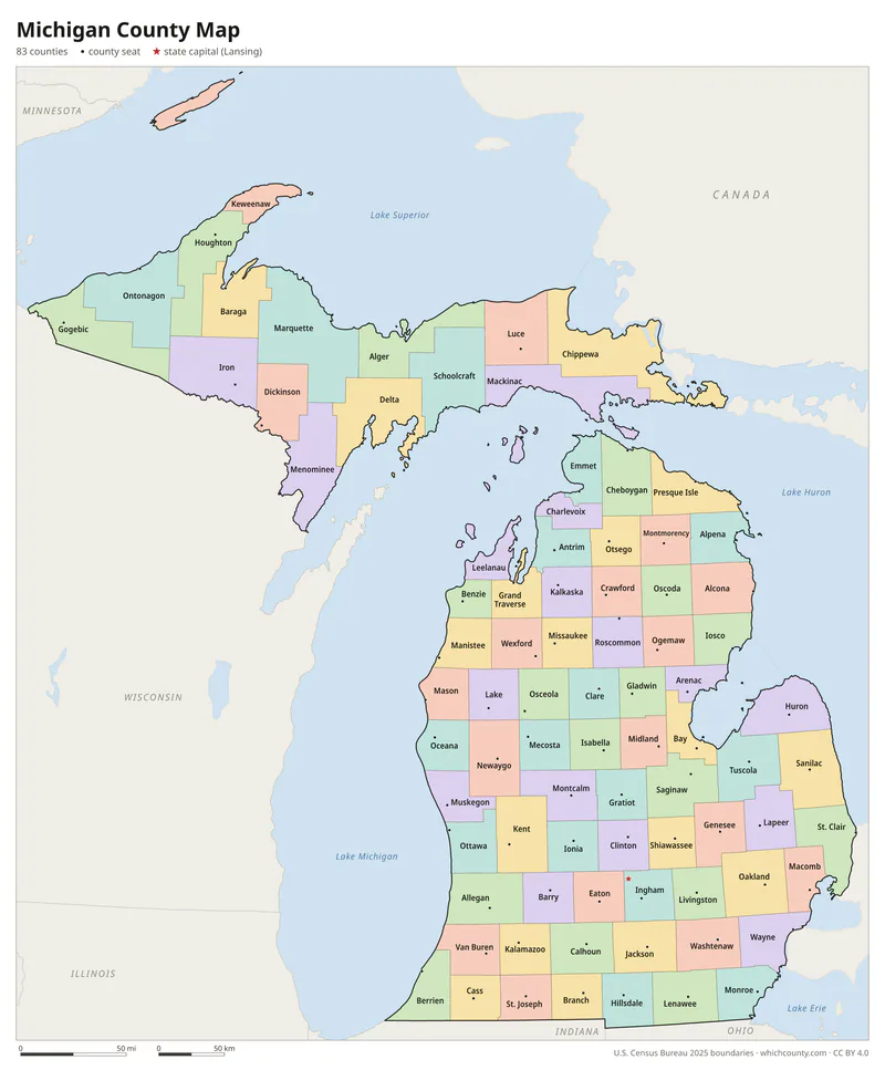
Color map with names
All 83 counties labeled, county seats marked. Letter and 11×17 PDF, high-resolution PNG, editable SVG.
Map with cities
Counties with their county seat towns and major cities.
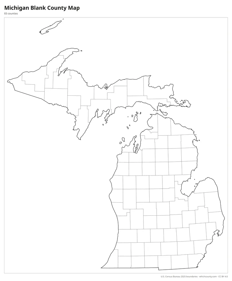
Blank outline map
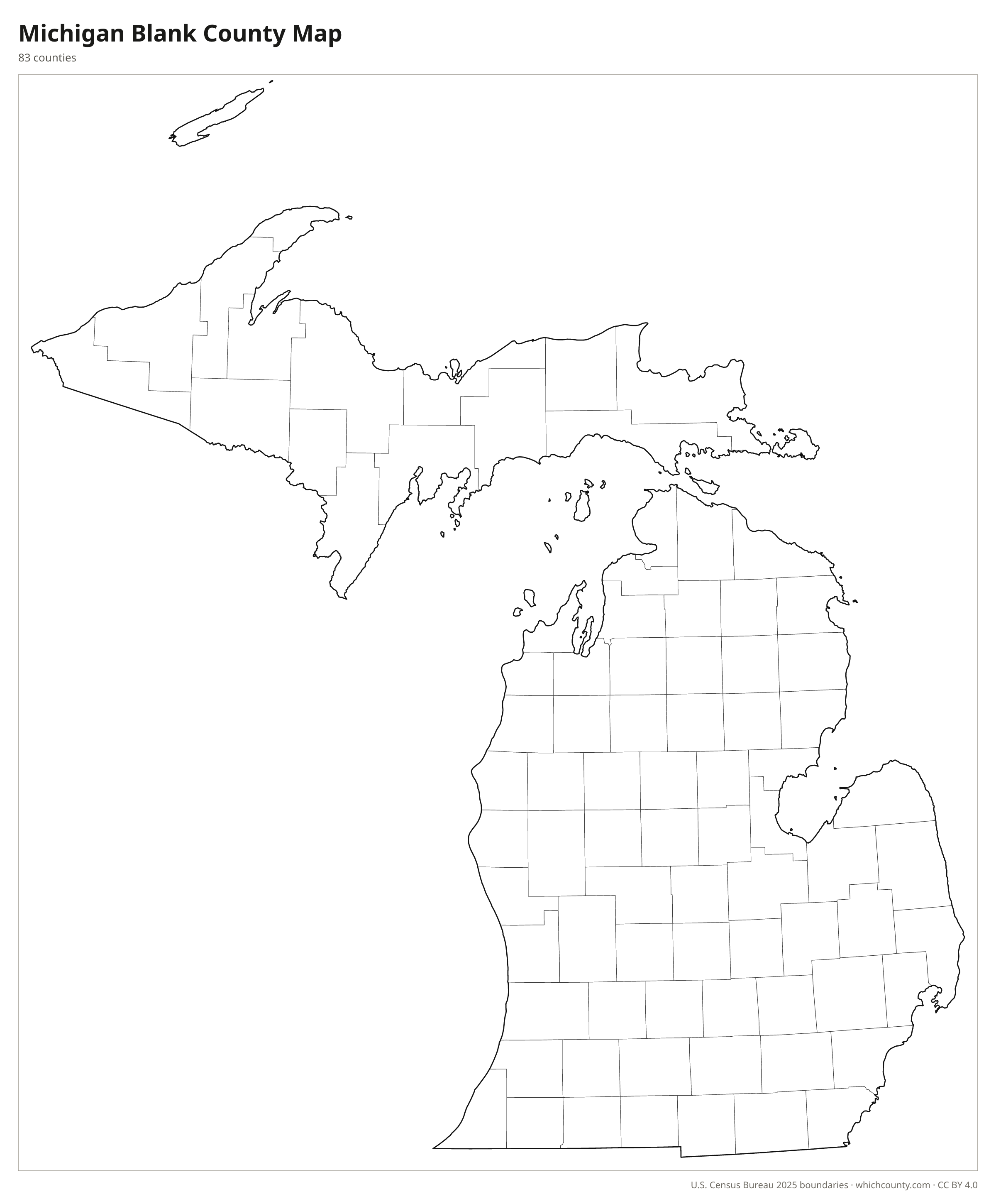
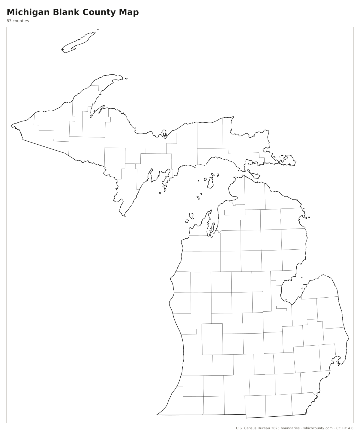
County lines only, no names. For quizzes, coloring and your own notes.
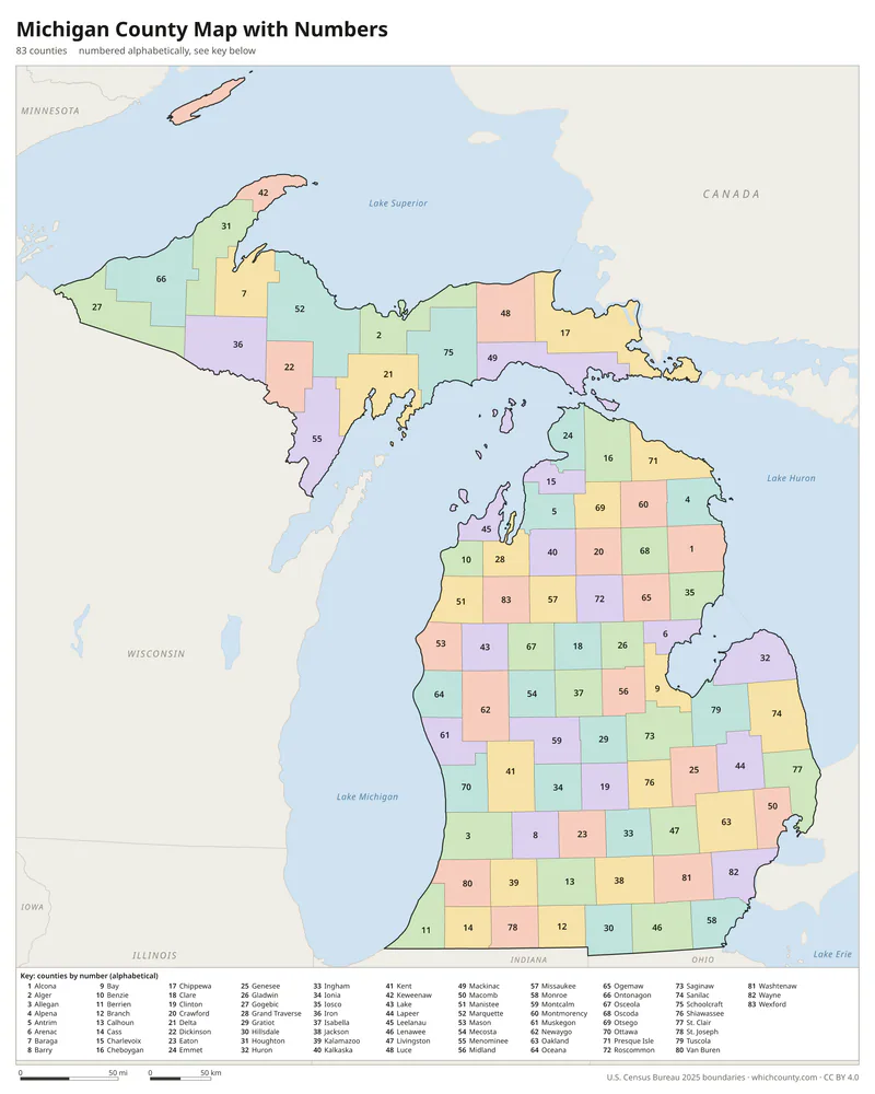
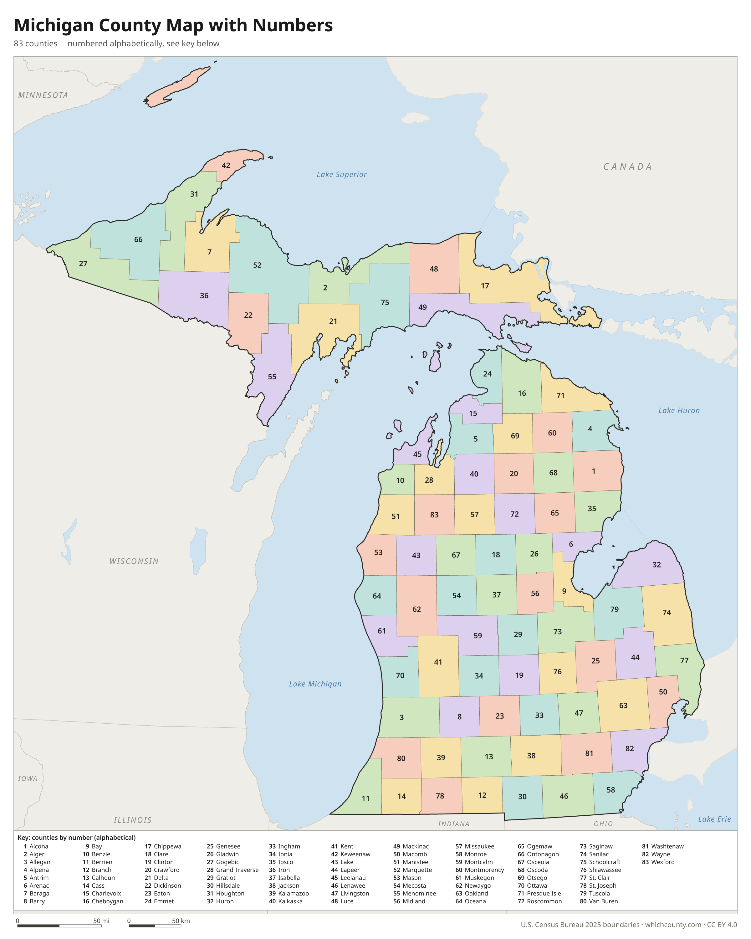
Numbered map with key
A number in every county with an alphabetical key.
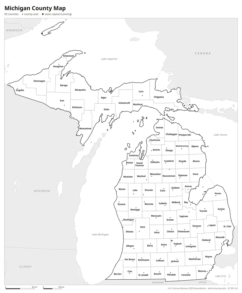
Black and white
Labeled map that prints well on any printer.
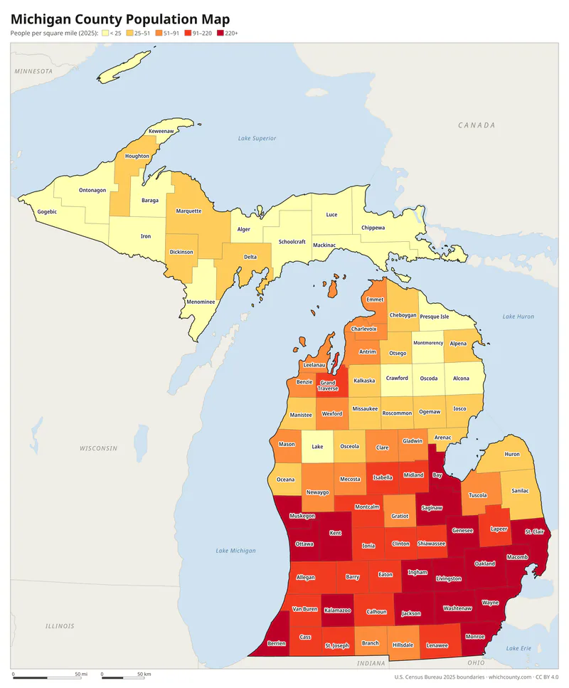
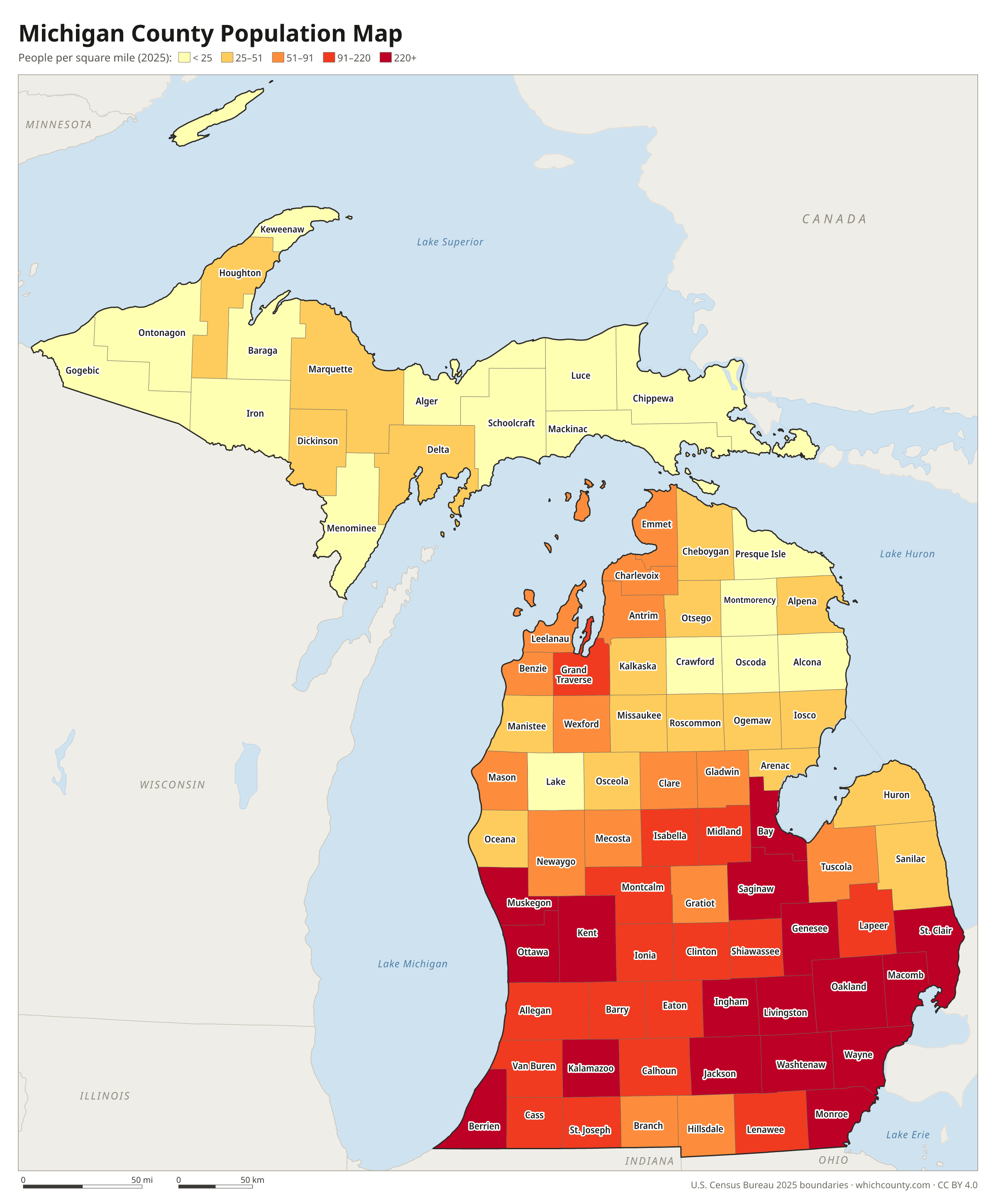
Population map
Counties shaded by population density (2025 estimates).
Data and GIS files
The county table as CSV, and the boundaries as GeoJSON and KML (Google Earth, Google My Maps).
How Michigan's 83 counties were laid out
Michigan's first county, Wayne, had its boundaries set by the acting territorial governor in 1796. It then took in all of future Michigan and parts of Ohio, Indiana, Illinois and Wisconsin. By 1830 Michigan had 12 organized counties. A single act that took effect on April 1, 1840, created 27 counties in the northern Lower Peninsula and the Thumb, most of them not yet organized and attached to older counties for court purposes. Several carried names that were later changed: Kaykakee became Clare, Tonedagana became Emmet, and Notipekago became Mason. By 1852 most Lower Peninsula counties were established. Dickinson County in the Upper Peninsula, organized in 1891, was the last of the 83.
Regions of Michigan
Michigan's counties grouped into the 10 Michigan prosperity regions (source).
Upper Peninsula (Region 1)
Alger, Baraga, Chippewa, Delta, Dickinson, Gogebic, Houghton, Iron, Keweenaw, Luce, Mackinac, Marquette, Menominee, Ontonagon, Schoolcraft
Northwest (Region 2)
Antrim, Benzie, Charlevoix, Emmet, Grand Traverse, Kalkaska, Leelanau, Manistee, Missaukee, Wexford
Northeast (Region 3)
Alcona, Alpena, Cheboygan, Crawford, Iosco, Montmorency, Ogemaw, Oscoda, Otsego, Presque Isle, Roscommon
West (Region 4)
Allegan, Barry, Ionia, Kent, Lake, Mason, Mecosta, Montcalm, Muskegon, Newaygo, Oceana, Osceola, Ottawa
East Central (Region 5)
Arenac, Bay, Clare, Gladwin, Gratiot, Isabella, Midland, Saginaw
East (Region 6)
Genesee, Huron, Lapeer, Sanilac, Shiawassee, St. Clair, Tuscola
South Central (Region 7)
Clinton, Eaton, Ingham
Southwest (Region 8)
Berrien, Branch, Calhoun, Cass, Kalamazoo, St. Joseph, Van Buren
Southeast (Region 9)
Hillsdale, Jackson, Lenawee, Livingston, Monroe, Washtenaw
Detroit Metro (Region 10)
Macomb, Oakland, Wayne
County maps of neighboring states
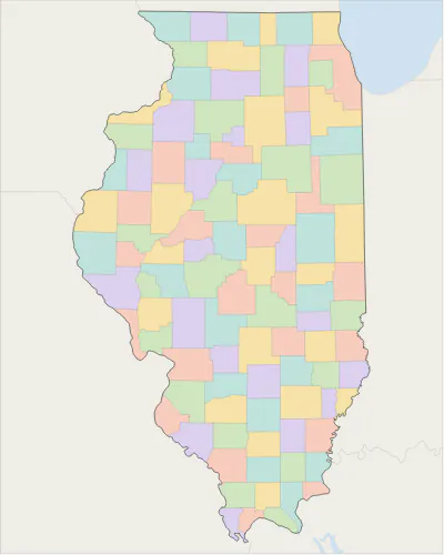 Illinois county map
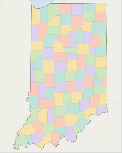 Indiana county map
 Minnesota county map
 Ohio county map
 Wisconsin county map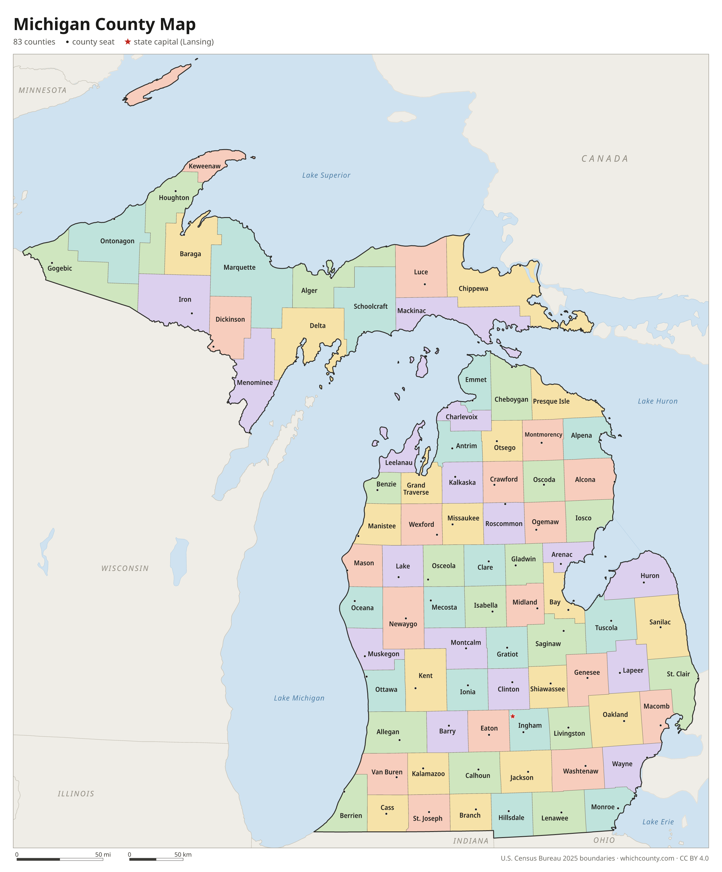
Michigan counties: questions and answers
- How many counties are in Michigan?
- Michigan has 83 counties.
- What is the largest county in Michigan?
- By land area, Marquette County is the largest (1,809 sq mi). By population, Wayne County is the largest, with 1,769,038 people (2025 estimate).
- What is the smallest county in Michigan?
- Benzie County is the smallest by land area (319.7 sq mi). Keweenaw County has the fewest people: 2,186 (2025 estimate).
- What is the wealthiest county in Michigan?
- By median household income, Livingston County ranks first with $103,039 (American Community Survey 2020–2024). The lowest is Clare County at $49,384.
- What county is Detroit in?
- Detroit is in Wayne County.
- What county is Grand Rapids in?
- Grand Rapids is in Kent County.
- What county is Warren in?
- Warren is in Macomb County.
- What county is Lansing in?
- Lansing, the state capital, is in Ingham County.
- How can I see county lines on Google Maps?
- Google Maps does not draw county lines. Download the KML file from the printable maps section above and import it into Google My Maps (Create a new map › Import) or open it in Google Earth to see every Michigan county boundary on top of Google's map.
- Can I use this map for free?
- Yes. The maps and files on this page are free to print, share and use in your own work, including commercial projects, under the CC BY 4.0 licence. Please credit “WhichCounty (whichcounty.com)”.
Use this map on your site
You may copy, print and publish these maps, also commercially, as long as you credit WhichCounty with a link (licence details). Paste this code to embed the map:
Sources and methodology
- Boundaries: U.S. Census Bureau, 2025 Cartographic Boundary Files (1:500,000), simplified for display. Projection: Lambert conformal conic fitted to Michigan.
- Population: Census Bureau county estimates, Vintage 2025 (July 1, 2025), compared with the April 1, 2020 estimates base.
- Land area: Census Bureau 2026 Gazetteer files. Median household income: American Community Survey 2020–2024 5-year estimates.
- County seats and founding years: Wikidata (CC0), checked against state lists by WhichCounty. Cities: Census Bureau city and town estimates, Vintage 2025.
- Michigan Counties (State of Michigan)
- Atlas of Historical County Boundaries: Michigan (Newberry Library)
Found an error? Tell us. Last data update: October 4, 2026.