Colorado County Map
All 64 counties with county seats and major cities
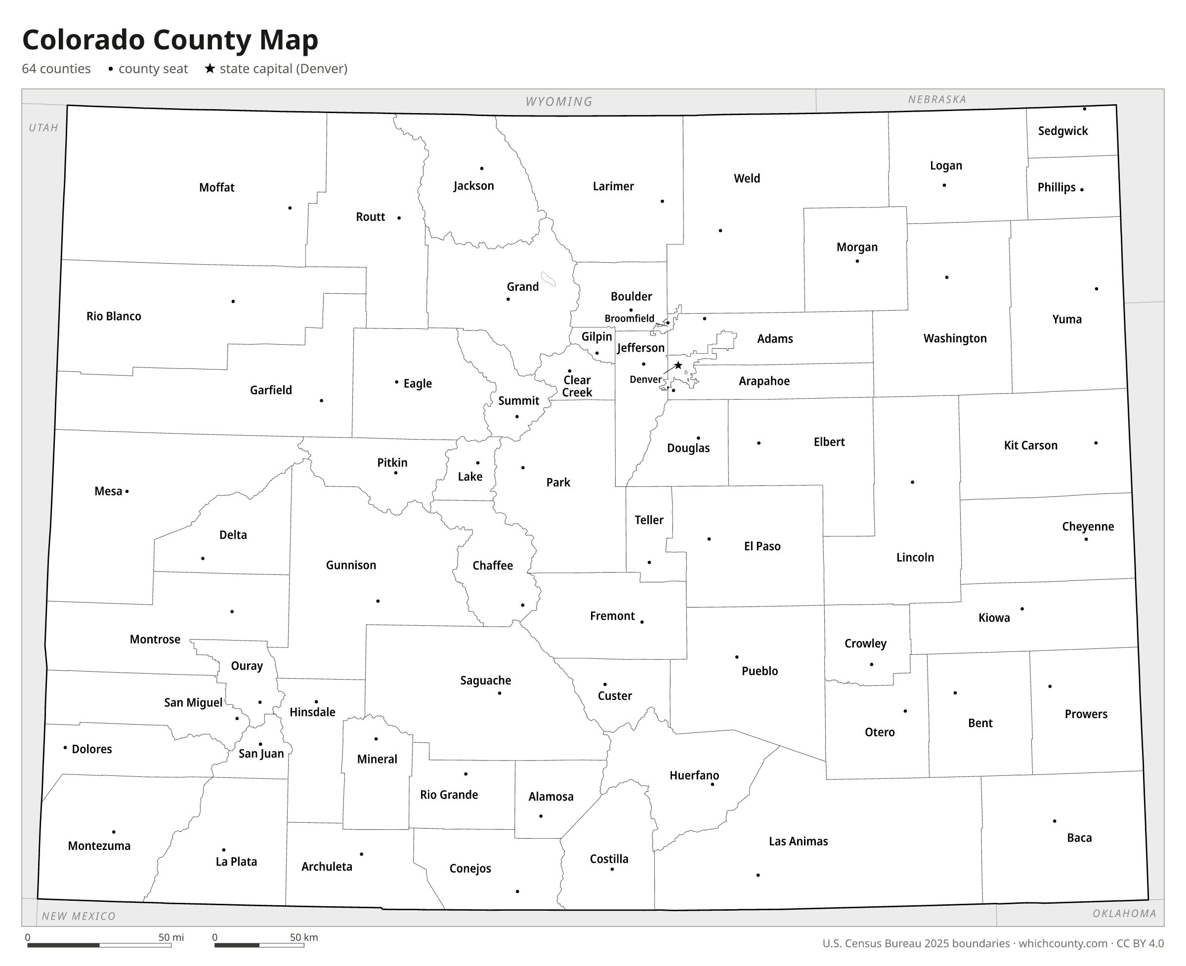
Colorado has 64 counties; the newest, Broomfield, dates only from 2001. This map shows all 64 counties and their county seats. Tap a county for details, or download the free printable map below.

Updated October 4, 2026 · Boundaries: U.S. Census Bureau 2025 · Population: Census estimates for July 1, 2025
Colorado county facts
- Number of counties
- 64
- Largest by land area
- Las Animas County 4,773 sq mi
- Smallest by land area
- Broomfield County 33 sq mi
- Most people
- El Paso County 757,040
- Fewest people
- Hinsdale County 753
- Fastest growing since 2020
- Custer County +18.8%
- Highest median household income
- Douglas County $149,594
- Oldest county
- Arapahoe County est. 1861
- Newest county
- Broomfield County est. 2001
- State capital
- Denver Denver County
Denver (since 1902) and Broomfield (since 2001) are consolidated city-counties.
List of 64 Colorado counties
Sorted A–Z. Click a column to sort, or a name to show it on the map. Download as CSV
| County | County seat | Population 2025 | Change since 2020 | Land area (sq mi) | Median income | Established | FIPS |
|---|---|---|---|---|---|---|---|
| Adams County | Brighton | 554,668 | +6.8% | 1,167 | $94,571 | 1902 | 08001 |
| Alamosa County | Alamosa | 16,688 | +1.9% | 723 | $55,397 | 1913 | 08003 |
| Arapahoe County | Littleton | 673,820 | +2.9% | 798 | $101,087 | 1861 | 08005 |
| Archuleta County | Pagosa Springs | 14,306 | +7.1% | 1,350 | $83,065 | 1885 | 08007 |
| Baca County | Springfield | 3,347 | −4.5% | 2,555 | $46,215 | 1889 | 08009 |
| Bent County | Las Animas | 5,716 | +1.3% | 1,513 | $50,179 | 1870 | 08011 |
| Boulder County | Boulder | 328,560 | −0.7% | 726 | $103,994 | 1861 | 08013 |
| Broomfield County | Broomfield | 79,174 | +6.8% | 33 | $123,874 | 2001 | 08014 |
| Chaffee County | Salida | 20,831 | +7% | 1,013 | $84,132 | 1879 | 08015 |
| Cheyenne County | Cheyenne Wells | 1,713 | −2.1% | 1,778 | $70,865 | 1889 | 08017 |
| Clear Creek County | Georgetown | 8,994 | −4% | 395 | $94,577 | 1861 | 08019 |
| Conejos County | Conejos | 7,529 | +0.9% | 1,287 | $50,978 | 1861 | 08021 |
| Costilla County | San Luis | 3,679 | +5.3% | 1,228 | $36,861 | 1861 | 08023 |
| Crowley County | Ordway | 5,677 | −4.2% | 787 | $48,826 | 1911 | 08025 |
| Custer County | Westcliffe | 5,590 | +18.8% | 739 | $72,674 | 1877 | 08027 |
| Delta County | Delta | 32,178 | +3.1% | 1,142 | $57,774 | 1883 | 08029 |
| Denver County | Denver | 740,613 | +3.5% | 153 | $94,718 | 1902 | 08031 |
| Dolores County | Dove Creek | 2,466 | +6.1% | 1,067 | $64,907 | 1881 | 08033 |
| Douglas County | Castle Rock | 399,396 | +11.6% | 840 | $149,594 | 1861 | 08035 |
| Eagle County | Eagle | 54,291 | −2.6% | 1,685 | $104,096 | 1883 | 08037 |
| El Paso County | Colorado Springs | 757,040 | +3.5% | 2,126 | $90,363 | 1861 | 08041 |
| Elbert County | Kiowa | 30,534 | +17.2% | 1,851 | $132,685 | 1874 | 08039 |
| Fremont County | Cañon City | 50,039 | +2.3% | 1,534 | $62,664 | 1861 | 08043 |
| Garfield County | Glenwood Springs | 63,474 | +2.9% | 2,947 | $91,131 | 1883 | 08045 |
| Gilpin County | Central City | 6,073 | +4.7% | 150 | $95,361 | 1861 | 08047 |
| Grand County | Hot Sulphur Springs | 16,496 | +5% | 1,847 | $88,612 | 1874 | 08049 |
| Gunnison County | Gunnison | 17,439 | +3.1% | 3,239 | $84,527 | 1877 | 08051 |
| Hinsdale County | Lake City | 753 | −4% | 1,117 | $75,972 | 1874 | 08053 |
| Huerfano County | Walsenburg | 7,011 | +2.9% | 1,591 | $52,526 | 1861 | 08055 |
| Jackson County | Walden | 1,211 | −12.3% | 1,614 | $47,667 | 1909 | 08057 |
| Jefferson County | Golden | 580,451 | −0.4% | 764 | $110,656 | 1861 | 08059 |
| Kiowa County | Eads | 1,412 | −2.4% | 1,768 | $58,618 | 1889 | 08061 |
| Kit Carson County | Burlington | 7,069 | −0.2% | 2,161 | $70,259 | 1889 | 08063 |
| La Plata County | Durango | 56,898 | +2.3% | 1,690 | $86,056 | 1874 | 08067 |
| Lake County | Leadville | 7,552 | +1.6% | 377 | $96,575 | 1861 | 08065 |
| Larimer County | Fort Collins | 377,292 | +5.1% | 2,596 | $93,765 | 1861 | 08069 |
| Las Animas County | Trinidad | 14,391 | −1.1% | 4,773 | $52,074 | 1866 | 08071 |
| Lincoln County | Hugo | 5,645 | −0.6% | 2,578 | $62,861 | 1889 | 08073 |
| Logan County | Sterling | 20,654 | −4.1% | 1,839 | $51,829 | 1887 | 08075 |
| Mesa County | Grand Junction | 162,845 | +4.6% | 3,329 | $73,658 | 1883 | 08077 |
| Mineral County | Creede | 910 | +5.2% | 876 | $56,250 | 1893 | 08079 |
| Moffat County | Craig | 13,122 | −1.3% | 4,743 | $73,849 | 1911 | 08081 |
| Montezuma County | Cortez | 26,678 | +3.2% | 2,029 | $65,244 | 1889 | 08083 |
| Montrose County | Montrose | 44,591 | +4.5% | 2,241 | $72,120 | 1883 | 08085 |
| Morgan County | Fort Morgan | 30,306 | +4.1% | 1,281 | $73,278 | 1889 | 08087 |
| Otero County | La Junta | 17,683 | −5.4% | 1,262 | $54,037 | 1889 | 08089 |
| Ouray County | Ouray | 5,265 | +7.9% | 541 | $91,020 | 1877 | 08091 |
| Park County | Fairplay | 18,314 | +5.3% | 2,194 | $103,670 | 1861 | 08093 |
| Phillips County | Holyoke | 4,420 | −2.5% | 688 | $64,674 | 1889 | 08095 |
| Pitkin County | Aspen | 16,625 | −4.2% | 971 | $102,645 | 1881 | 08097 |
| Prowers County | Lamar | 11,884 | −0.9% | 1,638 | $53,508 | 1889 | 08099 |
| Pueblo County | Pueblo | 169,277 | +0.7% | 2,387 | $64,010 | 1861 | 08101 |
| Rio Blanco County | Meeker | 6,683 | +2.4% | 3,221 | $65,473 | 1889 | 08103 |
| Rio Grande County | Del Norte | 11,087 | −3.9% | 912 | $64,411 | 1874 | 08105 |
| Routt County | Steamboat Springs | 25,329 | +2% | 2,362 | $106,489 | 1877 | 08107 |
| Saguache County | Saguache | 6,732 | +5.6% | 3,169 | $50,082 | 1866 | 08109 |
| San Juan County | Silverton | 813 | +15.5% | 388 | $77,824 | 1876 | 08111 |
| San Miguel County | Telluride | 7,753 | −3.9% | 1,287 | $79,024 | 1883 | 08113 |
| Sedgwick County | Julesburg | 2,247 | −6.5% | 548 | $52,386 | 1889 | 08115 |
| Summit County | Breckenridge | 31,517 | +0.7% | 608 | $109,773 | 1861 | 08117 |
| Teller County | Cripple Creek | 24,756 | +0.2% | 557 | $85,361 | 1899 | 08119 |
| Washington County | Akron | 4,732 | −1.7% | 2,518 | $67,167 | 1887 | 08121 |
| Weld County | Greeley | 378,426 | +15% | 3,985 | $97,097 | 1861 | 08123 |
| Yuma County | Wray | 9,896 | −0.9% | 2,364 | $60,545 | 1889 | 08125 |
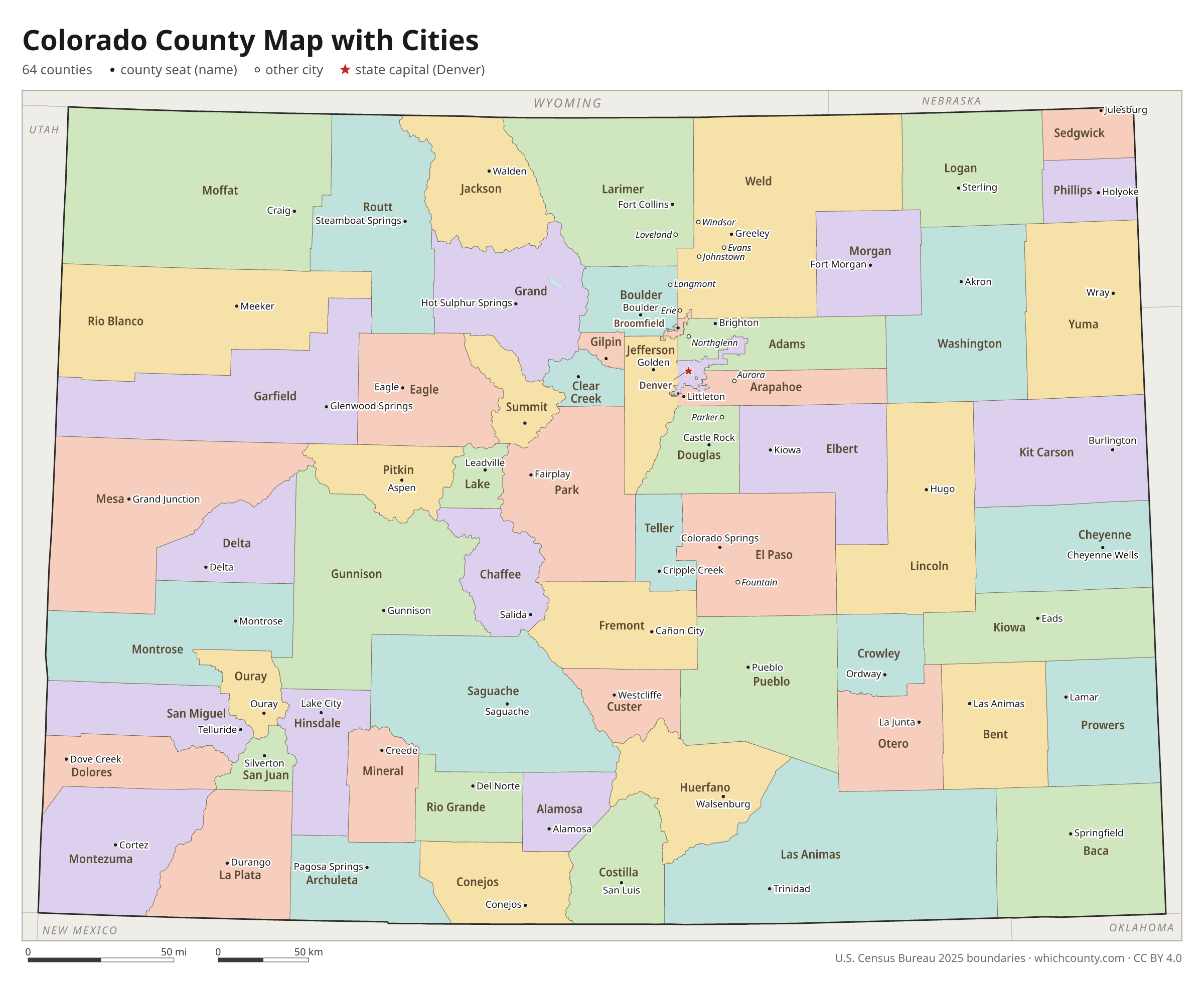
Colorado county map with cities
The largest cities in Colorado and the counties they are in. Cities that cross a county line list every county, the main one first. To find any smaller town, use the search box above.
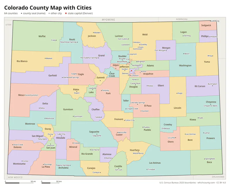
| City | County | Population 2025 |
|---|---|---|
| Denver | Denver County | 740,613 |
| Colorado Springs | El Paso County | 494,743 |
| Aurora | Arapahoe, Adams and Douglas counties | 410,053 |
| Fort Collins | Larimer County | 171,500 |
| Lakewood | Jefferson County | 156,927 |
| Thornton | Adams and Weld counties | 147,766 |
| Arvada | Jefferson and Adams counties | 122,901 |
| Westminster | Adams and Jefferson counties | 116,182 |
| Greeley | Weld County | 115,073 |
| Pueblo | Pueblo County | 110,404 |
| Centennial | Arapahoe County | 108,658 |
| Boulder | Boulder County | 105,689 |
| Longmont | Boulder and Weld counties | 100,109 |
| Castle Rock | Douglas County | 83,815 |
| Loveland | Larimer County | 81,387 |
| Broomfield | Broomfield County | 79,174 |
| Commerce City | Adams County | 72,345 |
| Grand Junction | Mesa County | 71,827 |
| Parker | Douglas County | 65,985 |
| Littleton | Arapahoe, Jefferson and Douglas counties | 46,246 |
| Brighton | Adams and Weld counties | 45,395 |
| Windsor | Weld and Larimer counties | 43,840 |
| Erie | Weld and Boulder counties | 40,904 |
| Northglenn | Adams and Weld counties | 38,893 |
| Englewood | Arapahoe County | 35,305 |
| Wheat Ridge | Jefferson County | 32,081 |
| Lafayette | Boulder County | 30,116 |
| Fountain | El Paso County | 29,450 |
| Evans | Weld County | 22,500 |
| Johnstown | Weld and Larimer counties | 22,433 |
Printable Colorado county maps (free PDF, PNG, SVG)
Every map is free to print and share. The PDFs are vector files with real text, so they stay sharp at any size and you can search them for a county name. Use 11×17 (tabloid) for the most readable labels.
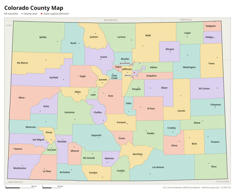
Color map with names
All 64 counties labeled, county seats marked. Letter and 11×17 PDF, high-resolution PNG, editable SVG.
Map with cities
Counties with their county seat towns and major cities.
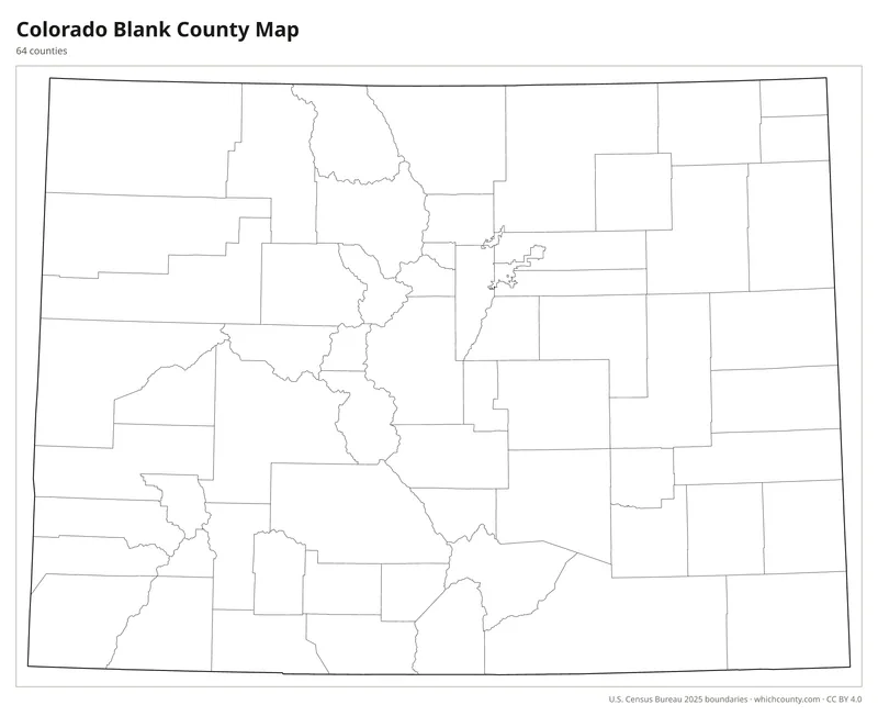
Blank outline map
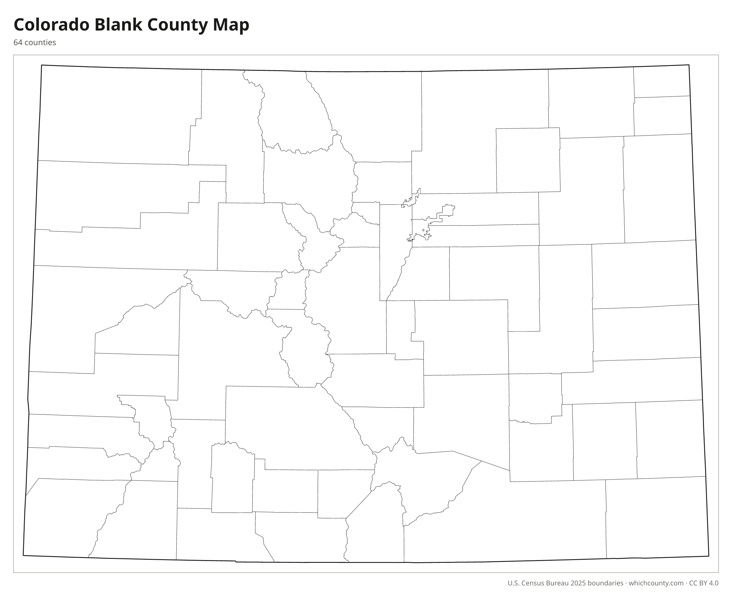
County lines only, no names. For quizzes, coloring and your own notes.
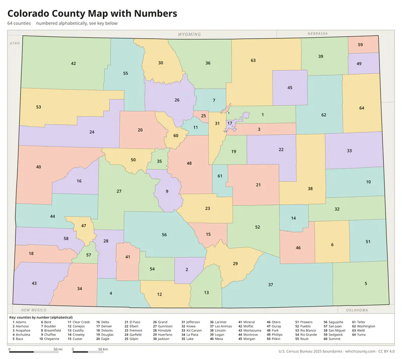
Numbered map with key
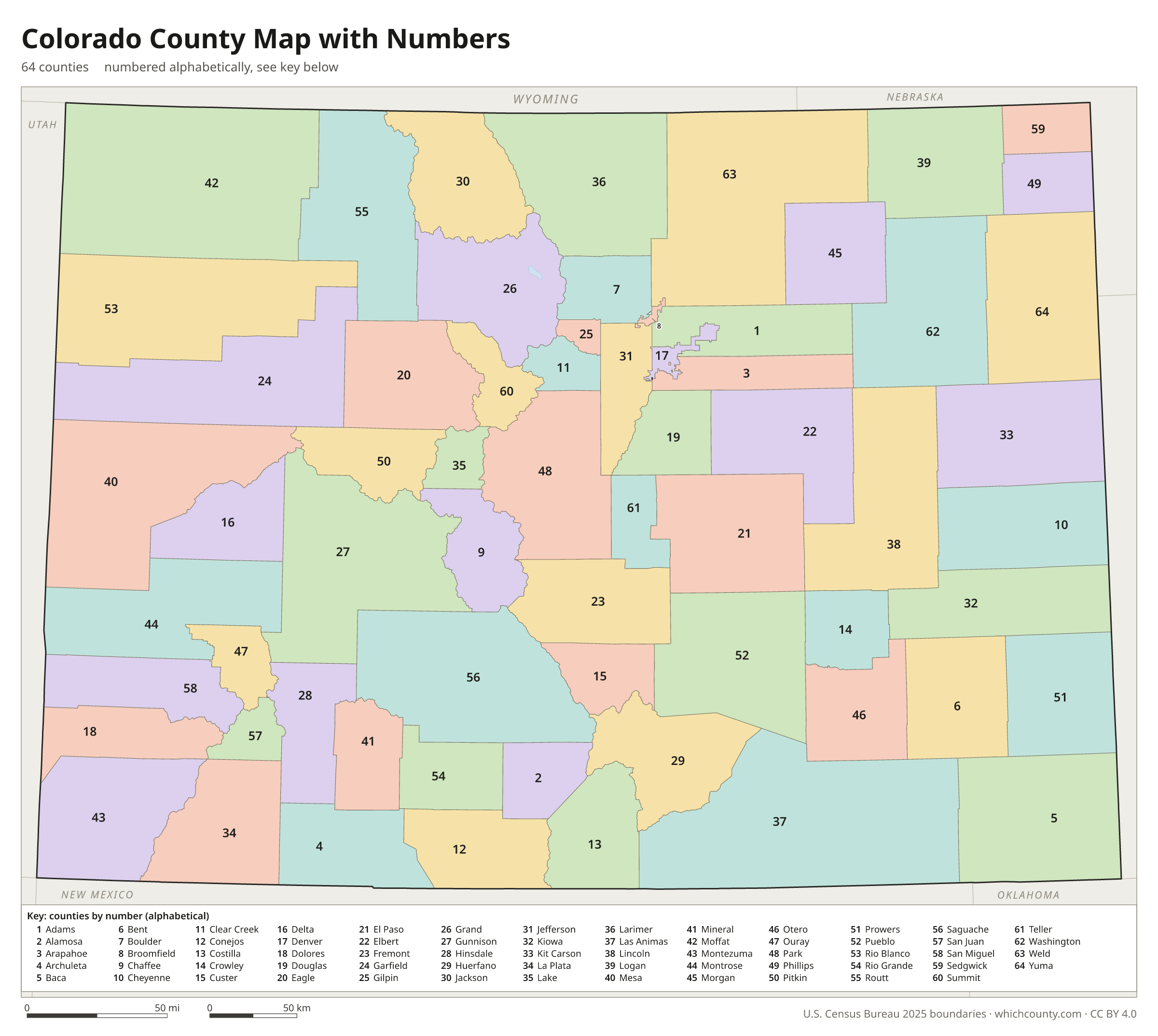
A number in every county with an alphabetical key.
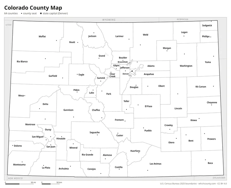
Black and white
Labeled map that prints well on any printer.
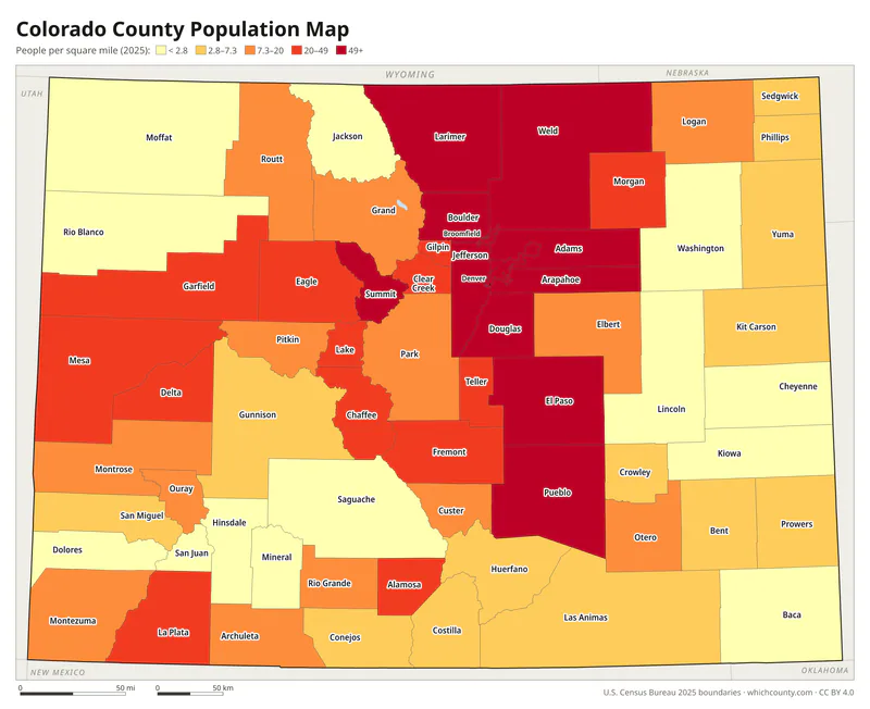
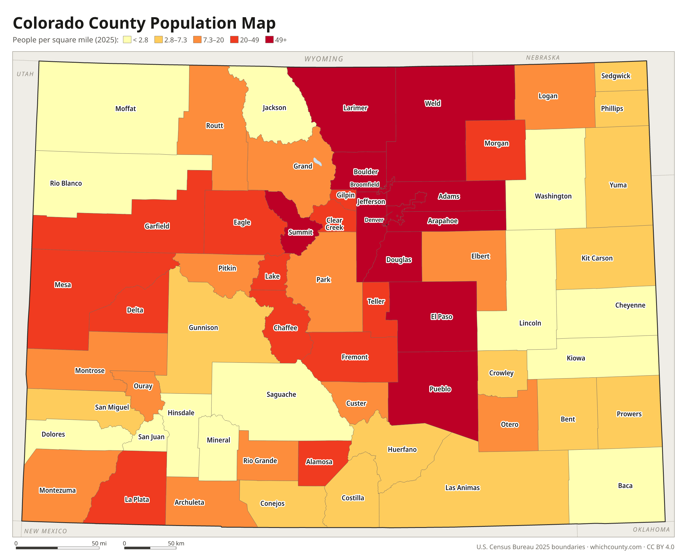
Population map
Counties shaded by population density (2025 estimates).
Data and GIS files
The county table as CSV, and the boundaries as GeoJSON and KML (Google Earth, Google My Maps).
How Colorado's 64 counties were created
Colorado Territory's legislature created the first 17 counties on November 1, 1861, among them Arapahoe, Boulder, El Paso, Jefferson and Pueblo. Only nine more followed before statehood in 1876. The largest wave came after statehood: the Newberry Library's county atlas records 29 new counties between 1877 and 1889. Seven more followed between 1899 and 1913. In 1902 Denver became a consolidated City and County, carved from Arapahoe County, and Adams County was created from Arapahoe's remainder at the same time. Alamosa County, formed in 1913, was the last new county for almost 90 years. Broomfield, a city that had spread into four counties, then sought relief through a constitutional amendment passed in 1998. The City and County of Broomfield became Colorado's 64th county on November 15, 2001.
Regions of Colorado
Colorado's counties grouped into the 14 Planning and Management Regions of Colorado (source).
Region 1: Northern Eastern Plains
Logan, Morgan, Phillips, Sedgwick, Washington, Yuma
Region 2: Northern Front Range
Larimer, Weld
Region 3: Denver Metropolitan Area
Adams, Arapahoe, Boulder, Broomfield, Clear Creek, Denver, Douglas, Gilpin, Jefferson
Region 4: Southern Front Range
El Paso, Park, Teller
Region 5: Central Eastern Plains
Cheyenne, Elbert, Kit Carson, Lincoln
Region 6: Southern Eastern Plains
Baca, Bent, Crowley, Kiowa, Otero, Prowers
Region 7: Pueblo County
Pueblo
Region 8: San Luis Valley
Alamosa, Conejos, Costilla, Mineral, Rio Grande, Saguache
Region 9: Southern Western Slope
Archuleta, Dolores, La Plata, Montezuma, San Juan
Region 10: Central Western Slope
Delta, Gunnison, Hinsdale, Montrose, Ouray, San Miguel
Region 11: Northern Western Slope
Garfield, Mesa, Moffat, Rio Blanco
Region 12: Northern Mountains
Eagle, Grand, Jackson, Pitkin, Routt, Summit
Region 13: Central Mountains
Chaffee, Custer, Fremont, Lake
Region 14: Southern Mountains
Huerfano, Las Animas
County maps of neighboring states
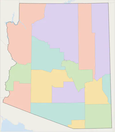 Arizona county map
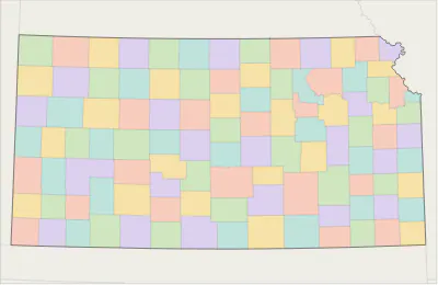 Kansas county map
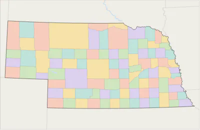 Nebraska county map
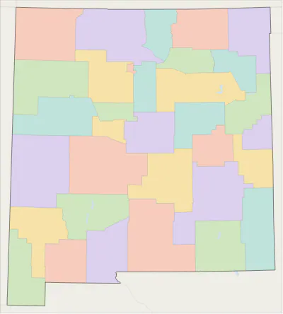 New Mexico county map
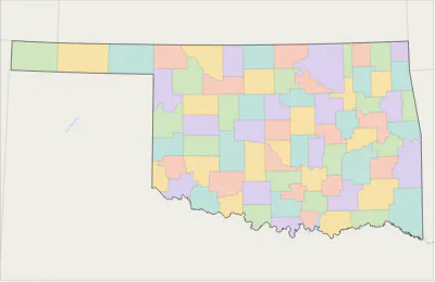 Oklahoma county map
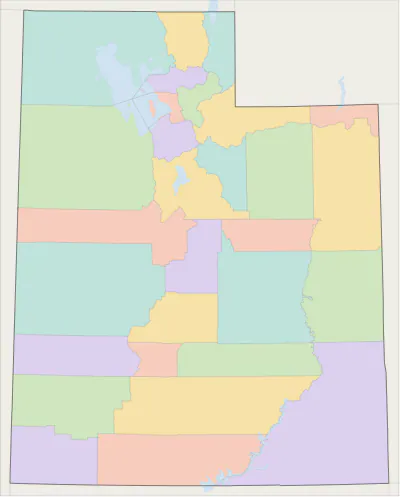 Utah county map
 Wyoming county map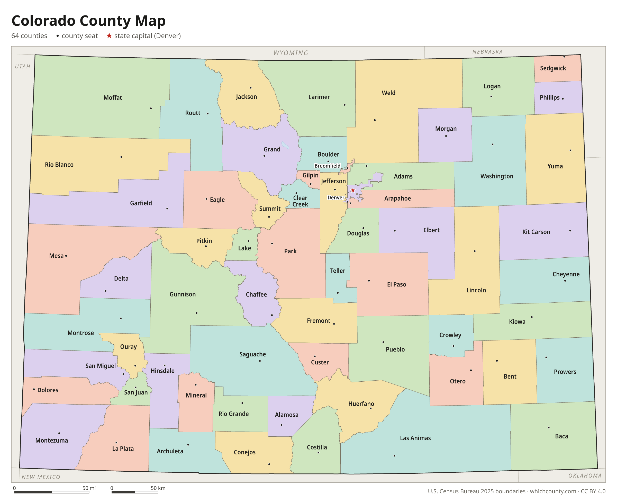
Colorado counties: questions and answers
- How many counties are in Colorado?
- Colorado has 64 counties.
- What is the largest county in Colorado?
- By land area, Las Animas County is the largest (4,773 sq mi). By population, El Paso County is the largest, with 757,040 people (2025 estimate).
- What is the smallest county in Colorado?
- Broomfield County is the smallest by land area (33 sq mi). Hinsdale County has the fewest people: 753 (2025 estimate).
- What is the wealthiest county in Colorado?
- By median household income, Douglas County ranks first with $149,594 (American Community Survey 2020–2024). The lowest is Costilla County at $36,861.
- What county is Denver in?
- Denver is in Denver County.
- What county is Colorado Springs in?
- Colorado Springs is in El Paso County.
- What county is Aurora in?
- Aurora is mostly in Arapahoe County, with smaller parts in Adams and Douglas counties.
- How can I see county lines on Google Maps?
- Google Maps does not draw county lines. Download the KML file from the printable maps section above and import it into Google My Maps (Create a new map › Import) or open it in Google Earth to see every Colorado county boundary on top of Google's map.
- Can I use this map for free?
- Yes. The maps and files on this page are free to print, share and use in your own work, including commercial projects, under the CC BY 4.0 licence. Please credit “WhichCounty (whichcounty.com)”.
Use this map on your site
You may copy, print and publish these maps, also commercially, as long as you credit WhichCounty with a link (licence details). Paste this code to embed the map:
Sources and methodology
- Boundaries: U.S. Census Bureau, 2025 Cartographic Boundary Files (1:500,000), simplified for display. Projection: Lambert conformal conic fitted to Colorado.
- Population: Census Bureau county estimates, Vintage 2025 (July 1, 2025), compared with the April 1, 2020 estimates base.
- Land area: Census Bureau 2026 Gazetteer files. Median household income: American Community Survey 2020–2024 5-year estimates.
- County seats and founding years: Wikidata (CC0), checked against state lists by WhichCounty. Cities: Census Bureau city and town estimates, Vintage 2025.
- Atlas of Historical County Boundaries: Colorado (Newberry Library)
- History of Broomfield (City and County of Broomfield)
- Substantial Changes to Counties and County Equivalent Entities: 2000s (U.S. Census Bureau)
- Counties (Colorado Encyclopedia)
Found an error? Tell us. Last data update: October 4, 2026.