Missouri County Map
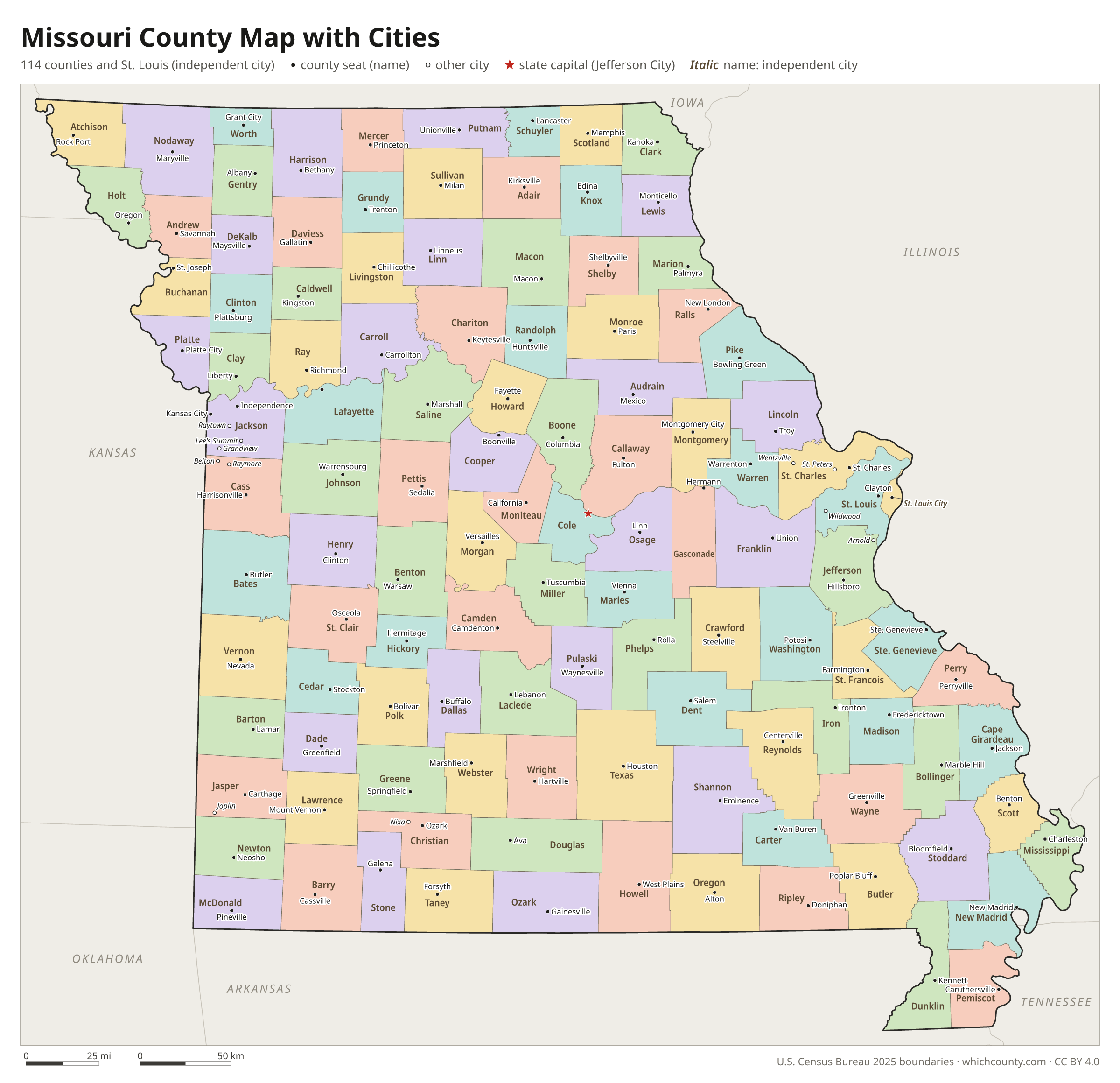
All 115 counties with county seats and major cities
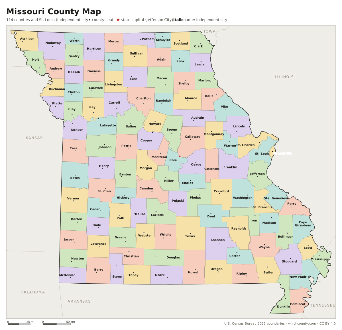
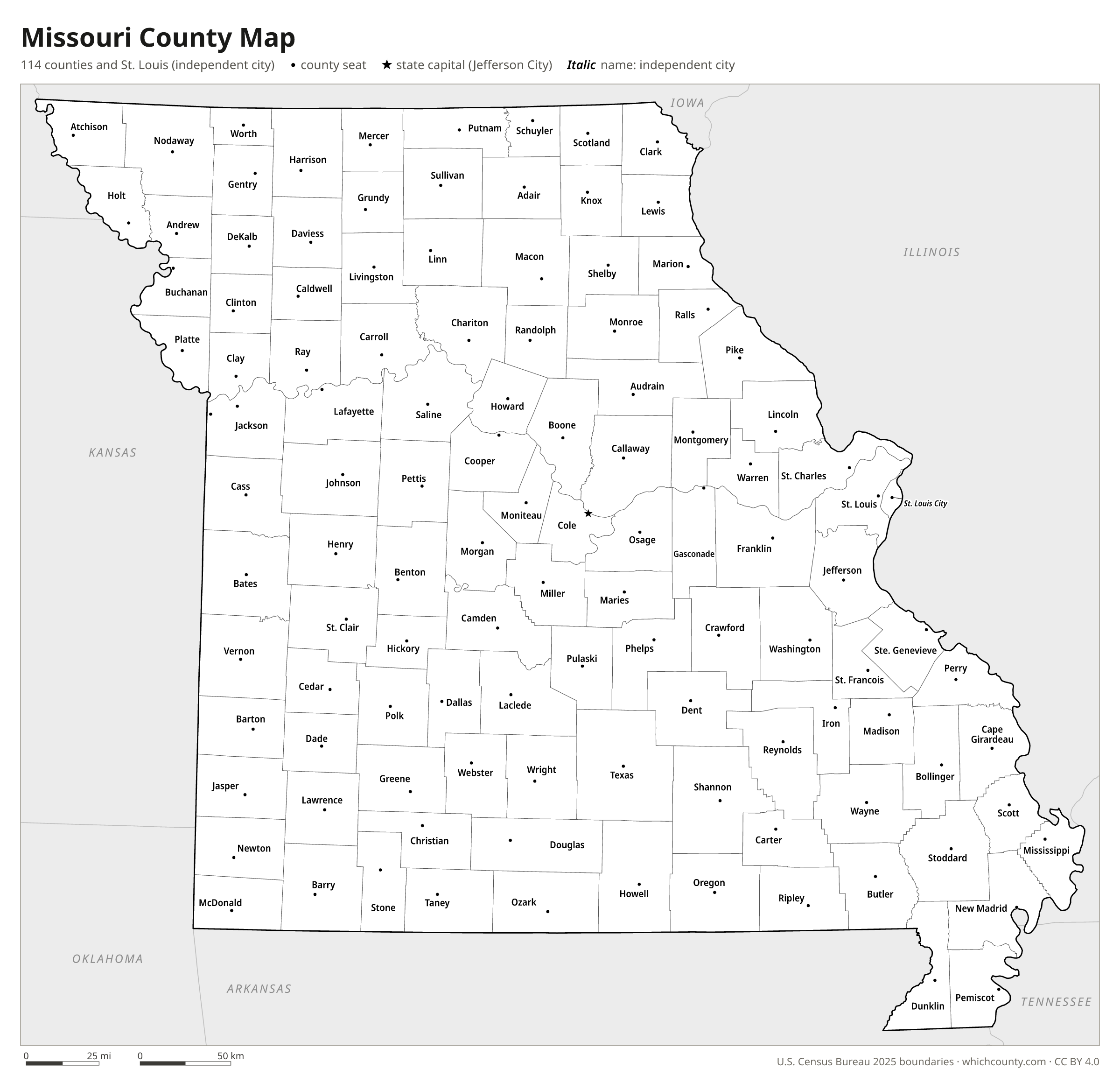
Missouri has 114 counties plus the independent City of St. Louis, which the Census Bureau counts as a 115th county-equivalent. This map shows all 115 counties and their county seats. Tap a county for details, or download the free printable map below.

Updated October 4, 2026 · Boundaries: U.S. Census Bureau 2025 · Population: Census estimates for July 1, 2025
Missouri county facts
- Number of counties
- 115
- Largest by land area
- Texas County 1,177 sq mi
- Smallest by land area
- St. Louis city 61.7 sq mi
- Most people
- St. Louis County 990,911
- Fewest people
- Worth County 1,914
- Fastest growing since 2020
- Lincoln County +11.9%
- Highest median household income
- St. Charles County $104,692
- Oldest county
- Cape Girardeau County est. 1812
- Newest county
- St. Louis city est. 1876
- State capital
- Jefferson City Cole County
The City of St. Louis has been independent of St. Louis County since August 22, 1876, and is not part of any county.
List of 115 Missouri counties
Sorted A–Z. Click a column to sort, or a name to show it on the map. Download as CSV
| County | County seat | Population 2025 | Change since 2020 | Land area (sq mi) | Median income | Established | FIPS |
|---|---|---|---|---|---|---|---|
| Adair County | Kirksville | 25,684 | +1.5% | 567 | $61,536 | 1841 | 29001 |
| Andrew County | Savannah | 18,241 | +0.6% | 433 | $75,625 | 1841 | 29003 |
| Atchison County | Rock Port | 5,175 | −2.5% | 547 | $58,750 | 1843 | 29005 |
| Audrain County | Mexico | 24,528 | −1.7% | 692 | $59,448 | 1831 | 29007 |
| Barry County | Cassville | 36,200 | +4.8% | 778 | $58,346 | 1835 | 29009 |
| Barton County | Lamar | 11,795 | +1.3% | 592 | $51,635 | 1855 | 29011 |
| Bates County | Butler | 16,512 | +3% | 837 | $60,733 | 1841 | 29013 |
| Benton County | Warsaw | 20,536 | +5.9% | 704 | $52,567 | 1835 | 29015 |
| Bollinger County | Marble Hill | 10,646 | +0.7% | 618 | $63,814 | 1851 | 29017 |
| Boone County | Columbia | 191,746 | +4.4% | 686 | $72,758 | 1820 | 29019 |
| Buchanan County | St. Joseph | 83,540 | −1.5% | 408 | $62,158 | 1838 | 29021 |
| Butler County | Poplar Bluff | 41,904 | −0.5% | 695 | $49,089 | 1849 | 29023 |
| Caldwell County | Kingston | 9,012 | +2.2% | 426 | $64,806 | 1836 | 29025 |
| Callaway County | Fulton | 45,765 | +3.3% | 835 | $74,176 | 1821 | 29027 |
| Camden County | Camdenton | 44,047 | +3.1% | 656 | $66,387 | 1841 | 29029 |
| Cape Girardeau County | Jackson | 83,999 | +2.8% | 579 | $68,464 | 1812 | 29031 |
| Carroll County | Carrollton | 8,417 | −0.9% | 695 | $62,154 | 1833 | 29033 |
| Carter County | Van Buren | 5,418 | +4.2% | 507 | $50,000 | 1859 | 29035 |
| Cass County | Harrisonville | 115,859 | +7.5% | 697 | $87,535 | 1833 | 29037 |
| Cedar County | Stockton | 14,888 | +4.9% | 475 | $48,181 | 1845 | 29039 |
| Chariton County | Keytesville | 7,377 | −0.5% | 751 | $71,520 | 1821 | 29041 |
| Christian County | Ozark | 96,725 | +8.9% | 563 | $83,437 | 1859 | 29043 |
| Clark County | Kahoka | 6,475 | −2.5% | 505 | $51,781 | 1836 | 29045 |
| Clay County | Liberty | 265,032 | +4.6% | 398 | $88,468 | 1822 | 29047 |
| Clinton County | Plattsburg | 21,661 | +2.3% | 419 | $70,627 | 1833 | 29049 |
| Cole County | Jefferson City | 77,908 | +0.8% | 392 | $74,876 | 1820 | 29051 |
| Cooper County | Boonville | 17,136 | +0.2% | 565 | $70,625 | 1818 | 29053 |
| Crawford County | Steelville | 22,929 | −0.5% | 743 | $57,629 | 1829 | 29055 |
| Dade County | Greenfield | 7,804 | +3.1% | 490 | $53,750 | 1841 | 29057 |
| Dallas County | Buffalo | 18,025 | +5.6% | 541 | $53,464 | 1841 | 29059 |
| Daviess County | Gallatin | 8,558 | +1.4% | 563 | $63,984 | 1836 | 29061 |
| DeKalb County | Maysville | 9,795 | −11.2% | 421 | $69,826 | 1843 | 29063 |
| Dent County | Salem | 14,584 | +1.1% | 753 | $56,312 | 1851 | 29065 |
| Douglas County | Ava | 12,342 | +6.6% | 814 | $45,985 | 1857 | 29067 |
| Dunklin County | Kennett | 26,855 | −5.1% | 542 | $47,849 | 1843 | 29069 |
| Franklin County | Union | 108,090 | +3.3% | 923 | $73,165 | 1818 | 29071 |
| Gasconade County | Hermann | 14,784 | −0.1% | 519 | $64,232 | 1821 | 29073 |
| Gentry County | Albany | 6,384 | +3.7% | 491 | $55,848 | 1841 | 29075 |
| Greene County | Springfield | 309,286 | +3.5% | 675 | $61,479 | 1833 | 29077 |
| Grundy County | Trenton | 9,744 | −0.7% | 435 | $51,975 | 1839 | 29079 |
| Harrison County | Bethany | 8,281 | +1.5% | 723 | $54,367 | 1843 | 29081 |
| Henry County | Clinton | 22,671 | +3.3% | 697 | $57,926 | 1834 | 29083 |
| Hickory County | Hermitage | 9,044 | +9.2% | 399 | $39,390 | 1845 | 29085 |
| Holt County | Oregon | 4,200 | −0.6% | 463 | $61,187 | 1841 | 29087 |
| Howard County | Fayette | 10,180 | +0.3% | 464 | $65,938 | 1816 | 29089 |
| Howell County | West Plains | 40,798 | +2.6% | 927 | $50,993 | 1857 | 29091 |
| Iron County | Ironton | 9,318 | −2.3% | 550 | $48,850 | 1857 | 29093 |
| Jackson County | Independence, Kansas City | 732,994 | +2.2% | 605 | $68,577 | 1826 | 29095 |
| Jasper County | Carthage | 127,428 | +3.8% | 639 | $60,694 | 1841 | 29097 |
| Jefferson County | Hillsboro | 233,132 | +2.9% | 656 | $82,851 | 1818 | 29099 |
| Johnson County | Warrensburg | 56,670 | +4.9% | 829 | $67,272 | 1834 | 29101 |
| Knox County | Edina | 3,728 | −0.3% | 504 | $57,788 | 1843 | 29103 |
| Laclede County | Lebanon | 36,943 | +2.5% | 765 | $53,282 | 1849 | 29105 |
| Lafayette County | Lexington | 33,531 | +1.6% | 628 | $80,612 | – | 29107 |
| Lawrence County | Mount Vernon | 39,401 | +3.7% | 612 | $61,215 | 1843 | 29109 |
| Lewis County | Monticello | 9,879 | −1.6% | 505 | $59,934 | 1833 | 29111 |
| Lincoln County | Troy | 66,676 | +11.9% | 627 | $89,278 | 1818 | 29113 |
| Linn County | Linneus | 11,815 | −0.5% | 616 | $61,635 | 1837 | 29115 |
| Livingston County | Chillicothe | 14,708 | +1% | 532 | $63,627 | 1837 | 29117 |
| Macon County | Macon | 15,190 | −0.1% | 801 | $62,357 | 1837 | 29121 |
| Madison County | Fredericktown | 12,858 | +1.9% | 494 | $54,434 | 1818 | 29123 |
| Maries County | Vienna | 8,397 | −0.4% | 527 | $59,455 | 1855 | 29125 |
| Marion County | Palmyra | 28,525 | ±0% | 437 | $62,903 | 1826 | 29127 |
| McDonald County | Pineville | 23,992 | +3% | 539 | $52,375 | 1847 | 29119 |
| Mercer County | Princeton | 3,404 | −3.8% | 454 | $62,679 | 1845 | 29129 |
| Miller County | Tuscumbia | 25,817 | +4.4% | 593 | $56,736 | 1837 | 29131 |
| Mississippi County | Charleston | 12,003 | −4.6% | 412 | $48,160 | 1842 | 29133 |
| Moniteau County | California | 15,428 | −0.3% | 415 | $65,715 | 1845 | 29135 |
| Monroe County | Paris | 8,959 | +3.4% | 648 | $54,516 | 1831 | 29137 |
| Montgomery County | Montgomery City | 11,590 | +2.4% | 535 | $65,500 | 1818 | 29139 |
| Morgan County | Versailles | 22,418 | +6.7% | 598 | $53,412 | 1833 | 29141 |
| New Madrid County | New Madrid | 15,086 | −8.2% | 675 | $51,881 | 1812 | 29143 |
| Newton County | Neosho | 62,263 | +6.1% | 625 | $66,301 | 1838 | 29145 |
| Nodaway County | Maryville | 20,174 | −5% | 877 | $59,315 | 1843 | 29147 |
| Oregon County | Alton | 8,709 | +0.9% | 790 | $43,069 | 1841 | 29149 |
| Osage County | Linn | 13,611 | +2.6% | 607 | $76,681 | 1841 | 29151 |
| Ozark County | Gainesville | 9,172 | +7.2% | 745 | $44,163 | 1841 | 29153 |
| Pemiscot County | Caruthersville | 14,465 | −7.6% | 493 | $40,089 | 1851 | 29155 |
| Perry County | Perryville | 19,093 | +0.7% | 474 | $62,981 | 1821 | 29157 |
| Pettis County | Sedalia | 44,254 | +3% | 682 | $60,430 | 1833 | 29159 |
| Phelps County | Rolla | 45,247 | +1.4% | 672 | $58,396 | 1857 | 29161 |
| Pike County | Bowling Green | 17,955 | +2.1% | 670 | $54,989 | 1818 | 29163 |
| Platte County | Platte City | 114,400 | +7.2% | 420 | $96,227 | 1838 | 29165 |
| Polk County | Bolivar | 33,604 | +6.6% | 636 | $59,647 | 1835 | 29167 |
| Pulaski County | Waynesville | 54,442 | +0.9% | 547 | $64,466 | 1833 | 29169 |
| Putnam County | Unionville | 4,546 | −2.8% | 517 | $63,510 | 1843 | 29171 |
| Ralls County | New London | 10,444 | +0.9% | 470 | $65,388 | 1821 | 29173 |
| Randolph County | Huntsville | 24,513 | −0.8% | 483 | $53,033 | 1829 | 29175 |
| Ray County | Richmond | 23,398 | +1% | 569 | $74,573 | 1820 | 29177 |
| Reynolds County | Centerville | 5,992 | −1.7% | 809 | $45,028 | 1845 | 29179 |
| Ripley County | Doniphan | 10,717 | +0.4% | 630 | $42,037 | 1831 | 29181 |
| Saline County | Marshall | 23,265 | −0.3% | 756 | $57,931 | 1820 | 29195 |
| Schuyler County | Lancaster | 4,140 | +2.8% | 307 | $61,205 | 1843 | 29197 |
| Scotland County | Memphis | 4,796 | +1.9% | 437 | $68,913 | 1841 | 29199 |
| Scott County | Benton | 37,975 | −0.2% | 420 | $62,782 | 1822 | 29201 |
| Shannon County | Eminence | 7,285 | +3.6% | 1,004 | $55,222 | 1837 | 29203 |
| Shelby County | Shelbyville | 5,870 | −3.9% | 501 | $51,594 | 1835 | 29205 |
| St. Charles County | St. Charles | 426,499 | +5.2% | 560 | $104,692 | 1812 | 29183 |
| St. Clair County | Osceola | 9,976 | +7.4% | 675 | $53,043 | 1841 | 29185 |
| St. Francois County | Farmington | 67,809 | +1.3% | 452 | $57,477 | 1821 | 29187 |
| St. Louis County | Clayton | 990,911 | −1.4% | 509 | $82,936 | 1812 | 29189 |
| St. Louis city | St. Louis | 278,144 | −7.7% | 62 | $56,160 | 1876 | 29510 |
| Ste. Genevieve County | Ste. Genevieve | 18,689 | +1.1% | 499 | $66,339 | 1812 | 29186 |
| Stoddard County | Bloomfield | 28,284 | −1.4% | 823 | $57,957 | 1835 | 29207 |
| Stone County | Galena | 32,503 | +4.6% | 464 | $63,520 | 1851 | 29209 |
| Sullivan County | Milan | 5,738 | −4.3% | 648 | $56,964 | 1843 | 29211 |
| Taney County | Forsyth | 57,001 | +1.7% | 632 | $56,497 | 1837 | 29213 |
| Texas County | Houston | 25,994 | +6.2% | 1,177 | $50,036 | 1843 | 29215 |
| Vernon County | Nevada | 19,946 | +1.3% | 826 | $52,230 | 1851 | 29217 |
| Warren County | Warrenton | 39,016 | +9.8% | 429 | $81,209 | 1833 | 29219 |
| Washington County | Potosi | 23,810 | +1.2% | 760 | $56,043 | 1813 | 29221 |
| Wayne County | Greenville | 10,782 | −1.8% | 759 | $47,226 | 1818 | 29223 |
| Webster County | Marshfield | 43,054 | +10.2% | 593 | $71,155 | 1855 | 29225 |
| Worth County | Grant City | 1,914 | −2.8% | 267 | $47,847 | 1861 | 29227 |
| Wright County | Hartville | 19,671 | +8.2% | 682 | $47,909 | 1841 | 29229 |
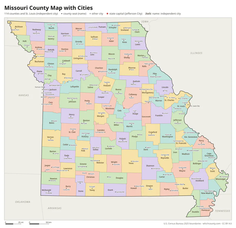
Missouri county map with cities
The largest cities in Missouri and the counties they are in. Cities that cross a county line list every county, the main one first. To find any smaller town, use the search box above.
| City | County | Population 2025 |
|---|---|---|
| Kansas City | Jackson, Clay, Platte and Cass counties | 521,220 |
| St. Louis | St. Louis city | 278,144 |
| Springfield | Greene and Christian counties | 169,847 |
| Columbia | Boone County | 130,851 |
| Independence | Jackson and Clay counties | 121,675 |
| Lee's Summit | Jackson and Cass counties | 107,514 |
| O'Fallon | St. Charles County | 96,101 |
| St. Charles | St. Charles County | 72,561 |
| St. Joseph | Buchanan County | 71,001 |
| Blue Springs | Jackson County | 61,632 |
| St. Peters | St. Charles County | 61,479 |
| Joplin | Jasper and Newton counties | 53,930 |
| Florissant | St. Louis County | 51,124 |
| Wentzville | St. Charles County | 49,495 |
| Chesterfield | St. Louis County | 49,309 |
| Jefferson City | Cole and Callaway counties | 42,489 |
| Cape Girardeau | Cape Girardeau and Scott counties | 40,977 |
| Wildwood | St. Louis County | 34,955 |
| University City | St. Louis County | 34,657 |
| Liberty | Clay County | 31,319 |
| Ballwin | St. Louis County | 30,901 |
| Kirkwood | St. Louis County | 29,331 |
| Raytown | Jackson County | 29,154 |
| Maryland Heights | St. Louis County | 27,559 |
| Gladstone | Clay County | 27,497 |
| Grandview | Jackson County | 26,653 |
| Raymore | Cass County | 26,633 |
| Nixa | Christian County | 26,597 |
| Belton | Cass County | 26,193 |
| Hazelwood | St. Louis County | 24,849 |
Printable Missouri county maps (free PDF, PNG, SVG)
Every map is free to print and share. The PDFs are vector files with real text, so they stay sharp at any size and you can search them for a county name. Use 11×17 (tabloid) for the most readable labels.
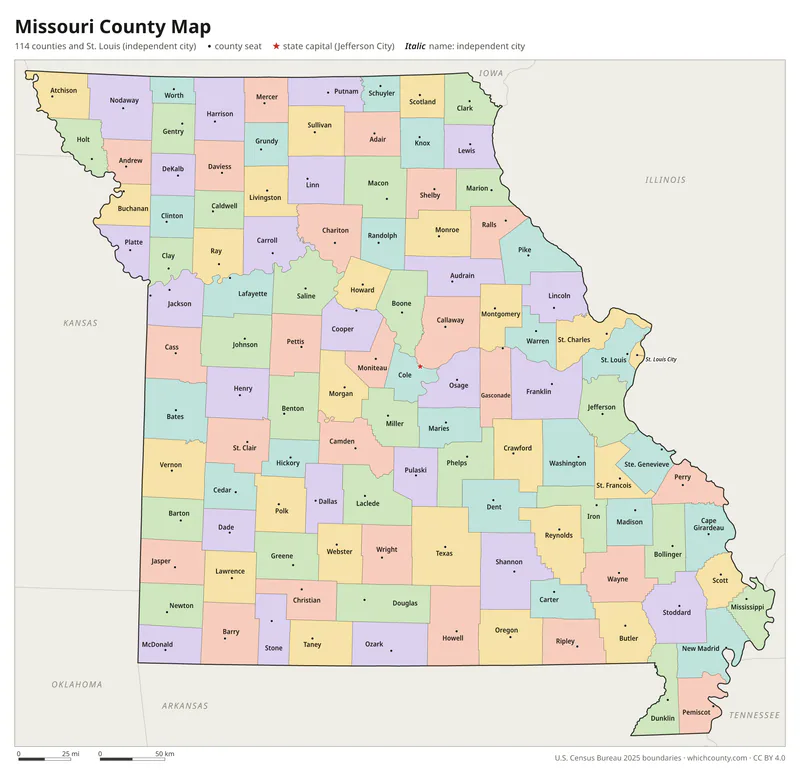
Color map with names
All 115 counties labeled, county seats marked. Letter and 11×17 PDF, high-resolution PNG, editable SVG.
Map with cities
Counties with their county seat towns and major cities.
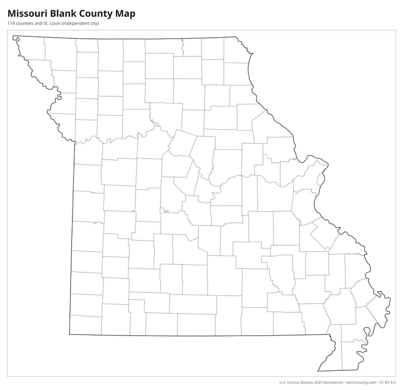
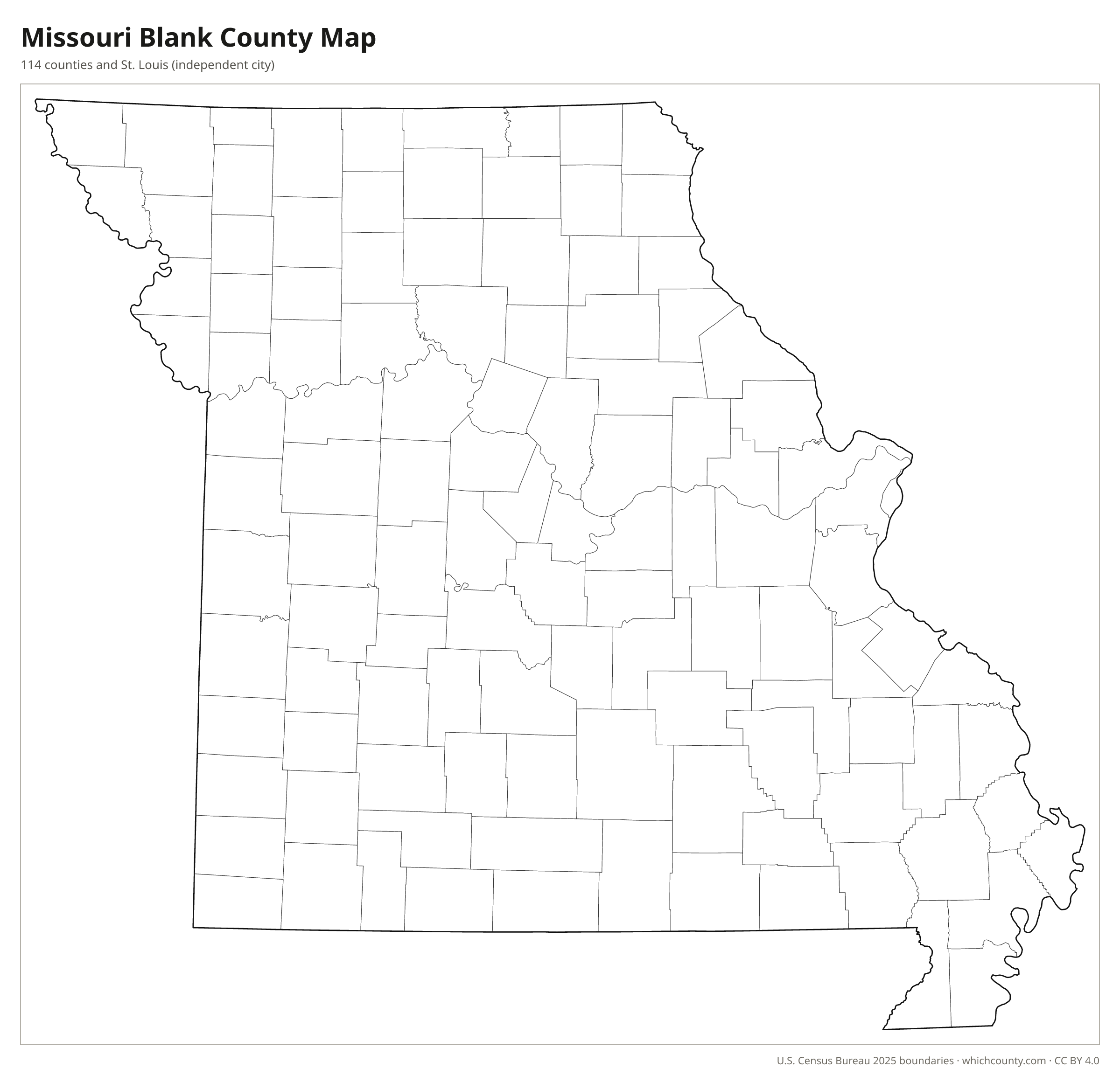
Blank outline map
County lines only, no names. For quizzes, coloring and your own notes.
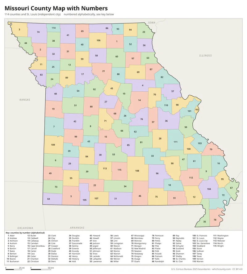
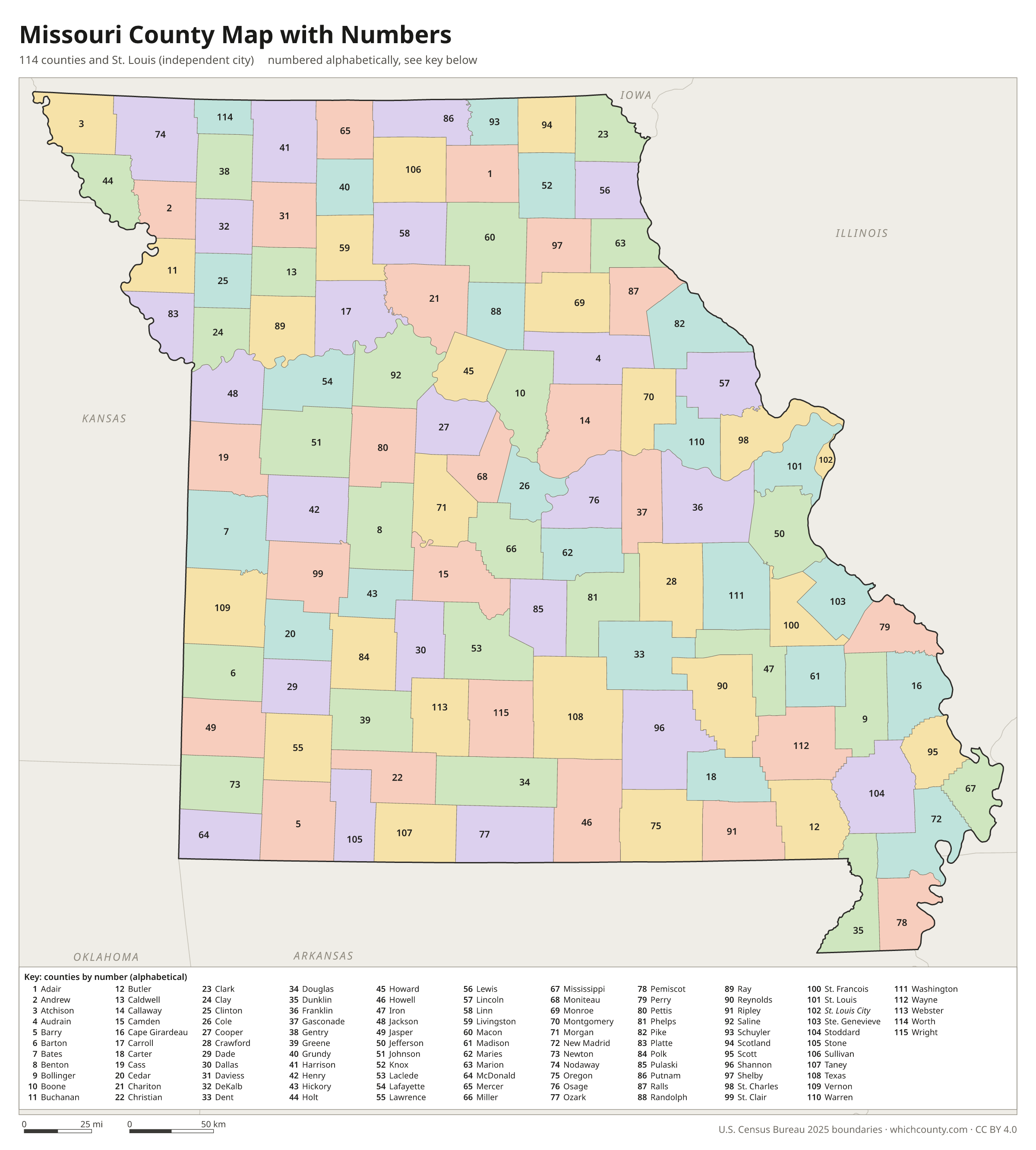
Numbered map with key
A number in every county with an alphabetical key.
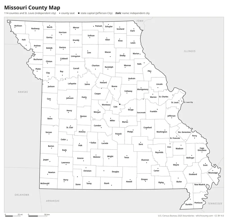
Black and white
Labeled map that prints well on any printer.
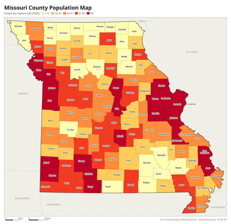
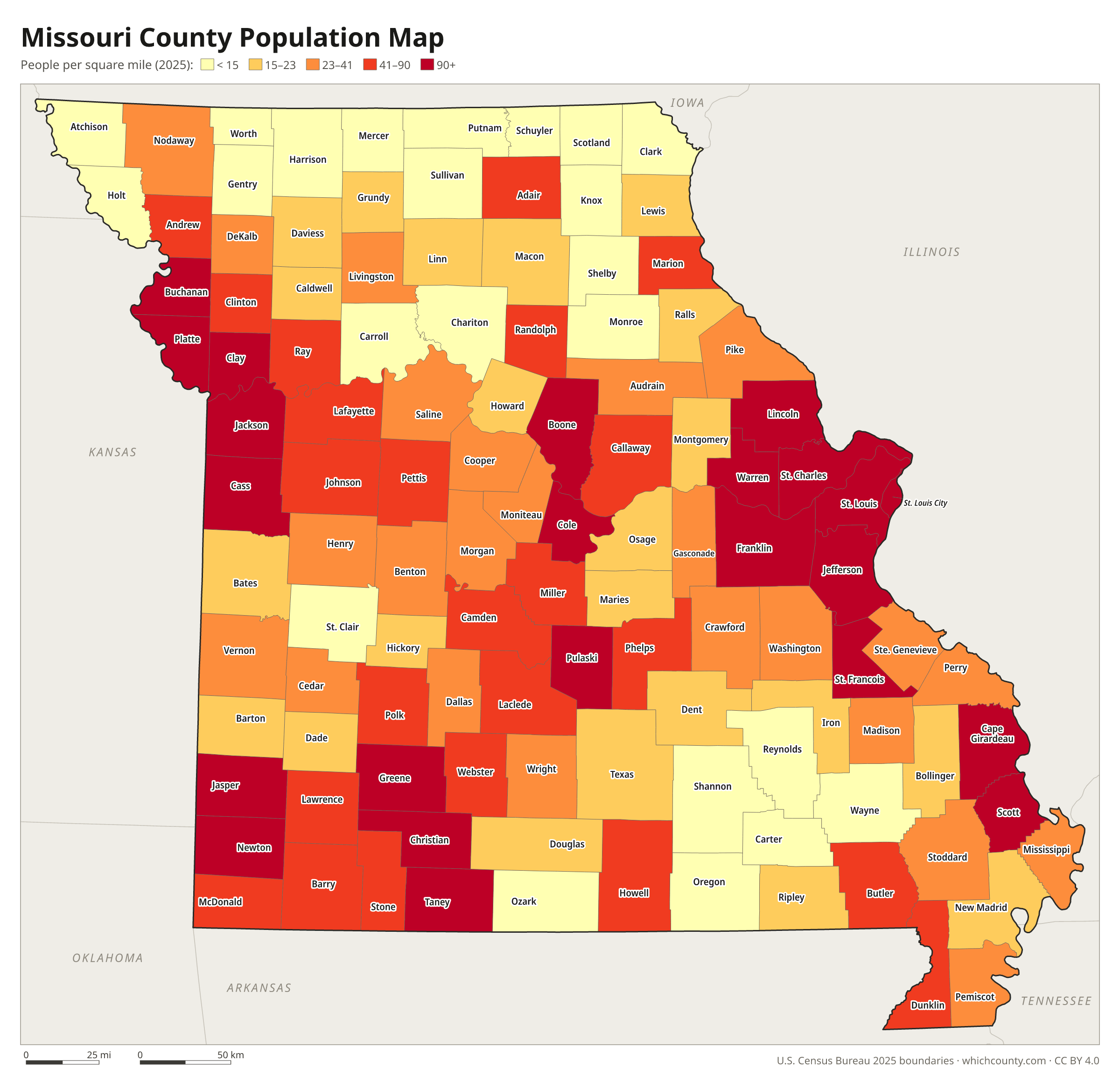
Population map
Counties shaded by population density (2025 estimates).
Data and GIS files
The county table as CSV, and the boundaries as GeoJSON and KML (Google Earth, Google My Maps).
How Missouri got 114 counties and an independent city
Missouri's first five counties, Cape Girardeau, New Madrid, St. Charles, St. Louis and Ste. Genevieve, were organized on October 1, 1812. They grew out of districts set up in 1804 within the District of Louisiana. Most of the other counties came in the next four decades. By the Secretary of State's dates, 67 of today's 114 counties were organized between 1830 and 1849 alone. Some started under other names: Kinderhook County became Camden in 1843, and Niangua became Dallas in 1844. Worth County, organized from Gentry County in February 1861, was the last. St. Louis is the exception. Until August 22, 1876, the city and St. Louis County were one entity. Under the 1875 Constitution the city then became separate, with its own courthouse and records, and it has stayed outside any county since.
Regions of Missouri
Missouri's counties grouped into the 19 Regional Planning Commissions and Councils of Governments of Missouri (source).
Boonslick Regional Planning Commission
Lincoln, Montgomery, Warren
Bootheel Regional Planning and Economic Development Commission
Dunklin, Mississippi, New Madrid, Pemiscot, Scott, Stoddard
East-West Gateway Council of Governments
Franklin, Jefferson, St. Charles, St. Louis, St. Louis city
Green Hills Regional Planning Commission
Caldwell, Carroll, Chariton, Daviess, Grundy, Harrison, Linn, Livingston, Mercer, Putnam, Sullivan
Harry S Truman Coordinating Council
Barton, Jasper, McDonald, Newton
Kaysinger Basin Regional Planning Commission
Bates, Benton, Cedar, Henry, Hickory, St. Clair, Vernon
Lake of the Ozarks Council of Local Governments
Camden, Laclede, Miller, Morgan
Mark Twain Regional Council of Governments
Audrain, Macon, Marion, Monroe, Ralls, Randolph, Pike, Shelby
Meramec Regional Planning Commission
Crawford, Dent, Gasconade, Maries, Osage, Phelps, Pulaski, Washington
Mid-America Regional Council
Cass, Clay, Jackson, Platte, Ray
Mid-Missouri Regional Planning Commission
Boone, Callaway, Cole, Cooper, Howard, Moniteau
Mo-Kan Regional Council
Andrew, Buchanan, Clinton, DeKalb
Northeast Missouri Regional Planning Commission
Adair, Clark, Knox, Lewis, Schuyler, Scotland
Northwest Missouri Regional Council of Governments
Atchison, Gentry, Holt, Nodaway, Worth
Ozark Foothills Regional Planning Commission
Butler, Carter, Reynolds, Ripley, Wayne
Pioneer Trails Regional Planning Commission
Johnson, Lafayette, Pettis, Saline
South Central Ozark Council of Governments
Douglas, Howell, Oregon, Ozark, Shannon, Texas, Wright
Southeast Missouri Regional Planning and Economic Development Commission
Bollinger, Cape Girardeau, Iron, Madison, Perry, Ste. Genevieve, St. Francois
Southwest Missouri Council of Governments
Barry, Christian, Dade, Dallas, Greene, Lawrence, Polk, Stone, Taney, Webster
County maps of neighboring states
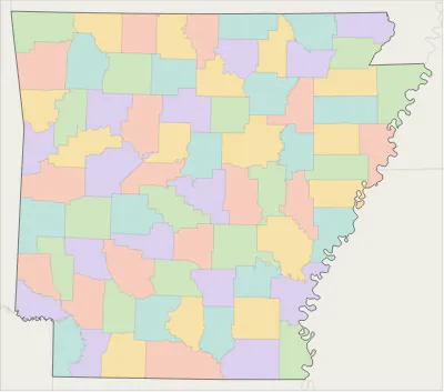 Arkansas county map
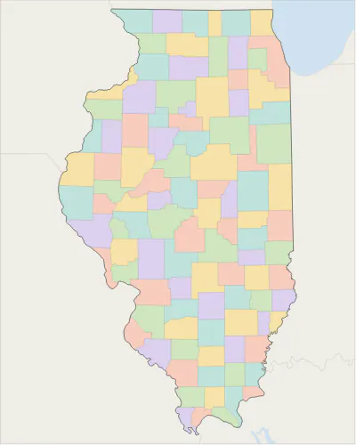 Illinois county map
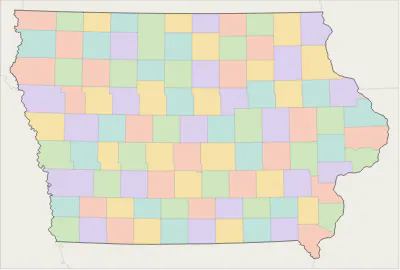 Iowa county map
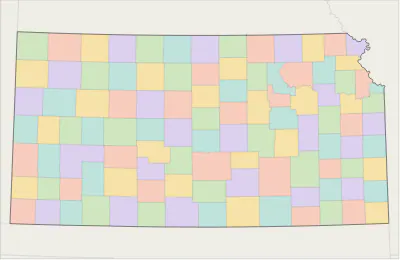 Kansas county map
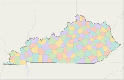 Kentucky county map
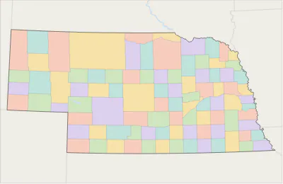 Nebraska county map
 Oklahoma county map
 Tennessee county map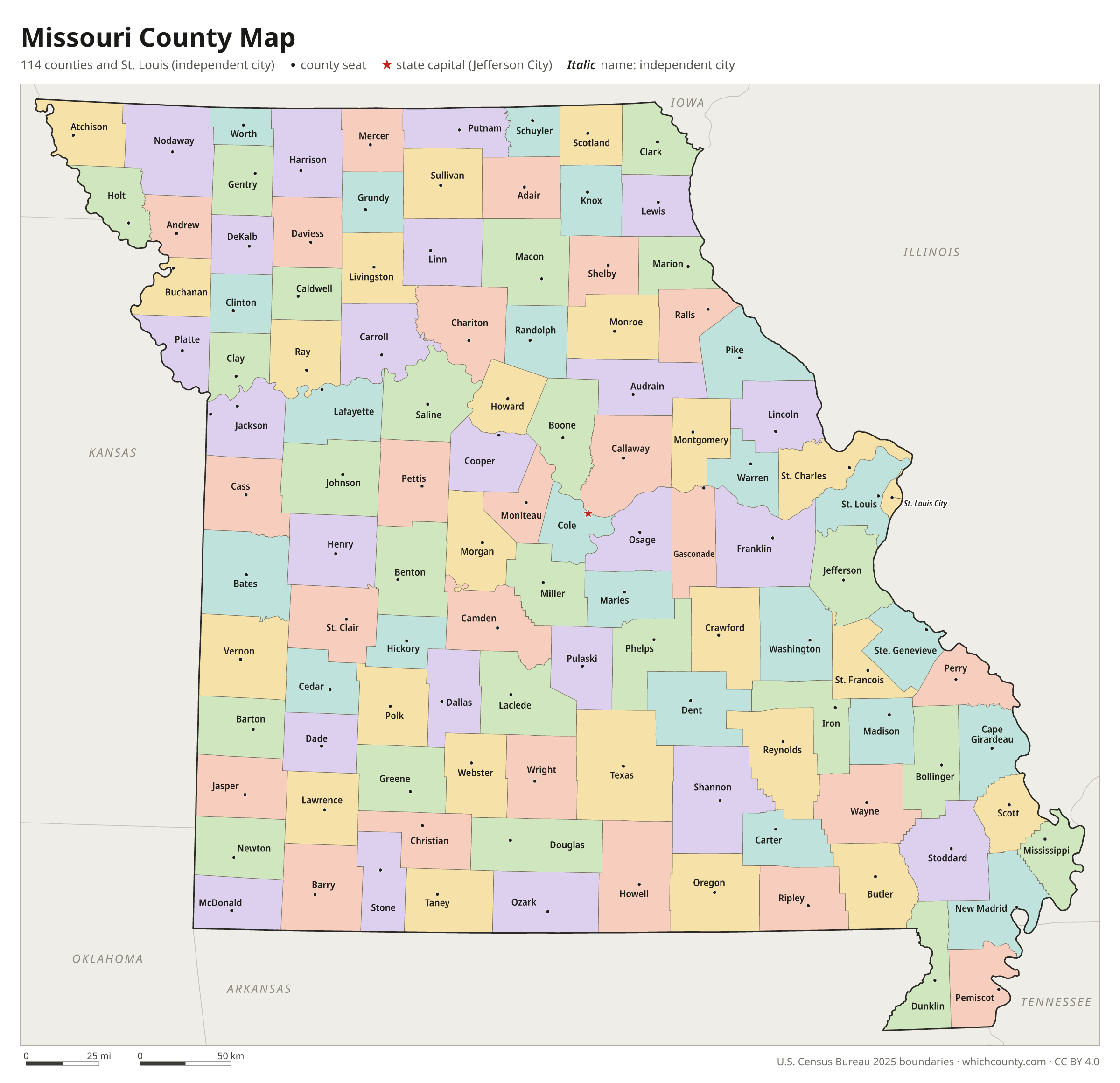
Missouri counties: questions and answers
- How many counties are in Missouri?
- Missouri has 115 counties. Missouri has 114 counties and one independent city, St. Louis, which belongs to no county. The Census Bureau counts 115 county-equivalents.
- What is the largest county in Missouri?
- By land area, Texas County is the largest (1,177 sq mi). By population, St. Louis County is the largest, with 990,911 people (2025 estimate).
- What is the smallest county in Missouri?
- St. Louis city is the smallest by land area (61.7 sq mi). Worth County has the fewest people: 1,914 (2025 estimate).
- What is the wealthiest county in Missouri?
- By median household income, St. Charles County ranks first with $104,692 (American Community Survey 2020–2024). The lowest is Hickory County at $39,390.
- What county is Kansas City in?
- Kansas City is mostly in Jackson County, with smaller parts in Clay, Platte and Cass counties.
- What county is St. Louis in?
- St. Louis is in St. Louis city.
- What county is Springfield in?
- Springfield is mostly in Greene County, with smaller parts in Christian County.
- What county is Jefferson City in?
- Jefferson City, the state capital, is in Cole County.
- How can I see county lines on Google Maps?
- Google Maps does not draw county lines. Download the KML file from the printable maps section above and import it into Google My Maps (Create a new map › Import) or open it in Google Earth to see every Missouri county boundary on top of Google's map.
- Can I use this map for free?
- Yes. The maps and files on this page are free to print, share and use in your own work, including commercial projects, under the CC BY 4.0 licence. Please credit “WhichCounty (whichcounty.com)”.
Use this map on your site
You may copy, print and publish these maps, also commercially, as long as you credit WhichCounty with a link (licence details). Paste this code to embed the map:
Sources and methodology
- Boundaries: U.S. Census Bureau, 2025 Cartographic Boundary Files (1:500,000), simplified for display. Projection: Lambert conformal conic fitted to Missouri.
- Population: Census Bureau county estimates, Vintage 2025 (July 1, 2025), compared with the April 1, 2020 estimates base.
- Land area: Census Bureau 2026 Gazetteer files. Median household income: American Community Survey 2020–2024 5-year estimates.
- County seats and founding years: Wikidata (CC0), checked against state lists by WhichCounty. Cities: Census Bureau city and town estimates, Vintage 2025.
- History: Counties (Missouri Secretary of State, State Archives)
- Atlas of Historical County Boundaries: Missouri (Newberry Library)
Found an error? Tell us. Last data update: October 4, 2026.