Wisconsin County Map
All 72 counties with county seats and major cities
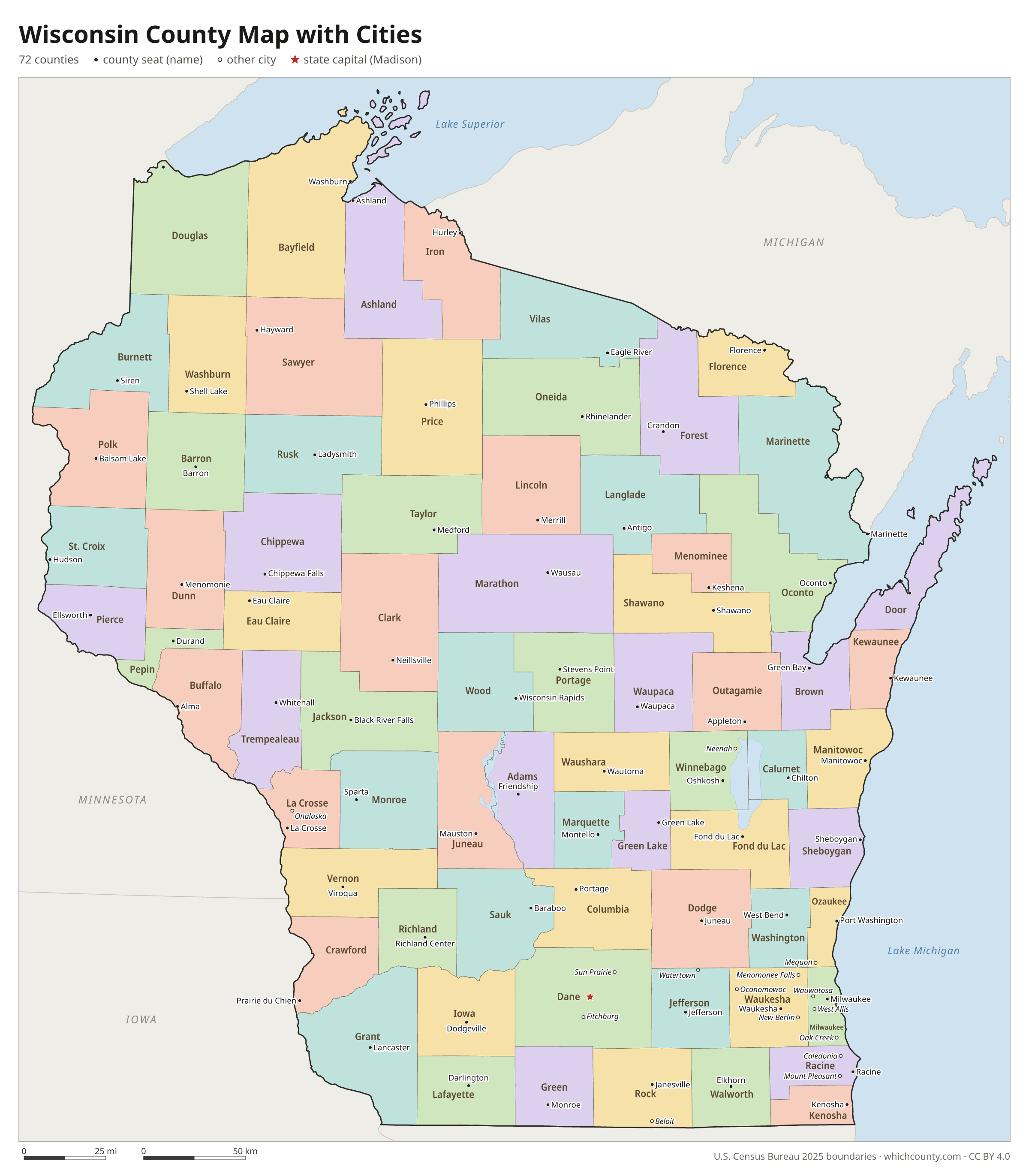
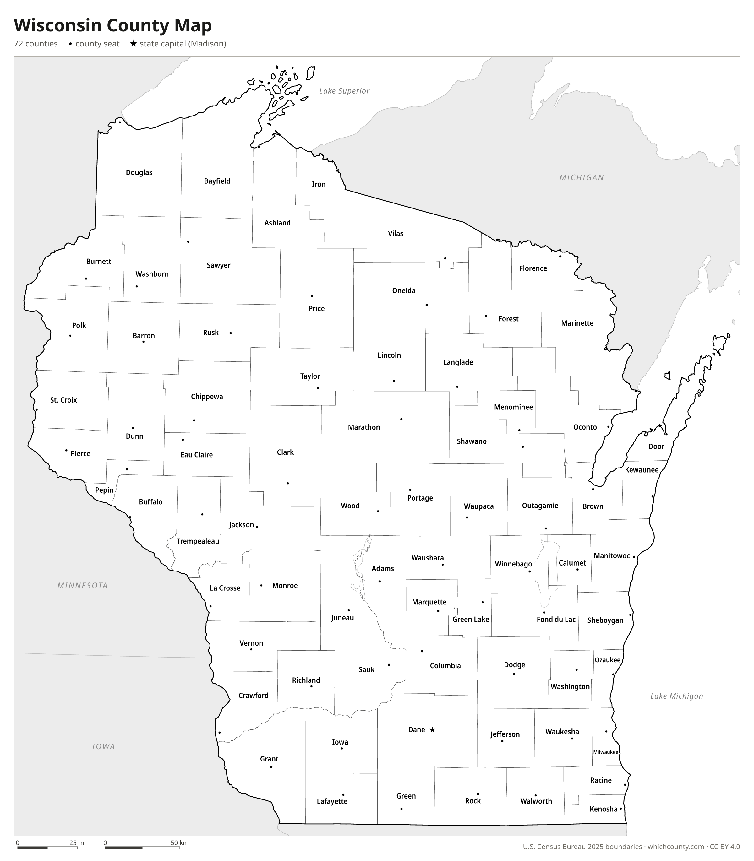
Wisconsin has 72 counties, and their boundaries, set by the legislature in state law, mostly run north to south or east to west or follow major rivers. This map shows all 72 counties and their county seats. Tap a county for details, or download the free printable map below.

Updated October 4, 2026 · Boundaries: U.S. Census Bureau 2025 · Population: Census estimates for July 1, 2025
Wisconsin county facts
- Number of counties
- 72
- Largest by land area
- Marathon County 1,545 sq mi
- Smallest by land area
- Pepin County 232 sq mi
- Most people
- Milwaukee County 924,216
- Fewest people
- Menominee County 4,199
- Fastest growing since 2020
- Adams County +5.3%
- Highest median household income
- Waukesha County $106,076
- Oldest county
- Brown County est. 1818
- Newest county
- Menominee County est. 1959
- State capital
- Madison Dane County
Menominee County was formed from the terminated Menominee Reservation in 1961. After Congress restored the tribe's federal status in 1973, the county's lands went back to reservation status in April 1975, but Menominee County was kept as a county.
Rusk County was created in 1901 as Gates County and renamed Rusk in 1905.
List of 72 Wisconsin counties
Sorted A–Z. Click a column to sort, or a name to show it on the map. Download as CSV
| County | County seat | Population 2025 | Change since 2020 | Land area (sq mi) | Median income | Established | FIPS |
|---|---|---|---|---|---|---|---|
| Adams County | Friendship | 21,752 | +5.3% | 646 | $59,442 | 1848 | 55001 |
| Ashland County | Ashland | 16,203 | +1.1% | 1,045 | $62,462 | 1860 | 55003 |
| Barron County | Barron | 46,484 | −0.5% | 863 | $65,933 | 1859 | 55005 |
| Bayfield County | Washburn | 16,787 | +3.5% | 1,478 | $71,151 | 1845 | 55007 |
| Brown County | Green Bay | 275,803 | +2.6% | 530 | $79,649 | 1818 | 55009 |
| Buffalo County | Alma | 13,318 | −0% | 676 | $70,479 | 1853 | 55011 |
| Burnett County | Siren | 17,223 | +4.2% | 822 | $62,819 | 1856 | 55013 |
| Calumet County | Chilton | 53,982 | +2.9% | 318 | $88,810 | 1836 | 55015 |
| Chippewa County | Chippewa Falls | 67,614 | +2% | 1,008 | $74,680 | 1845 | 55017 |
| Clark County | Neillsville | 35,052 | +1.2% | 1,210 | $67,400 | 1853 | 55019 |
| Columbia County | Portage | 58,132 | −0.6% | 766 | $85,351 | 1846 | 55021 |
| Crawford County | Prairie du Chien | 15,910 | −1.2% | 571 | $64,094 | 1818 | 55023 |
| Dane County | Madison | 590,375 | +5.1% | 1,197 | $89,975 | 1836 | 55025 |
| Dodge County | Juneau | 89,097 | −0.3% | 876 | $75,929 | 1836 | 55027 |
| Door County | Sturgeon Bay | 30,616 | +1.8% | 482 | $74,795 | 1851 | 55029 |
| Douglas County | Superior | 43,990 | −0.7% | 1,304 | $75,099 | 1854 | 55031 |
| Dunn County | Menomonie | 46,223 | +1.7% | 850 | $74,824 | 1854 | 55033 |
| Eau Claire County | Eau Claire | 109,033 | +3.2% | 638 | $74,546 | 1856 | 55035 |
| Florence County | Florence | 4,748 | +4.2% | 488 | $61,086 | 1882 | 55037 |
| Fond du Lac County | Fond du Lac | 104,669 | +0.5% | 720 | $74,275 | 1836 | 55039 |
| Forest County | Crandon | 9,574 | +4.3% | 1,014 | $61,071 | 1885 | 55041 |
| Grant County | Lancaster | 52,446 | +1% | 1,148 | $66,858 | 1837 | 55043 |
| Green County | Monroe | 37,227 | +0.4% | 584 | $82,852 | 1837 | 55045 |
| Green Lake County | Green Lake | 19,305 | +1.5% | 350 | $68,196 | 1858 | 55047 |
| Iowa County | Dodgeville | 23,951 | +1% | 763 | $82,182 | 1829 | 55049 |
| Iron County | Hurley | 6,127 | −0.2% | 758 | $60,625 | 1893 | 55051 |
| Jackson County | Black River Falls | 20,999 | −0.7% | 988 | $68,110 | 1853 | 55053 |
| Jefferson County | Jefferson | 86,505 | +0.4% | 557 | $83,750 | 1836 | 55055 |
| Juneau County | Mauston | 26,649 | −0.3% | 767 | $67,270 | 1857 | 55057 |
| Kenosha County | Kenosha | 168,448 | −0.4% | 272 | $81,239 | 1850 | 55059 |
| Kewaunee County | Kewaunee | 20,758 | +1% | 343 | $82,725 | 1852 | 55061 |
| La Crosse County | La Crosse | 121,339 | +0.5% | 452 | $73,013 | 1851 | 55063 |
| Lafayette County | Darlington | 17,478 | +5.2% | 634 | $76,462 | 1846 | 55065 |
| Langlade County | Antigo | 19,534 | +0.2% | 871 | $55,878 | 1879 | 55067 |
| Lincoln County | Merrill | 28,403 | −0% | 879 | $68,164 | 1874 | 55069 |
| Manitowoc County | Manitowoc | 81,710 | +0.4% | 589 | $69,148 | 1836 | 55071 |
| Marathon County | Wausau | 139,432 | +1% | 1,545 | $77,884 | 1850 | 55073 |
| Marinette County | Marinette | 42,574 | +1.7% | 1,400 | $63,809 | 1879 | 55075 |
| Marquette County | Montello | 15,927 | +2.1% | 456 | $65,681 | 1836 | 55077 |
| Menominee County | Keshena | 4,199 | −1.2% | 358 | $62,108 | 1959 | 55078 |
| Milwaukee County | Milwaukee | 924,216 | −1.6% | 242 | $64,435 | 1834 | 55079 |
| Monroe County | Sparta | 46,572 | +0.6% | 901 | $69,467 | 1854 | 55081 |
| Oconto County | Oconto | 40,195 | +3.2% | 998 | $75,049 | 1851 | 55083 |
| Oneida County | Rhinelander | 38,131 | +0.8% | 1,114 | $69,371 | 1887 | 55085 |
| Outagamie County | Appleton | 195,894 | +2.7% | 638 | $85,069 | 1851 | 55087 |
| Ozaukee County | Port Washington | 94,346 | +3.1% | 233 | $96,996 | 1853 | 55089 |
| Pepin County | Durand | 7,513 | +2.6% | 232 | $75,256 | 1858 | 55091 |
| Pierce County | Ellsworth | 43,519 | +3.1% | 574 | $92,109 | 1853 | 55093 |
| Polk County | Balsam Lake | 45,803 | +1.8% | 914 | $77,219 | 1853 | 55095 |
| Portage County | Stevens Point | 71,943 | +2.2% | 801 | $76,070 | 1836 | 55097 |
| Price County | Phillips | 13,988 | −0.5% | 1,254 | $60,546 | 1879 | 55099 |
| Racine County | Racine | 198,919 | +0.4% | 333 | $78,096 | 1836 | 55101 |
| Richland County | Richland Center | 17,036 | −1.6% | 586 | $66,420 | 1842 | 55103 |
| Rock County | Janesville | 166,472 | +1.7% | 718 | $75,673 | 1836 | 55105 |
| Rusk County | Ladysmith | 14,146 | −0.3% | 914 | $59,944 | 1901 | 55107 |
| Sauk County | Baraboo | 66,652 | +1.3% | 832 | $79,541 | 1840 | 55111 |
| Sawyer County | Hayward | 18,846 | +4.2% | 1,258 | $60,801 | 1883 | 55113 |
| Shawano County | Shawano | 41,560 | +1.7% | 893 | $66,479 | 1853 | 55115 |
| Sheboygan County | Sheboygan | 118,047 | +0% | 512 | $73,094 | 1836 | 55117 |
| St. Croix County | Hudson | 98,276 | +5.1% | 722 | $103,046 | 1840 | 55109 |
| Taylor County | Medford | 20,118 | +1% | 975 | $69,350 | 1875 | 55119 |
| Trempealeau County | Whitehall | 31,171 | +1.3% | 733 | $76,313 | 1854 | 55121 |
| Vernon County | Viroqua | 31,443 | +2.4% | 792 | $71,893 | 1851 | 55123 |
| Vilas County | Eagle River | 23,761 | +3.1% | 858 | $68,431 | 1893 | 55125 |
| Walworth County | Elkhorn | 106,127 | +0.9% | 555 | $80,520 | 1836 | 55127 |
| Washburn County | Shell Lake | 17,087 | +2.8% | 797 | $63,441 | 1883 | 55129 |
| Washington County | West Bend | 139,238 | +1.8% | 431 | $96,359 | 1836 | 55131 |
| Waukesha County | Waukesha | 417,210 | +2.5% | 550 | $106,076 | 1846 | 55133 |
| Waupaca County | Waupaca | 51,461 | −0.7% | 748 | $72,830 | 1851 | 55135 |
| Waushara County | Wautoma | 25,223 | +2.9% | 626 | $67,107 | 1851 | 55137 |
| Winnebago County | Oshkosh | 174,218 | +1.4% | 435 | $74,925 | 1840 | 55139 |
| Wood County | Wisconsin Rapids | 74,060 | −0.2% | 793 | $67,989 | 1856 | 55141 |
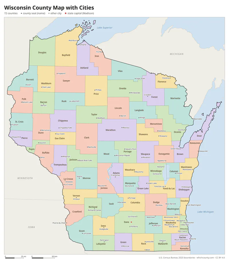
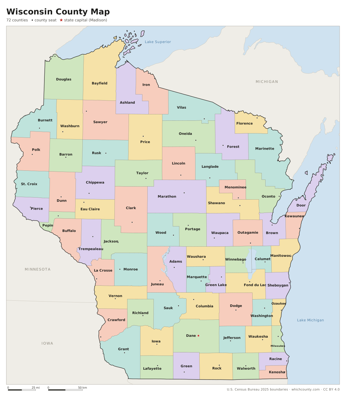
Wisconsin county map with cities
The largest cities in Wisconsin and the counties they are in. Cities that cross a county line list every county, the main one first. To find any smaller town, use the search box above.
| City | County | Population 2025 |
|---|---|---|
| Milwaukee | Milwaukee, Washington and Waukesha counties | 562,407 |
| Madison | Dane County | 286,233 |
| Green Bay | Brown County | 106,675 |
| Kenosha | Kenosha County | 99,239 |
| Racine | Racine County | 77,908 |
| Appleton | Outagamie, Calumet and Winnebago counties | 75,452 |
| Eau Claire | Eau Claire and Chippewa counties | 72,465 |
| Waukesha | Waukesha County | 70,872 |
| Oshkosh | Winnebago County | 67,460 |
| Janesville | Rock County | 66,929 |
| West Allis | Milwaukee County | 60,119 |
| La Crosse | La Crosse County | 50,784 |
| Sheboygan | Sheboygan County | 49,376 |
| Wauwatosa | Milwaukee County | 48,649 |
| Fond du Lac | Fond du Lac County | 44,541 |
| Brookfield | Waukesha County | 41,448 |
| Menomonee Falls | Waukesha County | 41,291 |
| Wausau | Marathon County | 40,188 |
| New Berlin | Waukesha County | 39,953 |
| Sun Prairie | Dane County | 39,227 |
| Oak Creek | Milwaukee County | 38,296 |
| Greenfield | Milwaukee County | 37,159 |
| Franklin | Milwaukee County | 36,687 |
| Beloit | Rock County | 36,649 |
| Manitowoc | Manitowoc County | 34,671 |
| Fitchburg | Dane County | 34,615 |
| West Bend | Washington County | 32,268 |
| Mount Pleasant | Racine County | 28,253 |
| Neenah | Winnebago County | 27,638 |
| Superior | Douglas County | 26,397 |
Printable Wisconsin county maps (free PDF, PNG, SVG)
Every map is free to print and share. The PDFs are vector files with real text, so they stay sharp at any size and you can search them for a county name. Use 11×17 (tabloid) for the most readable labels.
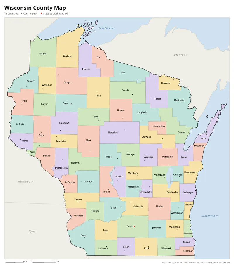
Color map with names
All 72 counties labeled, county seats marked. Letter and 11×17 PDF, high-resolution PNG, editable SVG.
Map with cities
Counties with their county seat towns and major cities.
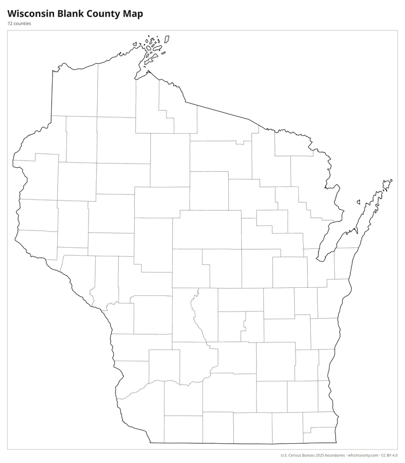
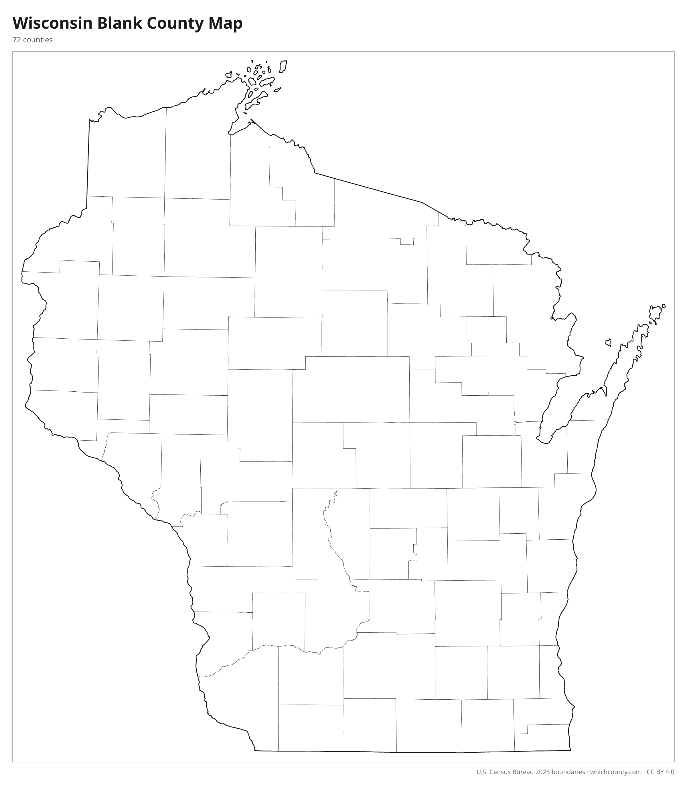
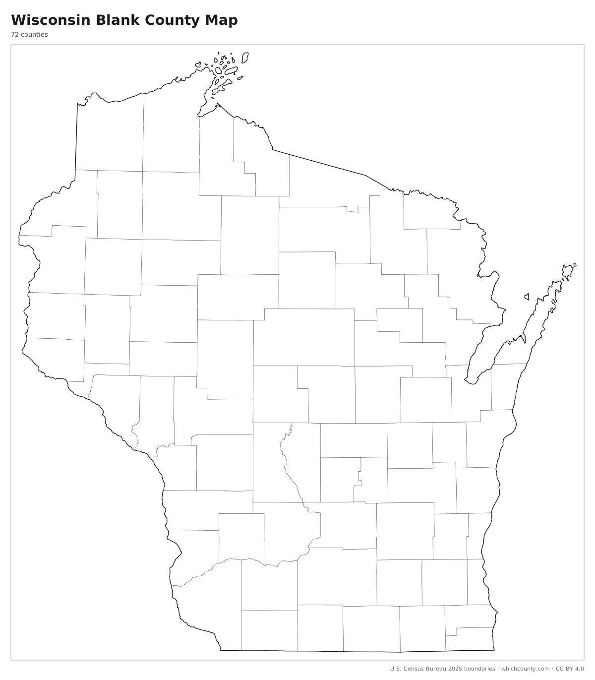
Blank outline map
County lines only, no names. For quizzes, coloring and your own notes.
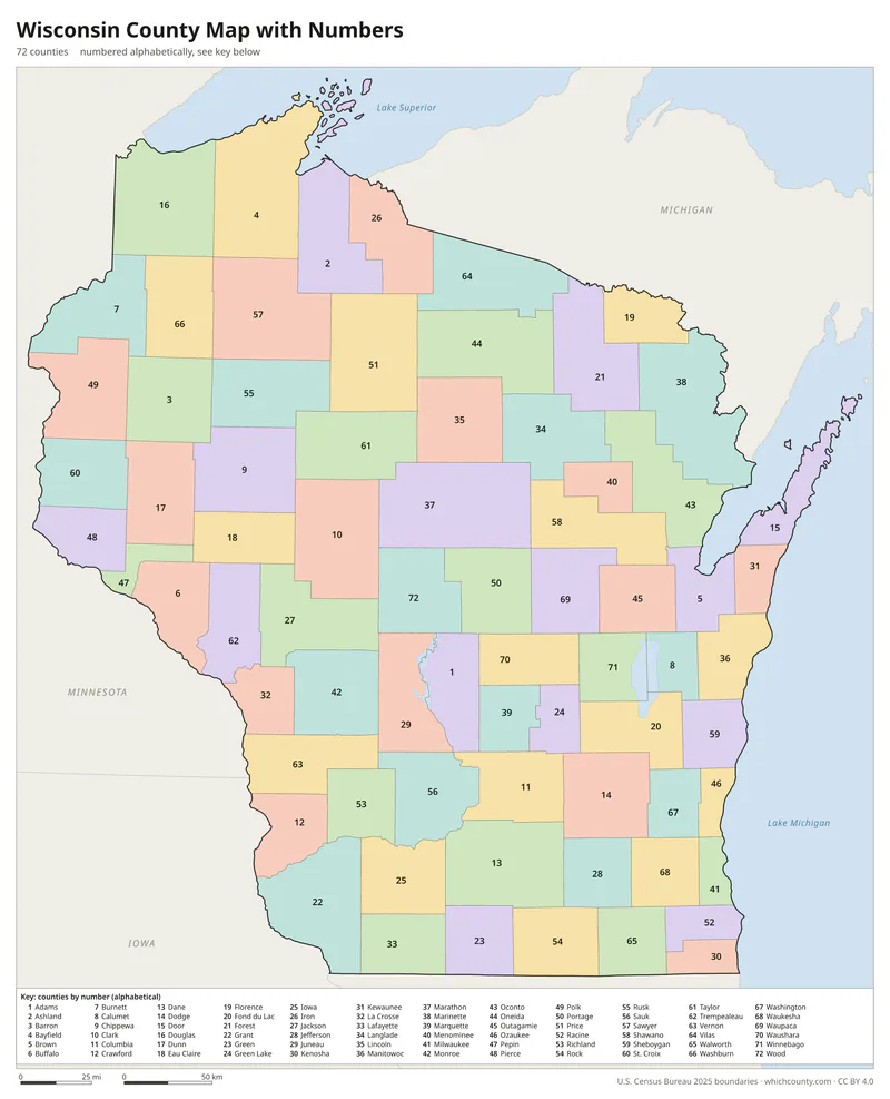
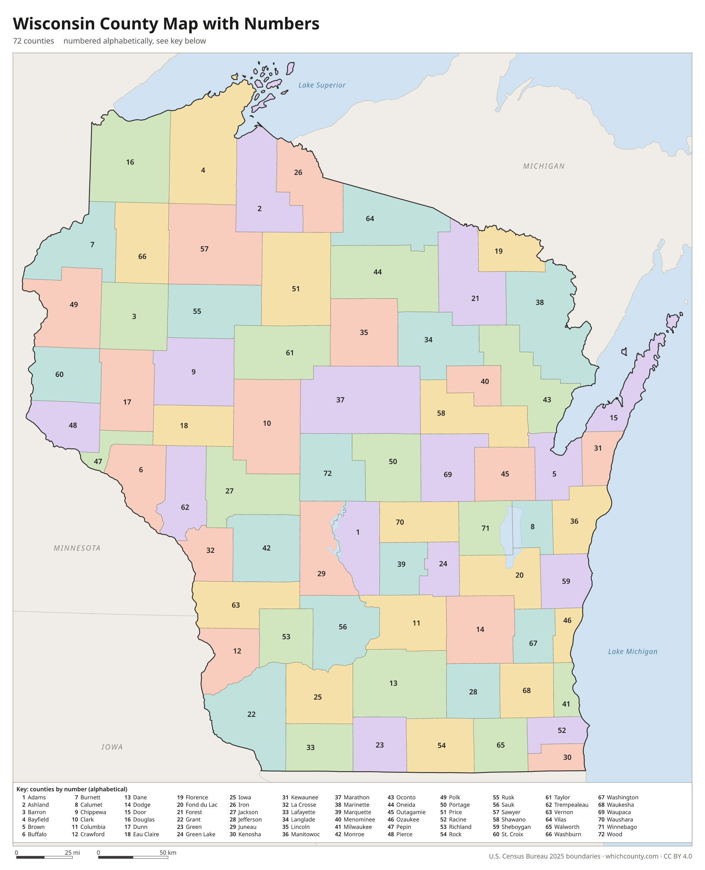
Numbered map with key
A number in every county with an alphabetical key.
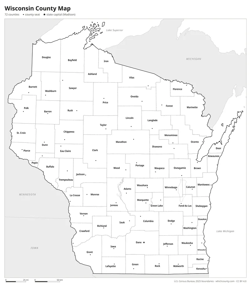
Black and white
Labeled map that prints well on any printer.
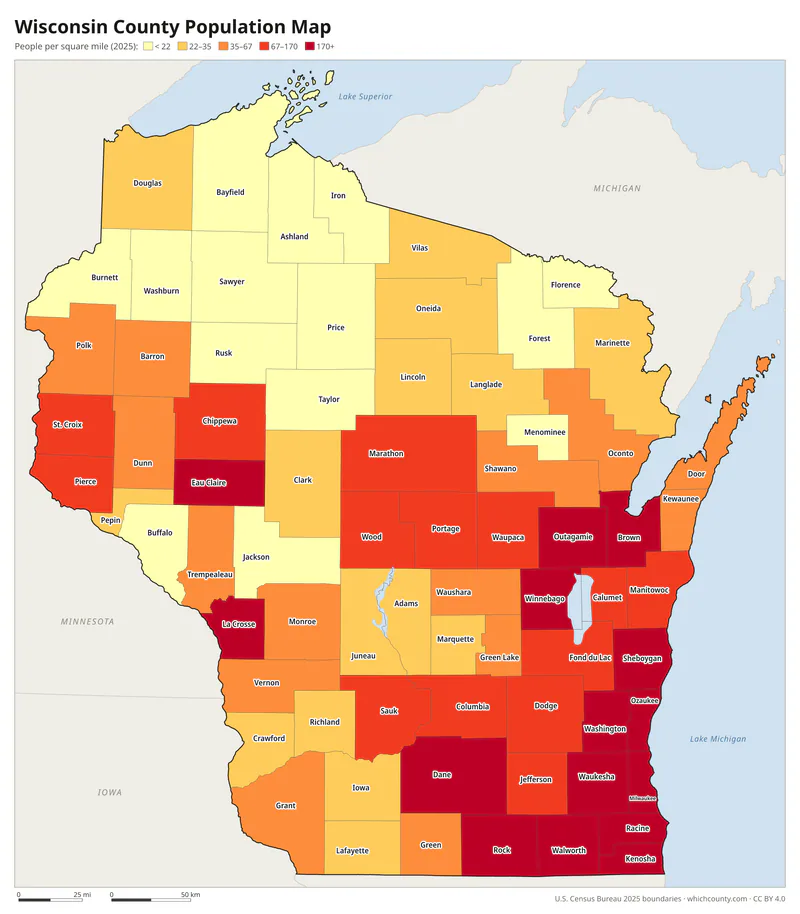
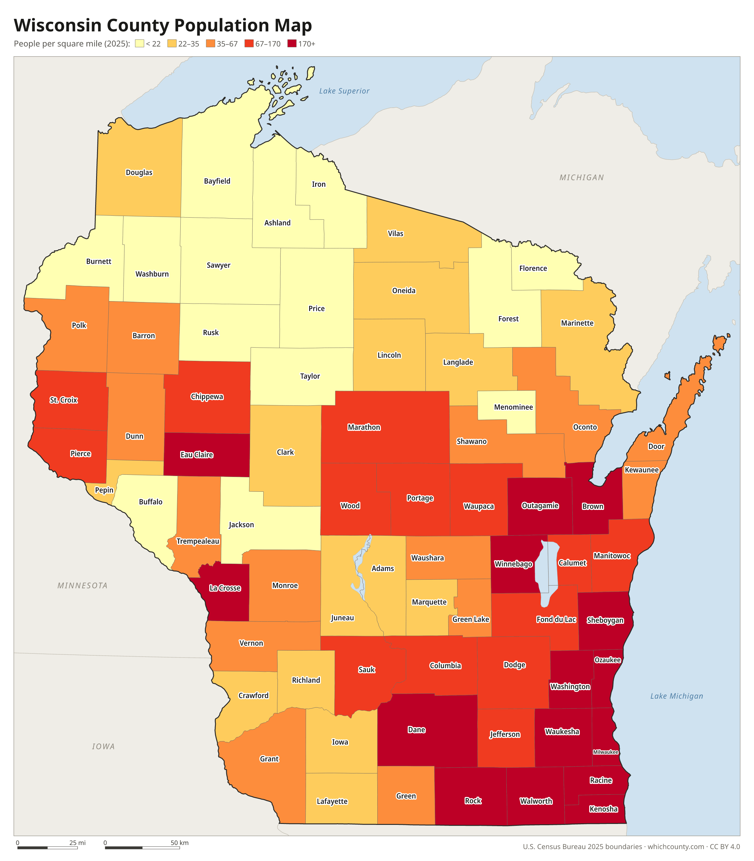
Population map
Counties shaded by population density (2025 estimates).
Data and GIS files
The county table as CSV, and the boundaries as GeoJSON and KML (Google Earth, Google My Maps).
How Wisconsin went from two counties to 72
Wisconsin's first counties were drawn by Michigan Territory. In 1818 it created two huge counties in the future state, Brown and Crawford. Brown also reached into present Michigan, and Crawford into present Minnesota. Michigan Territory added Iowa and Milwaukee counties before Wisconsin Territory was formed in 1836, and 15 of today's counties date from 1836 alone. The territorial and then the state legislature kept carving new counties out of the large ones. Eight were added between 1881 and 1901, the last of them Gates County, renamed Rusk in 1905. The state constitution protects smaller counties: a county of 900 square miles or less cannot be divided unless a majority of its voters approve. Menominee became the 72nd county in 1961, when federal termination ended the Menominee Reservation and its land became a county.
County maps of neighboring states
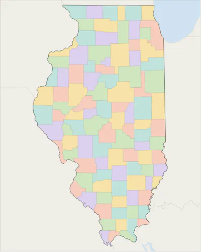 Illinois county map
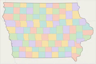 Iowa county map
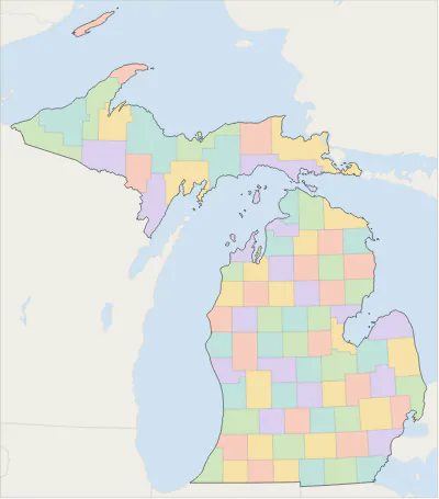 Michigan county map
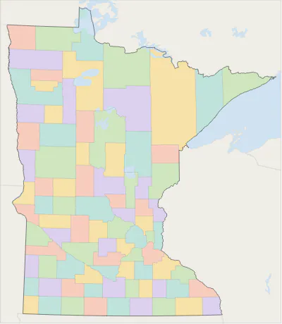 Minnesota county map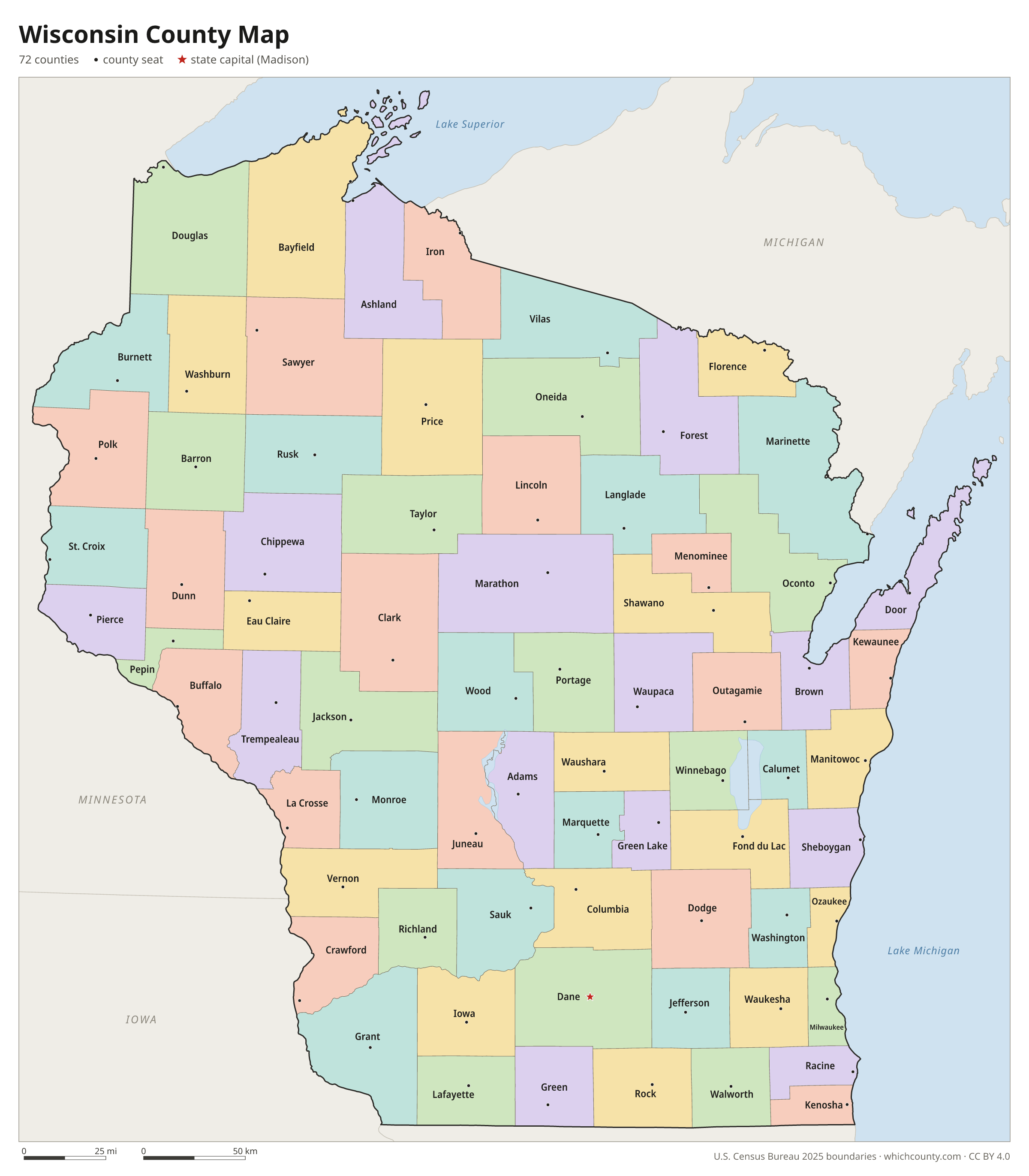
Wisconsin counties: questions and answers
- How many counties are in Wisconsin?
- Wisconsin has 72 counties.
- What is the largest county in Wisconsin?
- By land area, Marathon County is the largest (1,545 sq mi). By population, Milwaukee County is the largest, with 924,216 people (2025 estimate).
- What is the smallest county in Wisconsin?
- Pepin County is the smallest by land area (232 sq mi). Menominee County has the fewest people: 4,199 (2025 estimate).
- What is the wealthiest county in Wisconsin?
- By median household income, Waukesha County ranks first with $106,076 (American Community Survey 2020–2024). The lowest is Langlade County at $55,878.
- What county is Milwaukee in?
- Milwaukee is mostly in Milwaukee County, with smaller parts in Washington and Waukesha counties.
- What county is Madison in?
- Madison is in Dane County.
- What county is Green Bay in?
- Green Bay is in Brown County.
- How can I see county lines on Google Maps?
- Google Maps does not draw county lines. Download the KML file from the printable maps section above and import it into Google My Maps (Create a new map › Import) or open it in Google Earth to see every Wisconsin county boundary on top of Google's map.
- Can I use this map for free?
- Yes. The maps and files on this page are free to print, share and use in your own work, including commercial projects, under the CC BY 4.0 licence. Please credit “WhichCounty (whichcounty.com)”.
Use this map on your site
You may copy, print and publish these maps, also commercially, as long as you credit WhichCounty with a link (licence details). Paste this code to embed the map:
Sources and methodology
- Boundaries: U.S. Census Bureau, 2025 Cartographic Boundary Files (1:500,000), simplified for display. Projection: Lambert conformal conic fitted to Wisconsin.
- Population: Census Bureau county estimates, Vintage 2025 (July 1, 2025), compared with the April 1, 2020 estimates base.
- Land area: Census Bureau 2026 Gazetteer files. Median household income: American Community Survey 2020–2024 5-year estimates.
- County seats and founding years: Wikidata (CC0), checked against state lists by WhichCounty. Cities: Census Bureau city and town estimates, Vintage 2025.
- Wisconsin Blue Book 2023-2024: Population and political subdivisions, Basic data on Wisconsin counties (Legislative Reference Bureau)
- Wisconsin Blue Book 2023-2024: Local government in Wisconsin (Legislative Reference Bureau)
- Wisconsin Constitution, Article XIII, Section 7 (copy published by the Universities of Wisconsin, Office of General Counsel)
- Menominee History (Milwaukee Public Museum, Indian Country Wisconsin)
- Atlas of Historical County Boundaries: Wisconsin (Newberry Library)
Found an error? Tell us. Last data update: October 4, 2026.