West Virginia County Map
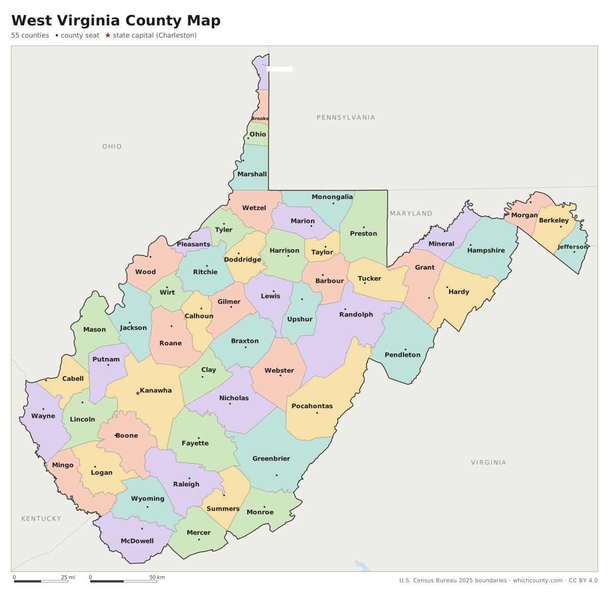
All 55 counties with county seats and major cities
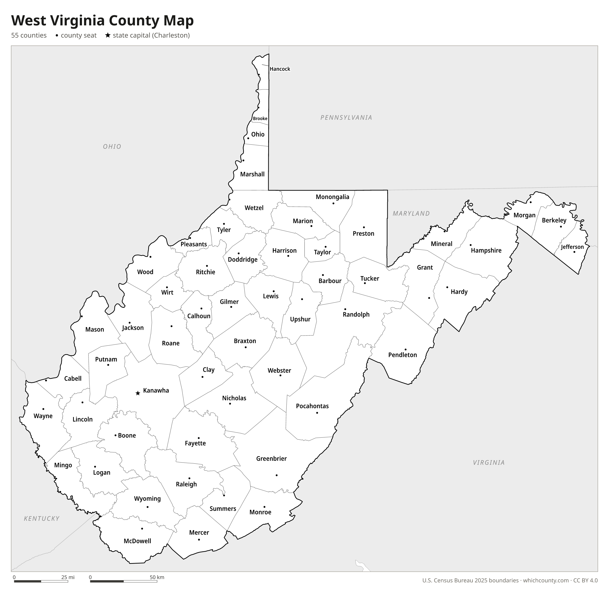
West Virginia has 55 counties; the smallest is Hancock in the Northern Panhandle and the largest is Randolph. This map shows all 55 counties and their county seats. Tap a county for details, or download the free printable map below.

Updated October 4, 2026 · Boundaries: U.S. Census Bureau 2025 · Population: Census estimates for July 1, 2025
West Virginia county facts
- Number of counties
- 55
- Largest by land area
- Randolph County 1,040 sq mi
- Smallest by land area
- Hancock County 82.6 sq mi
- Most people
- Kanawha County 172,381
- Fewest people
- Wirt County 4,879
- Fastest growing since 2020
- Berkeley County +14.3%
- Highest median household income
- Jefferson County $98,806
- Oldest county
- Hampshire County est. 1754
- Newest county
- Mingo County est. 1895
- State capital
- Charleston Kanawha County
Berkeley and Jefferson counties joined West Virginia after statehood, in August and November 1863. Congress confirmed their inclusion in 1866 and the U.S. Supreme Court in 1871.
Frederick County was the only county offered a place in the new state that voted not to join. It remains in Virginia.
Mineral County was split from Hampshire in 1866 partly because of wartime differences: its mountainous western part had favored the Union more than Hampshire's eastern river valleys.
List of 55 West Virginia counties
Sorted A–Z. Click a column to sort, or a name to show it on the map. Download as CSV
| County | County seat | Population 2025 | Change since 2020 | Land area (sq mi) | Median income | Established | FIPS |
|---|---|---|---|---|---|---|---|
| Barbour County | Philippi | 15,414 | −0.3% | 341 | $51,394 | 1843 | 54001 |
| Berkeley County | Martinsburg | 139,522 | +14.3% | 321 | $80,815 | 1772 | 54003 |
| Boone County | Madison | 20,251 | −7.2% | 502 | $57,093 | 1847 | 54005 |
| Braxton County | Sutton | 11,885 | −4.5% | 511 | $50,331 | 1836 | 54007 |
| Brooke County | Wellsburg | 21,142 | −6.3% | 89 | $54,316 | 1796 | 54009 |
| Cabell County | Huntington | 91,183 | −3.4% | 281 | $55,832 | 1809 | 54011 |
| Calhoun County | Grantsville | 5,978 | −4% | 279 | $43,980 | 1856 | 54013 |
| Clay County | Clay | 7,538 | −6.4% | 342 | $42,318 | 1858 | 54015 |
| Doddridge County | West Union | 7,634 | −2.2% | 320 | $57,401 | 1845 | 54017 |
| Fayette County | Fayetteville | 38,165 | −5.8% | 662 | $53,194 | 1831 | 54019 |
| Gilmer County | Glenville | 7,085 | −4.4% | 339 | $47,981 | 1845 | 54021 |
| Grant County | Petersburg | 11,041 | +0.6% | 477 | $62,361 | 1866 | 54023 |
| Greenbrier County | Lewisburg | 31,578 | −4.3% | 1,020 | $48,218 | 1778 | 54025 |
| Hampshire County | Romney | 24,105 | +4.5% | 640 | $63,116 | 1754 | 54027 |
| Hancock County | New Cumberland | 27,729 | −4.7% | 83 | $61,466 | 1848 | 54029 |
| Hardy County | Moorefield | 14,337 | +0.3% | 582 | $49,272 | 1786 | 54031 |
| Harrison County | Clarksburg | 64,221 | −2.6% | 416 | $60,377 | 1784 | 54033 |
| Jackson County | Ripley | 27,450 | −1.2% | 464 | $58,845 | 1831 | 54035 |
| Jefferson County | Charles Town | 63,102 | +9.4% | 209 | $98,806 | 1801 | 54037 |
| Kanawha County | Charleston | 172,381 | −4.6% | 902 | $60,943 | 1789 | 54039 |
| Lewis County | Weston | 16,394 | −3.7% | 387 | $56,477 | 1816 | 54041 |
| Lincoln County | Hamlin | 19,177 | −6.3% | 437 | $46,205 | 1867 | 54043 |
| Logan County | Logan | 30,375 | −6.7% | 453 | $49,723 | 1824 | 54045 |
| Marion County | Fairmont | 55,584 | −1.1% | 309 | $67,370 | 1842 | 54049 |
| Marshall County | Moundsville | 29,159 | −4.7% | 305 | $59,169 | 1835 | 54051 |
| Mason County | Point Pleasant | 24,707 | −2.9% | 431 | $49,761 | 1804 | 54053 |
| McDowell County | Welch | 16,878 | −11.7% | 534 | $31,559 | 1858 | 54047 |
| Mercer County | Princeton | 57,503 | −3.6% | 419 | $53,210 | 1837 | 54055 |
| Mineral County | Keyser | 26,792 | −0.5% | 328 | $69,375 | 1866 | 54057 |
| Mingo County | Williamson | 21,455 | −9% | 423 | $38,119 | 1895 | 54059 |
| Monongalia County | Morgantown | 107,991 | +2.1% | 360 | $65,346 | 1776 | 54061 |
| Monroe County | Union | 12,491 | +0.9% | 473 | $56,750 | 1799 | 54063 |
| Morgan County | Berkeley Springs | 18,027 | +5.7% | 229 | $72,179 | 1820 | 54065 |
| Nicholas County | Summersville | 23,848 | −3.1% | 647 | $54,639 | 1818 | 54067 |
| Ohio County | Wheeling | 40,496 | −4.6% | 106 | $57,094 | 1776 | 54069 |
| Pendleton County | Franklin | 5,826 | −5.1% | 696 | $64,931 | 1788 | 54071 |
| Pleasants County | St. Marys | 7,338 | −4.1% | 130 | $60,932 | 1851 | 54073 |
| Pocahontas County | Marlinton | 7,602 | −3.4% | 940 | $42,119 | 1821 | 54075 |
| Preston County | Kingwood | 34,004 | −0.6% | 649 | $61,880 | 1818 | 54077 |
| Putnam County | Winfield | 56,885 | −1% | 346 | $79,527 | 1848 | 54079 |
| Raleigh County | Beckley | 71,775 | −3.8% | 605 | $52,150 | 1850 | 54081 |
| Randolph County | Elkins | 26,882 | −3.8% | 1,040 | $52,757 | 1787 | 54083 |
| Ritchie County | Harrisville | 8,034 | −4.9% | 452 | $50,582 | 1843 | 54085 |
| Roane County | Spencer | 13,317 | −5.1% | 484 | $45,778 | 1856 | 54087 |
| Summers County | Hinton | 11,532 | −3.6% | 361 | $40,699 | 1871 | 54089 |
| Taylor County | Grafton | 16,287 | −2.5% | 173 | $57,795 | 1844 | 54091 |
| Tucker County | Parsons | 6,540 | −3.3% | 419 | $53,358 | 1856 | 54093 |
| Tyler County | Middlebourne | 7,881 | −5.1% | 256 | $63,693 | 1814 | 54095 |
| Upshur County | Buckhannon | 23,758 | −0.3% | 355 | $54,338 | 1851 | 54097 |
| Wayne County | Wayne | 37,309 | −4.3% | 506 | $58,878 | 1842 | 54099 |
| Webster County | Webster Springs | 7,760 | −7.4% | 554 | $43,839 | 1860 | 54101 |
| Wetzel County | New Martinsville | 13,734 | −5% | 358 | $56,836 | 1846 | 54103 |
| Wirt County | Elizabeth | 4,879 | −6.1% | 233 | $49,867 | 1848 | 54105 |
| Wood County | Parkersburg | 82,385 | −2.3% | 367 | $57,810 | 1798 | 54107 |
| Wyoming County | Pineville | 19,801 | −7.4% | 500 | $48,440 | 1850 | 54109 |
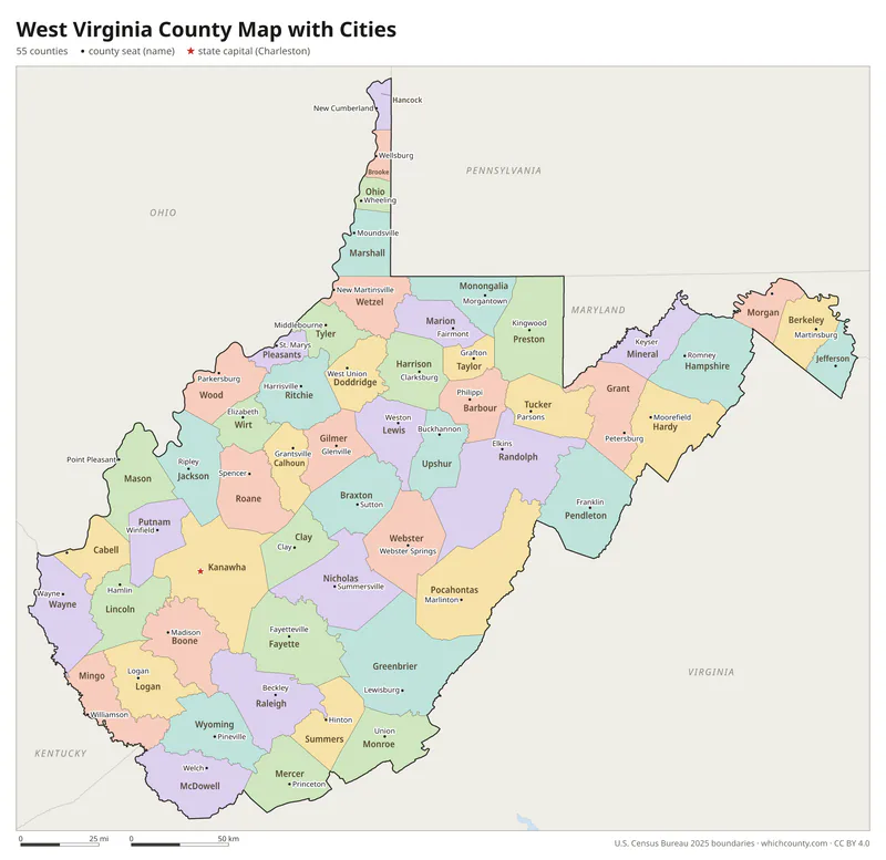
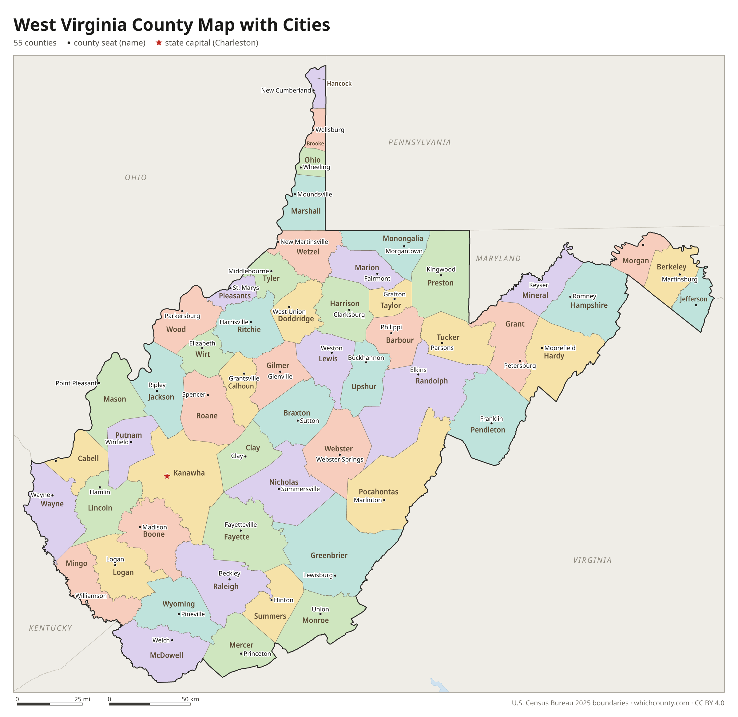
West Virginia county map with cities
The largest cities in West Virginia and the counties they are in. Cities that cross a county line list every county, the main one first. To find any smaller town, use the search box above.
| City | County | Population 2025 |
|---|---|---|
| Charleston | Kanawha County | 46,117 |
| Huntington | Cabell and Wayne counties | 44,815 |
| Morgantown | Monongalia County | 30,293 |
| Parkersburg | Wood County | 28,593 |
| Wheeling | Ohio and Marshall counties | 25,680 |
| Martinsburg | Berkeley County | 19,211 |
| Weirton | Hancock and Brooke counties | 18,133 |
| Fairmont | Marion County | 18,035 |
| Beckley | Raleigh County | 16,373 |
| Clarksburg | Harrison County | 15,562 |
| South Charleston | Kanawha County | 13,072 |
| Vienna | Wood County | 10,321 |
| St. Albans | Kanawha County | 10,210 |
| Bridgeport | Harrison County | 9,427 |
| Charles Town | Jefferson County | 9,329 |
| Bluefield | Mercer County | 9,158 |
| Moundsville | Marshall County | 7,659 |
| Oak Hill | Fayette County | 7,629 |
| Hurricane | Putnam County | 7,367 |
| Dunbar | Kanawha County | 7,050 |
| Ranson | Jefferson County | 6,853 |
| Elkins | Randolph County | 6,622 |
| Nitro | Kanawha and Putnam counties | 6,270 |
| Princeton | Mercer County | 5,578 |
| Buckhannon | Upshur County | 5,054 |
| New Martinsville | Wetzel County | 5,039 |
| Keyser | Mineral County | 4,777 |
| Grafton | Taylor County | 4,529 |
| Barboursville | Cabell County | 4,307 |
| Westover | Monongalia County | 4,086 |
Printable West Virginia county maps (free PDF, PNG, SVG)
Every map is free to print and share. The PDFs are vector files with real text, so they stay sharp at any size and you can search them for a county name. Use 11×17 (tabloid) for the most readable labels.
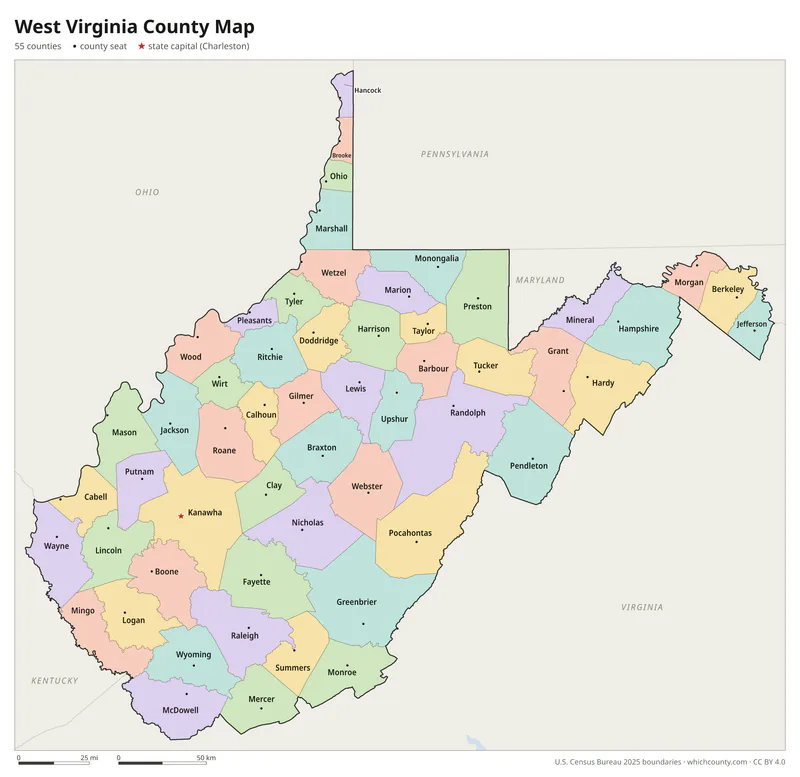
Color map with names
All 55 counties labeled, county seats marked. Letter and 11×17 PDF, high-resolution PNG, editable SVG.
Map with cities
Counties with their county seat towns and major cities.
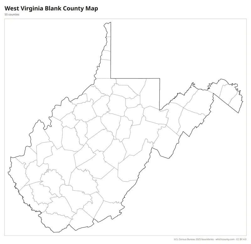
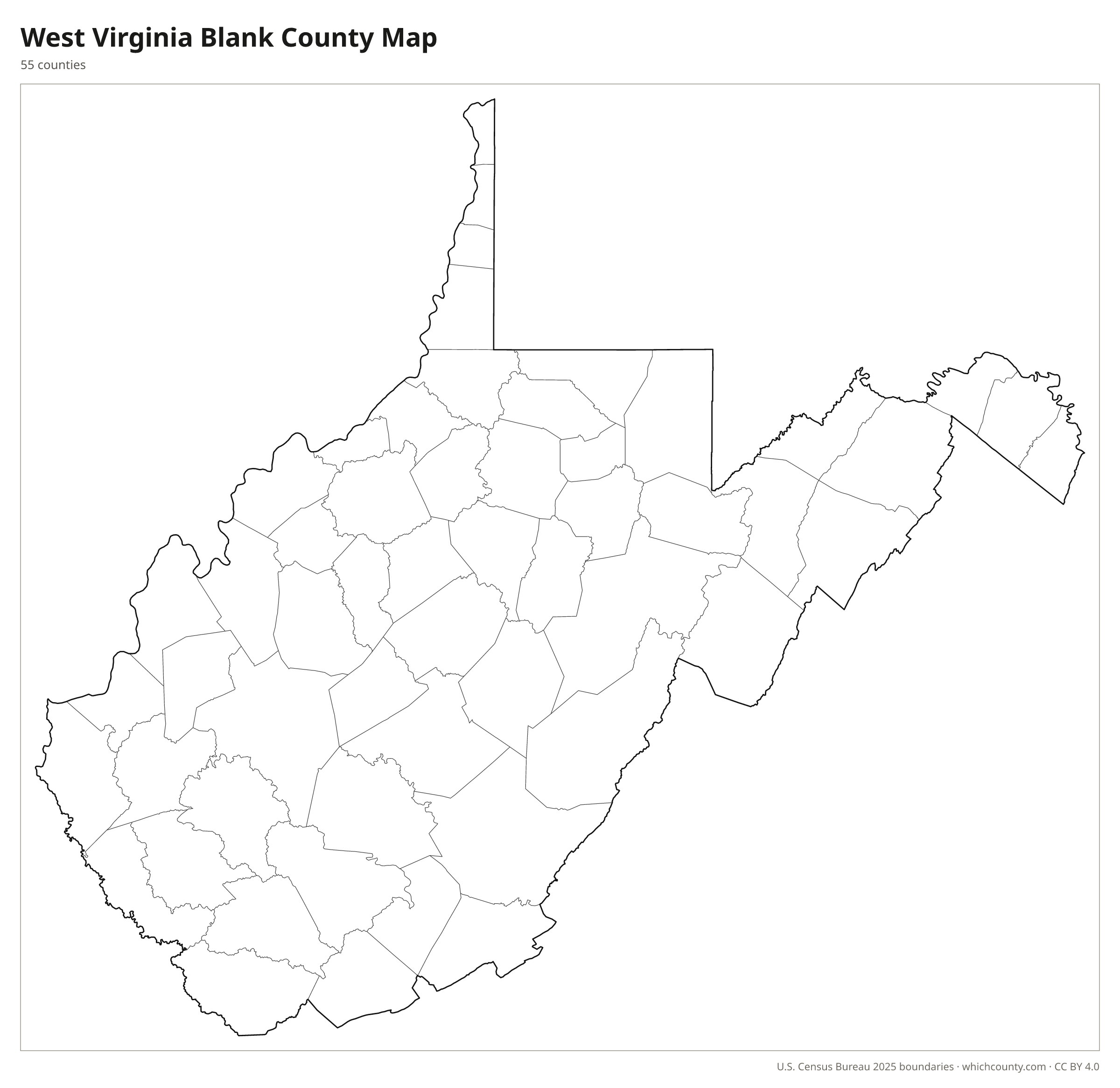
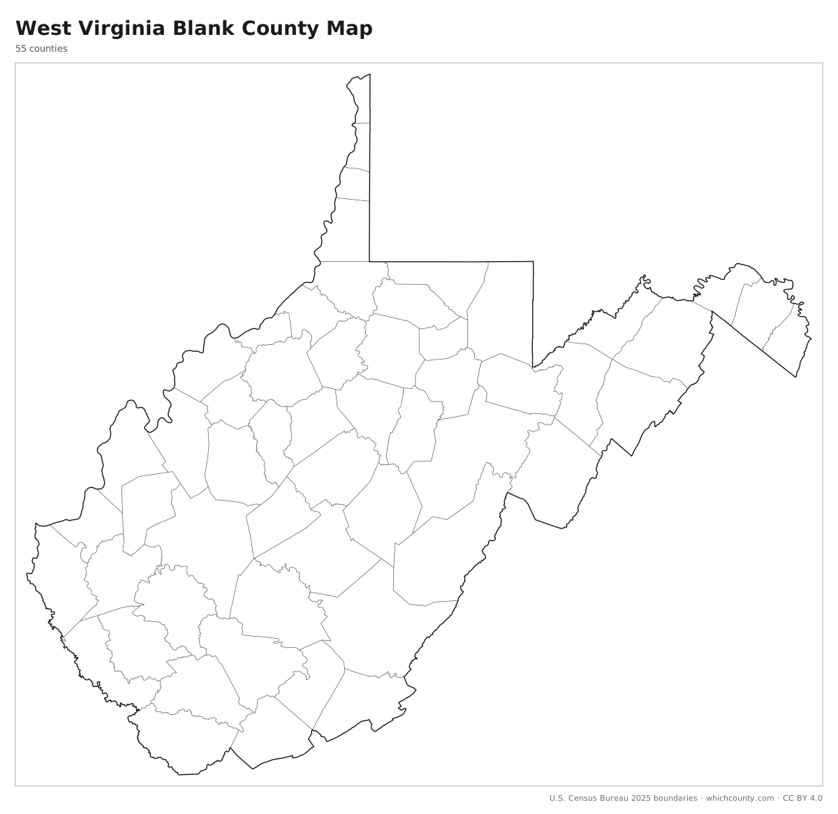
Blank outline map
County lines only, no names. For quizzes, coloring and your own notes.
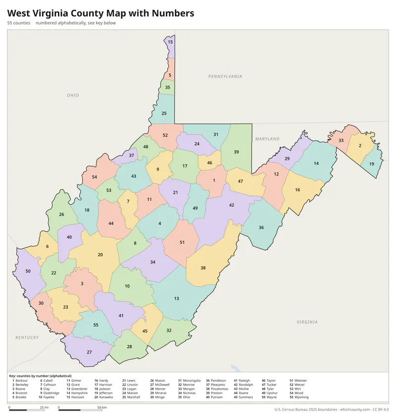
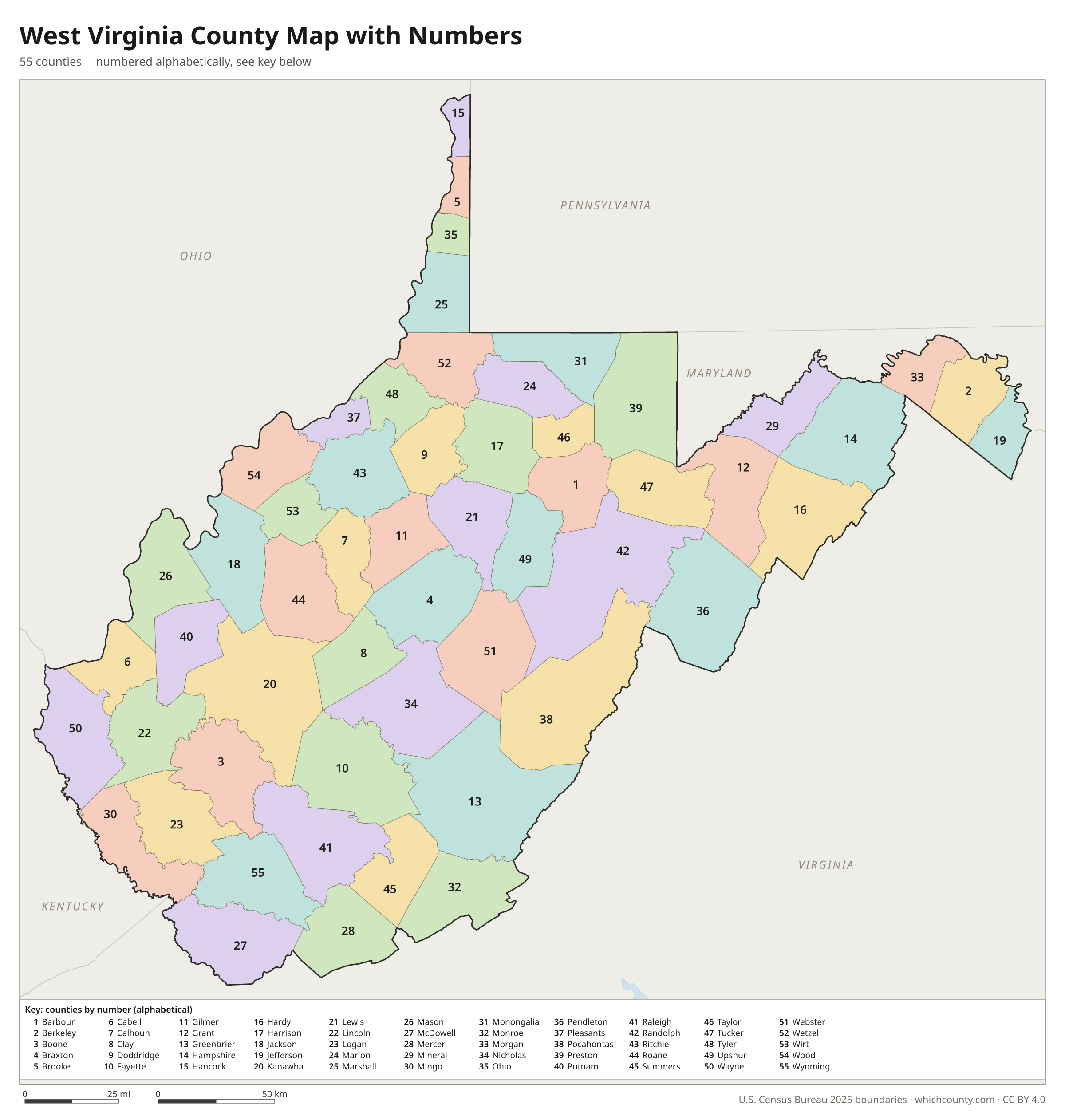
Numbered map with key
A number in every county with an alphabetical key.
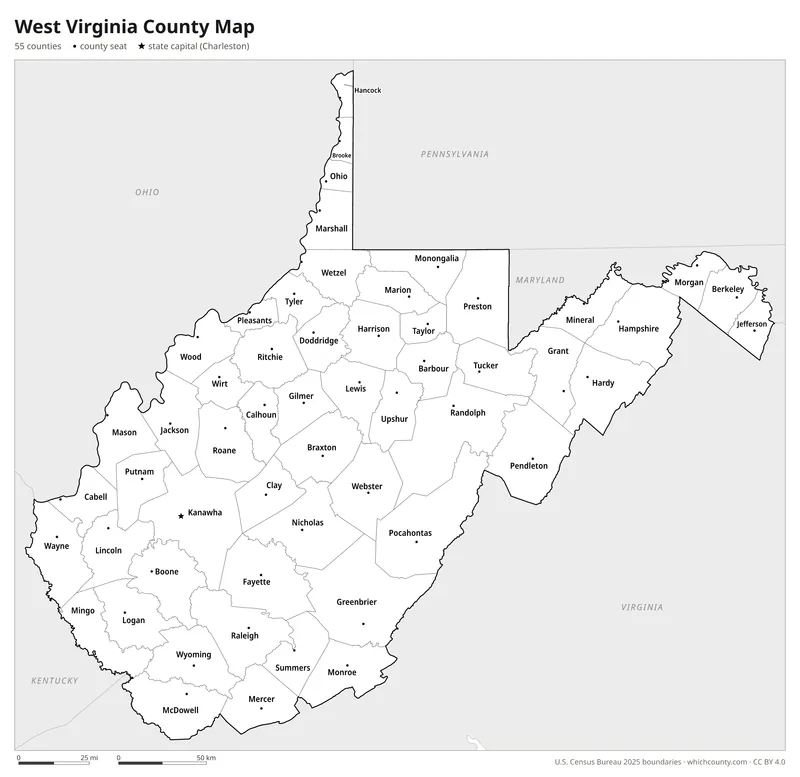
Black and white
Labeled map that prints well on any printer.
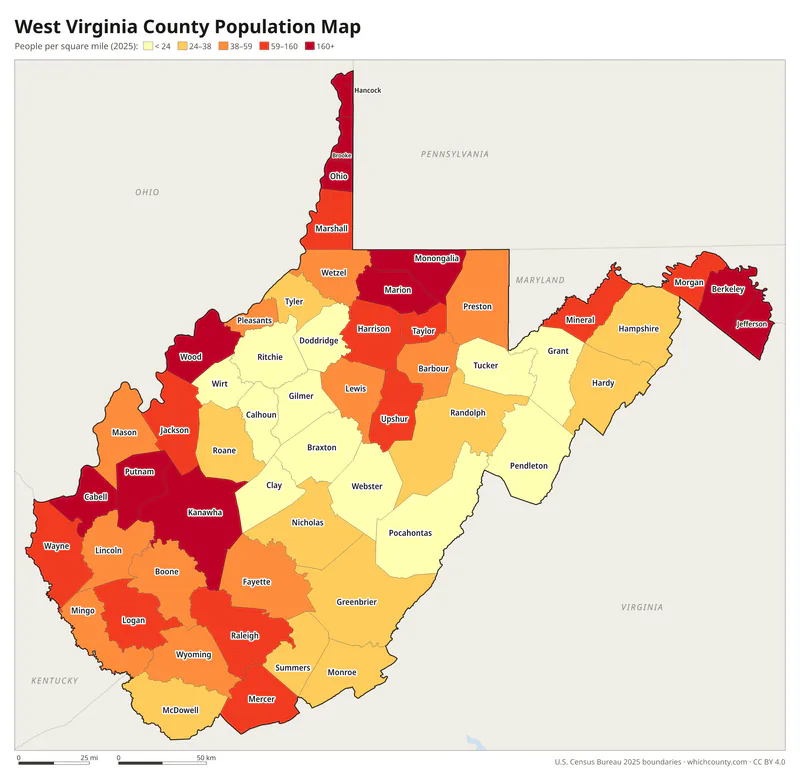
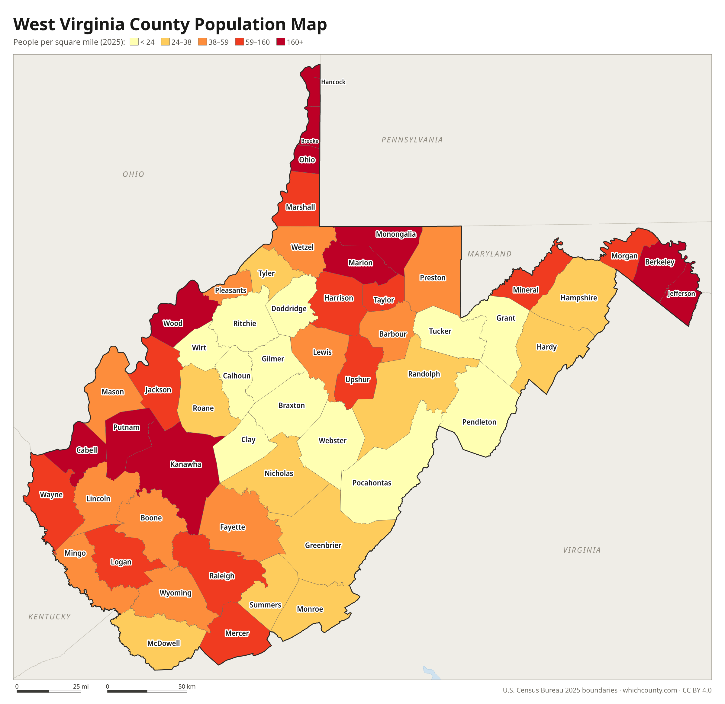
Population map
Counties shaded by population density (2025 estimates).
Data and GIS files
The county table as CSV, and the boundaries as GeoJSON and KML (Google Earth, Google My Maps).
How West Virginia inherited its counties from Virginia
West Virginia inherited its county system from Virginia, and 50 of its counties were created before the two states separated in 1863. Every county in the state descends from two Virginia counties, Frederick (1743) and Augusta (1745). Nearly half of the present counties appeared in the quarter-century before the Civil War, as settlers filled in almost every part of the state. New counties were meant to give people convenient access to government; the ideal was said to be no more than a day's ride on horseback from home to the courthouse. The first state constitution of 1863 tried a modified township system, but the 1872 constitution, still in force, went back to the Virginia model. Only five counties were added after statehood: Mineral and Grant in 1866, Lincoln in 1867, Summers in 1871 and Mingo in 1895.
County maps of neighboring states
 Kentucky county map
 Maryland county map
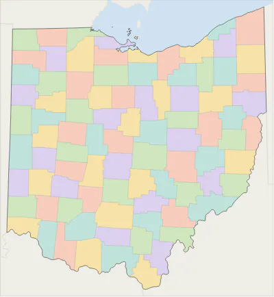 Ohio county map
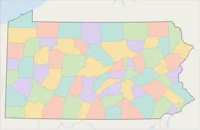 Pennsylvania county map
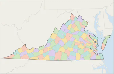 Virginia county map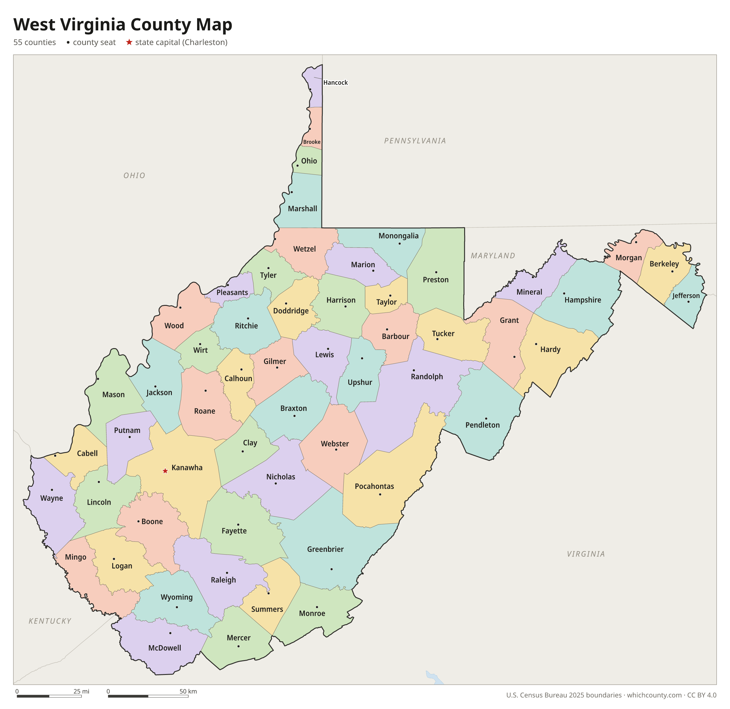
West Virginia counties: questions and answers
- How many counties are in West Virginia?
- West Virginia has 55 counties.
- What is the largest county in West Virginia?
- By land area, Randolph County is the largest (1,040 sq mi). By population, Kanawha County is the largest, with 172,381 people (2025 estimate).
- What is the smallest county in West Virginia?
- Hancock County is the smallest by land area (82.6 sq mi). Wirt County has the fewest people: 4,879 (2025 estimate).
- What is the wealthiest county in West Virginia?
- By median household income, Jefferson County ranks first with $98,806 (American Community Survey 2020–2024). The lowest is McDowell County at $31,559.
- What county is Charleston in?
- Charleston is in Kanawha County.
- What county is Huntington in?
- Huntington is mostly in Cabell County, with smaller parts in Wayne County.
- What county is Morgantown in?
- Morgantown is in Monongalia County.
- How can I see county lines on Google Maps?
- Google Maps does not draw county lines. Download the KML file from the printable maps section above and import it into Google My Maps (Create a new map › Import) or open it in Google Earth to see every West Virginia county boundary on top of Google's map.
- Can I use this map for free?
- Yes. The maps and files on this page are free to print, share and use in your own work, including commercial projects, under the CC BY 4.0 licence. Please credit “WhichCounty (whichcounty.com)”.
Use this map on your site
You may copy, print and publish these maps, also commercially, as long as you credit WhichCounty with a link (licence details). Paste this code to embed the map:
Sources and methodology
- Boundaries: U.S. Census Bureau, 2025 Cartographic Boundary Files (1:500,000), simplified for display. Projection: Lambert conformal conic fitted to West Virginia.
- Population: Census Bureau county estimates, Vintage 2025 (July 1, 2025), compared with the April 1, 2020 estimates base.
- Land area: Census Bureau 2026 Gazetteer files. Median household income: American Community Survey 2020–2024 5-year estimates.
- County seats and founding years: Wikidata (CC0), checked against state lists by WhichCounty. Cities: Census Bureau city and town estimates, Vintage 2025.
- County Government (e-WV: The West Virginia Encyclopedia)
- West Virginia Trivia (West Virginia Legislature)
- Hampshire County history sources (West Virginia Archives and History)
- Mingo County history sources (West Virginia Archives and History)
- Atlas of Historical County Boundaries: West Virginia (Newberry Library)
Found an error? Tell us. Last data update: October 4, 2026.