South Dakota County Map
All 66 counties with county seats and major cities
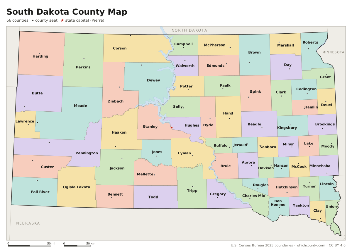
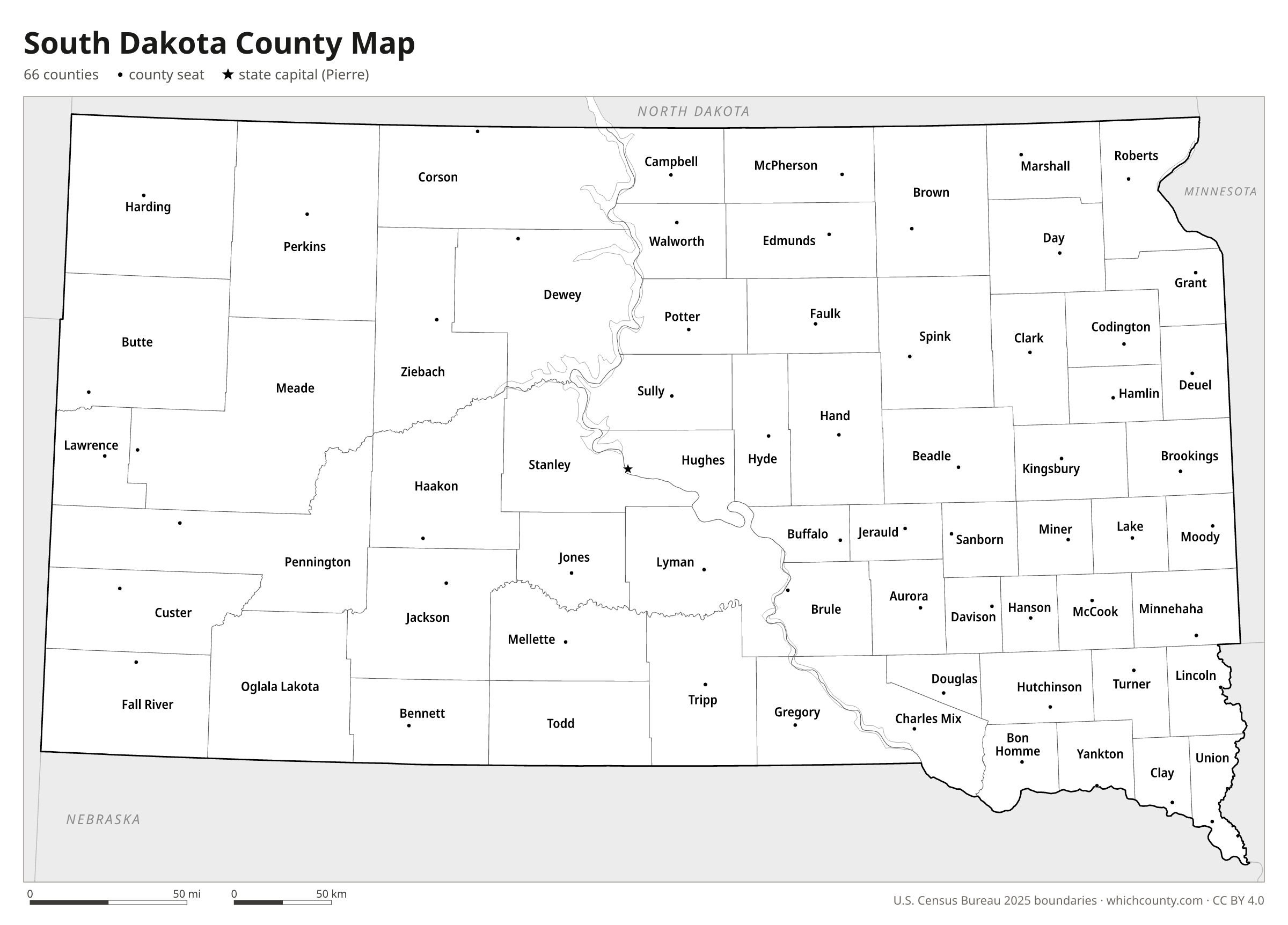
South Dakota has 66 counties, and two of them, Oglala Lakota and Todd, have no county seat of their own. This map shows all 66 counties and their county seats. Tap a county for details, or download the free printable map below.

Updated October 4, 2026 · Boundaries: U.S. Census Bureau 2025 · Population: Census estimates for July 1, 2025
South Dakota county facts
- Number of counties
- 66
- Largest by land area
- Meade County 3,471 sq mi
- Smallest by land area
- Clay County 412 sq mi
- Most people
- Minnehaha County 212,691
- Fewest people
- Jones County 913
- Fastest growing since 2020
- Lincoln County +18.4%
- Highest median household income
- Lincoln County $99,166
- Oldest county
- Bon Homme County est. 1862
- Newest county
- Jones County est. 1916
- State capital
- Pierre Hughes County
Oglala Lakota and Todd counties have no county seat; Oglala Lakota contracts with Fall River County (Hot Springs) for its auditor, treasurer and register of deeds.
Shannon County was renamed Oglala Lakota County in 2015.
Washabaugh County was merged into Jackson County effective January 1, 1983.
List of 66 South Dakota counties
Sorted A–Z. Click a column to sort, or a name to show it on the map. Download as CSV
| County | County seat | Population 2025 | Change since 2020 | Land area (sq mi) | Median income | Established | FIPS |
|---|---|---|---|---|---|---|---|
| Aurora County | Plankinton | 2,801 | +2.1% | 709 | $72,885 | 1879 | 46003 |
| Beadle County | Huron | 19,624 | +2.5% | 1,259 | $67,681 | 1879 | 46005 |
| Bennett County | Martin | 3,307 | −2.3% | 1,185 | $53,750 | 1909 | 46007 |
| Bon Homme County | Tyndall | 7,244 | +3.5% | 564 | $64,435 | 1862 | 46009 |
| Brookings County | Brookings | 37,635 | +9.5% | 792 | $70,064 | 1862 | 46011 |
| Brown County | Aberdeen | 37,561 | −1.9% | 1,713 | $70,898 | 1879 | 46013 |
| Brule County | Chamberlain | 5,278 | +0.5% | 817 | $73,720 | 1875 | 46015 |
| Buffalo County | Gann Valley | 1,802 | −7.3% | 471 | $47,045 | 1873 | 46017 |
| Butte County | Belle Fourche | 10,856 | +6% | 2,250 | $75,652 | 1883 | 46019 |
| Campbell County | Mound City | 1,377 | +0.1% | 734 | $68,929 | 1873 | 46021 |
| Charles Mix County | Lake Andes | 9,303 | −0.8% | 1,097 | $64,038 | 1862 | 46023 |
| Clark County | Clark | 4,031 | +5.1% | 958 | $70,726 | 1873 | 46025 |
| Clay County | Vermillion | 15,031 | +0.4% | 412 | $56,850 | 1862 | 46027 |
| Codington County | Watertown | 29,562 | +4.4% | 688 | $72,727 | 1877 | 46029 |
| Corson County | McIntosh | 3,781 | −3% | 2,470 | $46,406 | 1909 | 46031 |
| Custer County | Custer | 9,431 | +13.4% | 1,557 | $84,112 | 1875 | 46033 |
| Davison County | Mitchell | 20,069 | +0.6% | 436 | $66,208 | 1873 | 46035 |
| Day County | Webster | 5,484 | +0.6% | 1,029 | $66,033 | 1879 | 46037 |
| Deuel County | Clear Lake | 4,408 | +2.6% | 623 | $83,112 | 1862 | 46039 |
| Dewey County | Timber Lake | 5,419 | +3.3% | 2,302 | $54,104 | 1873 | 46041 |
| Douglas County | Armour | 2,888 | +1.9% | 432 | $86,442 | 1873 | 46043 |
| Edmunds County | Ipswich | 4,022 | +1% | 1,126 | $81,630 | 1873 | 46045 |
| Fall River County | Hot Springs | 7,467 | +7.2% | 1,740 | $67,917 | 1883 | 46047 |
| Faulk County | Faulkton | 2,178 | +2.4% | 982 | $57,750 | 1873 | 46049 |
| Grant County | Milbank | 7,534 | −0.4% | 681 | $75,028 | 1873 | 46051 |
| Gregory County | Burke | 4,037 | +1.3% | 1,015 | $62,917 | 1862 | 46053 |
| Haakon County | Philip | 1,802 | −3.9% | 1,811 | $65,625 | 1914 | 46055 |
| Hamlin County | Hayti | 6,900 | +11.8% | 507 | $87,101 | 1873 | 46057 |
| Hand County | Miller | 3,121 | −0.8% | 1,437 | $74,635 | 1873 | 46059 |
| Hanson County | Alexandria | 3,456 | −0.2% | 435 | $81,071 | 1873 | 46061 |
| Harding County | Buffalo | 1,331 | +2% | 2,672 | $80,441 | 1909 | 46063 |
| Hughes County | Pierre | 17,570 | −1.1% | 742 | $81,395 | 1880 | 46065 |
| Hutchinson County | Olivet | 7,413 | −0.2% | 813 | $73,977 | 1862 | 46067 |
| Hyde County | Highmore | 1,191 | −5.4% | 861 | $73,472 | 1873 | 46069 |
| Jackson County | Kadoka | 2,666 | −4.9% | 1,864 | $35,417 | 1914 | 46071 |
| Jerauld County | Wessington Springs | 1,654 | −0.4% | 526 | $73,750 | 1883 | 46073 |
| Jones County | Murdo | 913 | −0.8% | 970 | $65,119 | 1916 | 46075 |
| Kingsbury County | De Smet | 5,284 | +2% | 832 | $74,000 | 1873 | 46077 |
| Lake County | Madison | 10,993 | −0.6% | 563 | $76,808 | 1873 | 46079 |
| Lawrence County | Deadwood | 29,459 | +14.3% | 800 | $73,384 | 1875 | 46081 |
| Lincoln County | Canton | 77,145 | +18.4% | 577 | $99,166 | 1862 | 46083 |
| Lyman County | Kennebec | 3,694 | −0.5% | 1,642 | $67,143 | 1873 | 46085 |
| Marshall County | Britton | 4,426 | +2.8% | 838 | $78,156 | 1885 | 46091 |
| McCook County | Salem | 5,964 | +5% | 574 | $83,852 | 1873 | 46087 |
| McPherson County | Leola | 2,347 | −2.5% | 1,137 | $66,906 | 1873 | 46089 |
| Meade County | Sturgis | 30,711 | +2.9% | 3,471 | $74,790 | 1889 | 46093 |
| Mellette County | White River | 2,137 | +11.4% | 1,307 | $54,076 | 1909 | 46095 |
| Miner County | Howard | 2,281 | −0.7% | 570 | $76,140 | 1873 | 46097 |
| Minnehaha County | Sioux Falls | 212,691 | +7.9% | 807 | $76,880 | 1862 | 46099 |
| Moody County | Flandreau | 6,632 | +4.6% | 519 | $78,427 | 1873 | 46101 |
| Oglala Lakota County | Hot Springs | 13,338 | −2.5% | 2,094 | $41,417 | 1875 | 46102 |
| Pennington County | Rapid City | 116,792 | +6.9% | 2,777 | $74,517 | 1875 | 46103 |
| Perkins County | Bison | 2,853 | +0.9% | 2,871 | $66,908 | 1909 | 46105 |
| Potter County | Gettysburg | 2,377 | −3.9% | 861 | $72,045 | 1875 | 46107 |
| Roberts County | Sisseton | 10,255 | −0.3% | 1,101 | $65,130 | 1883 | 46109 |
| Sanborn County | Woonsocket | 2,388 | +2.3% | 569 | $78,750 | 1883 | 46111 |
| Spink County | Redfield | 6,155 | −3.2% | 1,504 | $70,139 | 1873 | 46115 |
| Stanley County | Fort Pierre | 3,018 | +1.3% | 1,444 | $87,712 | 1873 | 46117 |
| Sully County | Onida | 1,479 | +2.2% | 1,007 | $72,578 | 1873 | 46119 |
| Todd County | Winner | 8,863 | −4.9% | 1,389 | $42,075 | 1909 | 46121 |
| Tripp County | Winner | 5,708 | +1.4% | 1,612 | $58,987 | 1873 | 46123 |
| Turner County | Parker | 9,314 | +7.4% | 617 | $75,771 | 1871 | 46125 |
| Union County | Elk Point | 17,402 | +3.5% | 462 | $89,636 | 1862 | 46127 |
| Walworth County | Selby | 5,217 | −1.9% | 708 | $65,026 | 1873 | 46129 |
| Yankton County | Yankton | 23,635 | +1.4% | 521 | $72,821 | 1862 | 46135 |
| Ziebach County | Dupree | 2,389 | −1% | 1,961 | $53,958 | 1911 | 46137 |
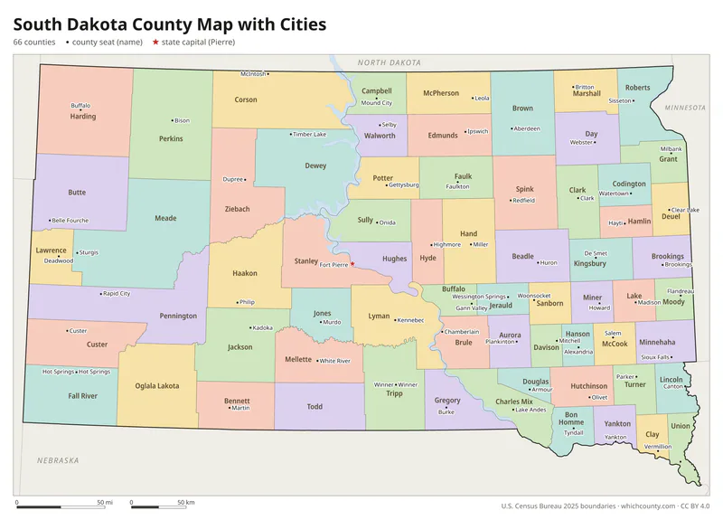
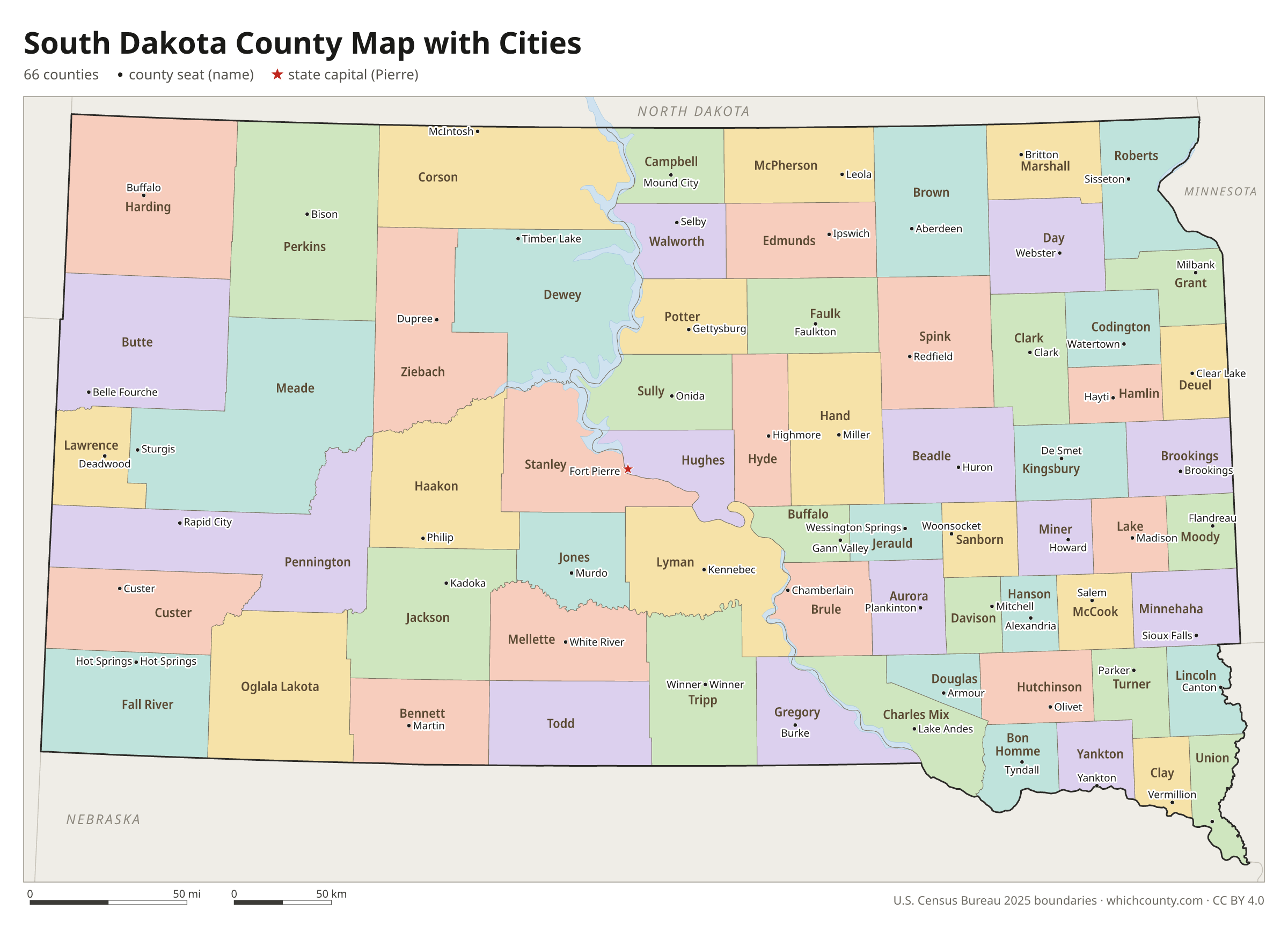
South Dakota county map with cities
The largest cities in South Dakota and the counties they are in. Cities that cross a county line list every county, the main one first. To find any smaller town, use the search box above.
| City | County | Population 2025 |
|---|---|---|
| Sioux Falls | Minnehaha and Lincoln counties | 213,748 |
| Rapid City | Pennington County | 80,589 |
| Aberdeen | Brown County | 27,961 |
| Brookings | Brookings County | 25,355 |
| Watertown | Codington County | 23,736 |
| Yankton | Yankton County | 15,816 |
| Mitchell | Davison County | 15,756 |
| Huron | Beadle County | 14,607 |
| Spearfish | Lawrence County | 14,154 |
| Box Elder | Pennington and Meade counties | 13,936 |
| Pierre | Hughes County | 13,848 |
| Vermillion | Clay County | 11,720 |
| Brandon | Minnehaha County | 11,306 |
| Harrisburg | Lincoln County | 10,405 |
| Tea | Lincoln County | 8,019 |
| Sturgis | Meade County | 6,922 |
| Madison | Lake County | 6,065 |
| Belle Fourche | Butte County | 5,791 |
| Dell Rapids | Minnehaha County | 3,852 |
| Hot Springs | Fall River County | 3,670 |
| Hartford | Minnehaha County | 3,635 |
| Milbank | Grant County | 3,512 |
| Mobridge | Walworth County | 3,192 |
| Lead | Lawrence County | 3,064 |
| North Sioux City | Union County | 3,036 |
| Summerset | Meade County | 3,030 |
| Canton | Lincoln County | 3,001 |
| Winner | Tripp County | 2,969 |
| Lennox | Lincoln County | 2,657 |
| Volga | Brookings County | 2,458 |
Printable South Dakota county maps (free PDF, PNG, SVG)
Every map is free to print and share. The PDFs are vector files with real text, so they stay sharp at any size and you can search them for a county name. Use 11×17 (tabloid) for the most readable labels.
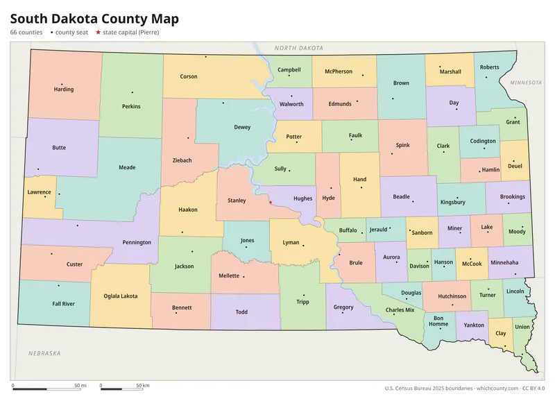
Color map with names
All 66 counties labeled, county seats marked. Letter and 11×17 PDF, high-resolution PNG, editable SVG.
Map with cities
Counties with their county seat towns and major cities.
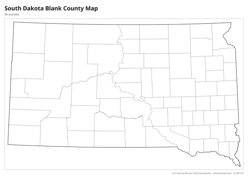
Blank outline map
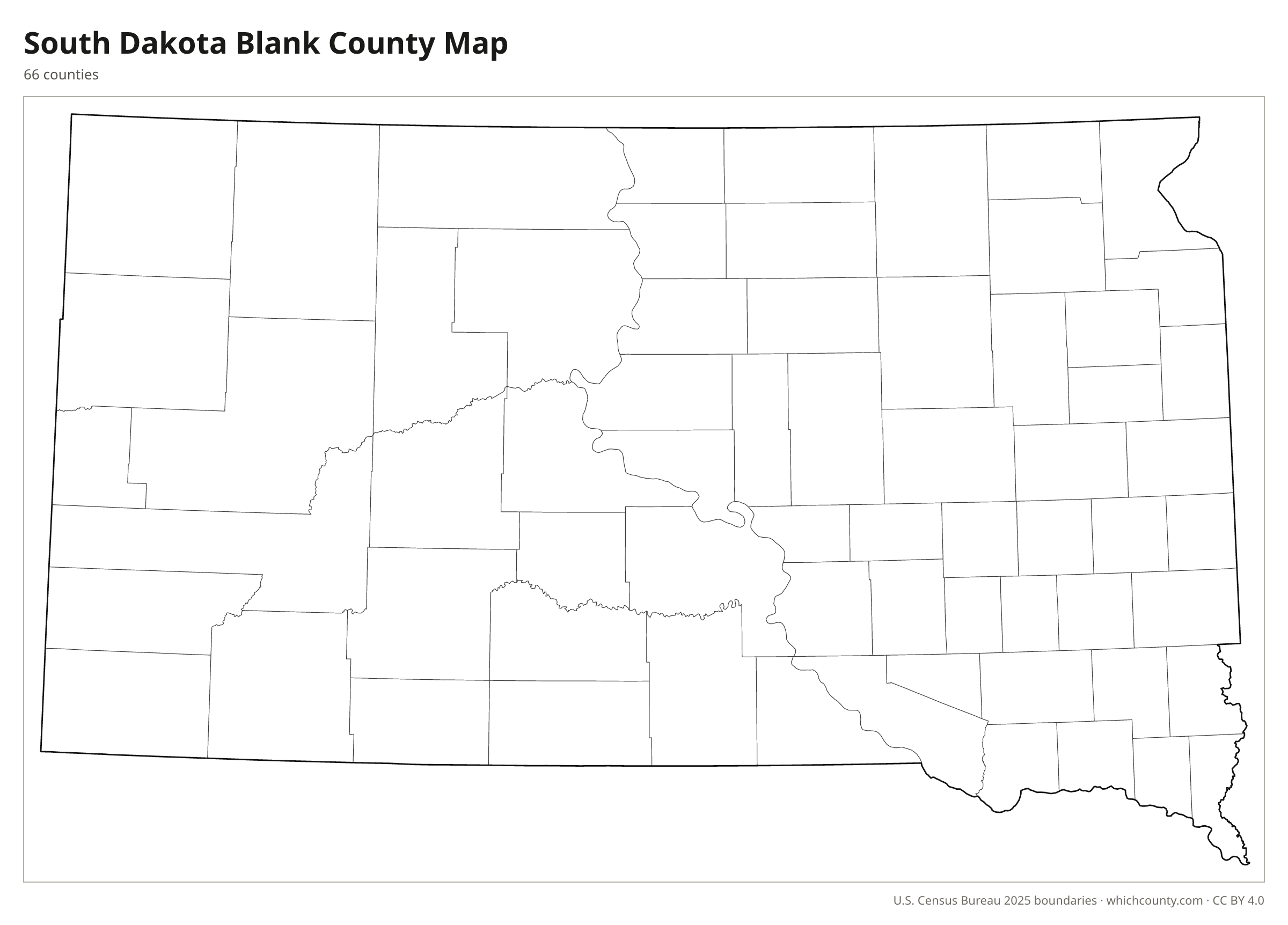
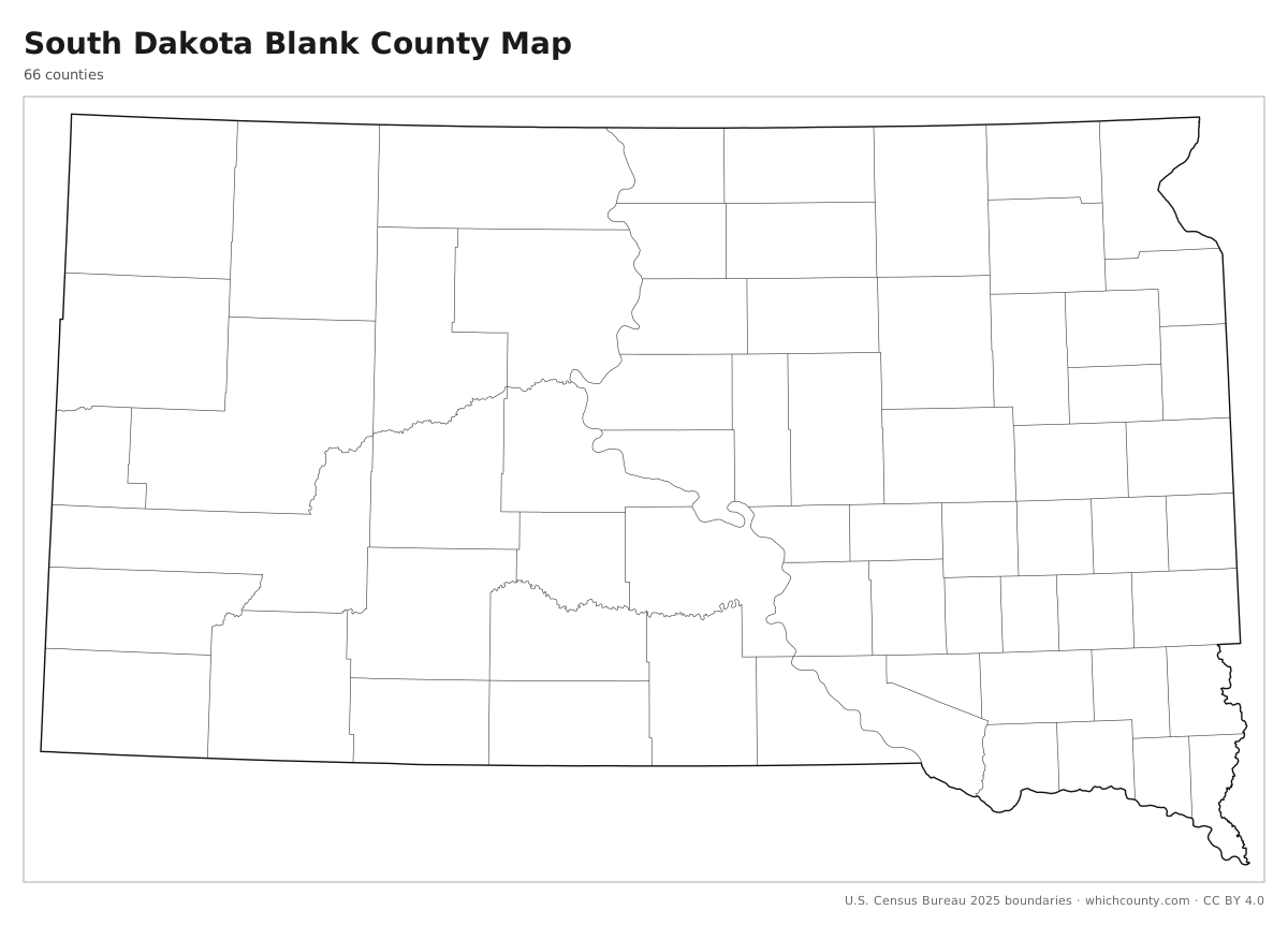
County lines only, no names. For quizzes, coloring and your own notes.
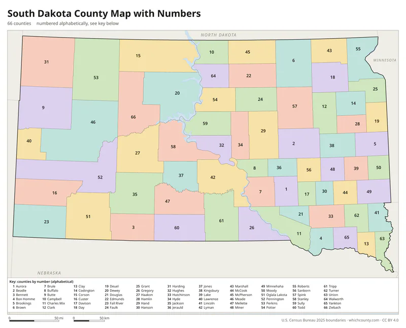
Numbered map with key
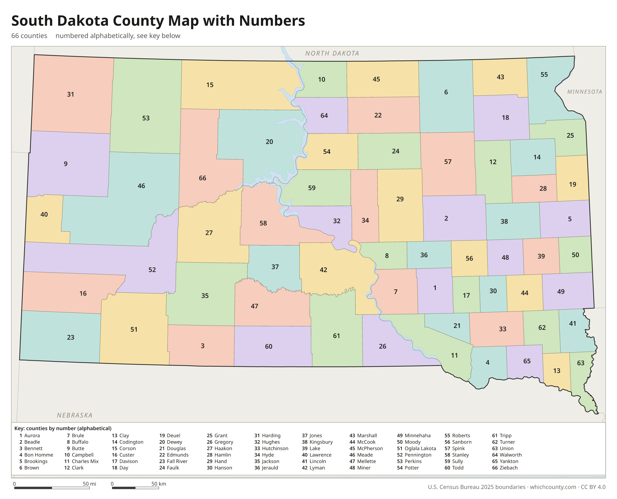
A number in every county with an alphabetical key.
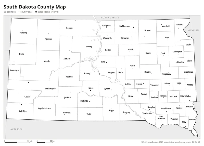
Black and white
Labeled map that prints well on any printer.
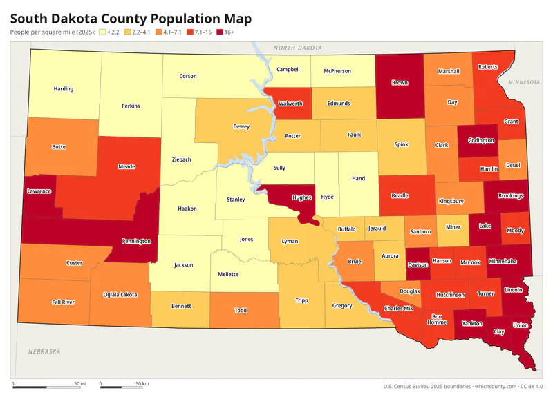
Population map
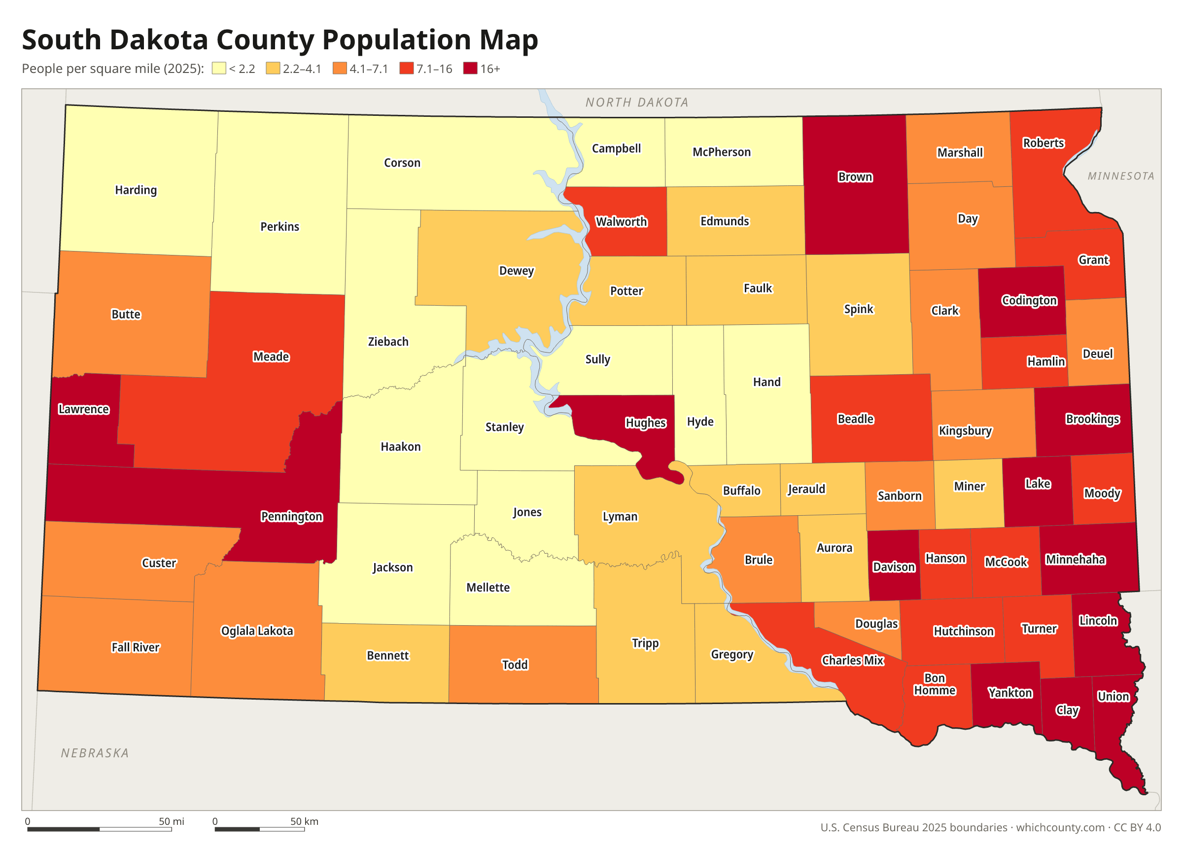
Counties shaded by population density (2025 estimates).
Data and GIS files
The county table as CSV, and the boundaries as GeoJSON and KML (Google Earth, Google My Maps).
How South Dakota's 66 counties took shape
South Dakota's first counties were created by the first Dakota Territory legislature in April 1862, in the southeast corner of the territory: Bon Homme, Brookings, Deuel, Lincoln and Minnehaha on April 5, and Clay and Yankton five days later. By statehood in 1889, 58 of today's 66 counties had been created in some form. The last eight came between 1908 and 1916: Perkins, then Corson, Bennett, Mellette and Todd in 1909, Ziebach in 1911, Haakon in 1914 and Jones, split from Lyman County in 1916. Shannon County, which lies entirely within the Pine Ridge Indian Reservation, and Washabaugh County were the last unorganized counties in the United States until 1982. Washabaugh was then merged into Jackson County, and Shannon was renamed Oglala Lakota County in 2015.
County maps of neighboring states
 Iowa county map
 Minnesota county map
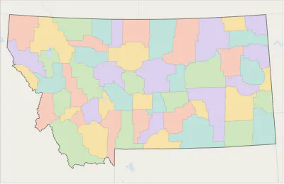 Montana county map
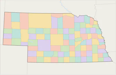 Nebraska county map
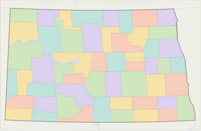 North Dakota county map
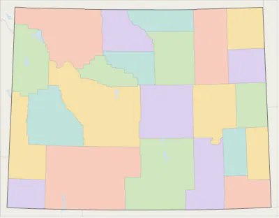 Wyoming county map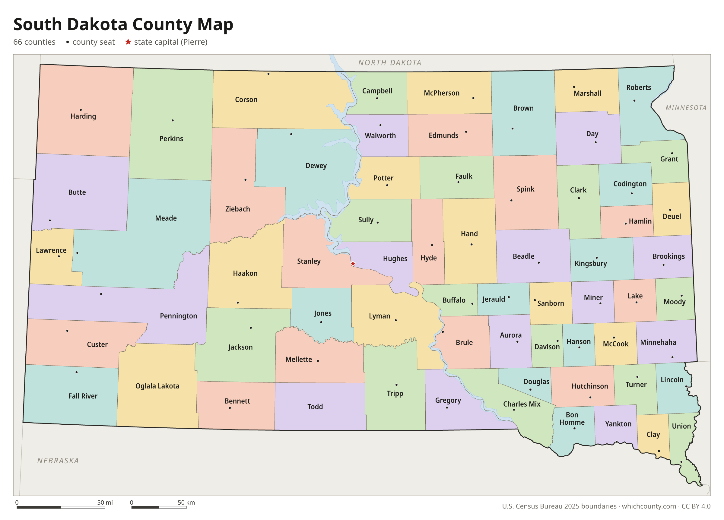
South Dakota counties: questions and answers
- How many counties are in South Dakota?
- South Dakota has 66 counties.
- What is the largest county in South Dakota?
- By land area, Meade County is the largest (3,471 sq mi). By population, Minnehaha County is the largest, with 212,691 people (2025 estimate).
- What is the smallest county in South Dakota?
- Clay County is the smallest by land area (412 sq mi). Jones County has the fewest people: 913 (2025 estimate).
- What is the wealthiest county in South Dakota?
- By median household income, Lincoln County ranks first with $99,166 (American Community Survey 2020–2024). The lowest is Jackson County at $35,417.
- What county is Sioux Falls in?
- Sioux Falls is mostly in Minnehaha County, with smaller parts in Lincoln County.
- What county is Rapid City in?
- Rapid City is in Pennington County.
- What county is Aberdeen in?
- Aberdeen is in Brown County.
- What county is Pierre in?
- Pierre, the state capital, is in Hughes County.
- How can I see county lines on Google Maps?
- Google Maps does not draw county lines. Download the KML file from the printable maps section above and import it into Google My Maps (Create a new map › Import) or open it in Google Earth to see every South Dakota county boundary on top of Google's map.
- Can I use this map for free?
- Yes. The maps and files on this page are free to print, share and use in your own work, including commercial projects, under the CC BY 4.0 licence. Please credit “WhichCounty (whichcounty.com)”.
Use this map on your site
You may copy, print and publish these maps, also commercially, as long as you credit WhichCounty with a link (licence details). Paste this code to embed the map:
Sources and methodology
- Boundaries: U.S. Census Bureau, 2025 Cartographic Boundary Files (1:500,000), simplified for display. Projection: Lambert conformal conic fitted to South Dakota.
- Population: Census Bureau county estimates, Vintage 2025 (July 1, 2025), compared with the April 1, 2020 estimates base.
- Land area: Census Bureau 2026 Gazetteer files. Median household income: American Community Survey 2020–2024 5-year estimates.
- County seats and founding years: Wikidata (CC0), checked against state lists by WhichCounty. Cities: Census Bureau city and town estimates, Vintage 2025.
- Atlas of Historical County Boundaries: Dakota Territory, Consolidated Chronology (Newberry Library)
- Atlas of Historical County Boundaries: South Dakota (Newberry Library)
- About Oglala Lakota County (Oglala Lakota County, South Dakota)
- Substantial Changes to Counties and County Equivalent Entities: 2010s (U.S. Census Bureau)
Found an error? Tell us. Last data update: October 4, 2026.