Pennsylvania County Map
All 67 counties with county seats and major cities
Pennsylvania has 67 counties, the same number as Alabama and Florida. This map shows all 67 counties and their county seats. Tap a county for details, or download the free printable map below.

Updated October 4, 2026 · Boundaries: U.S. Census Bureau 2025 · Population: Census estimates for July 1, 2025
Pennsylvania county facts
- Number of counties
- 67
- Largest by land area
- Lycoming County 1,229 sq mi
- Smallest by land area
- Montour County 130.3 sq mi
- Most people
- Philadelphia County 1,574,281
- Fewest people
- Cameron County 4,211
- Fastest growing since 2020
- Pike County +7.3%
- Highest median household income
- Chester County $127,208
- Oldest county
- Bucks County est. 1682
- Newest county
- Lackawanna County est. 1878
- State capital
- Harrisburg Dauphin County
Philadelphia is a consolidated city-county: all municipalities in the county were merged with the city in 1854, and the county offices were merged into city government in 1952.
List of 67 Pennsylvania counties
Sorted A–Z. Click a column to sort, or a name to show it on the map. Download as CSV
| County | County seat | Population 2025 | Change since 2020 | Land area (sq mi) | Median income | Established | FIPS |
|---|---|---|---|---|---|---|---|
| Adams County | Gettysburg | 107,594 | +3.6% | 519 | $84,092 | 1800 | 42001 |
| Allegheny County | Pittsburgh | 1,225,035 | −2% | 730 | $78,548 | 1788 | 42003 |
| Armstrong County | Kittanning | 63,698 | −2.9% | 653 | $65,008 | 1800 | 42005 |
| Beaver County | Beaver | 166,032 | −1.3% | 435 | $71,089 | 1800 | 42007 |
| Bedford County | Bedford | 47,480 | −0.2% | 1,012 | $59,992 | 1771 | 42009 |
| Berks County | Reading | 440,072 | +2.6% | 856 | $79,777 | 1752 | 42011 |
| Blair County | Hollidaysburg | 119,541 | −2.7% | 525 | $62,382 | 1846 | 42013 |
| Bradford County | Towanda | 59,600 | −0.6% | 1,147 | $63,675 | 1810 | 42015 |
| Bucks County | Doylestown | 647,828 | +0.2% | 604 | $114,764 | 1682 | 42017 |
| Butler County | Butler | 200,169 | +3.3% | 790 | $89,843 | 1800 | 42019 |
| Cambria County | Ebensburg | 128,968 | −3.4% | 688 | $58,418 | 1804 | 42021 |
| Cameron County | Emporium | 4,211 | −7.3% | 396 | $50,573 | 1860 | 42023 |
| Carbon County | Jim Thorpe | 65,868 | +1.7% | 381 | $67,554 | 1843 | 42025 |
| Centre County | Bellefonte | 157,393 | −0.5% | 1,107 | $74,291 | 1800 | 42027 |
| Chester County | West Chester | 557,116 | +4.3% | 751 | $127,208 | 1682 | 42029 |
| Clarion County | Clarion | 36,680 | −1.5% | 601 | $62,649 | 1839 | 42031 |
| Clearfield County | Clearfield | 78,100 | −3.1% | 1,145 | $62,152 | 1804 | 42033 |
| Clinton County | Lock Haven | 37,870 | +1.1% | 890 | $60,816 | 1839 | 42035 |
| Columbia County | Bloomsburg | 66,193 | +2.3% | 483 | $64,644 | 1813 | 42037 |
| Crawford County | Meadville | 81,792 | −2.6% | 1,012 | $60,476 | 1800 | 42039 |
| Cumberland County | Carlisle | 277,270 | +6.9% | 546 | $87,494 | 1750 | 42041 |
| Dauphin County | Harrisburg | 293,351 | +2.4% | 525 | $76,242 | 1785 | 42043 |
| Delaware County | Media | 580,937 | +0.7% | 184 | $89,546 | 1789 | 42045 |
| Elk County | Ridgway | 29,926 | −3.5% | 827 | $66,380 | 1843 | 42047 |
| Erie County | Erie | 265,832 | −1.9% | 799 | $63,354 | 1800 | 42049 |
| Fayette County | Uniontown | 123,021 | −4.5% | 791 | $58,236 | 1783 | 42051 |
| Forest County | Tionesta | 6,614 | −5.3% | 427 | $52,191 | 1848 | 42053 |
| Franklin County | Chambersburg | 160,652 | +3% | 772 | $77,003 | 1784 | 42055 |
| Fulton County | McConnellsburg | 14,483 | −0.5% | 438 | $65,836 | 1850 | 42057 |
| Greene County | Waynesburg | 33,885 | −5.8% | 576 | $68,041 | 1796 | 42059 |
| Huntingdon County | Huntingdon | 43,001 | −2.4% | 875 | $65,557 | 1787 | 42061 |
| Indiana County | Indiana | 82,878 | −0.4% | 827 | $60,208 | 1803 | 42063 |
| Jefferson County | Brookville | 43,255 | −2.8% | 653 | $58,686 | 1804 | 42065 |
| Juniata County | Mifflintown | 23,403 | −0.4% | 391 | $66,318 | 1831 | 42067 |
| Lackawanna County | Scranton | 216,502 | +0.3% | 459 | $66,223 | 1878 | 42069 |
| Lancaster County | Lancaster | 563,159 | +1.8% | 944 | $86,959 | 1729 | 42071 |
| Lawrence County | New Castle | 83,911 | −2.5% | 357 | $61,931 | 1849 | 42073 |
| Lebanon County | Lebanon | 146,380 | +2.2% | 362 | $78,425 | 1813 | 42075 |
| Lehigh County | Allentown | 384,383 | +2.6% | 345 | $80,079 | 1812 | 42077 |
| Luzerne County | Wilkes-Barre | 332,126 | +2% | 890 | $63,691 | 1786 | 42079 |
| Lycoming County | Williamsport | 112,587 | −1.4% | 1,229 | $63,917 | 1795 | 42081 |
| McKean County | Smethport | 38,984 | −3.6% | 980 | $62,905 | 1804 | 42083 |
| Mercer County | Mercer | 107,860 | −2.5% | 673 | $59,976 | 1800 | 42085 |
| Mifflin County | Lewistown | 46,127 | −0% | 411 | $63,953 | 1789 | 42087 |
| Monroe County | Stroudsburg | 167,179 | −0.7% | 608 | $83,565 | 1836 | 42089 |
| Montgomery County | Norristown | 877,643 | +2.5% | 483 | $113,915 | 1784 | 42091 |
| Montour County | Danville | 17,868 | −1.5% | 130 | $76,976 | 1850 | 42093 |
| Northampton County | Easton | 324,411 | +3.7% | 370 | $89,184 | 1752 | 42095 |
| Northumberland County | Sunbury | 89,920 | −1.9% | 458 | $60,583 | 1772 | 42097 |
| Perry County | Bloomfield | 46,806 | +2.1% | 552 | $79,444 | 1820 | 42099 |
| Philadelphia County | Philadelphia | 1,574,281 | −1.8% | 134 | $61,953 | 1682 | 42101 |
| Pike County | Milford | 62,808 | +7.3% | 545 | $81,323 | 1814 | 42103 |
| Potter County | Coudersport | 15,897 | −3.1% | 1,081 | $59,020 | 1804 | 42105 |
| Schuylkill County | Pottsville | 145,085 | +1.4% | 779 | $68,313 | 1811 | 42107 |
| Snyder County | Middleburg | 39,655 | −0.2% | 329 | $66,876 | 1855 | 42109 |
| Somerset County | Somerset | 72,004 | −2.9% | 1,075 | $61,446 | 1795 | 42111 |
| Sullivan County | Laporte | 5,856 | +0.4% | 450 | $69,764 | 1847 | 42113 |
| Susquehanna County | Montrose | 38,237 | −0.5% | 824 | $68,487 | 1810 | 42115 |
| Tioga County | Wellsboro | 40,502 | −1.3% | 1,134 | $64,899 | 1804 | 42117 |
| Union County | Lewisburg | 42,313 | −0.9% | 316 | $76,404 | 1813 | 42119 |
| Venango County | Franklin | 49,346 | −2.2% | 674 | $61,522 | 1800 | 42121 |
| Warren County | Warren | 37,038 | −4% | 884 | $60,480 | 1800 | 42123 |
| Washington County | Washington | 210,802 | +0.7% | 857 | $78,958 | 1781 | 42125 |
| Wayne County | Honesdale | 51,703 | +1.1% | 726 | $62,381 | 1798 | 42127 |
| Westmoreland County | Greensburg | 349,324 | −1.5% | 1,028 | $74,109 | 1773 | 42129 |
| Wyoming County | Tunkhannock | 25,790 | −1.1% | 397 | $72,460 | 1843 | 42131 |
| York County | York | 473,197 | +3.7% | 904 | $84,829 | 1749 | 42133 |
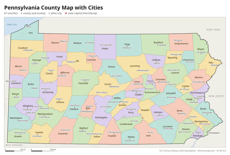
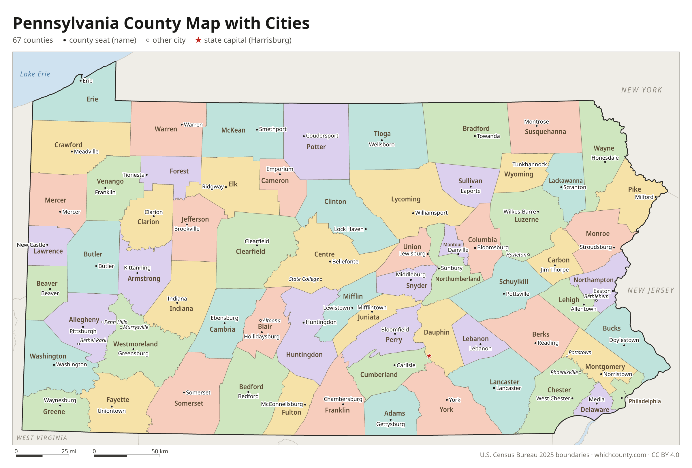
Pennsylvania county map with cities
The largest cities in Pennsylvania and the counties they are in. Cities that cross a county line list every county, the main one first. To find any smaller town, use the search box above.
| City | County | Population 2025 |
|---|---|---|
| Philadelphia | Philadelphia County | 1,574,281 |
| Pittsburgh | Allegheny County | 307,632 |
| Allentown | Lehigh County | 126,044 |
| Reading | Berks County | 95,832 |
| Erie | Erie County | 91,838 |
| Upper Darby | Delaware County | 85,458 |
| Bethlehem | Northampton and Lehigh counties | 79,644 |
| Scranton | Lackawanna County | 75,514 |
| Lower Merion | Montgomery County | 64,691 |
| Bensalem | Bucks County | 62,783 |
| Abington | Montgomery County | 58,656 |
| Lancaster | Lancaster County | 58,366 |
| Lower Paxton | Dauphin County | 55,564 |
| Bristol | Bucks County | 54,063 |
| Millcreek | Erie County | 52,680 |
| Haverford | Delaware County | 50,997 |
| Harrisburg | Dauphin County | 50,522 |
| Middletown | Bucks County | 45,547 |
| York | York County | 45,342 |
| Manheim | Lancaster County | 44,826 |
| Wilkes-Barre | Luzerne County | 44,523 |
| Altoona | Blair County | 42,347 |
| Hempfield | Westmoreland County | 41,421 |
| State College | Centre County | 40,844 |
| Northampton | Bucks County | 39,919 |
| Penn Hills | Allegheny County | 39,452 |
| Cheltenham | Montgomery County | 38,498 |
| Upper Merion | Montgomery County | 36,674 |
| Norristown | Montgomery County | 35,911 |
| Hampden | Cumberland County | 35,401 |
Printable Pennsylvania county maps (free PDF, PNG, SVG)
Every map is free to print and share. The PDFs are vector files with real text, so they stay sharp at any size and you can search them for a county name. Use 11×17 (tabloid) for the most readable labels.
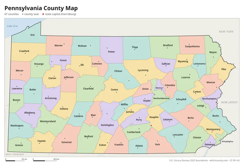
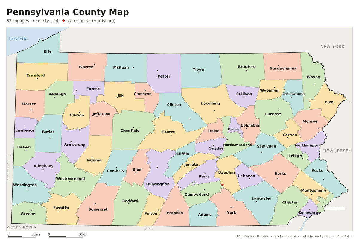
Color map with names
All 67 counties labeled, county seats marked. Letter and 11×17 PDF, high-resolution PNG, editable SVG.
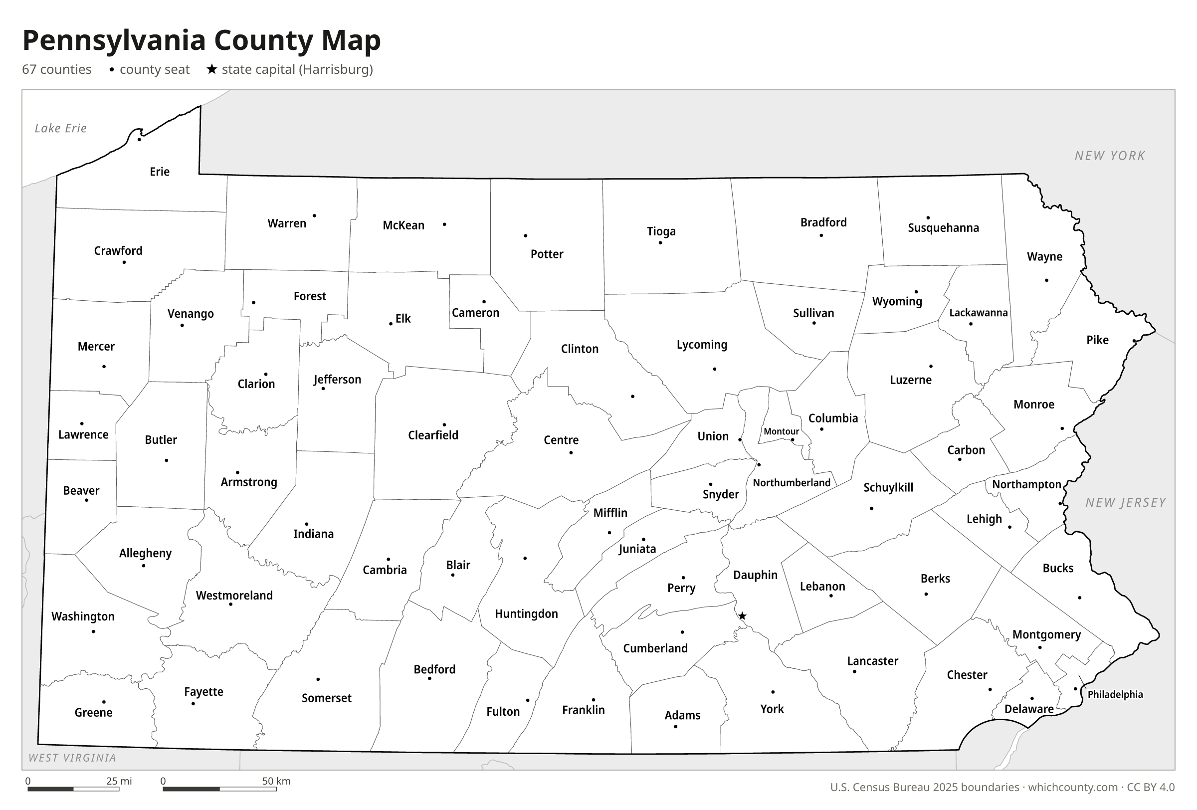
Map with cities
Counties with their county seat towns and major cities.
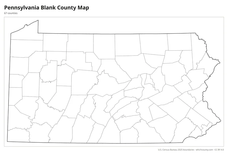
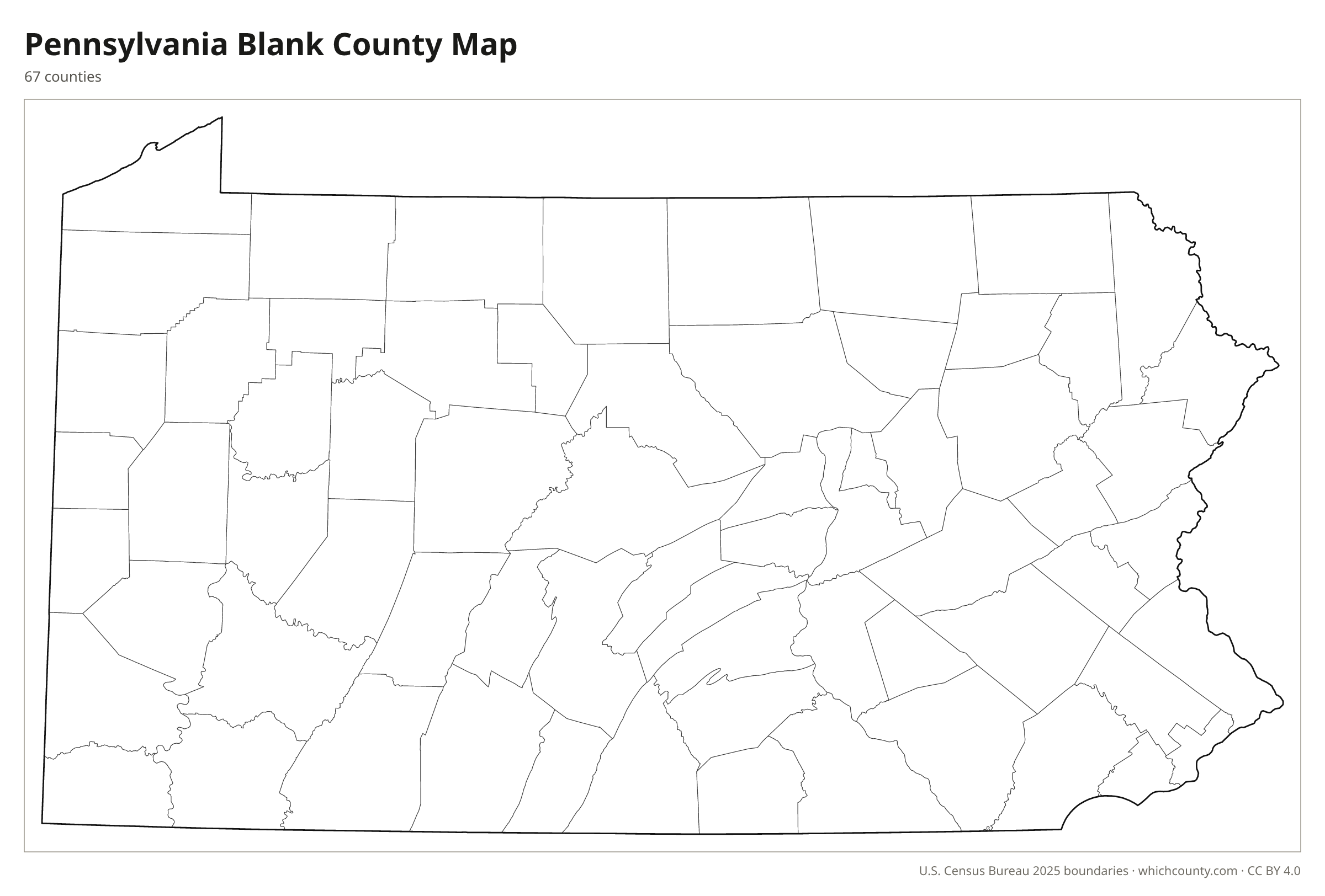
Blank outline map
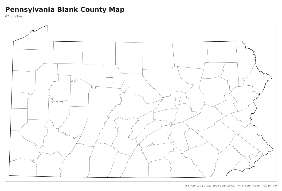
County lines only, no names. For quizzes, coloring and your own notes.
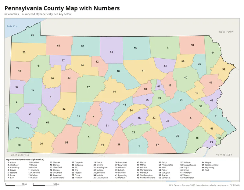
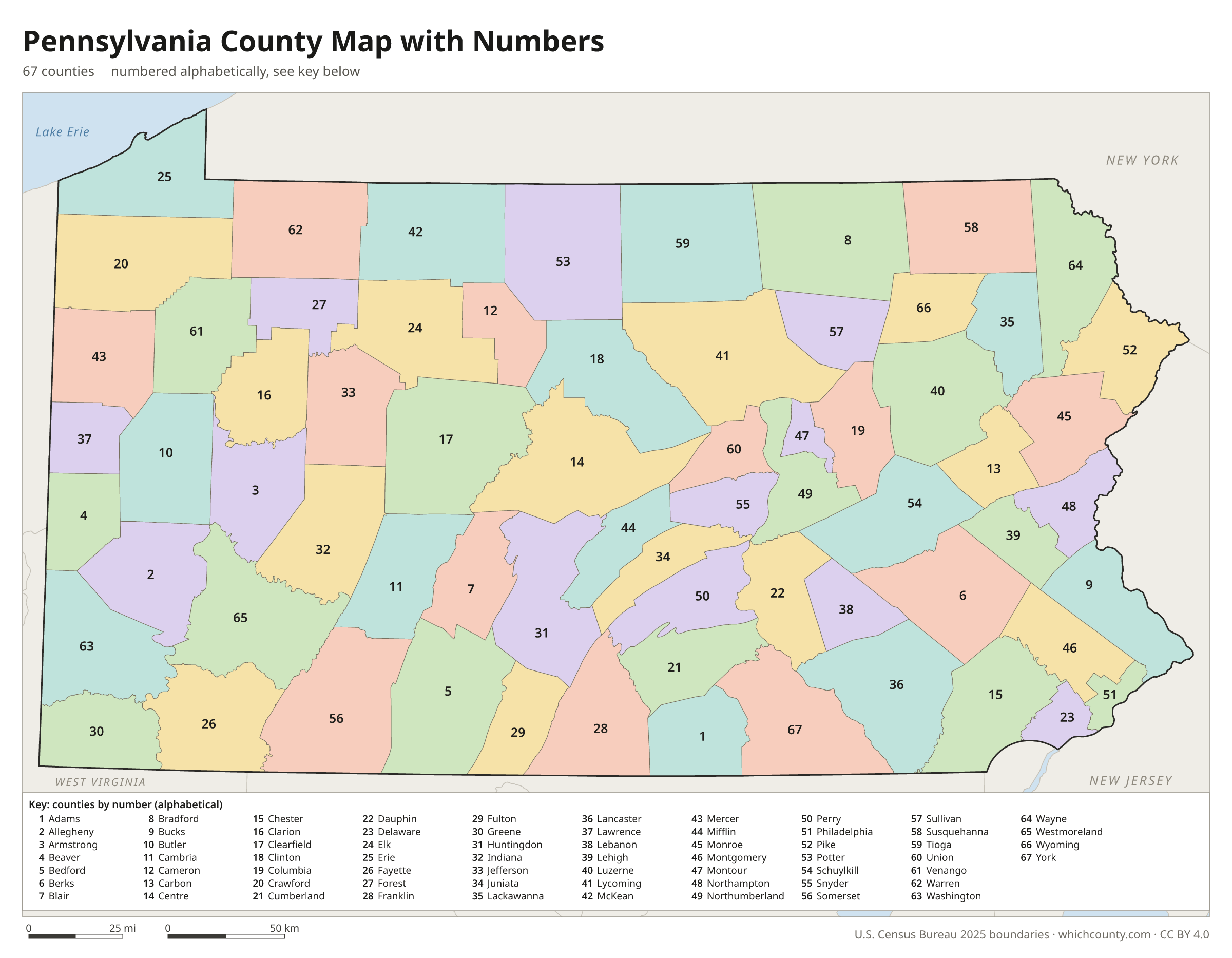
Numbered map with key
A number in every county with an alphabetical key.
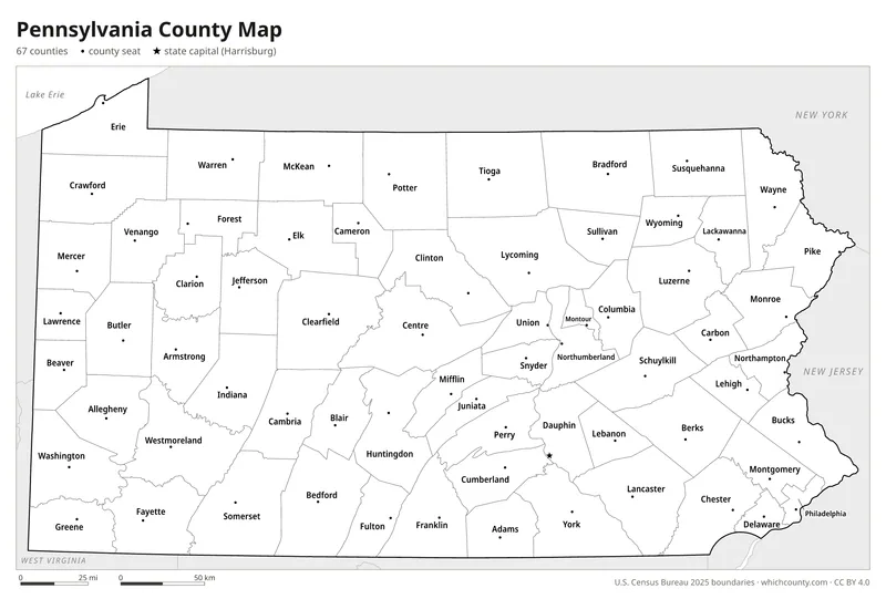
Black and white
Labeled map that prints well on any printer.
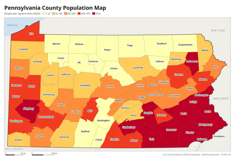
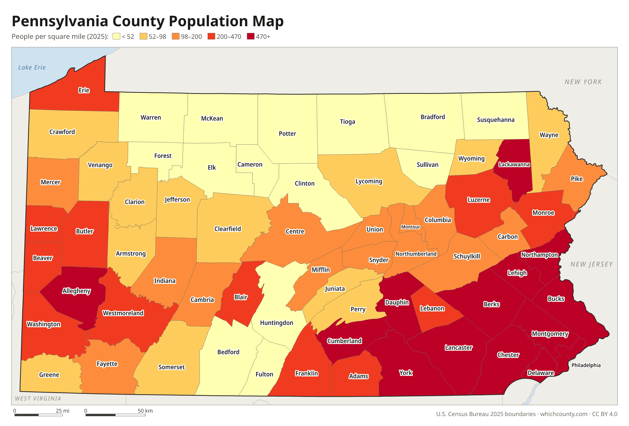
Population map
Counties shaded by population density (2025 estimates).
Data and GIS files
The county table as CSV, and the boundaries as GeoJSON and KML (Google Earth, Google My Maps).
Why does Pennsylvania have 67 counties?
William Penn created Pennsylvania's first three counties, Bucks, Chester and Philadelphia, in November 1682, the year after he received his charter from the king. The rest were carved out of these and of each other. By the end of 1799 there were 25 counties, and the next two decades added 25 more. The pace slowed after that. The Constitution of 1874 made new counties hard to create. It barred any new county that would cut an existing one below 400 square miles or 20,000 inhabitants, any new county smaller than that, and any new county line within ten miles of the seat of a county being divided. Lackawanna County, created from part of Luzerne in August 1878, was the last.
County numbers: The Department of Revenue numbers the counties 1–67 in alphabetical order for inheritance tax filings.
Regions of Pennsylvania
Pennsylvania's counties grouped into the 11 PennDOT engineering districts (source).
District 1
Crawford, Erie, Forest, Mercer, Venango, Warren
District 2
Cameron, Centre, Clearfield, Clinton, Elk, Juniata, McKean, Mifflin, Potter
District 3
Bradford, Columbia, Lycoming, Montour, Northumberland, Snyder, Sullivan, Tioga, Union
District 4
Lackawanna, Luzerne, Pike, Susquehanna, Wayne, Wyoming
District 5
Berks, Carbon, Lehigh, Monroe, Northampton, Schuylkill
District 6
Bucks, Chester, Delaware, Montgomery, Philadelphia
District 8
Adams, Cumberland, Dauphin, Franklin, Lancaster, Lebanon, Perry, York
District 9
Bedford, Blair, Cambria, Fulton, Huntingdon, Somerset
District 10
Armstrong, Butler, Clarion, Indiana, Jefferson
District 11
Allegheny, Beaver, Lawrence
District 12
Fayette, Greene, Washington, Westmoreland
County maps of neighboring states
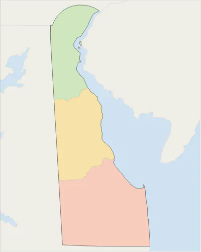 Delaware county map
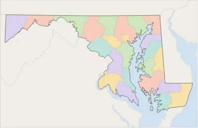 Maryland county map
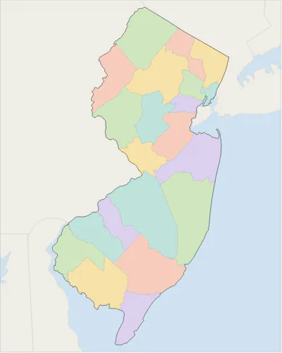 New Jersey county map
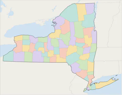 New York county map
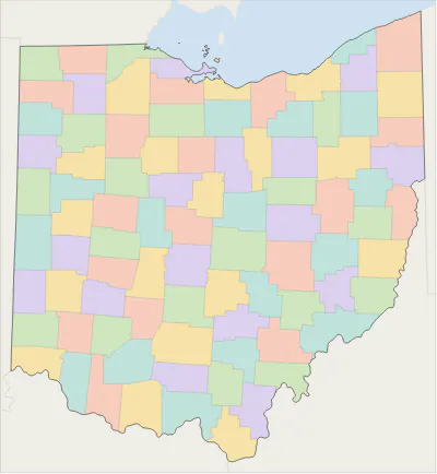 Ohio county map
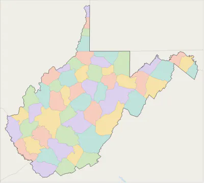 West Virginia county map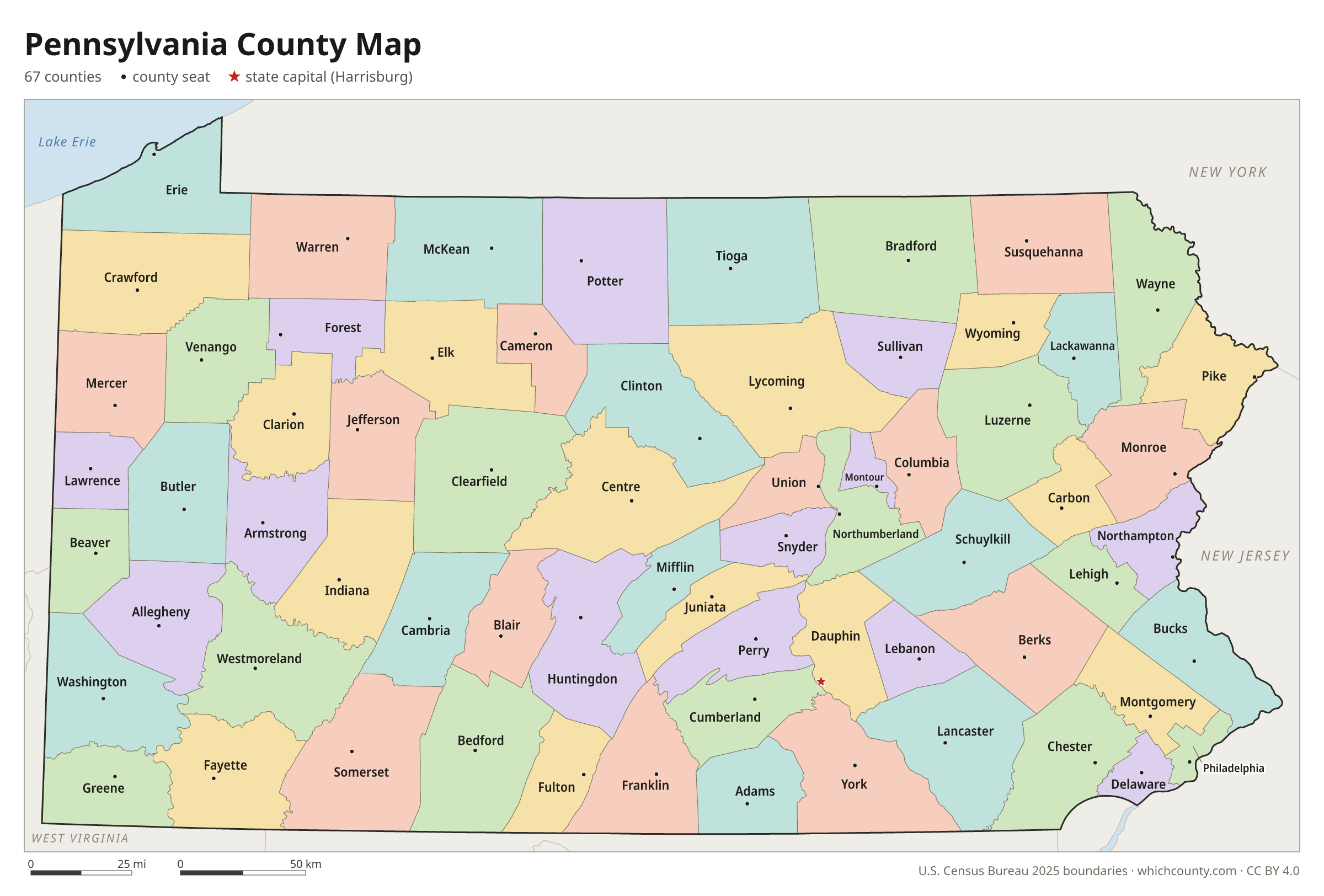
Pennsylvania counties: questions and answers
- How many counties are in Pennsylvania?
- Pennsylvania has 67 counties.
- What is the largest county in Pennsylvania?
- By land area, Lycoming County is the largest (1,229 sq mi). By population, Philadelphia County is the largest, with 1,574,281 people (2025 estimate).
- What is the smallest county in Pennsylvania?
- Montour County is the smallest by land area (130.3 sq mi). Cameron County has the fewest people: 4,211 (2025 estimate).
- What is the wealthiest county in Pennsylvania?
- By median household income, Chester County ranks first with $127,208 (American Community Survey 2020–2024). The lowest is Cameron County at $50,573.
- What county is Philadelphia in?
- Philadelphia is in Philadelphia County.
- What county is Pittsburgh in?
- Pittsburgh is in Allegheny County.
- What county is Allentown in?
- Allentown is in Lehigh County.
- What county is Harrisburg in?
- Harrisburg, the state capital, is in Dauphin County.
- How can I see county lines on Google Maps?
- Google Maps does not draw county lines. Download the KML file from the printable maps section above and import it into Google My Maps (Create a new map › Import) or open it in Google Earth to see every Pennsylvania county boundary on top of Google's map.
- Can I use this map for free?
- Yes. The maps and files on this page are free to print, share and use in your own work, including commercial projects, under the CC BY 4.0 licence. Please credit “WhichCounty (whichcounty.com)”.
Use this map on your site
You may copy, print and publish these maps, also commercially, as long as you credit WhichCounty with a link (licence details). Paste this code to embed the map:
Sources and methodology
- Boundaries: U.S. Census Bureau, 2025 Cartographic Boundary Files (1:500,000), simplified for display. Projection: Lambert conformal conic fitted to Pennsylvania.
- Population: Census Bureau county estimates, Vintage 2025 (July 1, 2025), compared with the April 1, 2020 estimates base.
- Land area: Census Bureau 2026 Gazetteer files. Median household income: American Community Survey 2020–2024 5-year estimates.
- County seats and founding years: Wikidata (CC0), checked against state lists by WhichCounty. Cities: Census Bureau city and town estimates, Vintage 2025.
- Incorporation Dates for Municipalities: Bucks County (Pennsylvania State Archives, PHMC)
- Incorporation Dates for Municipalities: Philadelphia County (Pennsylvania State Archives, PHMC)
- Incorporation Dates for Municipalities: Lackawanna County (Pennsylvania State Archives, PHMC)
- Pennsylvania Constitution of 1874, Article XIII: New Counties (Duquesne University, paconstitution.org)
- Atlas of Historical County Boundaries: Pennsylvania (Newberry Library)
Found an error? Tell us. Last data update: October 4, 2026.