Maine County Map
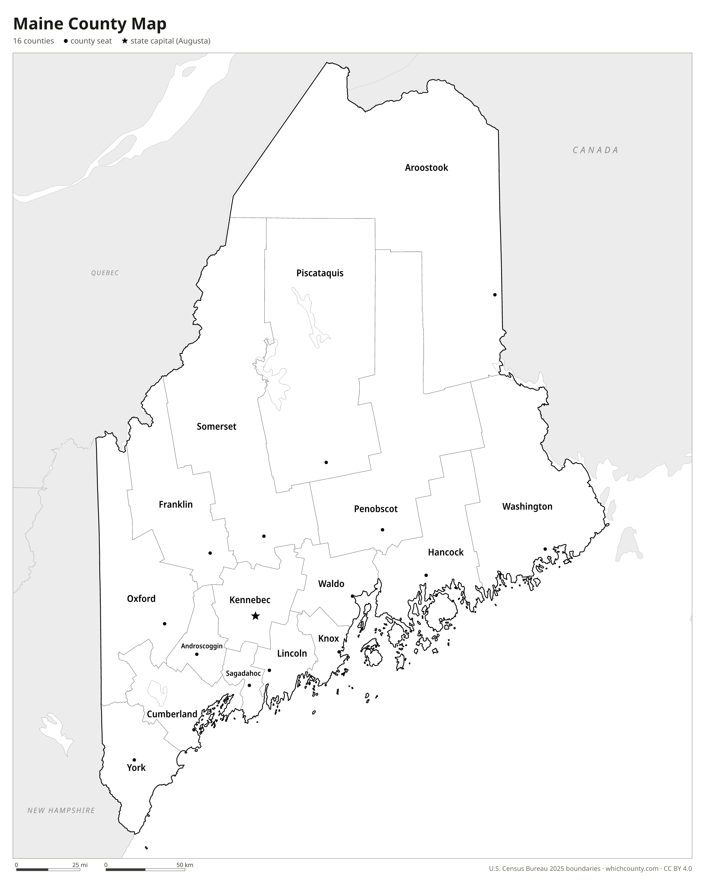
All 16 counties with county seats and major cities
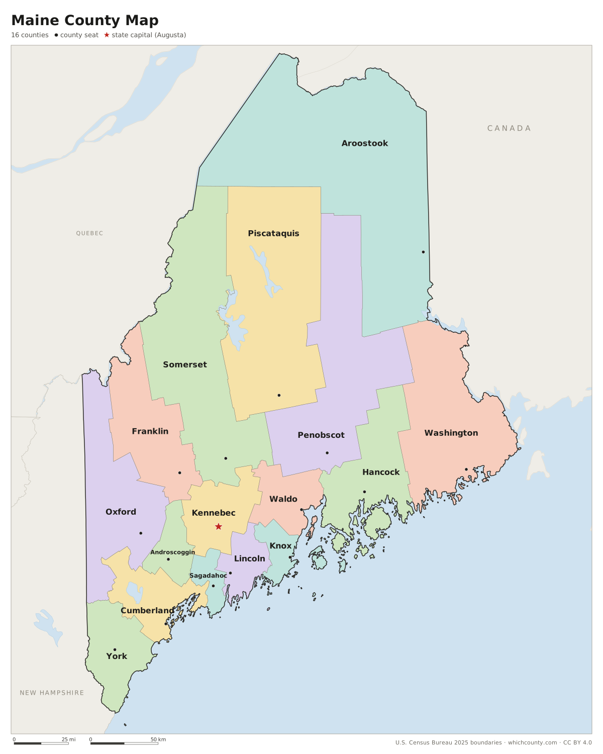
Maine has 16 counties, and the largest, Aroostook, has more land area than Connecticut and Rhode Island combined. This map shows all 16 counties and their county seats. Tap a county for details, or download the free printable map below.

Updated October 4, 2026 · Boundaries: U.S. Census Bureau 2025 · Population: Census estimates for July 1, 2025
Maine county facts
- Number of counties
- 16
- Largest by land area
- Aroostook County 6,671 sq mi
- Smallest by land area
- Sagadahoc County 254 sq mi
- Most people
- Cumberland County 317,222
- Fewest people
- Piscataquis County 17,409
- Fastest growing since 2020
- York County +4.9%
- Highest median household income
- Cumberland County $95,677
- Oldest county
- York County est. 1652
- Newest county
- Knox County est. 1860
- State capital
- Augusta Kennebec County
Yorkshire went into abeyance in 1664, when the Gorges family resumed the government of Maine, and Massachusetts reinstated the county as York in 1668.
Besides cities and towns, Maine has plantations, a third type of local government, such as Monhegan in Lincoln County and Matinicus Island in Knox County.
List of 16 Maine counties
Sorted A–Z. Click a column to sort, or a name to show it on the map. Download as CSV
| County | County seat | Population 2025 | Change since 2020 | Land area (sq mi) | Median income | Established | FIPS |
|---|---|---|---|---|---|---|---|
| Androscoggin County | Auburn | 116,487 | +4.8% | 468 | $67,873 | 1854 | 23001 |
| Aroostook County | Houlton | 66,609 | −0.7% | 6,671 | $56,700 | 1839 | 23003 |
| Cumberland County | Portland | 317,222 | +4.7% | 836 | $95,677 | 1760 | 23005 |
| Franklin County | Farmington | 30,824 | +4.7% | 1,697 | $58,675 | 1838 | 23007 |
| Hancock County | Ellsworth | 57,171 | +3% | 1,587 | $72,744 | 1790 | 23009 |
| Kennebec County | Augusta | 129,067 | +3.7% | 868 | $69,077 | 1799 | 23011 |
| Knox County | Rockland | 41,117 | +1.3% | 365 | $74,096 | 1860 | 23013 |
| Lincoln County | Wiscasset | 36,595 | +3.9% | 456 | $76,875 | 1760 | 23015 |
| Oxford County | Paris | 60,346 | +4.5% | 2,077 | $60,173 | 1805 | 23017 |
| Penobscot County | Bangor | 157,967 | +3.8% | 3,397 | $66,356 | 1816 | 23019 |
| Piscataquis County | Dover-Foxcroft | 17,409 | +3.6% | 3,961 | $61,345 | 1838 | 23021 |
| Sagadahoc County | Bath | 37,979 | +3.5% | 254 | $87,806 | 1854 | 23023 |
| Somerset County | Skowhegan | 51,620 | +2.3% | 3,924 | $58,179 | 1809 | 23025 |
| Waldo County | Belfast | 40,693 | +2.7% | 730 | $72,782 | 1827 | 23027 |
| Washington County | Machias | 31,334 | +0.8% | 2,563 | $56,024 | 1790 | 23029 |
| York County | Alfred | 222,434 | +4.9% | 991 | $88,333 | 1652 | 23031 |
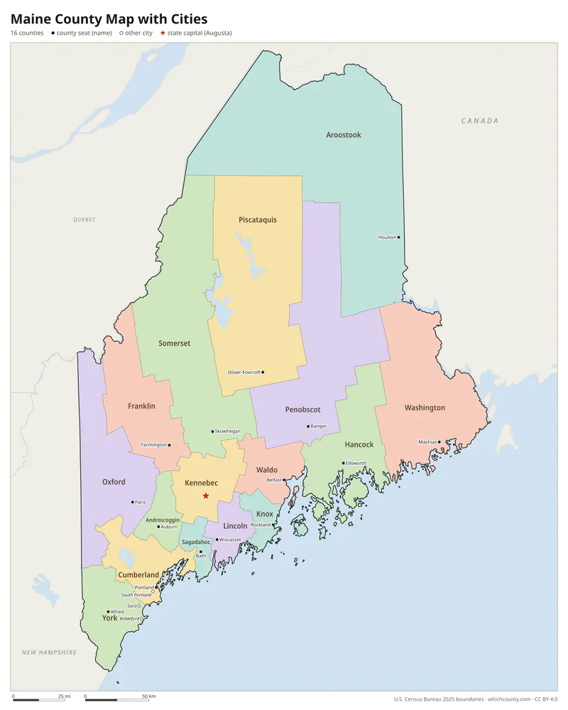
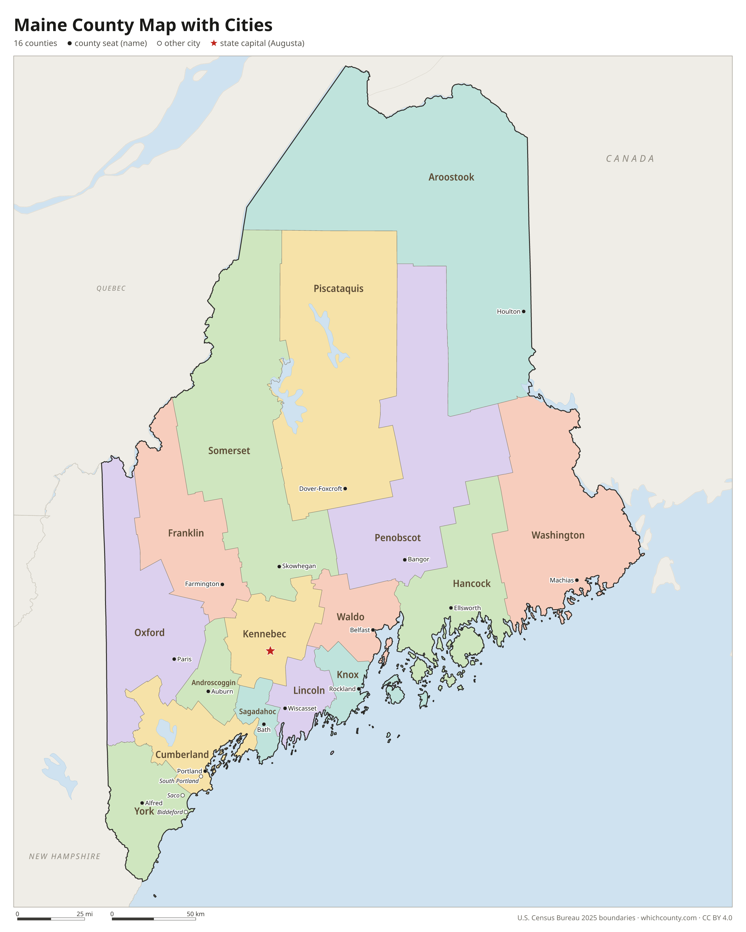
Maine county map with cities
The largest cities in Maine and the counties they are in. Cities that cross a county line list every county, the main one first. To find any smaller town, use the search box above.
| City | County | Population 2025 |
|---|---|---|
| Portland | Cumberland County | 69,911 |
| Lewiston | Androscoggin County | 38,866 |
| Bangor | Penobscot County | 32,518 |
| South Portland | Cumberland County | 27,007 |
| Auburn | Androscoggin County | 25,441 |
| Scarborough | Cumberland County | 24,547 |
| Brunswick | Cumberland County | 23,055 |
| Sanford | York County | 22,663 |
| Biddeford | York County | 22,399 |
| Westbrook | Cumberland County | 21,565 |
| Saco | York County | 21,159 |
| Windham | Cumberland County | 19,912 |
| Gorham | Cumberland County | 19,239 |
| Augusta | Kennebec County | 19,155 |
| Waterville | Kennebec County | 17,579 |
| York | York County | 14,293 |
| Falmouth | Cumberland County | 12,982 |
| Orono | Penobscot County | 12,421 |
| Kennebunk | York County | 12,152 |
| Wells | York County | 12,094 |
| Kittery | York County | 11,420 |
| Standish | Cumberland County | 11,000 |
| Topsham | Sagadahoc County | 9,982 |
| Lisbon | Androscoggin County | 9,919 |
| Cape Elizabeth | Cumberland County | 9,827 |
| Brewer | Penobscot County | 9,636 |
| Old Orchard Beach | York County | 9,533 |
| Yarmouth | Cumberland County | 9,062 |
| Freeport | Cumberland County | 8,934 |
| Cumberland | Cumberland County | 8,876 |
Printable Maine county maps (free PDF, PNG, SVG)
Every map is free to print and share. The PDFs are vector files with real text, so they stay sharp at any size and you can search them for a county name. Use 11×17 (tabloid) for the most readable labels.
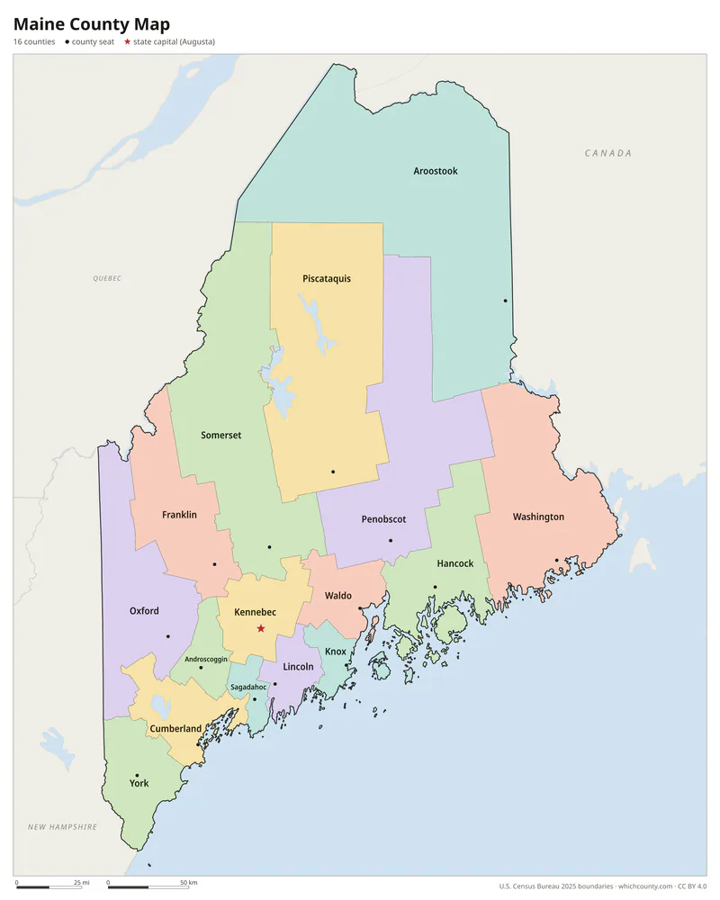
Color map with names
All 16 counties labeled, county seats marked. Letter and 11×17 PDF, high-resolution PNG, editable SVG.
Map with cities
Counties with their county seat towns and major cities.
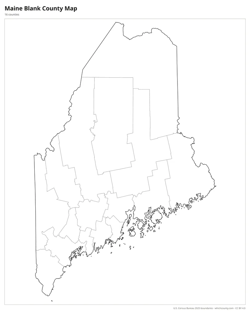
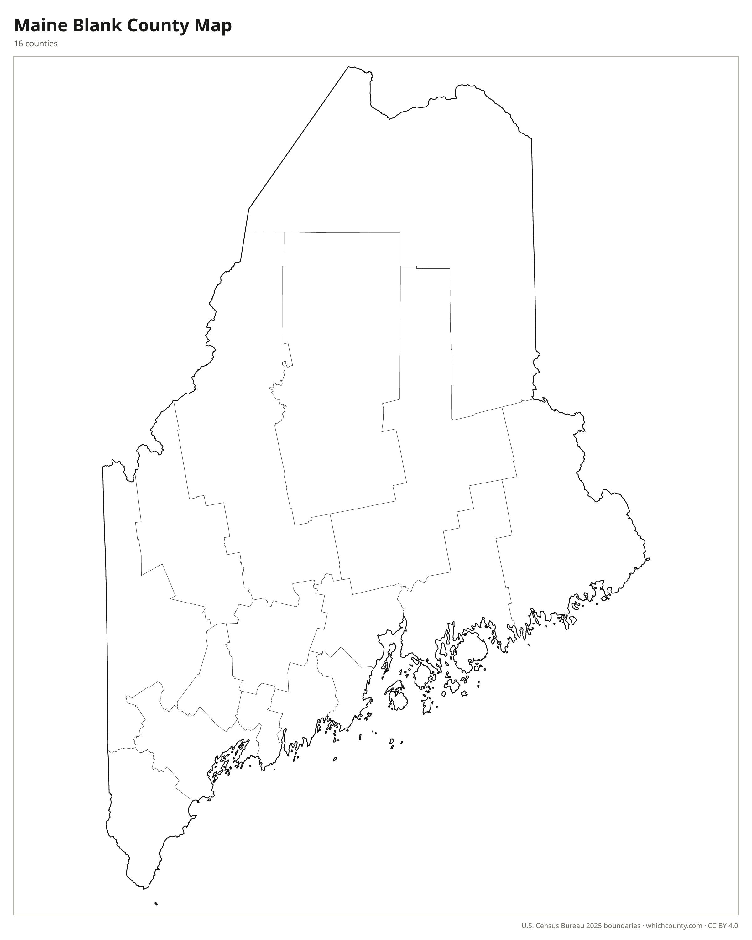
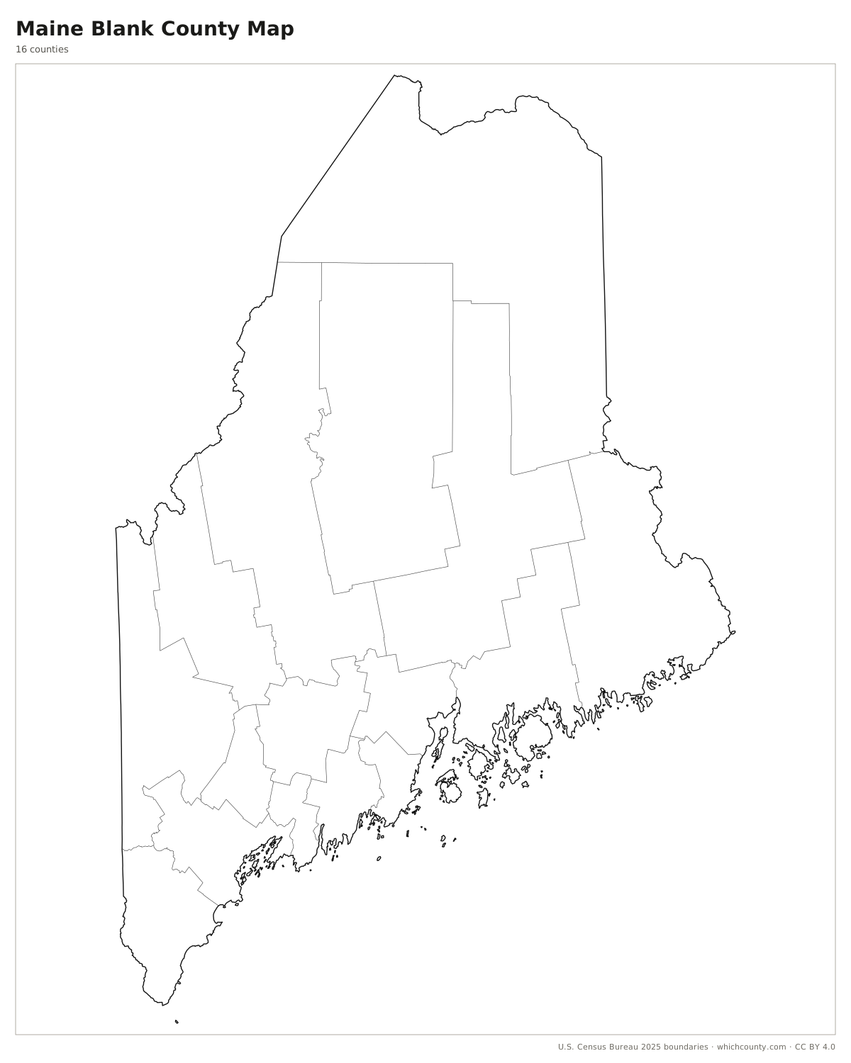
Blank outline map
County lines only, no names. For quizzes, coloring and your own notes.
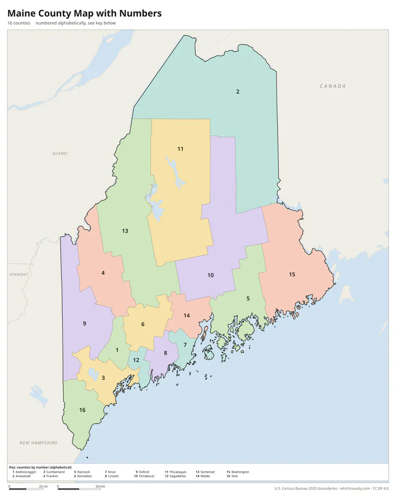
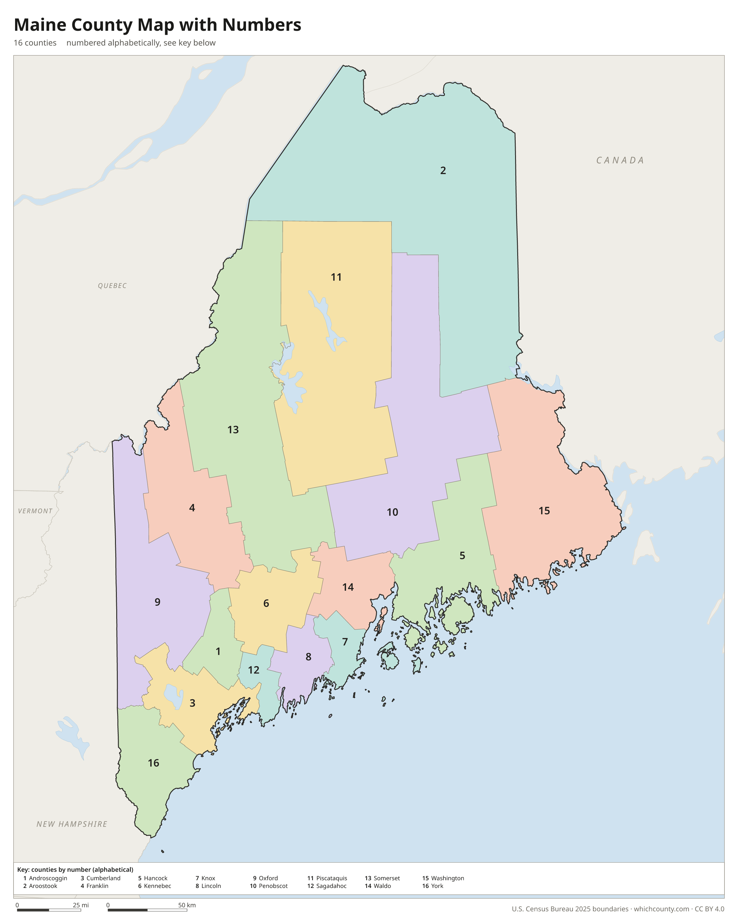
Numbered map with key
A number in every county with an alphabetical key.
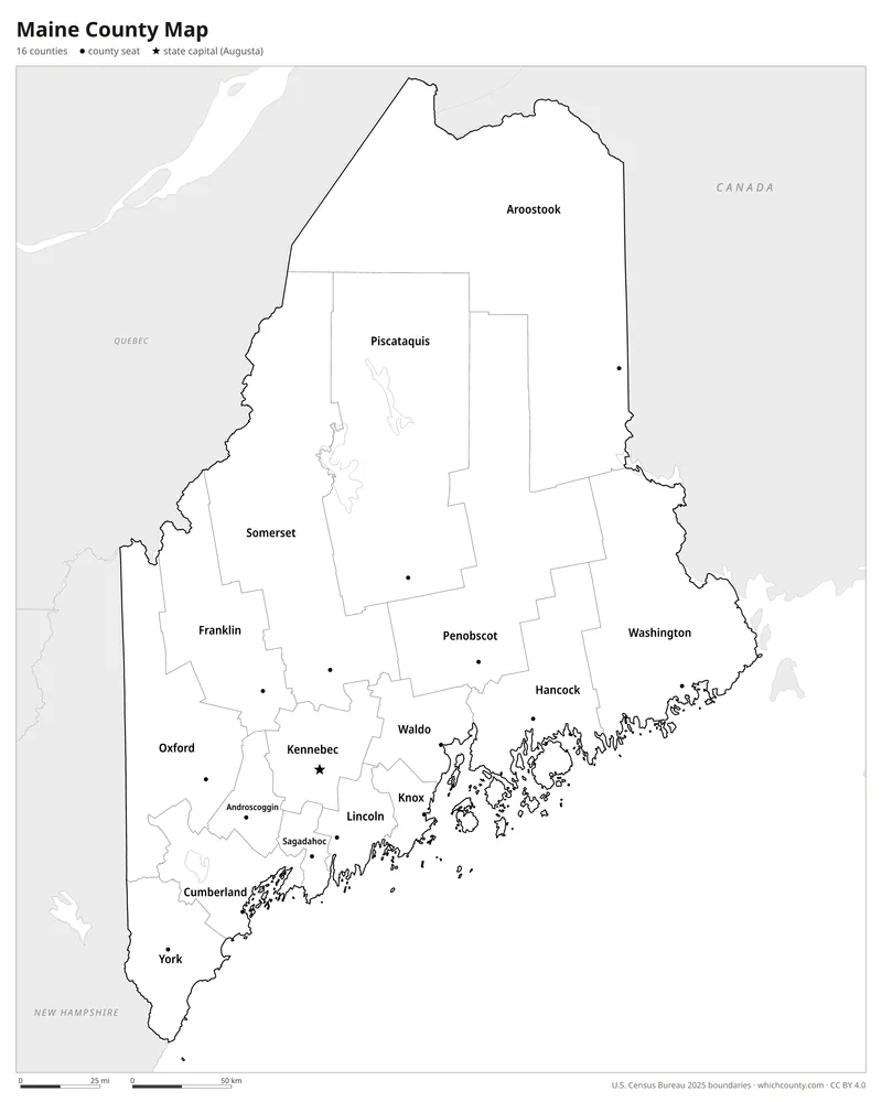
Black and white
Labeled map that prints well on any printer.
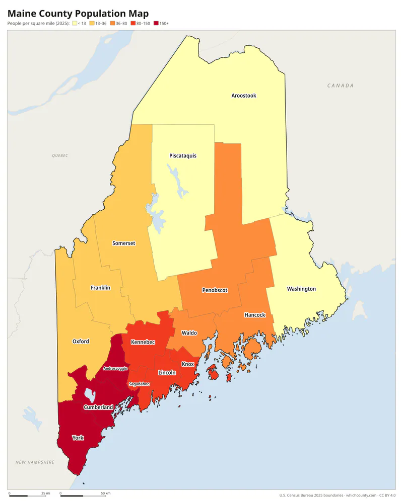
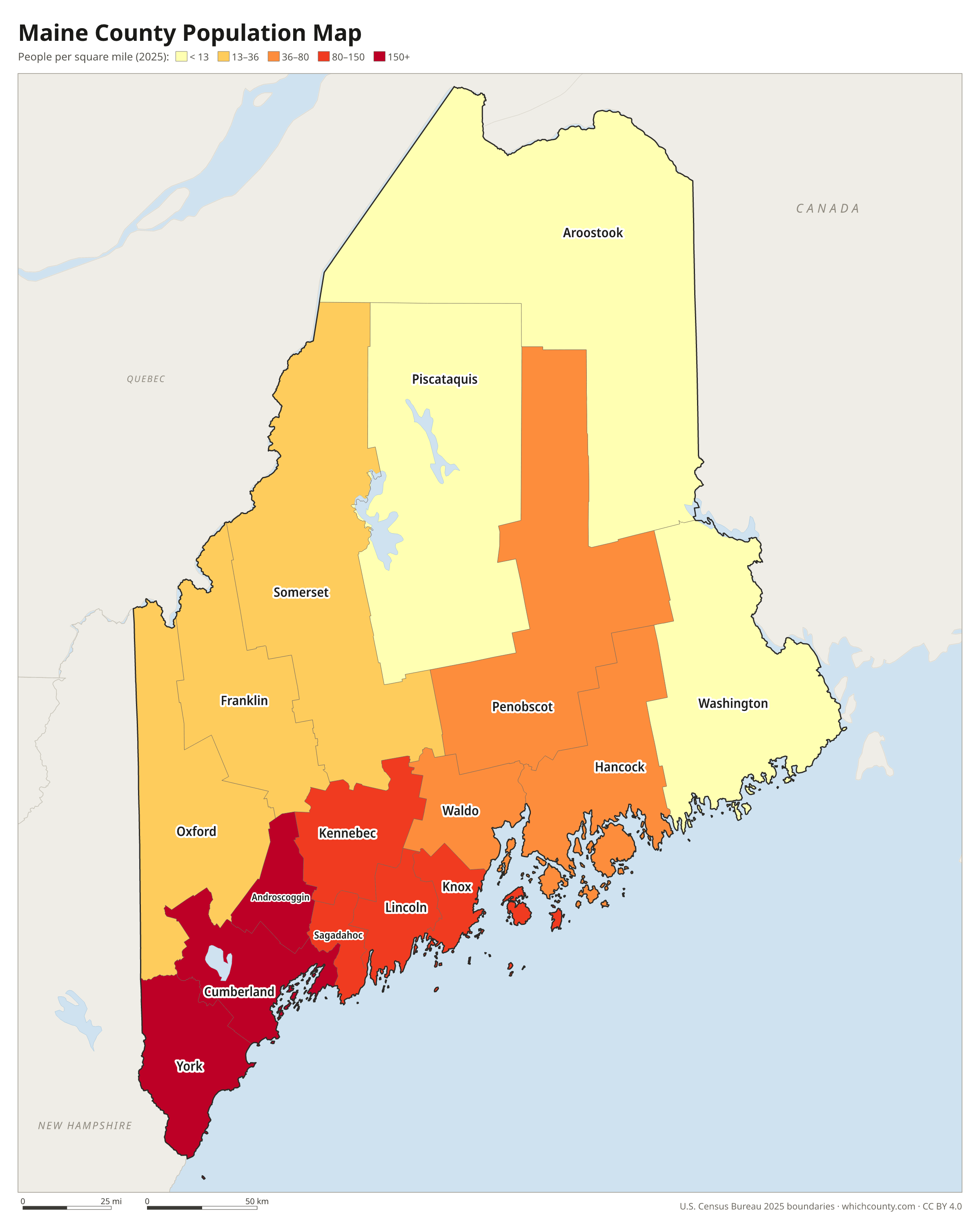
Population map
Counties shaded by population density (2025 estimates).
Data and GIS files
The county table as CSV, and the boundaries as GeoJSON and KML (Google Earth, Google My Maps).
Where Maine's 16 counties came from
Massachusetts created Maine's first nine counties. It set up Yorkshire, now York County, in 1652 after towns in southern Maine accepted its rule. Cumberland and Lincoln were cut from York in 1760, and Hancock, Washington, Kennebec, Oxford, Somerset and Penobscot followed by 1816. All nine became counties of the new state when Maine separated from Massachusetts and joined the Union on March 15, 1820. Maine then added seven of its own: Waldo in 1827, Franklin and Piscataquis in 1838, Aroostook in 1839, Androscoggin and Sagadahoc in 1854, and Knox in 1860. County government has a short list of duties: the courthouse and jail, the registries of deeds and probate, and the sheriff. About 40 percent of Maine has no city or town government. In that unorganized territory the state provides most services, and the counties handle some, such as roads and solid waste.
County maps of neighboring states
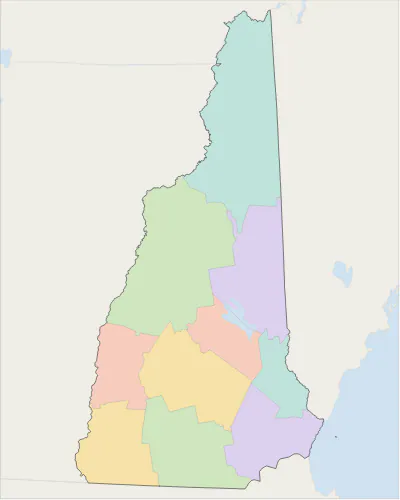 New Hampshire county map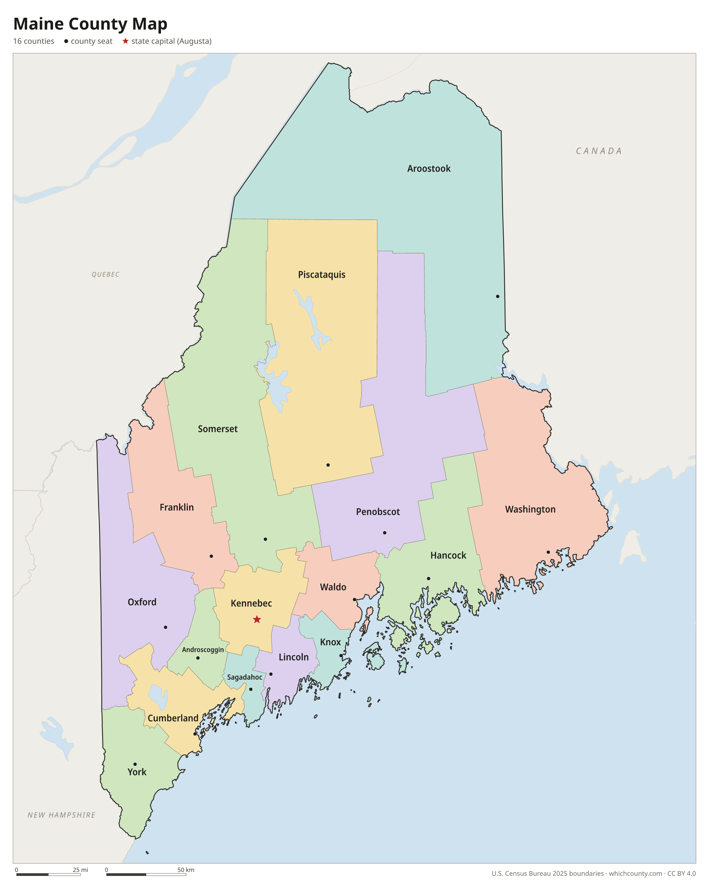
Maine counties: questions and answers
- How many counties are in Maine?
- Maine has 16 counties.
- What is the largest county in Maine?
- By land area, Aroostook County is the largest (6,671 sq mi). By population, Cumberland County is the largest, with 317,222 people (2025 estimate).
- What is the smallest county in Maine?
- Sagadahoc County is the smallest by land area (254 sq mi). Piscataquis County has the fewest people: 17,409 (2025 estimate).
- What is the wealthiest county in Maine?
- By median household income, Cumberland County ranks first with $95,677 (American Community Survey 2020–2024). The lowest is Washington County at $56,024.
- What county is Portland in?
- Portland is in Cumberland County.
- What county is Lewiston in?
- Lewiston is in Androscoggin County.
- What county is Bangor in?
- Bangor is in Penobscot County.
- What county is Augusta in?
- Augusta, the state capital, is in Kennebec County.
- How can I see county lines on Google Maps?
- Google Maps does not draw county lines. Download the KML file from the printable maps section above and import it into Google My Maps (Create a new map › Import) or open it in Google Earth to see every Maine county boundary on top of Google's map.
- Can I use this map for free?
- Yes. The maps and files on this page are free to print, share and use in your own work, including commercial projects, under the CC BY 4.0 licence. Please credit “WhichCounty (whichcounty.com)”.
Use this map on your site
You may copy, print and publish these maps, also commercially, as long as you credit WhichCounty with a link (licence details). Paste this code to embed the map:
Sources and methodology
- Boundaries: U.S. Census Bureau, 2025 Cartographic Boundary Files (1:500,000), simplified for display. Projection: Lambert conformal conic fitted to Maine.
- Population: Census Bureau county estimates, Vintage 2025 (July 1, 2025), compared with the April 1, 2020 estimates base.
- Land area: Census Bureau 2026 Gazetteer files. Median household income: American Community Survey 2020–2024 5-year estimates.
- County seats and founding years: Wikidata (CC0), checked against state lists by WhichCounty. Cities: Census Bureau city and town estimates, Vintage 2025.
- Atlas of Historical County Boundaries: Maine (Newberry Library)
- Maine Counties (Maine Secretary of State, Kids' Page)
- 2022 Census of Governments: Individual State Descriptions (U.S. Census Bureau)
- Gazetteer Files and cartographic boundary file cb_2025_us_county_500k (U.S. Census Bureau)
Found an error? Tell us. Last data update: October 4, 2026.