Minnesota County Map
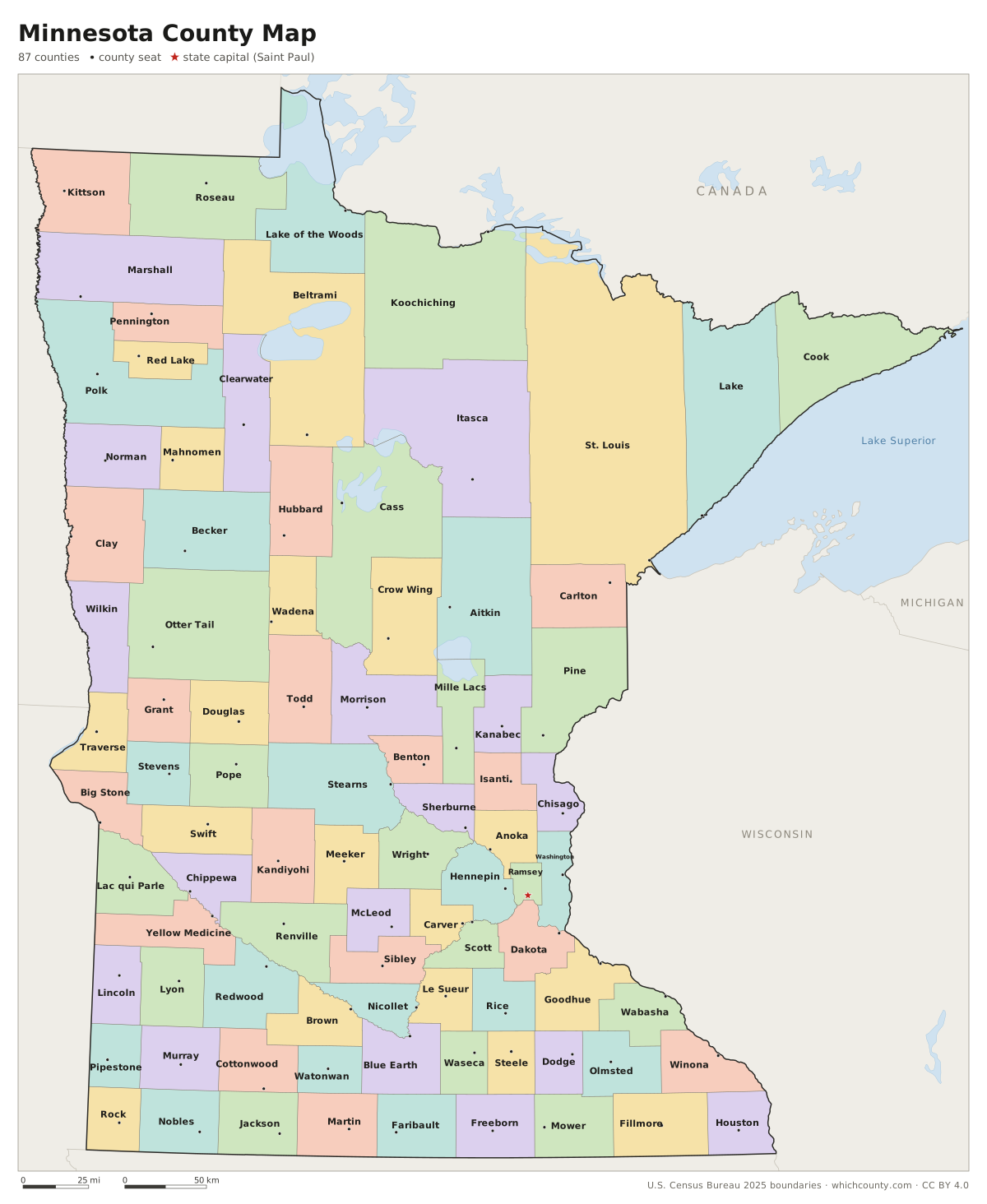
All 87 counties with county seats and major cities
Minnesota has 87 counties, and the largest, St. Louis County, covers more than 6,000 square miles of land. This map shows all 87 counties and their county seats. Tap a county for details, or download the free printable map below.

Updated October 4, 2026 · Boundaries: U.S. Census Bureau 2025 · Population: Census estimates for July 1, 2025
Minnesota county facts
- Number of counties
- 87
- Largest by land area
- St. Louis County 6,248 sq mi
- Smallest by land area
- Ramsey County 152.3 sq mi
- Most people
- Hennepin County 1,284,784
- Fewest people
- Traverse County 3,130
- Fastest growing since 2020
- Wright County +11.5%
- Highest median household income
- Carver County $125,946
- Oldest county
- Benton County est. 1849
- Newest county
- Lake of the Woods County est. 1922
- State capital
- Saint Paul Ramsey County
Kittson County was created in 1849 as Pembina County, one of the nine original territorial counties, and renamed Kittson in 1878.
List of 87 Minnesota counties
Sorted A–Z. Click a column to sort, or a name to show it on the map. Download as CSV
| County | County seat | Population 2025 | Change since 2020 | Land area (sq mi) | Median income | Established | FIPS |
|---|---|---|---|---|---|---|---|
| Aitkin County | Aitkin | 16,252 | +3.6% | 1,821 | $60,833 | 1857 | 27001 |
| Anoka County | Anoka | 381,605 | +4.9% | 422 | $101,869 | 1857 | 27003 |
| Becker County | Detroit Lakes | 35,497 | +0.9% | 1,315 | $71,388 | 1858 | 27005 |
| Beltrami County | Bemidji | 47,055 | +1.8% | 2,505 | $68,975 | 1866 | 27007 |
| Benton County | Foley | 41,744 | +0.9% | 408 | $74,410 | 1849 | 27009 |
| Big Stone County | Ortonville | 5,054 | −2.2% | 499 | $70,400 | 1862 | 27011 |
| Blue Earth County | Mankato | 70,634 | +2.2% | 748 | $74,477 | 1853 | 27013 |
| Brown County | New Ulm | 25,517 | −1.5% | 611 | $69,378 | 1855 | 27015 |
| Carlton County | Carlton | 36,711 | +1.4% | 861 | $80,573 | 1857 | 27017 |
| Carver County | Chaska | 114,379 | +7% | 354 | $125,946 | 1855 | 27019 |
| Cass County | Walker | 31,430 | +4.5% | 2,022 | $68,874 | 1851 | 27021 |
| Chippewa County | Montevideo | 12,406 | −1.6% | 581 | $71,458 | 1862 | 27023 |
| Chisago County | Center City | 59,142 | +4.5% | 415 | $99,400 | 1851 | 27025 |
| Clay County | Moorhead | 67,734 | +3.7% | 1,045 | $81,172 | 1862 | 27027 |
| Clearwater County | Bagley | 8,647 | +1.6% | 999 | $64,475 | 1902 | 27029 |
| Cook County | Grand Marais | 5,522 | −1.4% | 1,453 | $72,638 | 1874 | 27031 |
| Cottonwood County | Windom | 11,405 | −1% | 640 | $72,941 | 1857 | 27033 |
| Crow Wing County | Brainerd | 69,132 | +4.6% | 999 | $72,589 | 1857 | 27035 |
| Dakota County | Hastings | 457,710 | +4.1% | 563 | $106,318 | 1849 | 27037 |
| Dodge County | Mantorville | 21,376 | +2.4% | 439 | $95,739 | 1855 | 27039 |
| Douglas County | Alexandria | 40,120 | +2.9% | 637 | $79,043 | 1858 | 27041 |
| Faribault County | Blue Earth | 13,888 | −0.2% | 713 | $66,815 | 1855 | 27043 |
| Fillmore County | Preston | 21,540 | +1.5% | 861 | $77,512 | 1853 | 27045 |
| Freeborn County | Albert Lea | 30,440 | −1.5% | 707 | $71,023 | 1855 | 27047 |
| Goodhue County | Red Wing | 48,195 | +1.3% | 757 | $84,171 | 1853 | 27049 |
| Grant County | Elbow Lake | 6,085 | +0.2% | 548 | $73,917 | 1868 | 27051 |
| Hennepin County | Minneapolis | 1,284,784 | +0.3% | 554 | $97,653 | 1852 | 27053 |
| Houston County | Caledonia | 18,400 | −2.3% | 552 | $79,825 | 1854 | 27055 |
| Hubbard County | Park Rapids | 22,369 | +4.8% | 926 | $71,995 | 1883 | 27057 |
| Isanti County | Cambridge | 44,386 | +7.9% | 436 | $87,440 | 1857 | 27059 |
| Itasca County | Grand Rapids | 45,404 | +0.9% | 2,668 | $68,603 | 1849 | 27061 |
| Jackson County | Jackson | 9,857 | −1.3% | 703 | $75,743 | 1857 | 27063 |
| Kanabec County | Mora | 16,628 | +3.7% | 522 | $71,460 | 1858 | 27065 |
| Kandiyohi County | Willmar | 44,720 | +2.3% | 797 | $76,592 | 1858 | 27067 |
| Kittson County | Hallock | 4,031 | −4.2% | 1,099 | $76,100 | – | 27069 |
| Koochiching County | International Falls | 11,587 | −3.9% | 3,105 | $66,940 | 1906 | 27071 |
| Lac qui Parle County | Madison | 6,704 | −0.1% | 765 | $74,432 | 1871 | 27073 |
| Lake County | Two Harbors | 10,746 | −1.5% | 2,109 | $75,541 | 1856 | 27075 |
| Lake of the Woods County | Baudette | 3,770 | −0.1% | 1,298 | $77,546 | 1922 | 27077 |
| Le Sueur County | Le Center | 29,453 | +2.8% | 449 | $94,968 | 1853 | 27079 |
| Lincoln County | Ivanhoe | 5,583 | −1% | 537 | $69,694 | 1873 | 27081 |
| Lyon County | Marshall | 25,684 | +0.6% | 714 | $75,303 | 1869 | 27083 |
| Mahnomen County | Mahnomen | 5,153 | −4.6% | 558 | $59,441 | 1906 | 27087 |
| Marshall County | Warren | 8,798 | −2.6% | 1,775 | $72,543 | 1879 | 27089 |
| Martin County | Fairmont | 19,440 | −3% | 712 | $59,507 | 1857 | 27091 |
| McLeod County | Glencoe | 36,631 | −0.4% | 492 | $80,084 | 1856 | 27085 |
| Meeker County | Litchfield | 23,603 | +0.9% | 608 | $75,446 | 1856 | 27093 |
| Mille Lacs County | Milaca | 27,753 | +4.8% | 572 | $72,729 | 1857 | 27095 |
| Morrison County | Little Falls | 34,620 | +1.8% | 1,125 | $69,446 | 1856 | 27097 |
| Mower County | Austin | 40,971 | +2.3% | 711 | $73,074 | 1855 | 27099 |
| Murray County | Slayton | 7,942 | −2.9% | 705 | $74,033 | 1857 | 27101 |
| Nicollet County | St. Peter | 34,273 | −0.5% | 448 | $79,756 | 1853 | 27103 |
| Nobles County | Worthington | 22,338 | +0.2% | 715 | $66,101 | 1857 | 27105 |
| Norman County | Ada | 6,336 | −1.7% | 873 | $72,260 | 1881 | 27107 |
| Olmsted County | Rochester | 166,731 | +2.4% | 654 | $95,406 | 1855 | 27109 |
| Otter Tail County | Fergus Falls | 61,041 | +1.6% | 1,972 | $72,255 | 1858 | 27111 |
| Pennington County | Thief River Falls | 13,686 | −2.2% | 617 | $77,325 | 1910 | 27113 |
| Pine County | Pine City | 30,472 | +5.5% | 1,411 | $71,146 | 1856 | 27115 |
| Pipestone County | Pipestone | 9,260 | −1.7% | 465 | $69,628 | 1857 | 27117 |
| Polk County | Crookston | 30,545 | −2.1% | 1,971 | $73,107 | 1858 | 27119 |
| Pope County | Glenwood | 11,420 | +1% | 675 | $76,220 | 1862 | 27121 |
| Ramsey County | Saint Paul | 541,623 | −1.9% | 152 | $81,568 | 1849 | 27123 |
| Red Lake County | Red Lake Falls | 3,940 | +0.2% | 432 | $77,188 | 1896 | 27125 |
| Redwood County | Redwood Falls | 15,265 | −1% | 879 | $67,866 | 1862 | 27127 |
| Renville County | Olivia | 14,356 | −2.5% | 983 | $70,625 | 1855 | 27129 |
| Rice County | Faribault | 69,939 | +4.2% | 496 | $83,181 | 1853 | 27131 |
| Rock County | Luverne | 9,524 | −1.8% | 483 | $71,295 | 1857 | 27133 |
| Roseau County | Roseau | 15,246 | −0.5% | 1,672 | $74,474 | 1894 | 27135 |
| Scott County | Shakopee | 159,017 | +5.4% | 356 | $119,314 | 1853 | 27139 |
| Sherburne County | Elk River | 104,194 | +7.2% | 433 | $105,466 | 1856 | 27141 |
| Sibley County | Gaylord | 15,356 | +3.4% | 589 | $77,634 | 1853 | 27143 |
| St. Louis County | Duluth | 200,518 | +0.2% | 6,248 | $70,069 | 1856 | 27137 |
| Stearns County | St. Cloud | 164,110 | +3.7% | 1,343 | $77,066 | 1855 | 27145 |
| Steele County | Owatonna | 37,464 | +0.2% | 430 | $84,196 | 1855 | 27147 |
| Stevens County | Morris | 9,747 | +0.7% | 564 | $75,733 | 1862 | 27149 |
| Swift County | Benson | 9,763 | −0.7% | 742 | $60,412 | 1870 | 27151 |
| Todd County | Long Prairie | 26,060 | +3.2% | 945 | $67,662 | 1855 | 27153 |
| Traverse County | Wheaton | 3,130 | −6.9% | 574 | $62,989 | 1862 | 27155 |
| Wabasha County | Wabasha | 21,537 | +0.8% | 523 | $82,007 | 1849 | 27157 |
| Wadena County | Wadena | 14,388 | +2.3% | 536 | $61,467 | 1858 | 27159 |
| Waseca County | Waseca | 18,688 | −1.5% | 423 | $76,261 | 1857 | 27161 |
| Washington County | Stillwater | 286,895 | +7.2% | 385 | $115,345 | 1849 | 27163 |
| Watonwan County | St. James | 11,459 | +1.8% | 435 | $71,699 | 1860 | 27165 |
| Wilkin County | Breckenridge | 6,288 | −3.4% | 751 | $71,410 | 1858 | 27167 |
| Winona County | Winona | 50,523 | +1.7% | 626 | $70,744 | 1854 | 27169 |
| Wright County | Buffalo | 157,559 | +11.5% | 661 | $107,209 | 1855 | 27171 |
| Yellow Medicine County | Granite Falls | 9,477 | −0.5% | 759 | $74,000 | 1871 | 27173 |
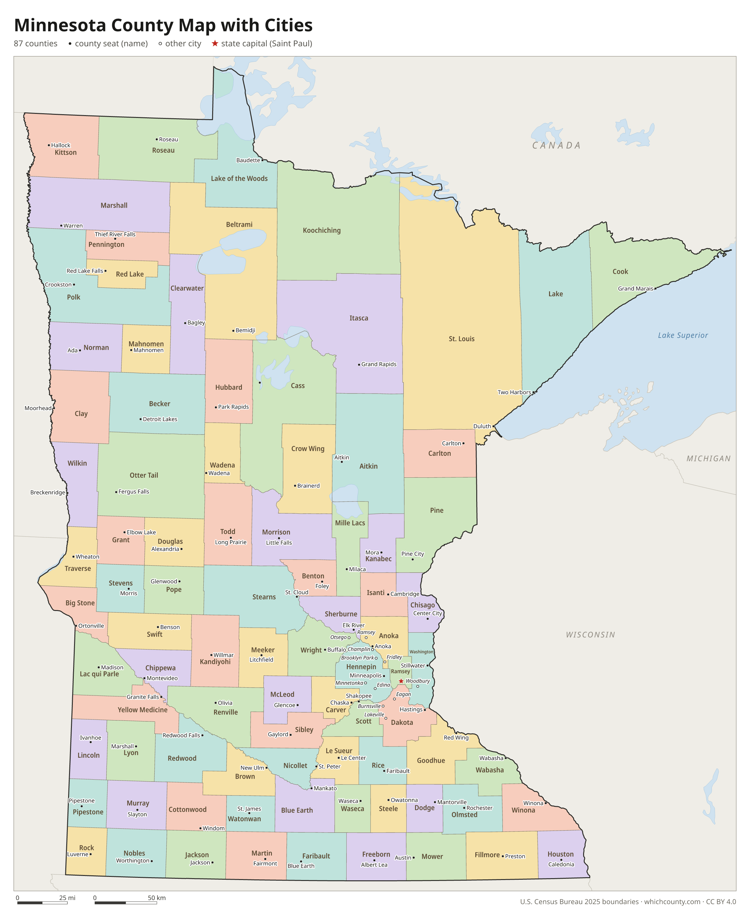
Minnesota county map with cities
The largest cities in Minnesota and the counties they are in. Cities that cross a county line list every county, the main one first. To find any smaller town, use the search box above.
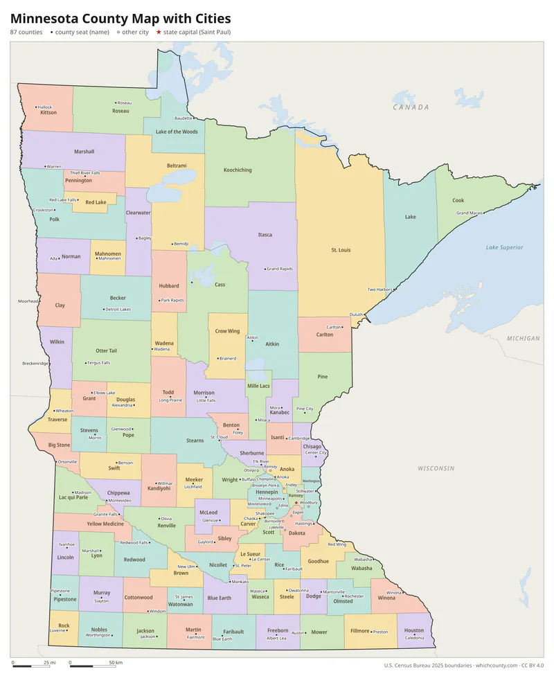
| City | County | Population 2025 |
|---|---|---|
| Minneapolis | Hennepin County | 430,324 |
| St. Paul | Ramsey County | 306,684 |
| Rochester | Olmsted County | 124,292 |
| Bloomington | Hennepin County | 89,034 |
| Duluth | St. Louis County | 88,330 |
| Brooklyn Park | Hennepin County | 83,543 |
| Woodbury | Washington County | 81,558 |
| Lakeville | Dakota County | 79,270 |
| Plymouth | Hennepin County | 78,942 |
| Blaine | Anoka and Ramsey counties | 76,603 |
| Maple Grove | Hennepin County | 73,893 |
| St. Cloud | Stearns, Sherburne and Benton counties | 72,647 |
| Eagan | Dakota County | 67,109 |
| Burnsville | Dakota County | 65,244 |
| Coon Rapids | Anoka County | 64,193 |
| Eden Prairie | Hennepin County | 63,075 |
| Apple Valley | Dakota County | 55,248 |
| Edina | Hennepin County | 54,356 |
| Minnetonka | Hennepin County | 53,969 |
| St. Louis Park | Hennepin County | 50,027 |
| Shakopee | Scott County | 49,366 |
| Moorhead | Clay County | 46,533 |
| Mankato | Blue Earth, Nicollet and Le Sueur counties | 46,529 |
| Cottage Grove | Washington County | 43,604 |
| Maplewood | Ramsey County | 40,717 |
| Inver Grove Heights | Dakota County | 36,873 |
| Richfield | Hennepin County | 36,593 |
| Roseville | Ramsey County | 35,663 |
| Andover | Anoka County | 33,874 |
| Savage | Scott County | 32,970 |
Printable Minnesota county maps (free PDF, PNG, SVG)
Every map is free to print and share. The PDFs are vector files with real text, so they stay sharp at any size and you can search them for a county name. Use 11×17 (tabloid) for the most readable labels.
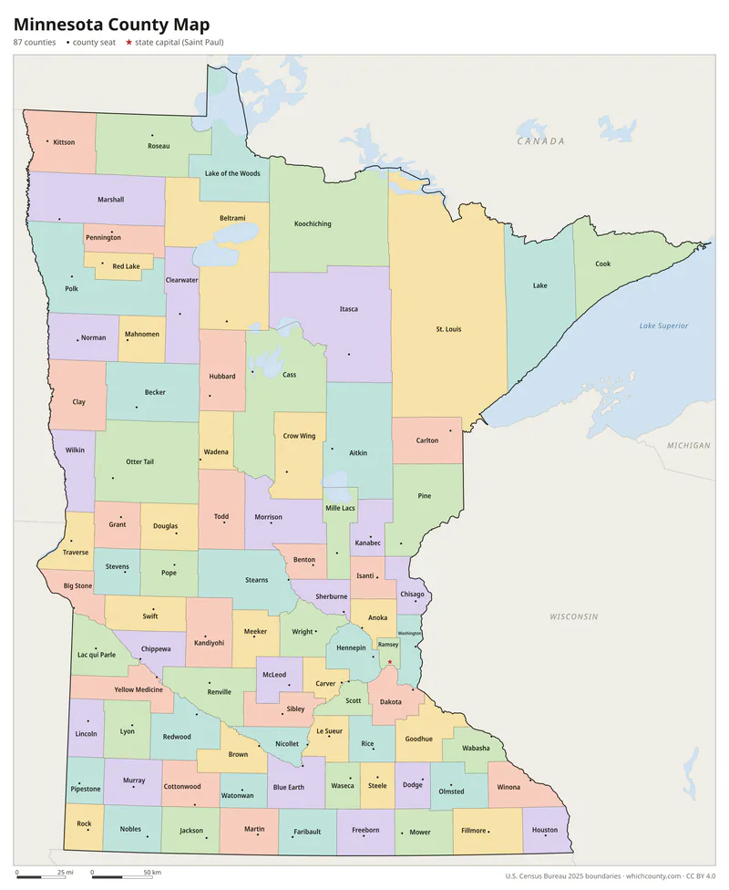
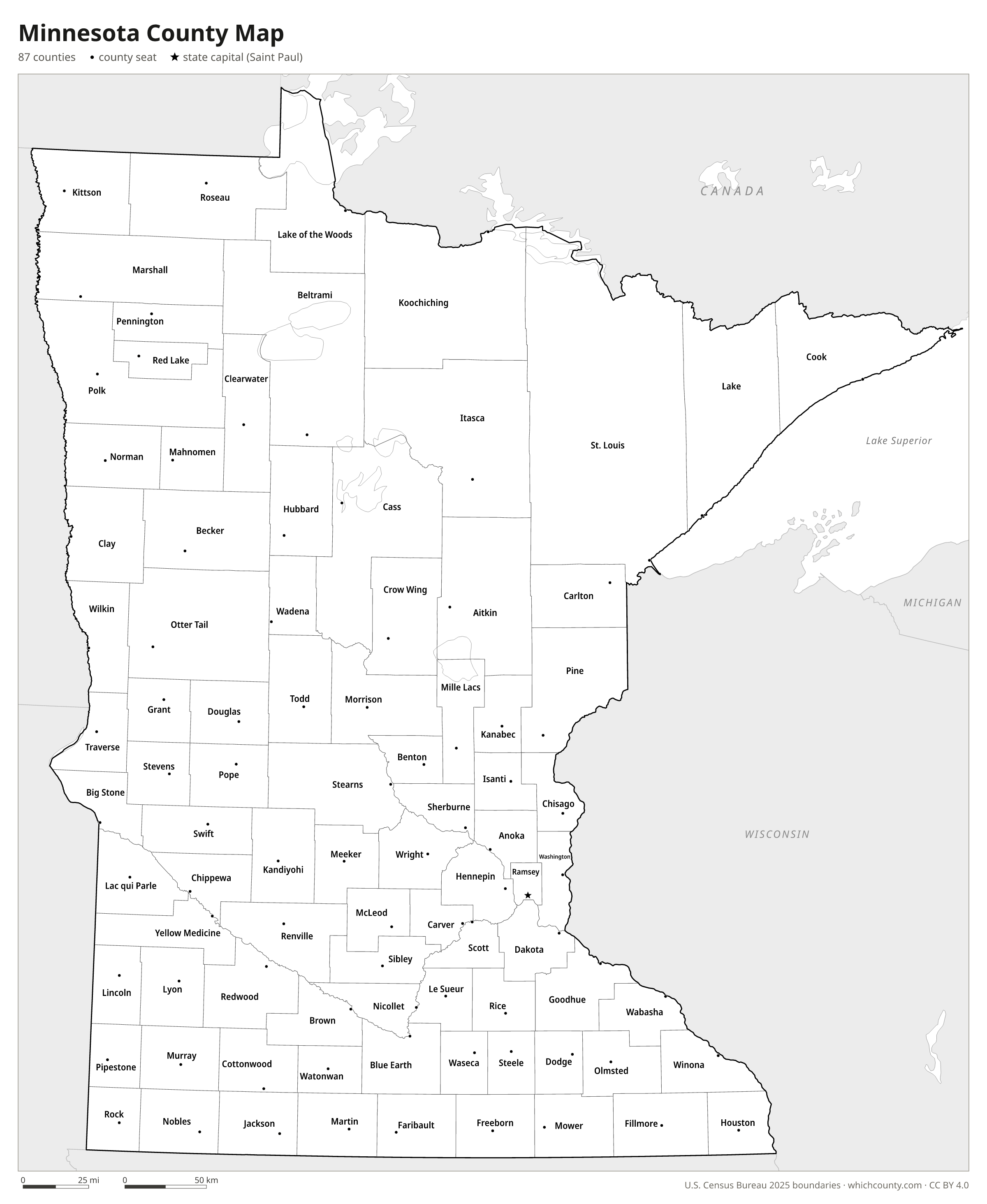
Color map with names
All 87 counties labeled, county seats marked. Letter and 11×17 PDF, high-resolution PNG, editable SVG.
Map with cities
Counties with their county seat towns and major cities.
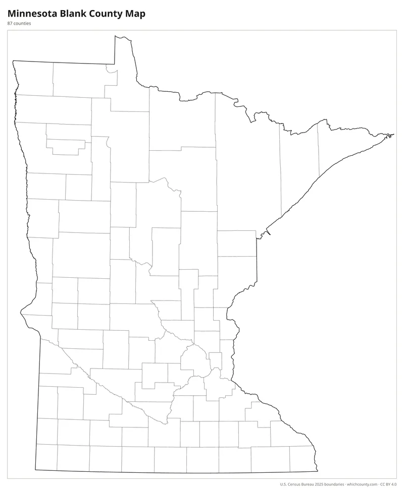
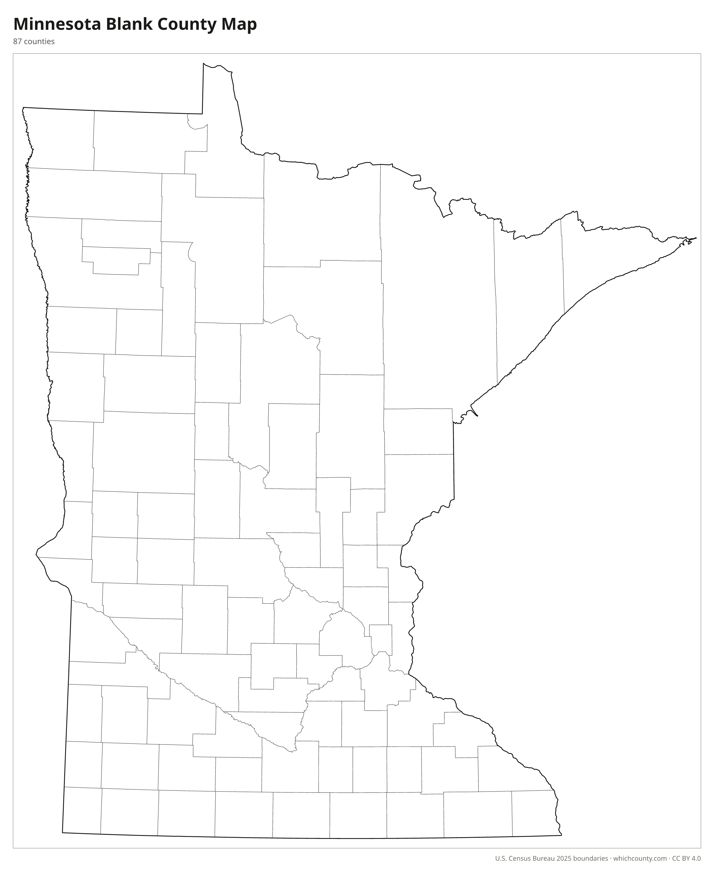
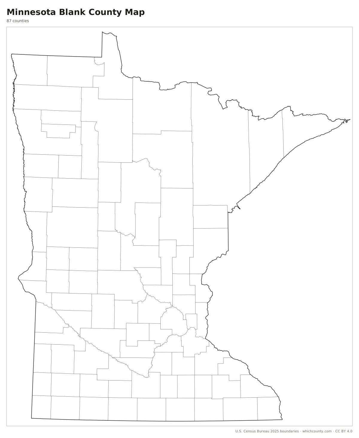
Blank outline map
County lines only, no names. For quizzes, coloring and your own notes.
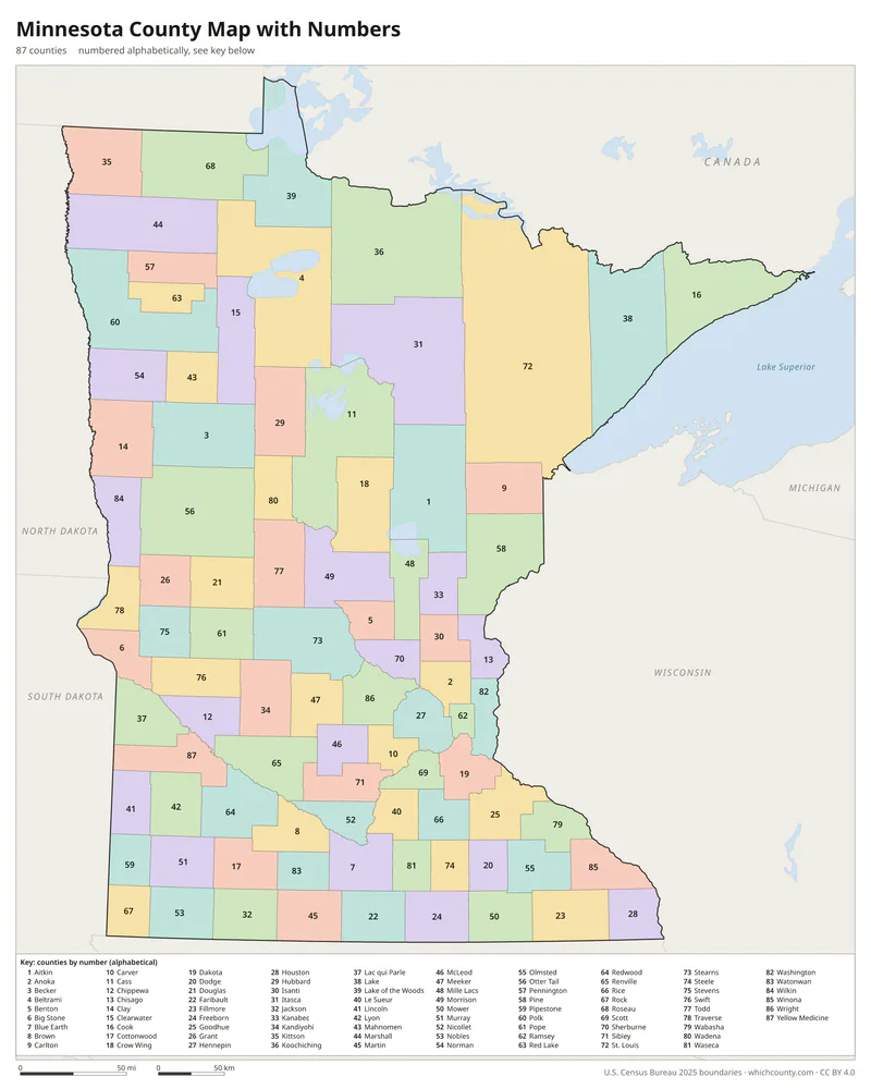
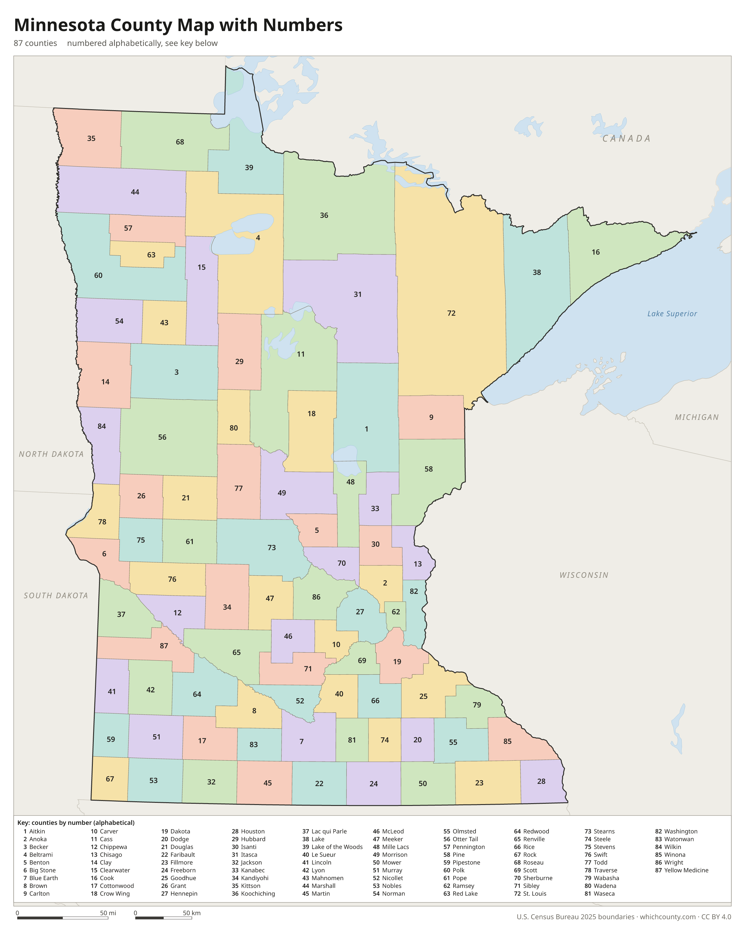
Numbered map with key
A number in every county with an alphabetical key.
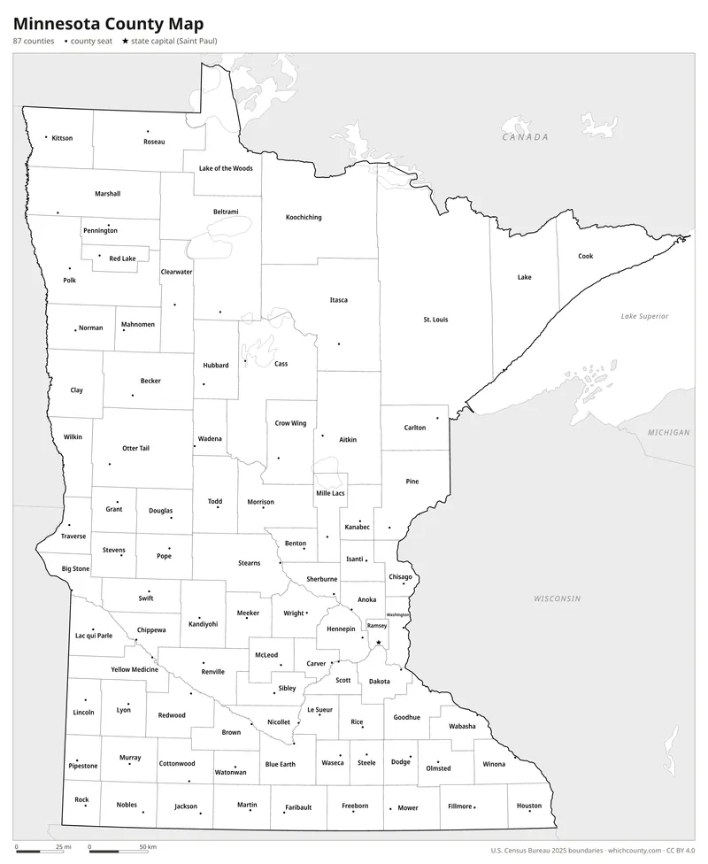
Black and white
Labeled map that prints well on any printer.
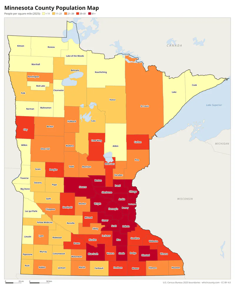
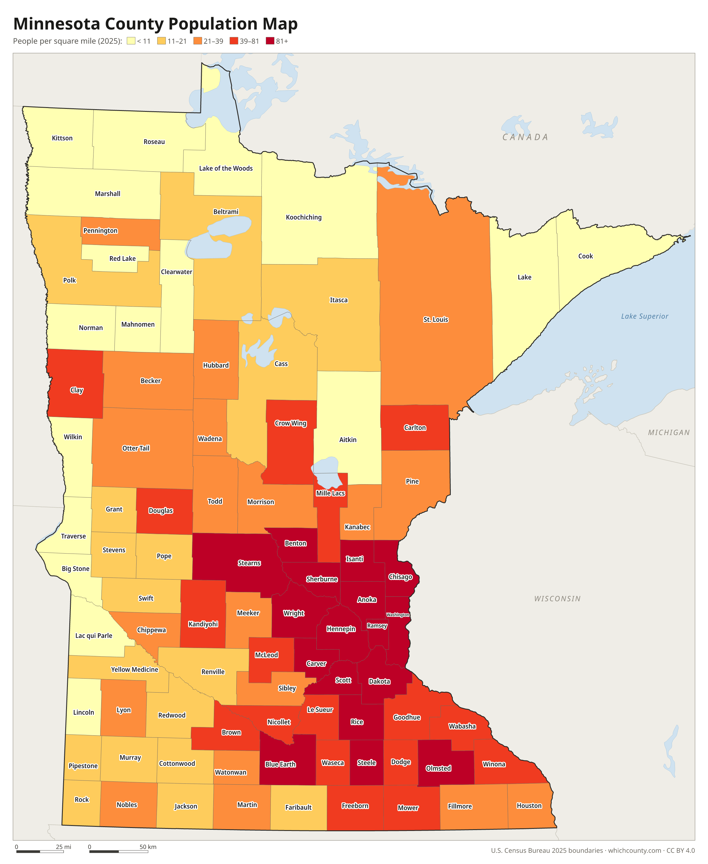
Population map
Counties shaded by population density (2025 estimates).
Data and GIS files
The county table as CSV, and the boundaries as GeoJSON and KML (Google Earth, Google My Maps).
How Minnesota's 87 counties were drawn
When Minnesota became a territory in 1849, it adopted the county and township government used by the territories to its east. On October 27, 1849, the territorial legislature created nine counties. Only Benton, Ramsey and Washington were fully organized; the other six were attached to them for court purposes. Two of the nine, Mahkahto and Wahnahta, were eliminated in 1851, and Pembina was renamed Kittson in 1878. The 1857 state constitution let the legislature create new counties but set a minimum of 400 square miles for each one. It also required a vote in the affected counties before the lines of an organized county changed or a county seat moved. Large northern counties were still being divided in the 20th century: Koochiching came out of Itasca in 1906, Pennington out of Red Lake in 1910, and Lake of the Woods out of Beltrami in 1922.
County maps of neighboring states
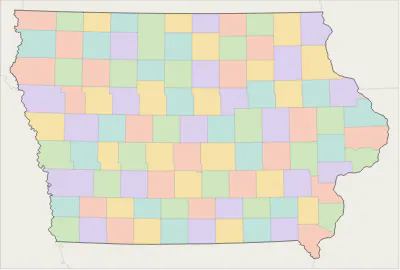 Iowa county map
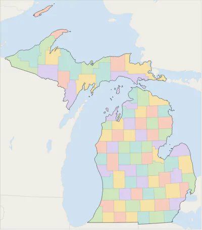 Michigan county map
 North Dakota county map
 South Dakota county map
 Wisconsin county map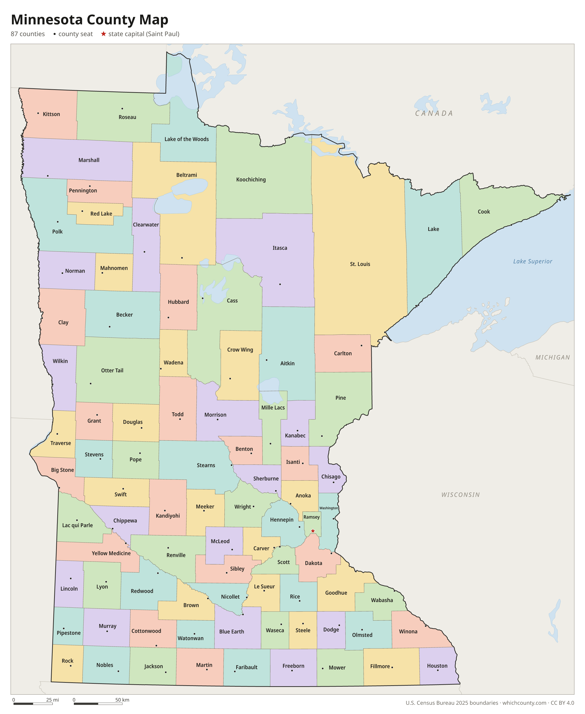
Minnesota counties: questions and answers
- How many counties are in Minnesota?
- Minnesota has 87 counties.
- What is the largest county in Minnesota?
- By land area, St. Louis County is the largest (6,248 sq mi). By population, Hennepin County is the largest, with 1,284,784 people (2025 estimate).
- What is the smallest county in Minnesota?
- Ramsey County is the smallest by land area (152.3 sq mi). Traverse County has the fewest people: 3,130 (2025 estimate).
- What is the wealthiest county in Minnesota?
- By median household income, Carver County ranks first with $125,946 (American Community Survey 2020–2024). The lowest is Mahnomen County at $59,441.
- What county is Minneapolis in?
- Minneapolis is in Hennepin County.
- What county is St. Paul in?
- St. Paul is in Ramsey County.
- What county is Rochester in?
- Rochester is in Olmsted County.
- What county is Saint Paul in?
- Saint Paul, the state capital, is in Ramsey County.
- How can I see county lines on Google Maps?
- Google Maps does not draw county lines. Download the KML file from the printable maps section above and import it into Google My Maps (Create a new map › Import) or open it in Google Earth to see every Minnesota county boundary on top of Google's map.
- Can I use this map for free?
- Yes. The maps and files on this page are free to print, share and use in your own work, including commercial projects, under the CC BY 4.0 licence. Please credit “WhichCounty (whichcounty.com)”.
Use this map on your site
You may copy, print and publish these maps, also commercially, as long as you credit WhichCounty with a link (licence details). Paste this code to embed the map:
Sources and methodology
- Boundaries: U.S. Census Bureau, 2025 Cartographic Boundary Files (1:500,000), simplified for display. Projection: Lambert conformal conic fitted to Minnesota.
- Population: Census Bureau county estimates, Vintage 2025 (July 1, 2025), compared with the April 1, 2020 estimates base.
- Land area: Census Bureau 2026 Gazetteer files. Median household income: American Community Survey 2020–2024 5-year estimates.
- County seats and founding years: Wikidata (CC0), checked against state lists by WhichCounty. Cities: Census Bureau city and town estimates, Vintage 2025.
- Minnesota Legislative Manual 2023-2024, Chapter Seven: Local Government (Minnesota Secretary of State)
- Minnesota Constitution of 1857, Article 11, transcript (Minnesota Historical Society)
- Lake of the Woods County Courthouse History (Minnesota Judicial Branch)
- Atlas of Historical County Boundaries: Minnesota (Newberry Library)
Found an error? Tell us. Last data update: October 4, 2026.