Tennessee County Map
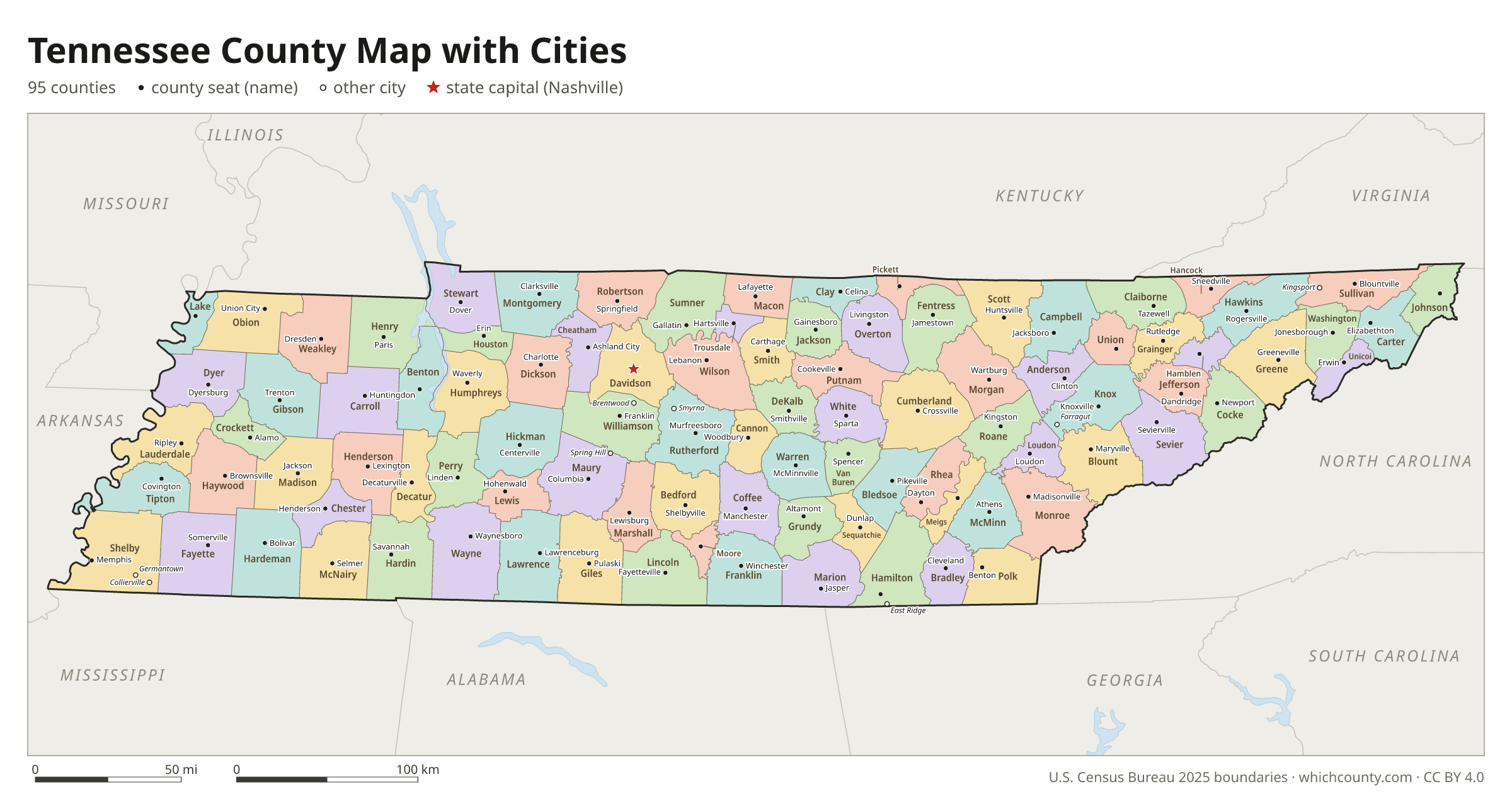
All 95 counties with county seats and major cities
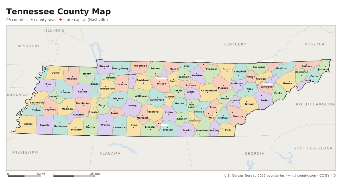
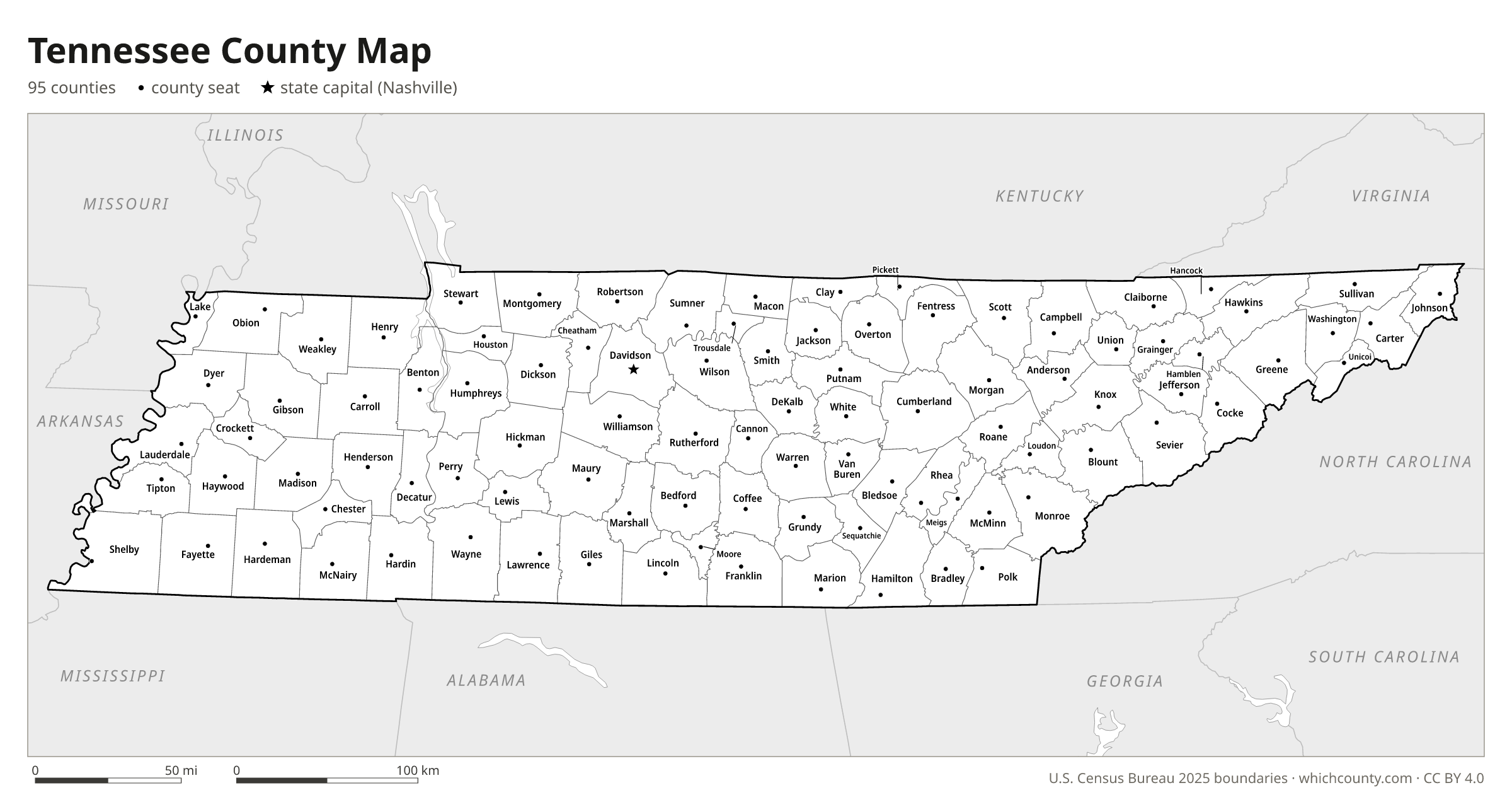
Tennessee has 95 counties, each assigned by state law to one of three Grand Divisions: East, Middle and West Tennessee. This map shows all 95 counties and their county seats. Tap a county for details, or download the free printable map below.

Updated October 4, 2026 · Boundaries: U.S. Census Bureau 2025 · Population: Census estimates for July 1, 2025
Tennessee county facts
- Number of counties
- 95
- Largest by land area
- Shelby County 753 sq mi
- Smallest by land area
- Trousdale County 114.3 sq mi
- Most people
- Shelby County 910,226
- Fewest people
- Pickett County 5,219
- Fastest growing since 2020
- Wilson County +18.5%
- Highest median household income
- Williamson County $135,594
- Oldest county
- Washington County est. 1777
- Newest county
- Chester County est. 1882
- State capital
- Nashville Davidson County
Nashville and Davidson County have had a single Metropolitan Government since 1963.
Moore County was cut to 129 square miles after Lincoln County sued: the 1871 boundaries had left Lincoln below the constitutional minimum of 275 square miles.
List of 95 Tennessee counties
Sorted A–Z. Click a column to sort, or a name to show it on the map. Download as CSV
| County | County seat | Population 2025 | Change since 2020 | Land area (sq mi) | Median income | Established | FIPS |
|---|---|---|---|---|---|---|---|
| Anderson County | Clinton | 82,066 | +6.3% | 337 | $66,183 | 1801 | 47001 |
| Bedford County | Shelbyville | 55,273 | +10% | 474 | $67,225 | 1807 | 47003 |
| Benton County | Camden | 16,183 | +2.1% | 394 | $51,746 | 1836 | 47005 |
| Bledsoe County | Pikeville | 15,920 | +6.8% | 407 | $54,720 | 1807 | 47007 |
| Blount County | Maryville | 143,820 | +6.3% | 559 | $77,365 | 1795 | 47009 |
| Bradley County | Cleveland | 115,465 | +6.3% | 329 | $66,552 | 1836 | 47011 |
| Campbell County | Jacksboro | 40,290 | +2.6% | 480 | $51,557 | 1806 | 47013 |
| Cannon County | Woodbury | 15,296 | +5.4% | 266 | $59,443 | 1836 | 47015 |
| Carroll County | Huntingdon | 29,200 | +2.7% | 598 | $51,787 | 1821 | 47017 |
| Carter County | Elizabethton | 57,361 | +1.8% | 341 | $50,135 | 1796 | 47019 |
| Cheatham County | Ashland City | 42,778 | +4.3% | 303 | $89,852 | 1856 | 47021 |
| Chester County | Henderson | 17,994 | +3.7% | 286 | $59,341 | 1882 | 47023 |
| Claiborne County | Tazewell | 33,229 | +3.7% | 435 | $49,379 | 1801 | 47025 |
| Clay County | Celina | 7,821 | +3.2% | 237 | $39,972 | 1870 | 47027 |
| Cocke County | Newport | 37,889 | +5.3% | 436 | $48,016 | 1797 | 47029 |
| Coffee County | Manchester | 62,419 | +7.9% | 429 | $61,505 | 1836 | 47031 |
| Crockett County | Alamo | 14,006 | +0.7% | 266 | $62,165 | 1871 | 47033 |
| Cumberland County | Crossville | 66,300 | +8.4% | 681 | $60,375 | 1855 | 47035 |
| Davidson County | Nashville | 745,904 | +4.2% | 504 | $77,853 | 1783 | 47037 |
| DeKalb County | Smithville | 21,873 | +9% | 304 | $53,153 | 1837 | 47041 |
| Decatur County | Decaturville | 11,820 | +3.4% | 334 | $45,375 | 1845 | 47039 |
| Dickson County | Charlotte | 58,662 | +8% | 490 | $75,003 | 1803 | 47043 |
| Dyer County | Dyersburg | 36,320 | −1.3% | 512 | $58,154 | 1823 | 47045 |
| Fayette County | Somerville | 45,071 | +8% | 704 | $88,456 | 1824 | 47047 |
| Fentress County | Jamestown | 20,322 | +9.9% | 499 | $51,149 | 1823 | 47049 |
| Franklin County | Winchester | 45,579 | +6.6% | 555 | $63,494 | 1807 | 47051 |
| Gibson County | Trenton | 51,779 | +2.7% | 603 | $62,755 | 1823 | 47053 |
| Giles County | Pulaski | 31,433 | +3.6% | 611 | $62,307 | 1809 | 47055 |
| Grainger County | Rutledge | 25,739 | +9.4% | 281 | $50,538 | 1796 | 47057 |
| Greene County | Greeneville | 73,831 | +5.2% | 622 | $56,194 | 1783 | 47059 |
| Grundy County | Altamont | 14,116 | +4.4% | 360 | $47,593 | 1844 | 47061 |
| Hamblen County | Morristown | 68,843 | +6.7% | 161 | $55,454 | 1870 | 47063 |
| Hamilton County | Chattanooga | 390,833 | +6.5% | 542 | $76,183 | 1819 | 47065 |
| Hancock County | Sneedville | 7,075 | +6.2% | 222 | $34,960 | 1844 | 47067 |
| Hardeman County | Bolivar | 25,274 | −0.7% | 668 | $46,069 | 1823 | 47069 |
| Hardin County | Savannah | 27,983 | +3.8% | 578 | $49,956 | 1819 | 47071 |
| Hawkins County | Rogersville | 59,559 | +5% | 487 | $56,936 | 1786 | 47073 |
| Haywood County | Brownsville | 17,042 | −4.6% | 533 | $50,472 | 1823 | 47075 |
| Henderson County | Lexington | 28,518 | +2.4% | 520 | $55,136 | 1821 | 47077 |
| Henry County | Paris | 32,896 | +2.2% | 562 | $50,613 | 1821 | 47079 |
| Hickman County | Centerville | 26,219 | +5.3% | 613 | $68,247 | 1807 | 47081 |
| Houston County | Erin | 8,479 | +2.5% | 200 | $59,576 | 1871 | 47083 |
| Humphreys County | Waverly | 19,646 | +3.5% | 531 | $60,616 | 1809 | 47085 |
| Jackson County | Gainesboro | 12,466 | +7.3% | 309 | $47,951 | 1801 | 47087 |
| Jefferson County | Dandridge | 60,024 | +9.8% | 275 | $66,114 | 1792 | 47089 |
| Johnson County | Mountain City | 18,718 | +4.3% | 298 | $53,129 | 1836 | 47091 |
| Knox County | Knoxville | 511,453 | +6.8% | 508 | $74,222 | 1792 | 47093 |
| Lake County | Tiptonville | 6,249 | −10.7% | 166 | $28,814 | 1870 | 47095 |
| Lauderdale County | Ripley | 24,617 | −2.1% | 472 | $49,879 | 1835 | 47097 |
| Lawrence County | Lawrenceburg | 46,914 | +6.2% | 617 | $54,706 | 1817 | 47099 |
| Lewis County | Hohenwald | 13,487 | +7.2% | 282 | $56,285 | 1843 | 47101 |
| Lincoln County | Fayetteville | 36,853 | +4.3% | 570 | $64,667 | 1809 | 47103 |
| Loudon County | Loudon | 63,764 | +16.2% | 229 | $84,185 | 1870 | 47105 |
| Macon County | Lafayette | 27,663 | +9.7% | 307 | $59,177 | 1842 | 47111 |
| Madison County | Jackson | 100,790 | +2% | 557 | $60,042 | 1821 | 47113 |
| Marion County | Jasper | 29,804 | +3.3% | 498 | $61,824 | 1817 | 47115 |
| Marshall County | Lewisburg | 38,071 | +10.9% | 376 | $71,049 | 1836 | 47117 |
| Maury County | Columbia | 118,131 | +17% | 613 | $76,130 | 1807 | 47119 |
| McMinn County | Athens | 57,404 | +7.8% | 430 | $61,470 | 1819 | 47107 |
| McNairy County | Selmer | 26,236 | +1.4% | 563 | $53,473 | 1823 | 47109 |
| Meigs County | Decatur | 14,186 | +11.2% | 195 | $61,375 | 1836 | 47121 |
| Monroe County | Madisonville | 49,730 | +7.5% | 636 | $56,895 | 1819 | 47123 |
| Montgomery County | Clarksville | 249,935 | +13.6% | 539 | $75,613 | 1796 | 47125 |
| Moore County | Lynchburg | 6,920 | +7% | 129 | $66,469 | 1871 | 47127 |
| Morgan County | Wartburg | 22,160 | +5.3% | 522 | $65,954 | 1817 | 47129 |
| Obion County | Union City | 30,067 | −2.4% | 545 | $54,613 | 1823 | 47131 |
| Overton County | Livingston | 23,787 | +5.7% | 434 | $48,959 | 1806 | 47133 |
| Perry County | Linden | 9,126 | +8.9% | 415 | $55,972 | 1819 | 47135 |
| Pickett County | Byrdstown | 5,219 | +4.3% | 163 | $49,030 | 1879 | 47137 |
| Polk County | Benton | 18,592 | +6% | 435 | $62,522 | 1839 | 47139 |
| Putnam County | Cookeville | 86,612 | +8.4% | 401 | $58,912 | 1854 | 47141 |
| Rhea County | Dayton | 34,844 | +4.8% | 316 | $55,033 | 1807 | 47143 |
| Roane County | Kingston | 57,395 | +7.2% | 361 | $71,885 | 1801 | 47145 |
| Robertson County | Springfield | 80,175 | +10.1% | 476 | $83,047 | 1796 | 47147 |
| Rutherford County | Murfreesboro | 386,352 | +13.1% | 620 | $85,470 | 1803 | 47149 |
| Scott County | Huntsville | 22,671 | +3.8% | 532 | $44,711 | 1849 | 47151 |
| Sequatchie County | Dunlap | 17,861 | +12.9% | 266 | $58,750 | 1857 | 47153 |
| Sevier County | Sevierville | 101,342 | +2.7% | 593 | $62,581 | 1794 | 47155 |
| Shelby County | Memphis | 910,226 | −2.1% | 753 | $63,767 | 1819 | 47157 |
| Smith County | Carthage | 20,981 | +5.4% | 314 | $66,293 | 1799 | 47159 |
| Stewart County | Dover | 14,439 | +5.7% | 460 | $63,114 | 1803 | 47161 |
| Sullivan County | Blountville | 163,759 | +3.6% | 414 | $58,807 | 1779 | 47163 |
| Sumner County | Gallatin | 215,538 | +9.8% | 530 | $90,301 | 1786 | 47165 |
| Tipton County | Covington | 62,287 | +2.2% | 456 | $74,127 | 1823 | 47167 |
| Trousdale County | Hartsville | 12,623 | +8.8% | 114 | $72,747 | 1870 | 47169 |
| Unicoi County | Erwin | 17,856 | −0.3% | 186 | $52,218 | 1875 | 47171 |
| Union County | Maynardville | 21,450 | +8.3% | 224 | $62,727 | 1850 | 47173 |
| Van Buren County | Spencer | 6,874 | +11.5% | 273 | $54,931 | 1840 | 47175 |
| Warren County | McMinnville | 43,717 | +6.8% | 433 | $55,487 | 1807 | 47177 |
| Washington County | Jonesborough | 141,199 | +6.2% | 327 | $62,809 | 1777 | 47179 |
| Wayne County | Waynesboro | 16,416 | +1.2% | 734 | $52,294 | 1817 | 47181 |
| Weakley County | Dresden | 33,261 | +1.1% | 580 | $51,880 | 1823 | 47183 |
| White County | Sparta | 29,612 | +8.3% | 377 | $52,188 | 1806 | 47185 |
| Williamson County | Franklin | 272,061 | +9.8% | 583 | $135,594 | 1799 | 47187 |
| Wilson County | Lebanon | 175,033 | +18.5% | 571 | $95,839 | 1799 | 47189 |
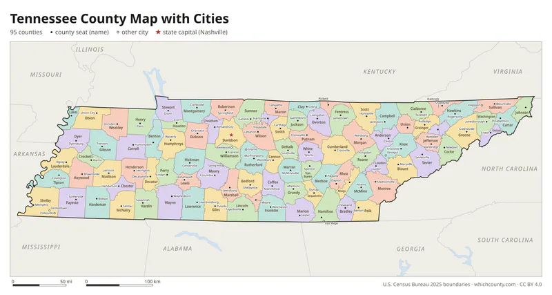
Tennessee county map with cities
The largest cities in Tennessee and the counties they are in. Cities that cross a county line list every county, the main one first. To find any smaller town, use the search box above.
| City | County | Population 2025 |
|---|---|---|
| Nashville | Davidson County | 721,074 |
| Memphis | Shelby County | 609,647 |
| Knoxville | Knox County | 202,021 |
| Chattanooga | Hamilton County | 194,144 |
| Clarksville | Montgomery County | 188,829 |
| Murfreesboro | Rutherford County | 171,178 |
| Franklin | Williamson County | 90,226 |
| Johnson City | Washington, Carter and Sullivan counties | 74,943 |
| Jackson | Madison County | 69,339 |
| Hendersonville | Sumner County | 64,266 |
| Smyrna | Rutherford and Williamson counties | 63,321 |
| Spring Hill | Williamson and Maury counties | 61,336 |
| Kingsport | Sullivan and Hawkins counties | 57,530 |
| Bartlett | Shelby County | 56,416 |
| Gallatin | Sumner County | 54,590 |
| Lebanon | Wilson County | 53,412 |
| Collierville | Shelby County | 51,909 |
| Cleveland | Bradley County | 51,172 |
| Columbia | Maury County | 50,072 |
| Brentwood | Williamson County | 45,313 |
| Mount Juliet | Wilson County | 45,172 |
| La Vergne | Rutherford County | 42,146 |
| Germantown | Shelby County | 40,001 |
| Cookeville | Putnam County | 38,212 |
| Oak Ridge | Anderson and Roane counties | 35,395 |
| Morristown | Hamblen and Jefferson counties | 33,517 |
| Maryville | Blount County | 32,442 |
| Bristol | Sullivan County | 28,107 |
| Shelbyville | Bedford County | 26,146 |
| Farragut | Knox and Loudon counties | 25,121 |
Printable Tennessee county maps (free PDF, PNG, SVG)
Every map is free to print and share. The PDFs are vector files with real text, so they stay sharp at any size and you can search them for a county name. Use 11×17 (tabloid) for the most readable labels.
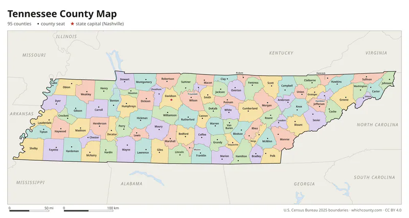
Color map with names
All 95 counties labeled, county seats marked. Letter and 11×17 PDF, high-resolution PNG, editable SVG.
Map with cities
Counties with their county seat towns and major cities.
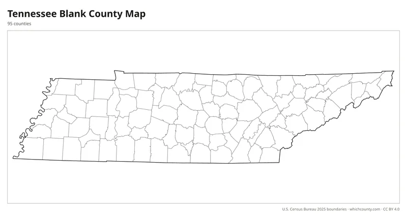
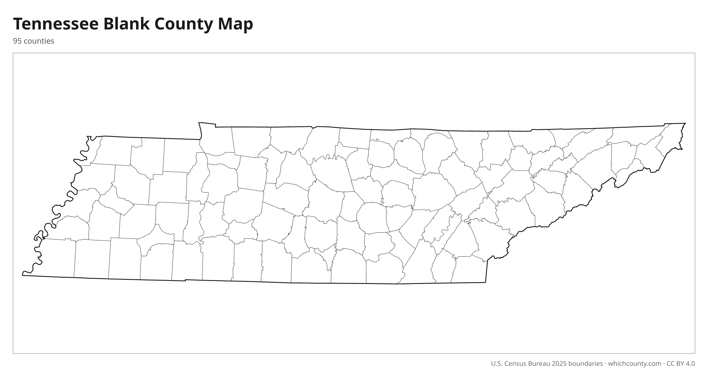
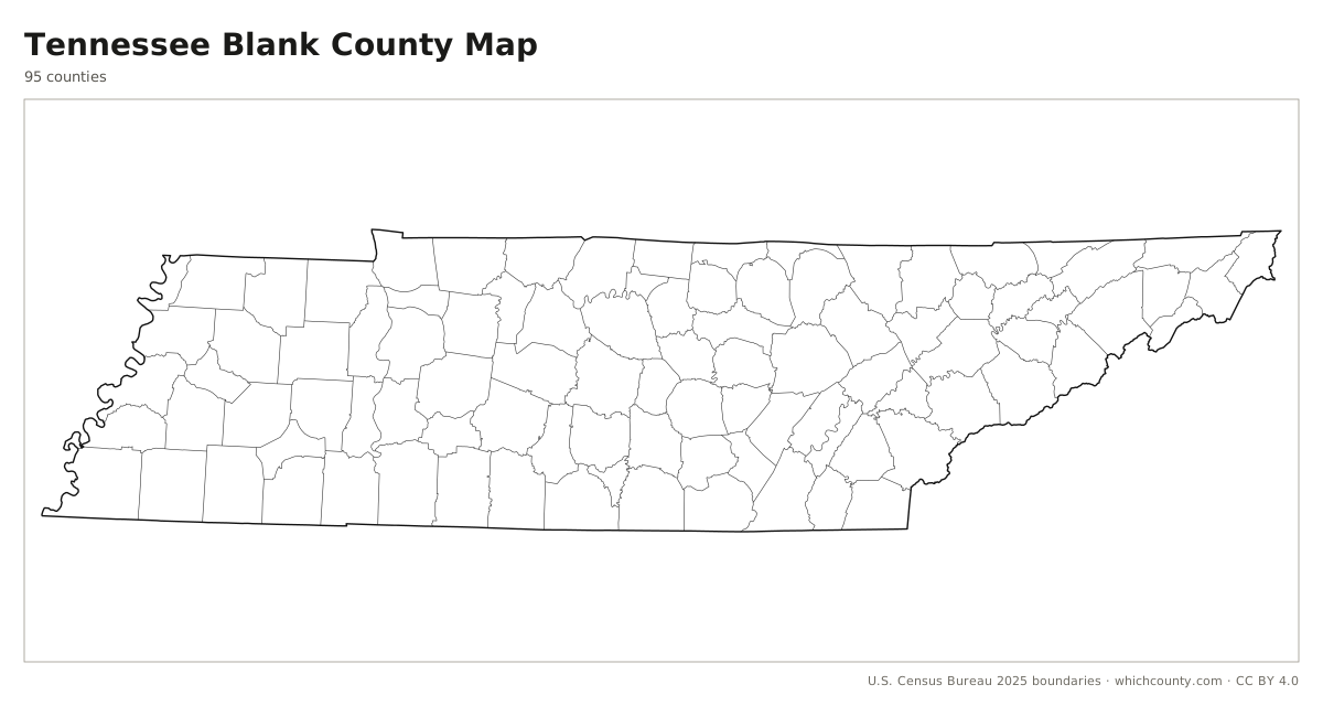
Blank outline map
County lines only, no names. For quizzes, coloring and your own notes.
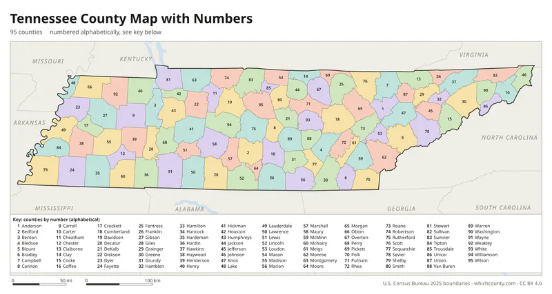
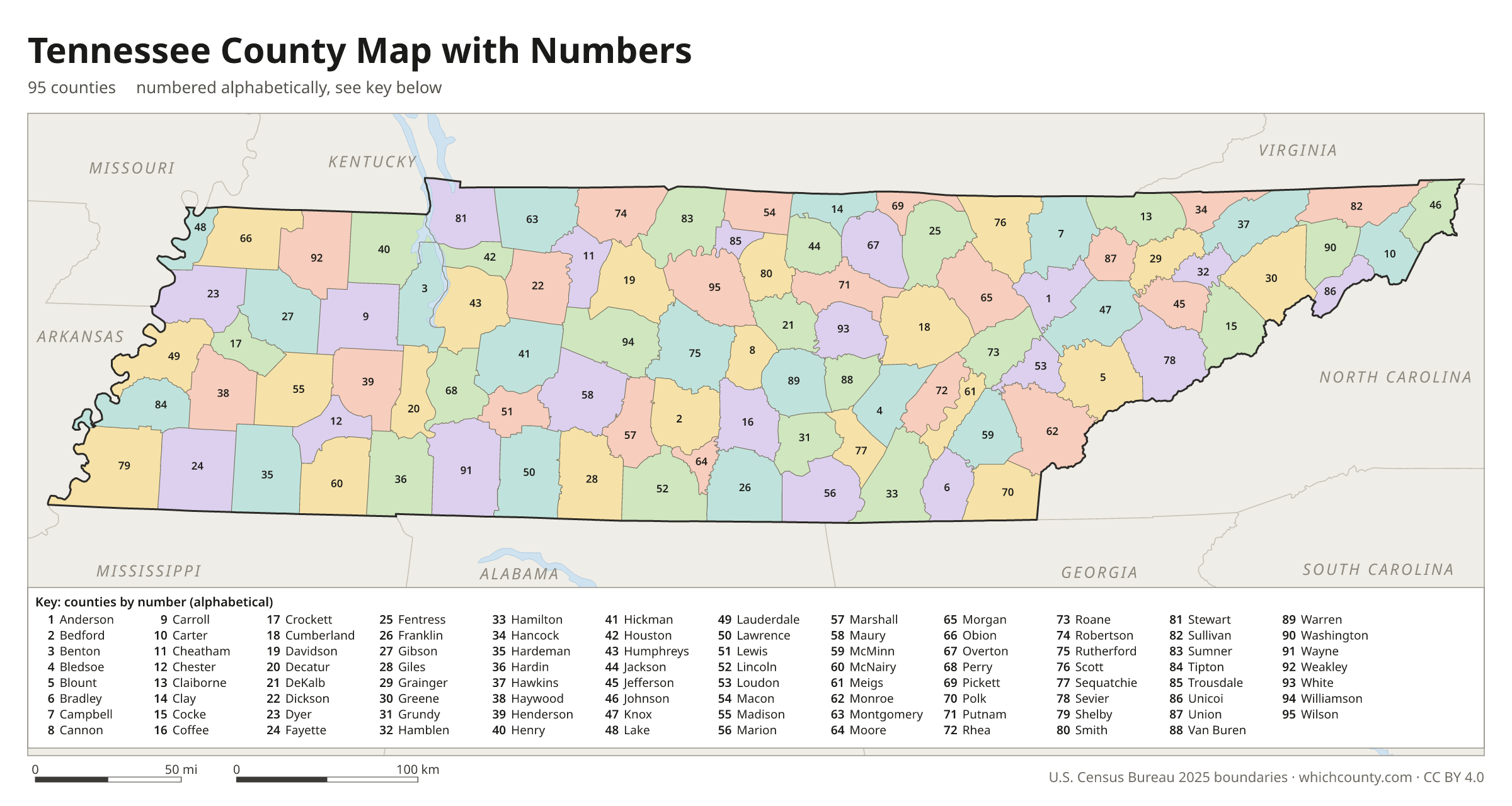
Numbered map with key
A number in every county with an alphabetical key.
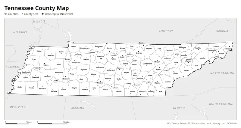
Black and white
Labeled map that prints well on any printer.
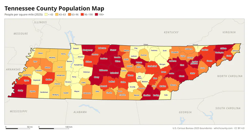
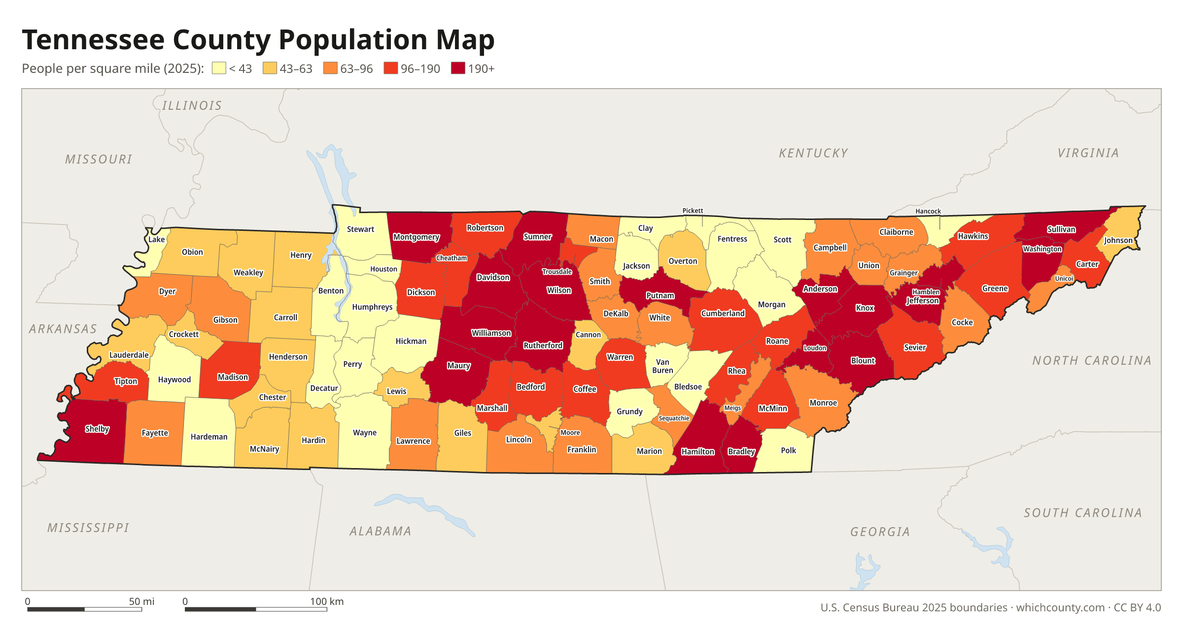
Population map
Counties shaded by population density (2025 estimates).
Data and GIS files
The county table as CSV, and the boundaries as GeoJSON and KML (Google Earth, Google My Maps).
How Tennessee was divided into 95 counties
Tennessee's first county, Washington, was established by the North Carolina legislature in November 1777 and took in the whole territory of the future state. During Governor Joseph McMinn's terms (1815-1821), the Chickasaw Purchase opened West Tennessee to settlement, and fourteen new counties were carved out of newly acquired land. Residents pushed for new counties when distance and bad roads kept the courts out of reach; the founders of Moore County made that case in 1871. The Constitution of 1870 slowed the process: no county may be smaller than 275 square miles, and no new county line may come within 11 miles of an old county's courthouse. Chester County, created in March 1879 on land first set aside in 1875 for a Wisdom County that was never organized, was the last.
County numbers: The Comptroller numbers the counties 01–95 in alphabetical order (Mc names filed as Mac), and the numbers are used in sales tax location codes.
Regions of Tennessee
Tennessee's counties grouped into the 3 Grand Divisions of Tennessee (source).
East Tennessee
Anderson, Bledsoe, Blount, Bradley, Campbell, Claiborne, Carter, Cocke, Cumberland, Grainger, Greene, Hamblen, Hamilton, Hancock, Hawkins, Jefferson, Johnson, Knox, Loudon, Marion, McMinn, Meigs, Monroe, Morgan, Polk, Rhea, Roane, Scott, Sevier, Sullivan, Unicoi, Union, Washington
Middle Tennessee
Bedford, Cannon, Cheatham, Clay, Coffee, Davidson, DeKalb, Dickson, Fentress, Franklin, Giles, Grundy, Hickman, Houston, Humphreys, Jackson, Lawrence, Lewis, Lincoln, Macon, Marshall, Maury, Montgomery, Moore, Overton, Perry, Pickett, Putnam, Robertson, Rutherford, Sequatchie, Smith, Stewart, Sumner, Trousdale, Van Buren, Warren, Wayne, White, Williamson, Wilson
West Tennessee
Benton, Carroll, Chester, Crockett, Decatur, Dyer, Fayette, Gibson, Hardeman, Hardin, Haywood, Henderson, Henry, Lake, Lauderdale, Madison, McNairy, Obion, Shelby, Tipton, Weakley
County maps of neighboring states
 Alabama county map
 Arkansas county map
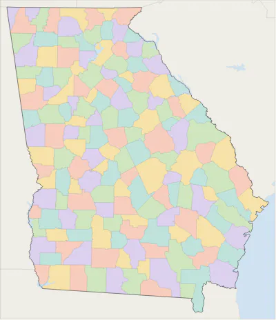 Georgia county map
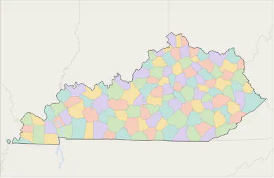 Kentucky county map
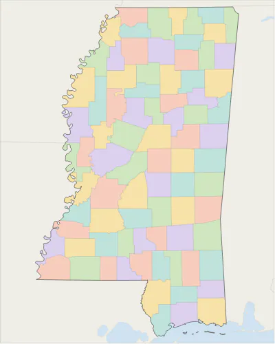 Mississippi county map
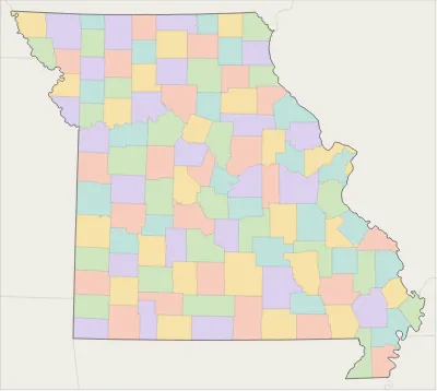 Missouri county map
 North Carolina county map
 Virginia county map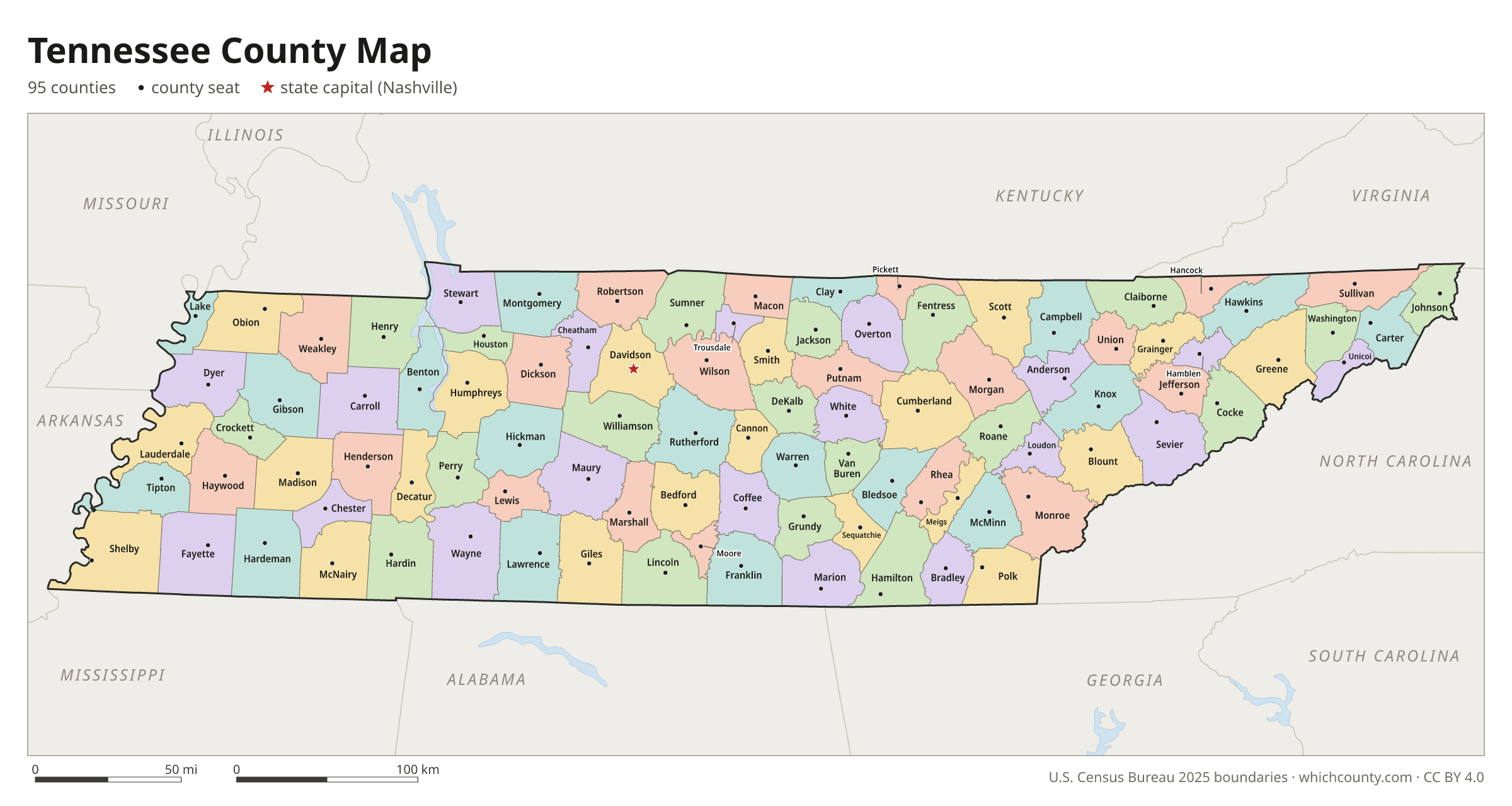
Tennessee counties: questions and answers
- How many counties are in Tennessee?
- Tennessee has 95 counties.
- What is the largest county in Tennessee?
- By land area, Shelby County is the largest (753 sq mi). By population, Shelby County is the largest, with 910,226 people (2025 estimate).
- What is the smallest county in Tennessee?
- Trousdale County is the smallest by land area (114.3 sq mi). Pickett County has the fewest people: 5,219 (2025 estimate).
- What is the wealthiest county in Tennessee?
- By median household income, Williamson County ranks first with $135,594 (American Community Survey 2020–2024). The lowest is Lake County at $28,814.
- What county is Nashville in?
- Nashville is in Davidson County.
- What county is Memphis in?
- Memphis is in Shelby County.
- What county is Knoxville in?
- Knoxville is in Knox County.
- How can I see county lines on Google Maps?
- Google Maps does not draw county lines. Download the KML file from the printable maps section above and import it into Google My Maps (Create a new map › Import) or open it in Google Earth to see every Tennessee county boundary on top of Google's map.
- Can I use this map for free?
- Yes. The maps and files on this page are free to print, share and use in your own work, including commercial projects, under the CC BY 4.0 licence. Please credit “WhichCounty (whichcounty.com)”.
Use this map on your site
You may copy, print and publish these maps, also commercially, as long as you credit WhichCounty with a link (licence details). Paste this code to embed the map:
Sources and methodology
- Boundaries: U.S. Census Bureau, 2025 Cartographic Boundary Files (1:500,000), simplified for display. Projection: Lambert conformal conic fitted to Tennessee.
- Population: Census Bureau county estimates, Vintage 2025 (July 1, 2025), compared with the April 1, 2020 estimates base.
- Land area: Census Bureau 2026 Gazetteer files. Median household income: American Community Survey 2020–2024 5-year estimates.
- County seats and founding years: Wikidata (CC0), checked against state lists by WhichCounty. Cities: Census Bureau city and town estimates, Vintage 2025.
- Washington County (Tennessee Encyclopedia, Tennessee Historical Society)
- Chester County (Tennessee Encyclopedia)
- Moore County (Tennessee Encyclopedia)
- Tennessee Blue Book 2025-2026: Tennessee State (Tennessee Secretary of State)
- Davidson County (Tennessee Encyclopedia)
Found an error? Tell us. Last data update: October 4, 2026.