New Mexico County Map
All 33 counties with county seats and major cities
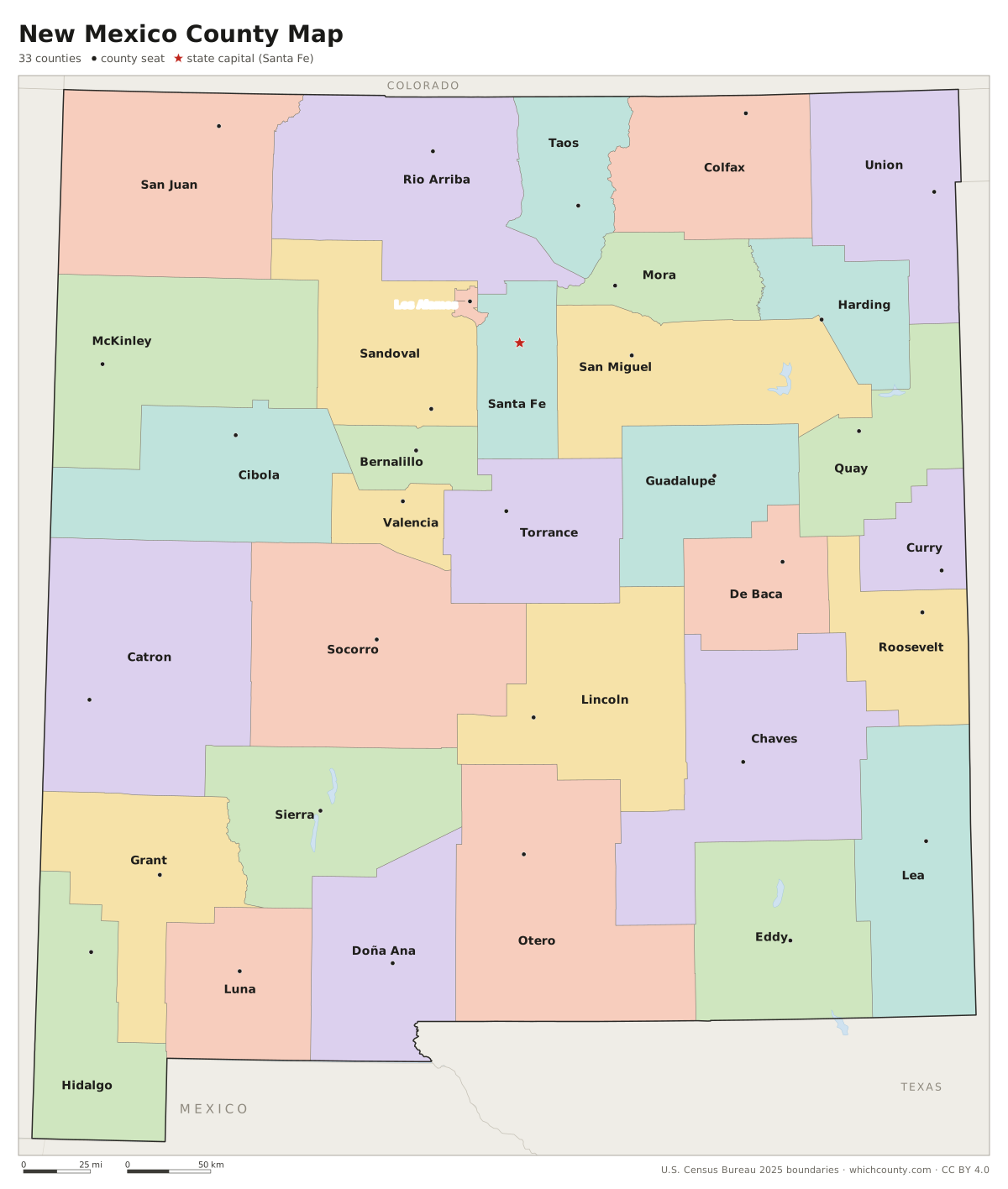
New Mexico has 33 counties, the smallest of which, Los Alamos, covers just 109 square miles. This map shows all 33 counties and their county seats. Tap a county for details, or download the free printable map below.

Updated October 4, 2026 · Boundaries: U.S. Census Bureau 2025 · Population: Census estimates for July 1, 2025
New Mexico county facts
- Number of counties
- 33
- Largest by land area
- Catron County 6,924 sq mi
- Smallest by land area
- Los Alamos County 109.1 sq mi
- Most people
- Bernalillo County 667,601
- Fewest people
- Harding County 617
- Fastest growing since 2020
- Valencia County +7.4%
- Highest median household income
- Los Alamos County $147,139
- Oldest county
- Bernalillo County est. 1852
- Newest county
- Cibola County est. 1981
- State capital
- Santa Fe Santa Fe County
Los Alamos County is an incorporated county. A special provision of the state constitution gives it both county and municipal powers, and it is governed under a home rule charter by a seven-member County Council.
List of 33 New Mexico counties
Sorted A–Z. Click a column to sort, or a name to show it on the map. Download as CSV
| County | County seat | Population 2025 | Change since 2020 | Land area (sq mi) | Median income | Established | FIPS |
|---|---|---|---|---|---|---|---|
| Bernalillo County | Albuquerque | 667,601 | −1.3% | 1,162 | $69,473 | 1852 | 35001 |
| Catron County | Reserve | 3,827 | +6.9% | 6,924 | $49,864 | 1921 | 35003 |
| Chaves County | Roswell | 63,364 | −2.8% | 6,067 | $52,938 | 1889 | 35005 |
| Cibola County | Grants | 26,807 | −0.9% | 4,540 | $50,759 | 1981 | 35006 |
| Colfax County | Raton | 12,184 | −1.6% | 3,758 | $53,554 | 1869 | 35007 |
| Curry County | Clovis | 46,655 | −3.7% | 1,406 | $57,309 | 1909 | 35009 |
| De Baca County | Fort Sumner | 1,647 | −3.2% | 2,323 | – | 1917 | 35011 |
| Doña Ana County | Las Cruces | 229,091 | +4.3% | 3,808 | $56,848 | 1852 | 35013 |
| Eddy County | Carlsbad | 62,509 | +0.3% | 4,176 | $78,426 | 1891 | 35015 |
| Grant County | Silver City | 27,252 | −3.3% | 3,961 | $44,958 | 1868 | 35017 |
| Guadalupe County | Santa Rosa | 4,343 | −2.5% | 3,030 | $42,750 | 1891 | 35019 |
| Harding County | Mosquero | 617 | −5.7% | 2,126 | $48,553 | 1921 | 35021 |
| Hidalgo County | Lordsburg | 3,929 | −5.9% | 3,439 | $48,882 | 1920 | 35023 |
| Lea County | Lovington | 74,749 | +0.4% | 4,392 | $68,015 | 1917 | 35025 |
| Lincoln County | Carrizozo | 19,844 | −2.1% | 4,831 | $53,303 | 1869 | 35027 |
| Los Alamos County | Los Alamos | 19,407 | −0.1% | 109 | $147,139 | 1949 | 35028 |
| Luna County | Deming | 25,407 | −0.1% | 2,965 | $36,419 | 1901 | 35029 |
| McKinley County | Gallup | 68,119 | −6.5% | 5,451 | $47,668 | 1901 | 35031 |
| Mora County | Mora | 4,051 | −3.2% | 1,926 | $53,663 | 1860 | 35033 |
| Otero County | Alamogordo | 70,368 | +3.7% | 6,613 | $55,876 | 1899 | 35035 |
| Quay County | Tucumcari | 8,454 | −3.3% | 2,874 | $41,946 | 1903 | 35037 |
| Rio Arriba County | Tierra Amarilla | 39,832 | −1.3% | 5,861 | $57,155 | 1852 | 35039 |
| Roosevelt County | Portales | 18,615 | −3% | 2,446 | $52,685 | 1903 | 35041 |
| San Juan County | Aztec | 120,340 | −1.1% | 5,517 | $55,872 | 1887 | 35045 |
| San Miguel County | Las Vegas | 26,260 | −3.5% | 4,722 | $49,431 | 1852 | 35047 |
| Sandoval County | Bernalillo | 159,565 | +7.2% | 3,710 | $86,636 | 1903 | 35043 |
| Santa Fe County | Santa Fe | 156,907 | +1.3% | 1,910 | $79,071 | 1852 | 35049 |
| Sierra County | Truth or Consequences | 11,395 | −1.5% | 4,181 | $41,600 | 1884 | 35051 |
| Socorro County | Socorro | 15,838 | −4.6% | 6,646 | $36,570 | 1852 | 35053 |
| Taos County | Taos | 34,564 | +0.2% | 2,202 | $58,950 | 1852 | 35055 |
| Torrance County | Estancia | 16,100 | +7% | 3,345 | $57,842 | 1903 | 35057 |
| Union County | Clayton | 3,844 | −5.8% | 3,825 | $46,694 | 1894 | 35059 |
| Valencia County | Los Lunas | 82,013 | +7.4% | 1,067 | $58,933 | 1852 | 35061 |
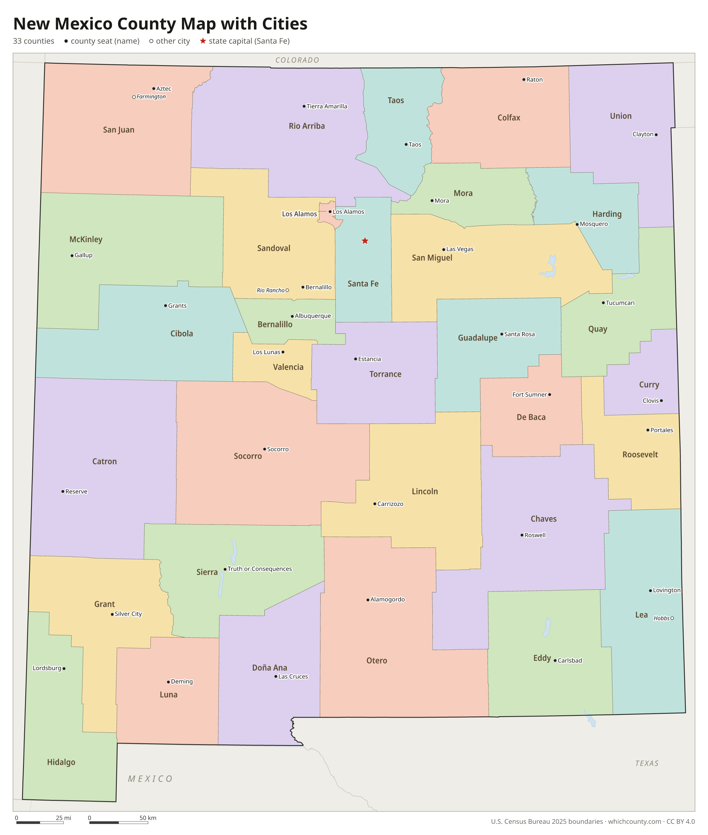
New Mexico county map with cities
The largest cities in New Mexico and the counties they are in. Cities that cross a county line list every county, the main one first. To find any smaller town, use the search box above.
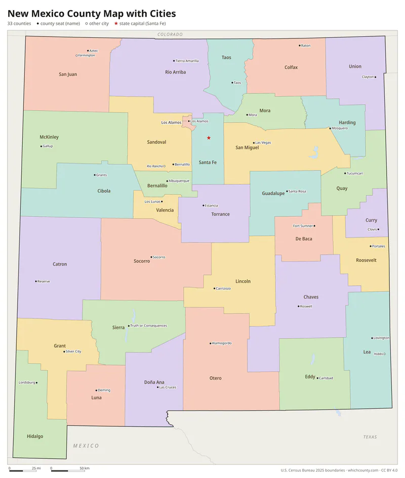
| City | County | Population 2025 |
|---|---|---|
| Albuquerque | Bernalillo County | 556,588 |
| Las Cruces | Doña Ana County | 116,978 |
| Rio Rancho | Sandoval and Bernalillo counties | 114,419 |
| Santa Fe | Santa Fe County | 89,837 |
| Roswell | Chaves County | 46,878 |
| Farmington | San Juan County | 46,055 |
| Hobbs | Lea County | 40,863 |
| Clovis | Curry County | 37,127 |
| Carlsbad | Eddy County | 32,524 |
| Alamogordo | Otero County | 31,906 |
| Los Lunas | Valencia County | 20,572 |
| Gallup | McKinley County | 19,969 |
| Sunland Park | Doña Ana County | 18,268 |
| Deming | Luna County | 14,944 |
| Artesia | Eddy County | 12,735 |
| Las Vegas | San Miguel County | 12,574 |
| Portales | Roosevelt County | 11,734 |
| Lovington | Lea County | 11,620 |
| Española | Rio Arriba and Santa Fe counties | 10,458 |
| Silver City | Grant County | 9,284 |
| Bernalillo | Sandoval County | 9,159 |
| Grants | Cibola County | 8,933 |
| Anthony | Doña Ana County | 8,900 |
| Corrales | Sandoval County | 8,484 |
| Socorro | Socorro County | 8,261 |
| Belen | Valencia County | 7,589 |
| Ruidoso | Lincoln County | 7,580 |
| Bloomfield | San Juan County | 7,335 |
| Taos | Taos County | 6,526 |
| Edgewood | Santa Fe, Bernalillo and Sandoval counties | 6,157 |
Printable New Mexico county maps (free PDF, PNG, SVG)
Every map is free to print and share. The PDFs are vector files with real text, so they stay sharp at any size and you can search them for a county name. Use 11×17 (tabloid) for the most readable labels.
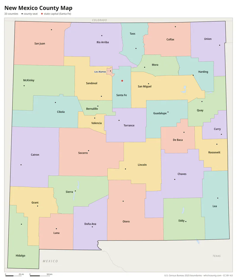
Color map with names
All 33 counties labeled, county seats marked. Letter and 11×17 PDF, high-resolution PNG, editable SVG.
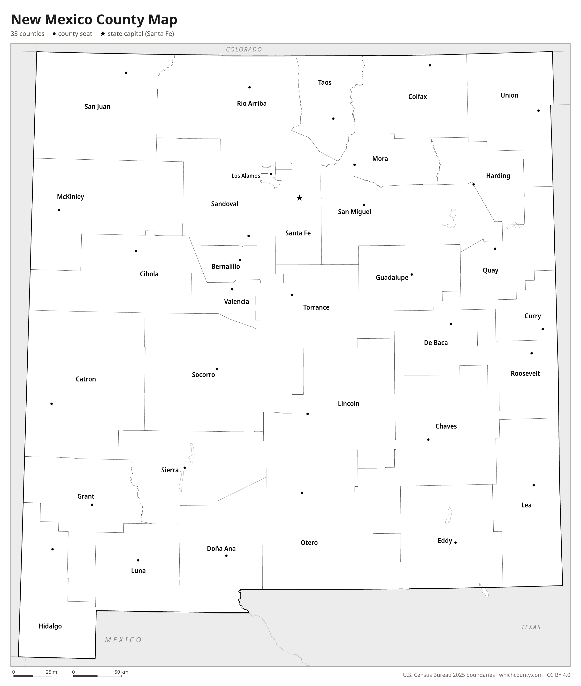
Map with cities
Counties with their county seat towns and major cities.
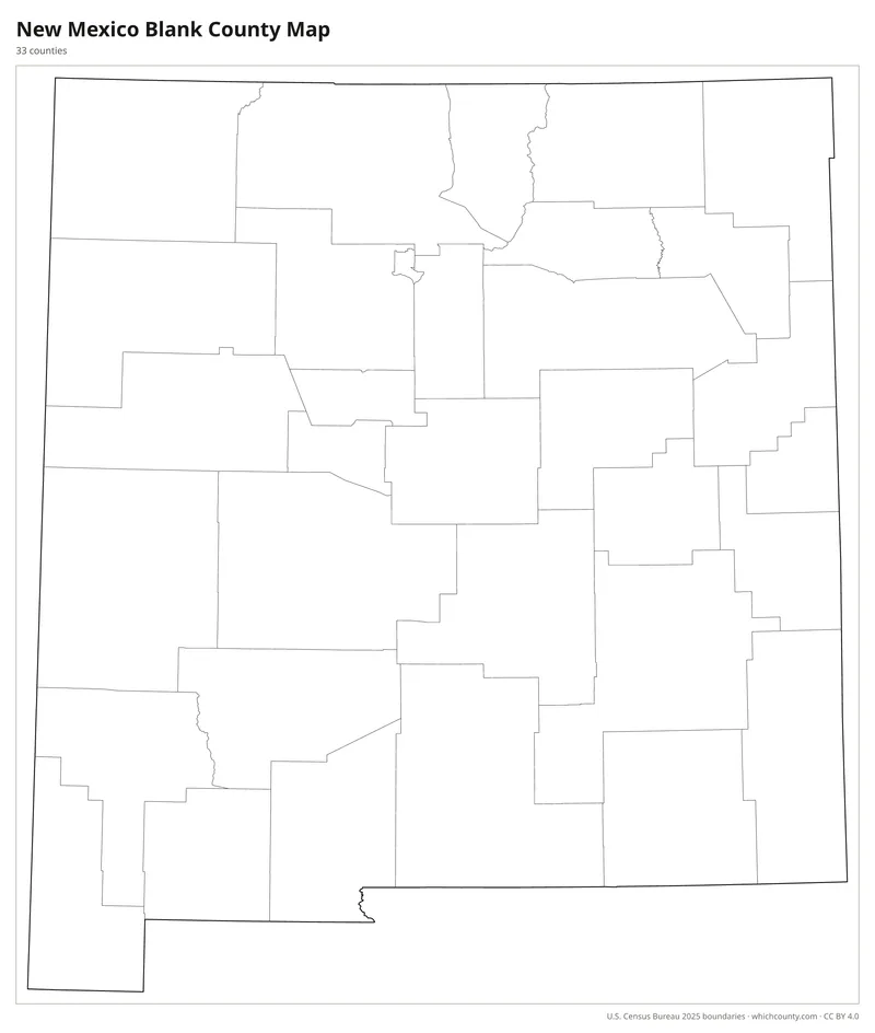
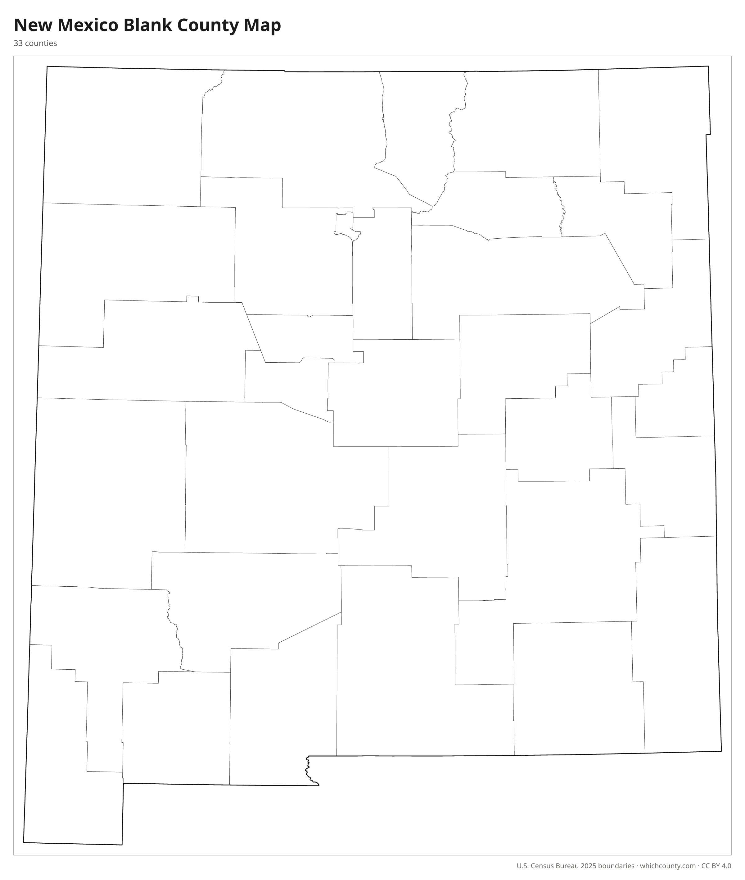
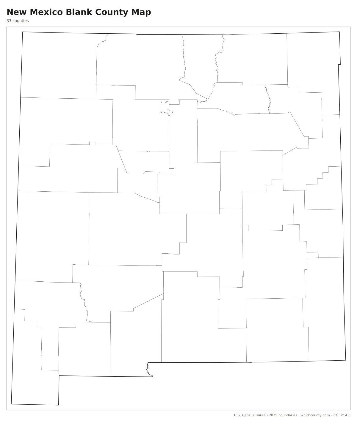
Blank outline map
County lines only, no names. For quizzes, coloring and your own notes.
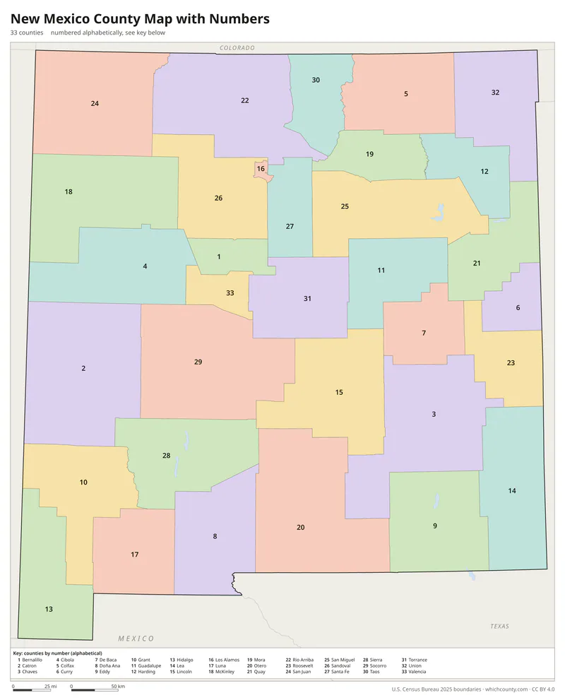
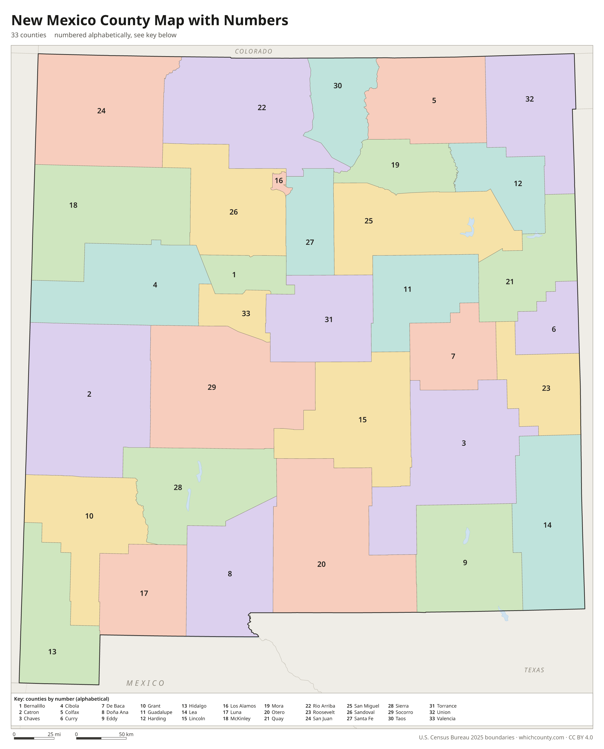
Numbered map with key
A number in every county with an alphabetical key.
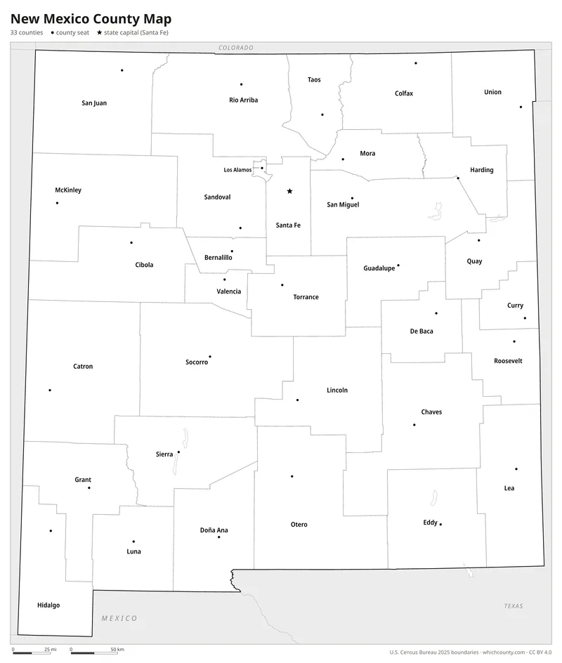
Black and white
Labeled map that prints well on any printer.
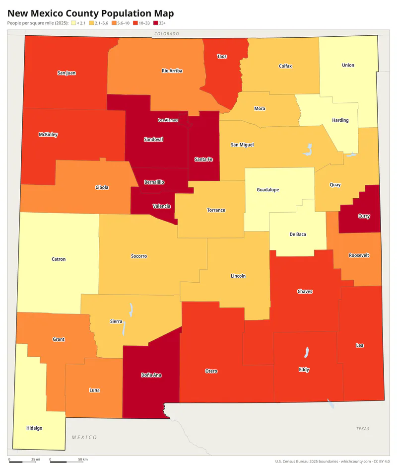
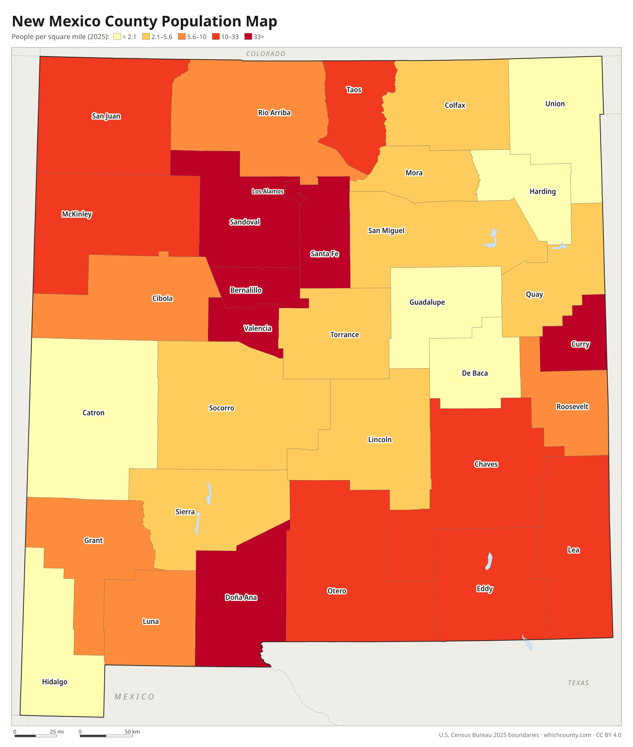
Population map
Counties shaded by population density (2025 estimates).
Data and GIS files
The county table as CSV, and the boundaries as GeoJSON and KML (Google Earth, Google My Maps).
How New Mexico's counties took shape
New Mexico's counties date from the American occupation. On September 22, 1846, General Kearny's Code of Laws set up seven counties: Bernalillo, Rio Arriba, San Miguel, Santa Ana, Santa Fe, Taos and Valencia. In 1852 the territorial legislature redefined all of them and added Doña Ana and Socorro. Several of these counties stretched west across present Arizona into present Nevada until Congress created Arizona Territory in 1863. Most of today's counties were split off between 1884 and 1921, from Sierra County to Catron County. The state constitution forbids changing county boundaries by special or local law, and in 1928 the New Mexico Supreme Court struck down a 1927 act that would have abolished Catron. Only two counties have been added since 1921: Los Alamos in 1949, birthplace of the wartime Manhattan Project, and Cibola, split from Valencia in 1981.
County maps of neighboring states
 Arizona county map
 Colorado county map
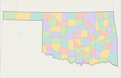 Oklahoma county map
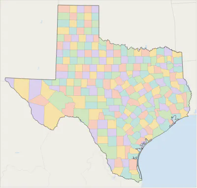 Texas county map
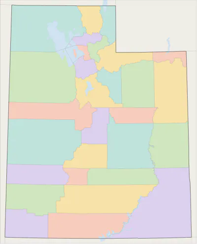 Utah county map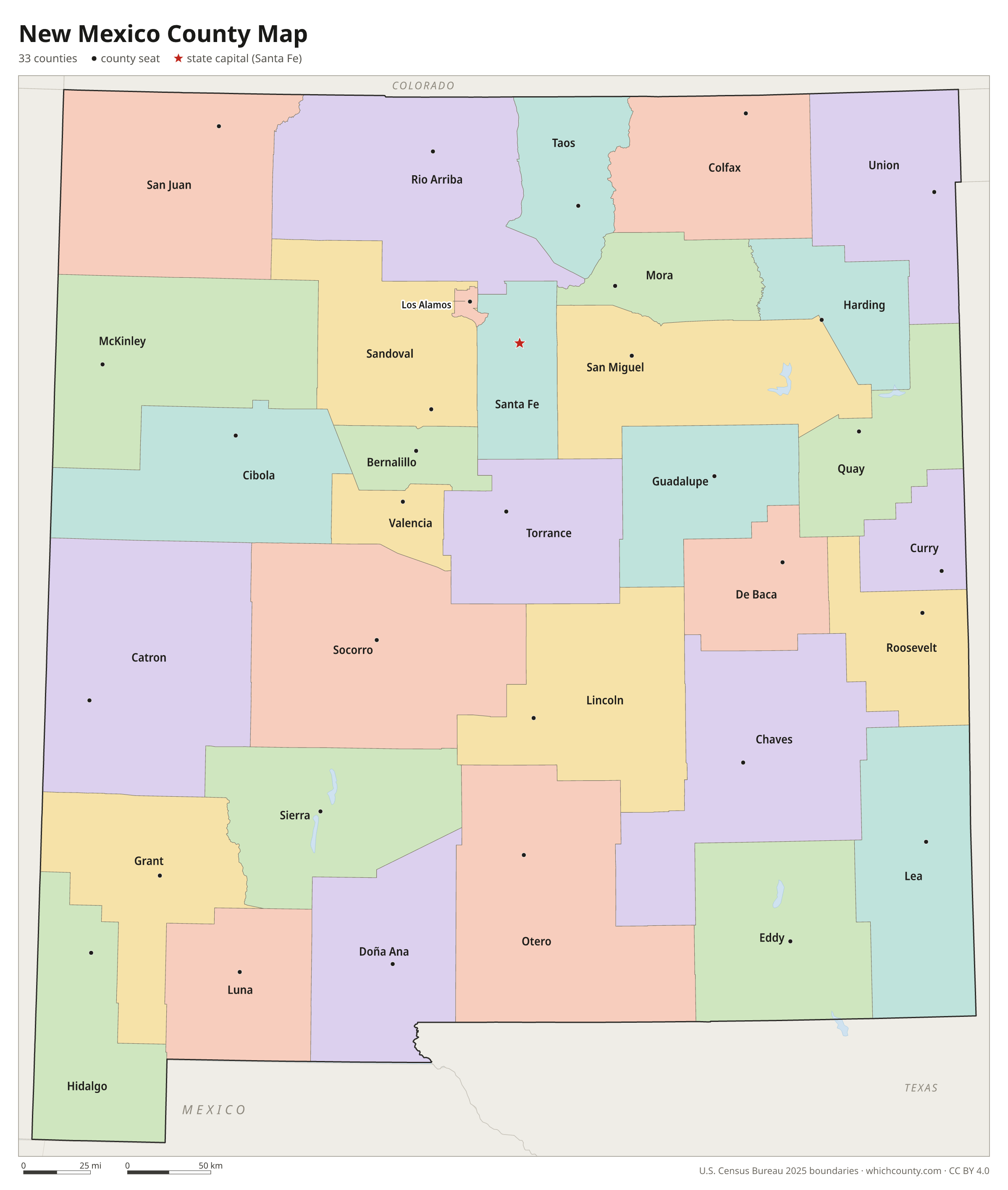
New Mexico counties: questions and answers
- How many counties are in New Mexico?
- New Mexico has 33 counties.
- What is the largest county in New Mexico?
- By land area, Catron County is the largest (6,924 sq mi). By population, Bernalillo County is the largest, with 667,601 people (2025 estimate).
- What is the smallest county in New Mexico?
- Los Alamos County is the smallest by land area (109.1 sq mi). Harding County has the fewest people: 617 (2025 estimate).
- What is the wealthiest county in New Mexico?
- By median household income, Los Alamos County ranks first with $147,139 (American Community Survey 2020–2024). The lowest is Luna County at $36,419.
- What county is Albuquerque in?
- Albuquerque is in Bernalillo County.
- What county is Las Cruces in?
- Las Cruces is in Doña Ana County.
- What county is Rio Rancho in?
- Rio Rancho is mostly in Sandoval County, with smaller parts in Bernalillo County.
- What county is Santa Fe in?
- Santa Fe, the state capital, is in Santa Fe County.
- How can I see county lines on Google Maps?
- Google Maps does not draw county lines. Download the KML file from the printable maps section above and import it into Google My Maps (Create a new map › Import) or open it in Google Earth to see every New Mexico county boundary on top of Google's map.
- Can I use this map for free?
- Yes. The maps and files on this page are free to print, share and use in your own work, including commercial projects, under the CC BY 4.0 licence. Please credit “WhichCounty (whichcounty.com)”.
Use this map on your site
You may copy, print and publish these maps, also commercially, as long as you credit WhichCounty with a link (licence details). Paste this code to embed the map:
Sources and methodology
- Boundaries: U.S. Census Bureau, 2025 Cartographic Boundary Files (1:500,000), simplified for display. Projection: Lambert conformal conic fitted to New Mexico.
- Population: Census Bureau county estimates, Vintage 2025 (July 1, 2025), compared with the April 1, 2020 estimates base.
- Land area: Census Bureau 2026 Gazetteer files. Median household income: American Community Survey 2020–2024 5-year estimates.
- County seats and founding years: Wikidata (CC0), checked against state lists by WhichCounty. Cities: Census Bureau city and town estimates, Vintage 2025.
- Rio Arriba County (New Mexico Association of Counties)
- Los Alamos County (New Mexico Association of Counties)
- Cibola County (New Mexico Association of Counties)
- Atlas of Historical County Boundaries: New Mexico (Newberry Library)
Found an error? Tell us. Last data update: October 4, 2026.