Florida County Map
All 67 counties with county seats and major cities
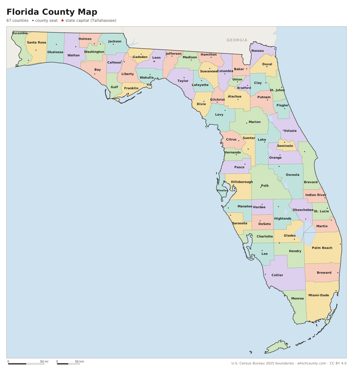
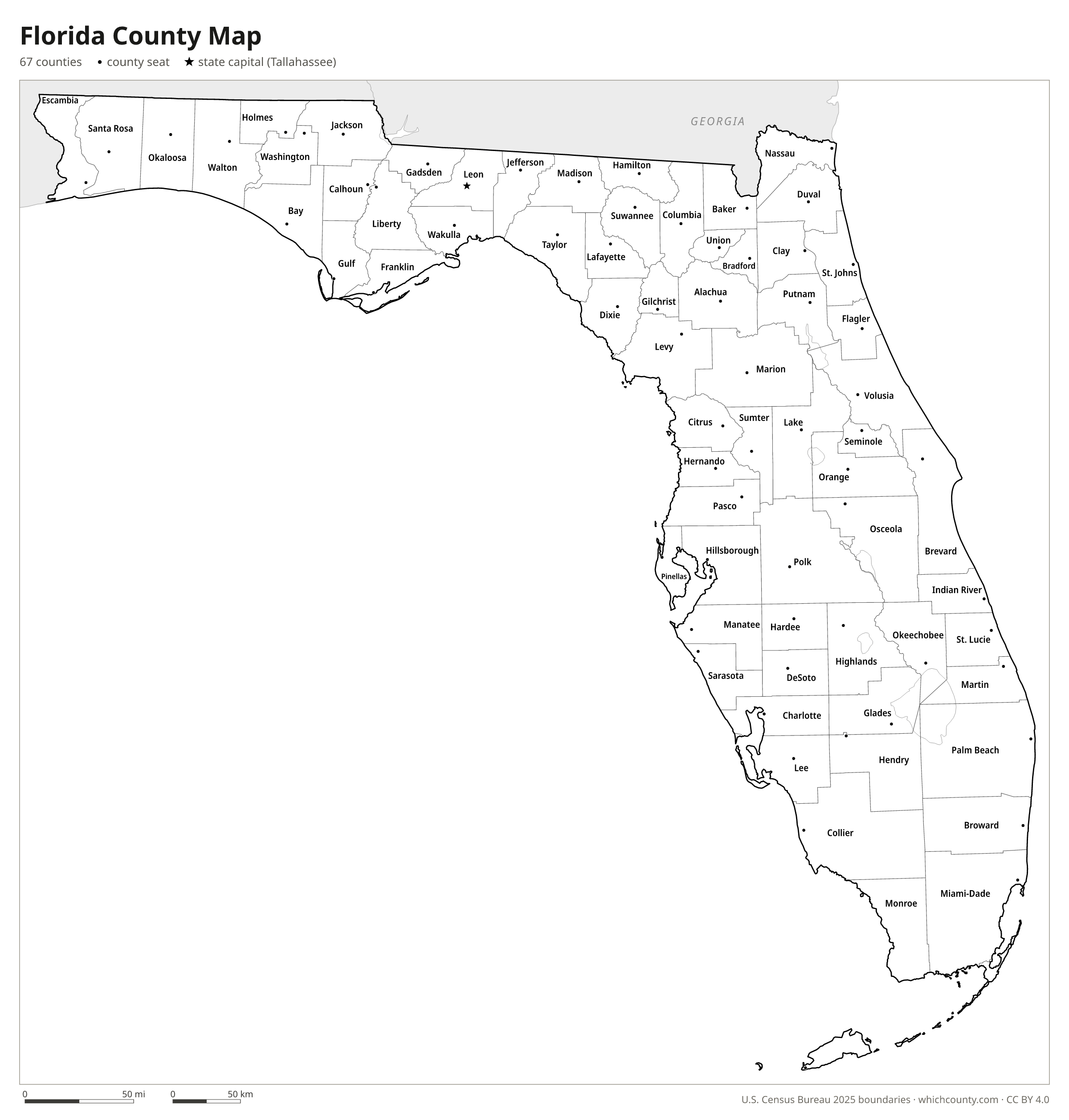
Florida has 67 counties, a number that has not changed since Gilchrist County was created in 1925. This map shows all 67 counties and their county seats. Tap a county for details, or download the free printable map below.

Updated October 4, 2026 · Boundaries: U.S. Census Bureau 2025 · Population: Census estimates for July 1, 2025
Florida county facts
- Number of counties
- 67
- Largest by land area
- Collier County 1,997 sq mi
- Smallest by land area
- Union County 243.9 sq mi
- Most people
- Miami-Dade County 2,802,029
- Fewest people
- Liberty County 8,035
- Fastest growing since 2020
- St. Johns County +26.7%
- Highest median household income
- St. Johns County $109,839
- Oldest county
- Escambia County est. 1821
- Newest county
- Gilchrist County est. 1925
- State capital
- Tallahassee Leon County
Jacksonville and Duval County merged into one consolidated government on October 1, 1968.
Fayette County (1832-1834) is the only Florida county ever abolished; its area went back to Jackson County.
List of 67 Florida counties
Sorted A–Z. Click a column to sort, or a name to show it on the map. Download as CSV
| County | County seat | Population 2025 | Change since 2020 | Land area (sq mi) | Median income | Established | FIPS |
|---|---|---|---|---|---|---|---|
| Alachua County | Gainesville | 290,028 | +4.2% | 876 | $61,949 | 1824 | 12001 |
| Baker County | Macclenny | 29,737 | +5.2% | 585 | $79,836 | 1861 | 12003 |
| Bay County | Panama City | 204,479 | +16.7% | 759 | $73,533 | 1913 | 12005 |
| Bradford County | Starke | 28,307 | +0% | 294 | $63,050 | 1858 | 12007 |
| Brevard County | Titusville | 663,982 | +9.5% | 1,015 | $78,476 | 1844 | 12009 |
| Broward County | Fort Lauderdale | 2,013,317 | +3.6% | 1,203 | $77,633 | 1915 | 12011 |
| Calhoun County | Blountstown | 13,289 | −2.6% | 567 | $50,517 | 1838 | 12013 |
| Charlotte County | Punta Gorda | 217,212 | +16.3% | 681 | $69,952 | 1921 | 12015 |
| Citrus County | Inverness | 171,666 | +11.6% | 582 | $56,546 | 1887 | 12017 |
| Clay County | Green Cove Springs | 239,593 | +9.8% | 605 | $87,820 | 1858 | 12019 |
| Collier County | East Naples | 417,131 | +11% | 1,997 | $90,045 | 1923 | 12021 |
| Columbia County | Lake City | 74,094 | +6.3% | 797 | $59,205 | 1832 | 12023 |
| DeSoto County | Arcadia | 37,078 | +9.1% | 637 | $54,417 | 1887 | 12027 |
| Dixie County | Cross City | 18,038 | +7.6% | 705 | $50,110 | 1921 | 12029 |
| Duval County | Jacksonville | 1,062,963 | +6.8% | 763 | $71,277 | 1822 | 12031 |
| Escambia County | Pensacola | 333,834 | +3.7% | 657 | $67,500 | 1821 | 12033 |
| Flagler County | Bunnell | 140,360 | +21.7% | 486 | $77,363 | 1917 | 12035 |
| Franklin County | Apalachicola | 13,029 | +4.7% | 545 | $64,105 | 1832 | 12037 |
| Gadsden County | Quincy | 44,298 | +1.1% | 516 | $48,801 | 1823 | 12039 |
| Gilchrist County | Trenton | 20,488 | +14.7% | 350 | $63,523 | 1925 | 12041 |
| Glades County | Moore Haven | 13,270 | +9.4% | 807 | $45,870 | 1921 | 12043 |
| Gulf County | Port St. Joe | 15,943 | +12.3% | 554 | $61,179 | 1925 | 12045 |
| Hamilton County | Jasper | 14,180 | +1.3% | 514 | $50,144 | 1827 | 12047 |
| Hardee County | Wauchula | 25,932 | +2.4% | 638 | $60,489 | 1921 | 12049 |
| Hendry County | LaBelle | 48,276 | +21.8% | 1,156 | $56,393 | 1923 | 12051 |
| Hernando County | Brooksville | 221,701 | +14% | 473 | $66,058 | 1843 | 12053 |
| Highlands County | Sebring | 111,122 | +9.8% | 1,018 | $54,897 | 1921 | 12055 |
| Hillsborough County | Tampa | 1,574,115 | +7.8% | 1,022 | $79,540 | 1834 | 12057 |
| Holmes County | Bonifay | 20,119 | +2.3% | 479 | $49,343 | 1848 | 12059 |
| Indian River County | Vero Beach | 172,799 | +8.1% | 503 | $73,491 | 1925 | 12061 |
| Jackson County | Marianna | 49,629 | +4.9% | 918 | $49,149 | 1822 | 12063 |
| Jefferson County | Monticello | 16,007 | +10.3% | 598 | $61,212 | 1827 | 12065 |
| Lafayette County | Mayo | 8,792 | +6.9% | 543 | $62,757 | 1856 | 12067 |
| Lake County | Tavares | 456,068 | +18.8% | 954 | $73,161 | 1887 | 12069 |
| Lee County | Fort Myers | 875,607 | +15.1% | 781 | $76,107 | 1887 | 12071 |
| Leon County | Tallahassee | 299,048 | +2.3% | 668 | $66,287 | 1824 | 12073 |
| Levy County | Bronson | 48,520 | +13.1% | 1,118 | $56,750 | 1845 | 12075 |
| Liberty County | Bristol | 8,035 | +0.7% | 836 | $58,671 | 1855 | 12077 |
| Madison County | Madison | 18,759 | +4.4% | 697 | $48,485 | 1827 | 12079 |
| Manatee County | Bradenton | 468,200 | +17.1% | 743 | $78,457 | 1855 | 12081 |
| Marion County | Ocala | 442,660 | +17.8% | 1,588 | $61,010 | 1844 | 12083 |
| Martin County | Stuart | 166,272 | +5% | 544 | $82,943 | 1925 | 12085 |
| Miami-Dade County | Miami | 2,802,029 | +3.7% | 1,900 | $71,753 | 1836 | 12086 |
| Monroe County | Key West | 80,406 | −3% | 983 | $87,738 | 1823 | 12087 |
| Nassau County | Fernandina Beach | 106,879 | +18.3% | 649 | $89,804 | 1824 | 12089 |
| Okaloosa County | Crestview | 221,810 | +4.8% | 930 | $81,998 | 1915 | 12091 |
| Okeechobee County | Okeechobee | 42,608 | +7.5% | 769 | $57,984 | 1917 | 12093 |
| Orange County | Orlando | 1,528,002 | +6.9% | 903 | $79,719 | 1824 | 12095 |
| Osceola County | Kissimmee | 481,718 | +24% | 1,327 | $72,637 | 1887 | 12097 |
| Palm Beach County | West Palm Beach | 1,575,726 | +5.6% | 1,964 | $83,581 | 1909 | 12099 |
| Pasco County | Dade City | 674,516 | +20% | 747 | $70,492 | 1887 | 12101 |
| Pinellas County | Clearwater | 948,563 | −1.1% | 274 | $72,646 | 1911 | 12103 |
| Polk County | Bartow | 874,790 | +20.7% | 1,799 | $65,978 | 1861 | 12105 |
| Putnam County | Palatka | 77,734 | +6% | 728 | $47,934 | 1849 | 12107 |
| Santa Rosa County | Milton | 211,115 | +12.3% | 1,012 | $91,922 | 1842 | 12113 |
| Sarasota County | Sarasota | 479,958 | +10.6% | 556 | $83,416 | 1921 | 12115 |
| Seminole County | Sanford | 491,884 | +4.5% | 309 | $85,761 | 1913 | 12117 |
| St. Johns County | St. Augustine | 346,328 | +26.7% | 601 | $109,839 | 1821 | 12109 |
| St. Lucie County | Fort Pierce | 402,449 | +22.2% | 572 | $71,457 | 1905 | 12111 |
| Sumter County | Bushnell | 157,772 | +21.6% | 557 | $76,508 | 1853 | 12119 |
| Suwannee County | Live Oak | 48,149 | +10.8% | 689 | $56,658 | 1858 | 12121 |
| Taylor County | Perry | 21,210 | −2.7% | 1,043 | $49,073 | 1856 | 12123 |
| Union County | Lake Butler | 16,250 | +0.7% | 244 | $64,146 | 1921 | 12125 |
| Volusia County | DeLand | 606,573 | +9.6% | 1,101 | $70,044 | 1854 | 12127 |
| Wakulla County | Crawfordville | 38,089 | +12.8% | 606 | $81,895 | 1843 | 12129 |
| Walton County | DeFuniak Springs | 93,288 | +23.9% | 1,038 | $81,986 | 1824 | 12131 |
| Washington County | Chipley | 26,695 | +5.4% | 585 | $58,210 | 1825 | 12133 |
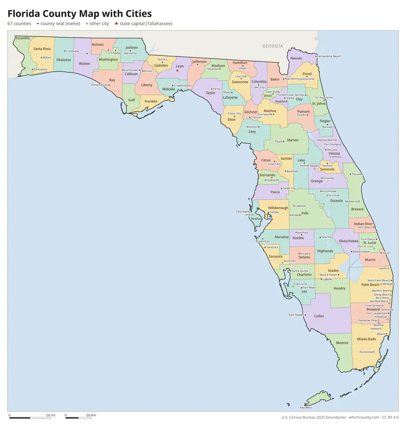
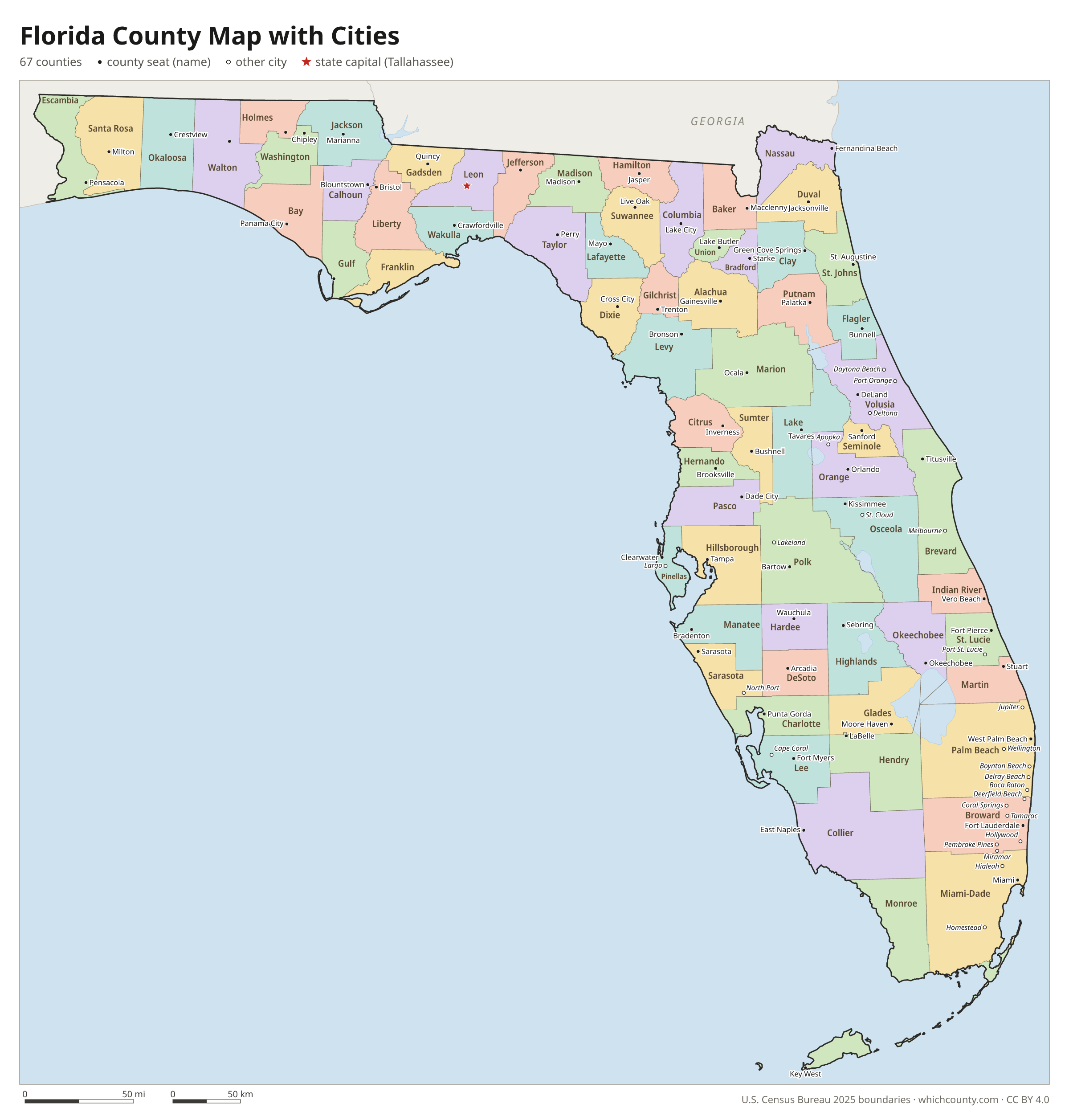
Florida county map with cities
The largest cities in Florida and the counties they are in. Cities that cross a county line list every county, the main one first. To find any smaller town, use the search box above.
| City | County | Population 2025 |
|---|---|---|
| Jacksonville | Duval County | 1,017,689 |
| Miami | Miami-Dade County | 489,812 |
| Tampa | Hillsborough County | 413,554 |
| Orlando | Orange County | 333,888 |
| Port St. Lucie | St. Lucie County | 268,062 |
| St. Petersburg | Pinellas County | 264,033 |
| Cape Coral | Lee County | 236,264 |
| Hialeah | Miami-Dade County | 230,968 |
| Tallahassee | Leon County | 204,902 |
| Fort Lauderdale | Broward County | 188,677 |
| Pembroke Pines | Broward County | 176,714 |
| Hollywood | Broward County | 157,019 |
| Gainesville | Alachua County | 148,671 |
| Palm Bay | Brevard County | 148,092 |
| Miramar | Broward County | 142,570 |
| Coral Springs | Broward County | 138,783 |
| West Palm Beach | Palm Beach County | 127,189 |
| Lakeland | Polk County | 125,520 |
| Pompano Beach | Broward County | 117,211 |
| Clearwater | Pinellas County | 114,364 |
| Miami Gardens | Miami-Dade County | 113,579 |
| Davie | Broward County | 110,851 |
| Palm Coast | Flagler County | 109,886 |
| Boca Raton | Palm Beach County | 101,582 |
| Fort Myers | Lee County | 101,581 |
| Deltona | Volusia County | 100,267 |
| Plantation | Broward County | 99,183 |
| Sunrise | Broward County | 98,846 |
| North Port | Sarasota County | 96,551 |
| Deerfield Beach | Broward County | 89,339 |
Printable Florida county maps (free PDF, PNG, SVG)
Every map is free to print and share. The PDFs are vector files with real text, so they stay sharp at any size and you can search them for a county name. Use 11×17 (tabloid) for the most readable labels.
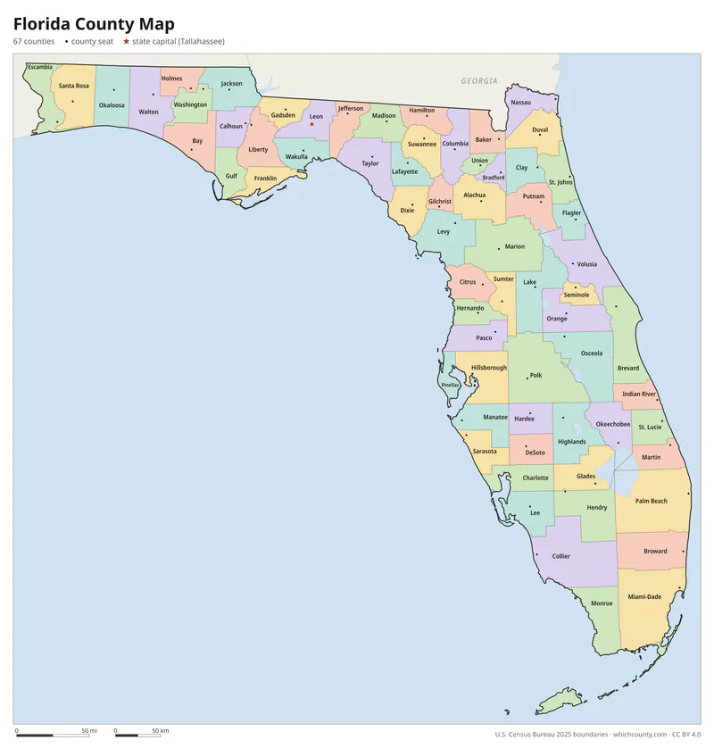
Color map with names
All 67 counties labeled, county seats marked. Letter and 11×17 PDF, high-resolution PNG, editable SVG.
Map with cities
Counties with their county seat towns and major cities.
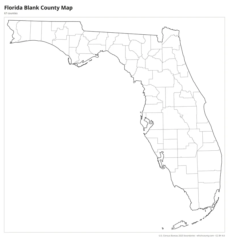
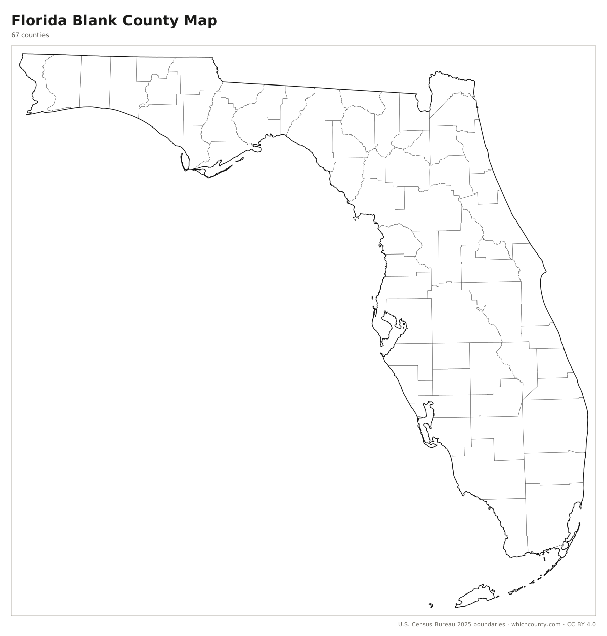
Blank outline map
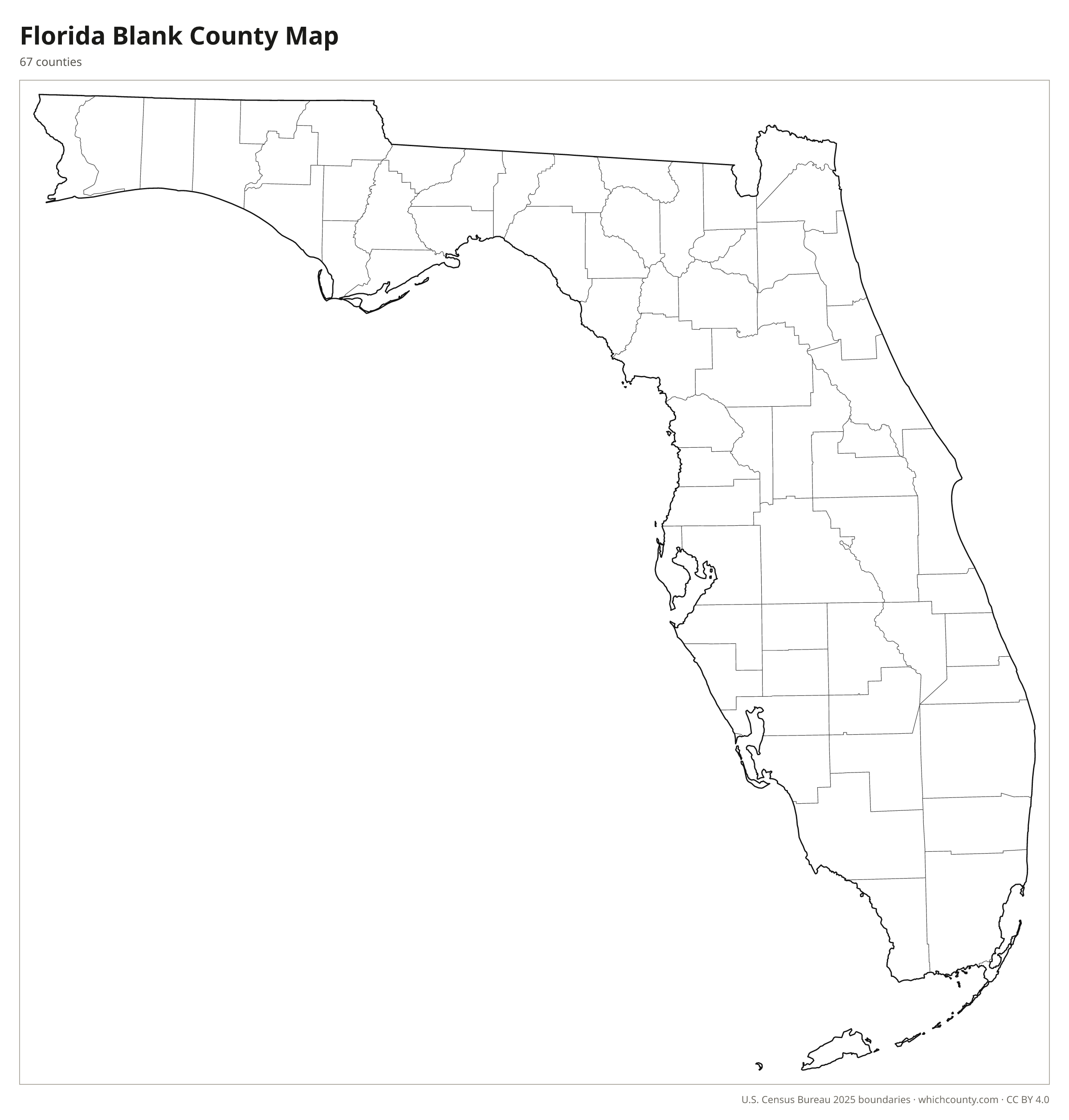
County lines only, no names. For quizzes, coloring and your own notes.
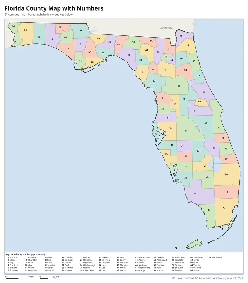
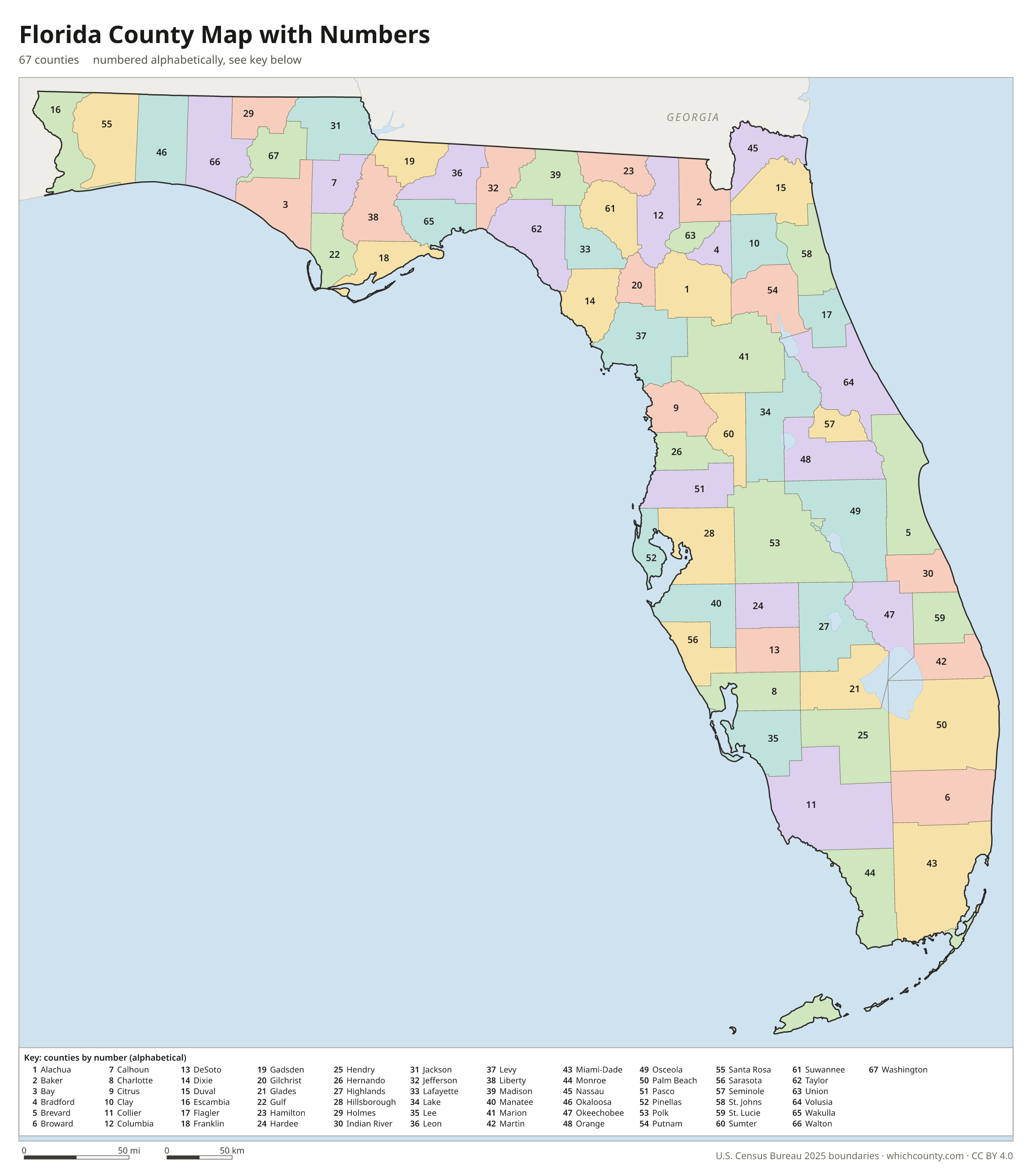
Numbered map with key
A number in every county with an alphabetical key.
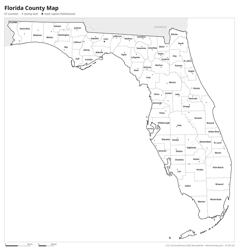
Black and white
Labeled map that prints well on any printer.
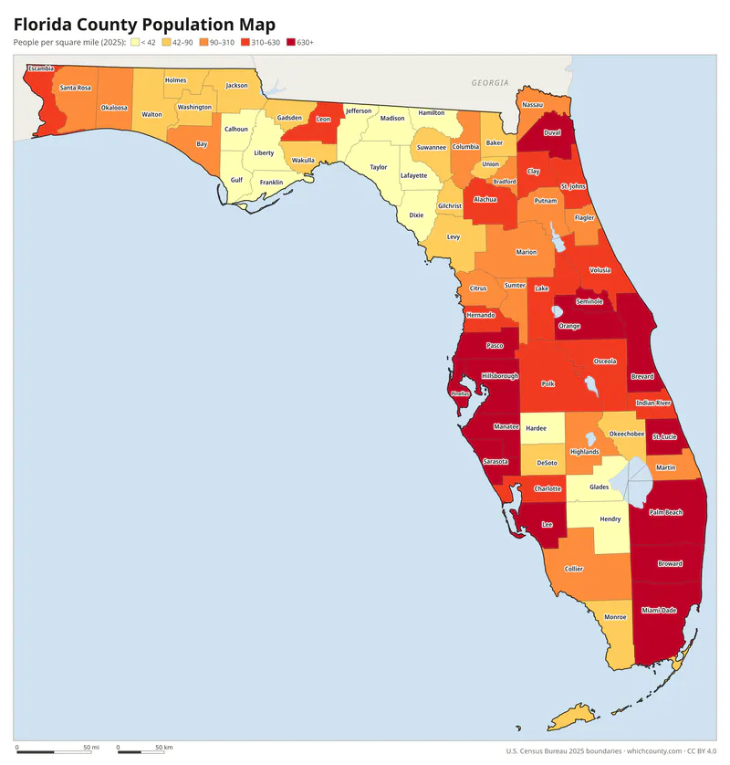
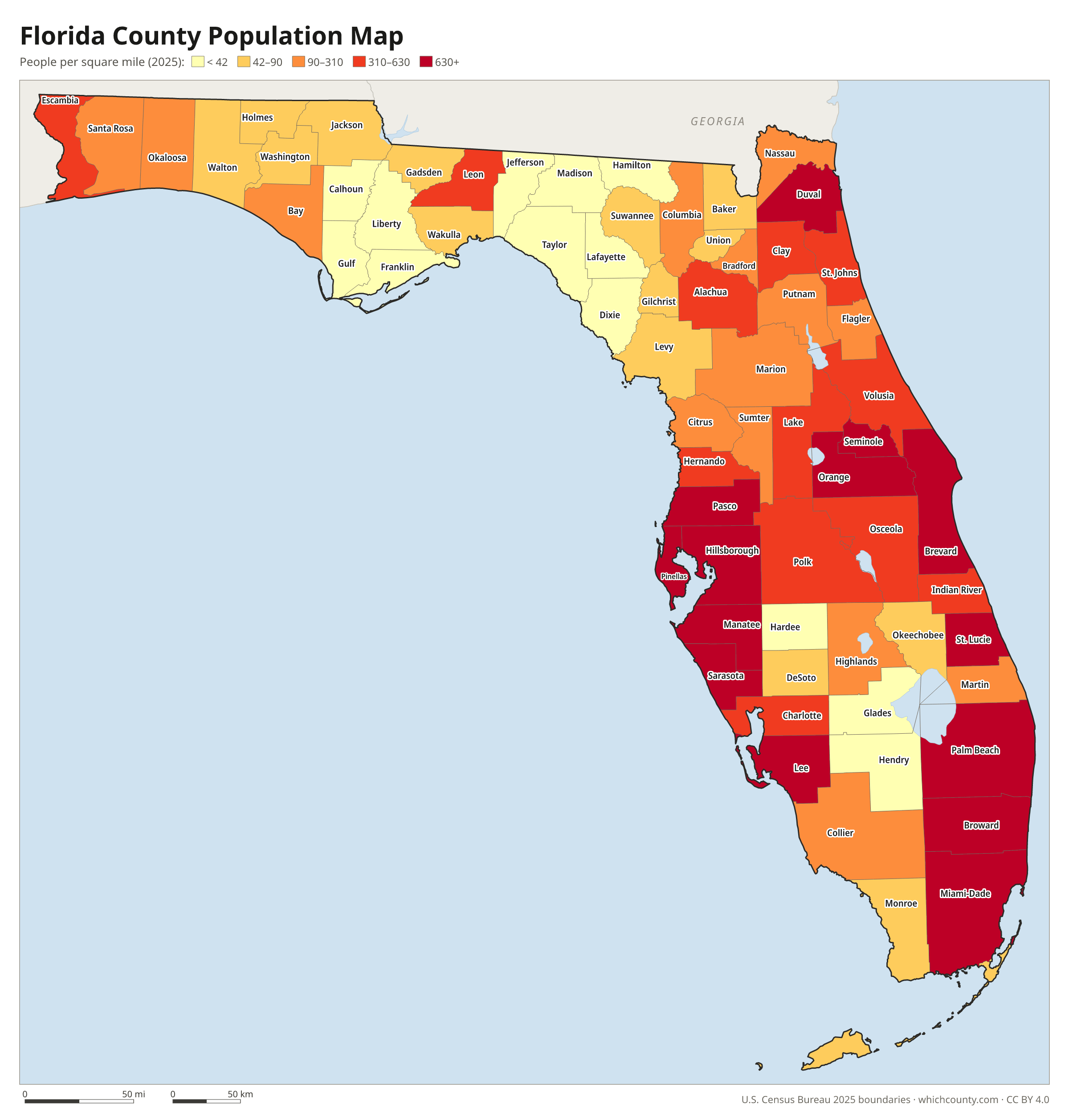
Population map
Counties shaded by population density (2025 estimates).
Data and GIS files
The county table as CSV, and the boundaries as GeoJSON and KML (Google Earth, Google My Maps).
How Florida got its 67 counties
Florida's first two counties, Escambia and St. Johns, were set up on July 21, 1821, by an ordinance of provisional governor Andrew Jackson, four days after he took possession of Florida from Spain. The territorial council added four more in 1822. The Constitution of 1885 gave the Legislature the power to create counties and change their boundaries, and it used that power often during the growth of the early 1900s. Between 1909 and 1925 it created 21 of today's 67 counties, including Palm Beach, split from Dade in 1909, and Broward, formed from Dade and Palm Beach in 1915. Gilchrist County, created by special act in 1925, was the last. A 1965 bill to create a Kennedy County out of Dade failed. Only one Florida county has ever been abolished: Fayette, which existed from 1832 to 1834.
Regions of Florida
Florida's counties grouped into the 10 Florida regional planning council regions (source).
Emerald Coast
Bay, Escambia, Holmes, Okaloosa, Santa Rosa, Walton, Washington
Apalachee
Calhoun, Franklin, Gadsden, Gulf, Jackson, Jefferson, Leon, Liberty, Wakulla
North Central Florida
Alachua, Bradford, Columbia, Dixie, Gilchrist, Hamilton, Lafayette, Levy, Madison, Suwannee, Taylor, Union
Northeast Florida
Baker, Clay, Duval, Flagler, Nassau, Putnam, St. Johns
East Central Florida
Brevard, Lake, Marion, Orange, Osceola, Seminole, Sumter, Volusia
Central Florida
DeSoto, Hardee, Highlands, Okeechobee, Polk
Tampa Bay
Citrus, Hernando, Hillsborough, Manatee, Pasco, Pinellas
Southwest Florida
Charlotte, Collier, Glades, Hendry, Lee, Sarasota
Treasure Coast
Indian River, Martin, Palm Beach, St. Lucie
South Florida
Broward, Miami-Dade, Monroe
County maps of neighboring states
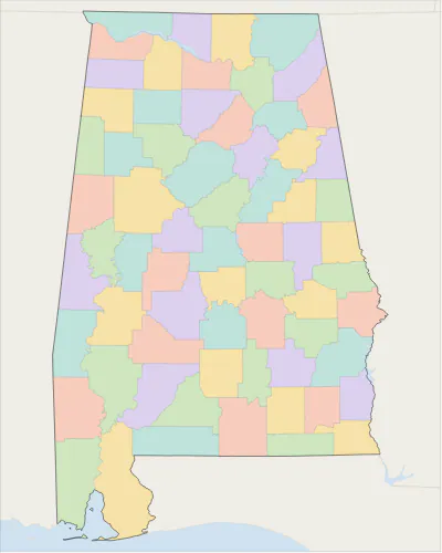 Alabama county map
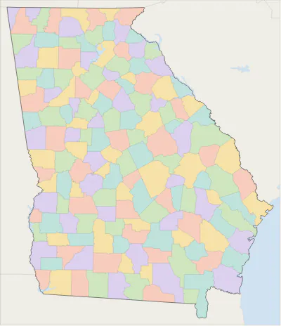 Georgia county map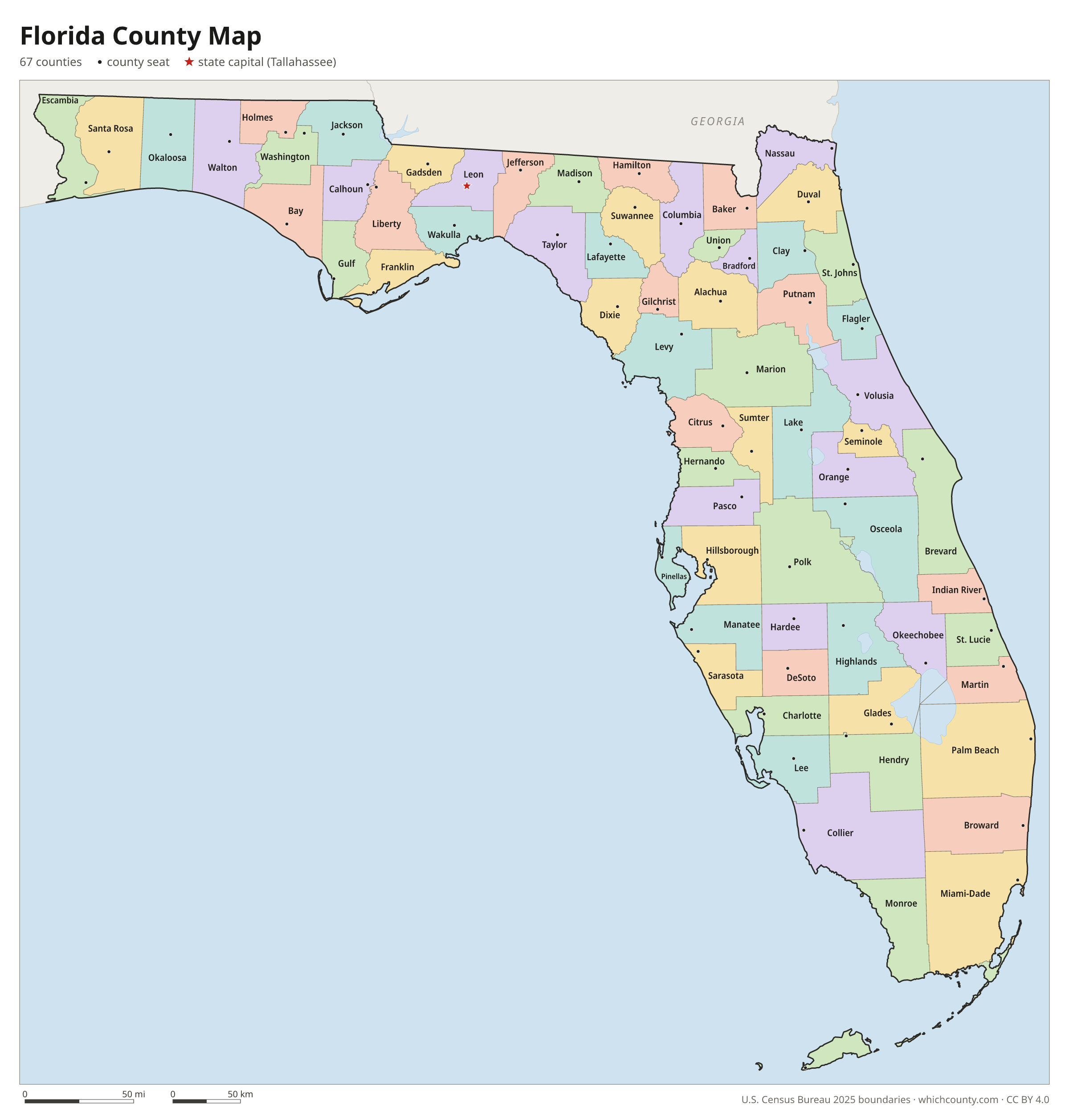
Florida counties: questions and answers
- How many counties are in Florida?
- Florida has 67 counties.
- What is the largest county in Florida?
- By land area, Collier County is the largest (1,997 sq mi). By population, Miami-Dade County is the largest, with 2,802,029 people (2025 estimate).
- What is the smallest county in Florida?
- Union County is the smallest by land area (243.9 sq mi). Liberty County has the fewest people: 8,035 (2025 estimate).
- What is the wealthiest county in Florida?
- By median household income, St. Johns County ranks first with $109,839 (American Community Survey 2020–2024). The lowest is Glades County at $45,870.
- What county is Jacksonville in?
- Jacksonville is in Duval County.
- What county is Miami in?
- Miami is in Miami-Dade County.
- What county is Tampa in?
- Tampa is in Hillsborough County.
- What county is Tallahassee in?
- Tallahassee, the state capital, is in Leon County.
- How can I see county lines on Google Maps?
- Google Maps does not draw county lines. Download the KML file from the printable maps section above and import it into Google My Maps (Create a new map › Import) or open it in Google Earth to see every Florida county boundary on top of Google's map.
- Can I use this map for free?
- Yes. The maps and files on this page are free to print, share and use in your own work, including commercial projects, under the CC BY 4.0 licence. Please credit “WhichCounty (whichcounty.com)”.
Use this map on your site
You may copy, print and publish these maps, also commercially, as long as you credit WhichCounty with a link (licence details). Paste this code to embed the map:
Sources and methodology
- Boundaries: U.S. Census Bureau, 2025 Cartographic Boundary Files (1:500,000), simplified for display. Projection: Lambert conformal conic fitted to Florida.
- Population: Census Bureau county estimates, Vintage 2025 (July 1, 2025), compared with the April 1, 2020 estimates base.
- Land area: Census Bureau 2026 Gazetteer files. Median household income: American Community Survey 2020–2024 5-year estimates.
- County seats and founding years: Wikidata (CC0), checked against state lists by WhichCounty. Cities: Census Bureau city and town estimates, Vintage 2025.
- Local Government Formation Manual, Chapter 1: Counties (Florida House of Representatives, 2003)
- Atlas of Historical County Boundaries: Florida (Newberry Library)
- Our Story: The Promise of Consolidation (City of Jacksonville)
Found an error? Tell us. Last data update: October 4, 2026.