Kentucky County Map
All 120 counties with county seats and major cities
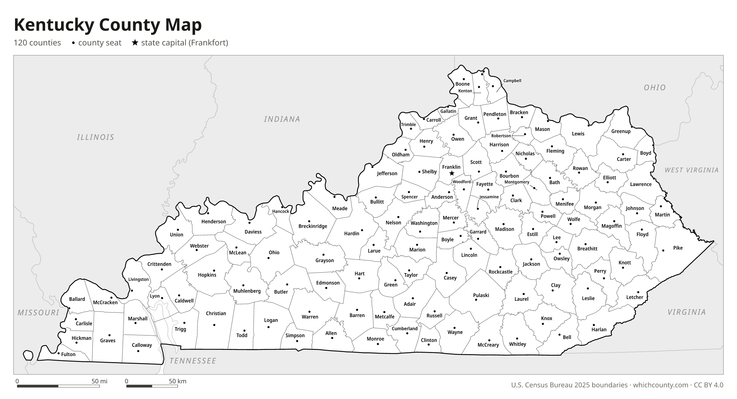
Kentucky has 120 counties, the third-most of any state if Virginia's independent cities are left out of the count. This map shows all 120 counties and their county seats. Tap a county for details, or download the free printable map below.

Updated October 4, 2026 · Boundaries: U.S. Census Bureau 2025 · Population: Census estimates for July 1, 2025
Kentucky county facts
- Number of counties
- 120
- Largest by land area
- Pike County 786 sq mi
- Smallest by land area
- Gallatin County 98.3 sq mi
- Most people
- Jefferson County 795,222
- Fewest people
- Robertson County 2,325
- Fastest growing since 2020
- Warren County +11%
- Highest median household income
- Oldham County $122,497
- Oldest county
- Fayette County est. 1780
- Newest county
- McCreary County est. 1912
- State capital
- Frankfort Franklin County
Beckham County, formed on February 9, 1904, lasted 80 days: the Court of Appeals ruled it left a parent county below 400 square miles, and it ceased to exist on April 29, 1904.
List of 120 Kentucky counties
Sorted A–Z. Click a column to sort, or a name to show it on the map. Download as CSV
| County | County seat | Population 2025 | Change since 2020 | Land area (sq mi) | Median income | Established | FIPS |
|---|---|---|---|---|---|---|---|
| Adair County | Columbia | 19,423 | +2.8% | 405 | $53,553 | 1802 | 21001 |
| Allen County | Scottsville | 22,536 | +9.5% | 344 | $61,403 | 1815 | 21003 |
| Anderson County | Lawrenceburg | 25,225 | +5.6% | 202 | $74,488 | 1827 | 21005 |
| Ballard County | Wickliffe | 7,594 | −1.8% | 247 | $66,164 | 1842 | 21007 |
| Barren County | Glasgow | 45,641 | +2.6% | 487 | $50,628 | – | 21009 |
| Bath County | Owingsville | 13,176 | +3.4% | 278 | $56,541 | 1811 | 21011 |
| Bell County | Pineville | 22,829 | −5.3% | 359 | $31,354 | 1867 | 21013 |
| Boone County | Burlington | 145,316 | +6.9% | 246 | $99,414 | 1798 | 21015 |
| Bourbon County | Paris | 20,243 | −0.1% | 290 | $61,354 | 1786 | 21017 |
| Boyd County | Catlettsburg | 47,751 | −1.1% | 160 | $61,118 | 1860 | 21019 |
| Boyle County | Danville | 31,632 | +3.3% | 180 | $61,159 | 1842 | 21021 |
| Bracken County | Brooksville | 8,511 | +1.3% | 203 | $66,319 | 1796 | 21023 |
| Breathitt County | Jackson | 12,558 | −8.5% | 492 | $34,808 | 1839 | 21025 |
| Breckinridge County | Hardinsburg | 21,503 | +5.2% | 570 | $55,843 | 1799 | 21027 |
| Bullitt County | Shepherdsville | 86,454 | +5.1% | 297 | $80,558 | 1796 | 21029 |
| Butler County | Morgantown | 12,520 | +1.2% | 426 | $56,092 | 1810 | 21031 |
| Caldwell County | Princeton | 12,609 | −0.4% | 345 | $59,583 | 1809 | 21033 |
| Calloway County | Murray | 39,421 | +5% | 385 | $52,706 | 1821 | 21035 |
| Campbell County | Alexandria, Newport | 95,441 | +2.5% | 151 | $77,567 | 1794 | 21037 |
| Carlisle County | Bardwell | 4,747 | −1.5% | 190 | $62,439 | 1886 | 21039 |
| Carroll County | Carrollton | 11,141 | +3.1% | 129 | $56,466 | 1838 | 21041 |
| Carter County | Grayson | 26,149 | −1.8% | 410 | $51,235 | 1838 | 21043 |
| Casey County | Liberty | 16,205 | +1.6% | 444 | $45,510 | 1806 | 21045 |
| Christian County | Hopkinsville | 70,115 | −3.7% | 718 | $55,494 | 1796 | 21047 |
| Clark County | Winchester | 37,888 | +2.4% | 253 | $64,348 | 1792 | 21049 |
| Clay County | Manchester | 19,465 | −4.3% | 469 | $40,900 | 1807 | 21051 |
| Clinton County | Albany | 9,139 | −1.2% | 197 | $44,844 | 1836 | 21053 |
| Crittenden County | Marion | 8,807 | −2% | 360 | $46,656 | 1842 | 21055 |
| Cumberland County | Burkesville | 5,992 | +1.8% | 305 | $40,000 | – | 21057 |
| Daviess County | Owensboro | 104,898 | +1.5% | 458 | $68,214 | 1815 | 21059 |
| Edmonson County | Brownsville | 12,749 | +5.2% | 303 | $54,937 | 1825 | 21061 |
| Elliott County | Sandy Hook | 7,265 | −1.2% | 234 | $45,776 | 1869 | 21063 |
| Estill County | Irvine | 13,962 | −1.4% | 253 | $46,051 | 1808 | 21065 |
| Fayette County | Lexington | 329,751 | +2.2% | 284 | $69,479 | 1780 | 21067 |
| Fleming County | Flemingsburg | 15,787 | +4.7% | 349 | $49,307 | 1798 | 21069 |
| Floyd County | Prestonsburg | 34,401 | −4.3% | 393 | $41,279 | 1800 | 21071 |
| Franklin County | Frankfort | 52,649 | +2.2% | 208 | $65,298 | 1794 | 21073 |
| Fulton County | Hickman | 6,218 | −4.5% | 206 | $38,217 | 1845 | 21075 |
| Gallatin County | Warsaw | 8,840 | +1.7% | 98 | $63,346 | 1798 | 21077 |
| Garrard County | Lancaster | 18,207 | +7.4% | 230 | $63,087 | 1796 | 21079 |
| Grant County | Williamstown | 26,181 | +5% | 258 | $69,178 | 1820 | 21081 |
| Graves County | Mayfield | 37,050 | +1.1% | 552 | $50,772 | 1824 | 21083 |
| Grayson County | Leitchfield | 27,406 | +3.7% | 500 | $50,757 | 1810 | 21085 |
| Green County | Greensburg | 11,644 | +4.8% | 286 | $46,798 | 1792 | 21087 |
| Greenup County | Greenup | 35,213 | −2.1% | 345 | $60,751 | 1803 | 21089 |
| Hancock County | Hawesville | 9,050 | −0.5% | 188 | $65,464 | 1829 | 21091 |
| Hardin County | Elizabethtown | 113,482 | +2.5% | 624 | $67,647 | 1792 | 21093 |
| Harlan County | Harlan | 24,725 | −7.9% | 466 | $41,693 | 1819 | 21095 |
| Harrison County | Cynthiana | 19,627 | +5.1% | 307 | $66,442 | 1793 | 21097 |
| Hart County | Munfordville | 20,117 | +4.4% | 413 | $52,285 | 1819 | 21099 |
| Henderson County | Henderson | 44,255 | −1.2% | 436 | $58,851 | 1798 | 21101 |
| Henry County | New Castle | 16,447 | +4.9% | 286 | $63,347 | 1798 | 21103 |
| Hickman County | Clinton | 4,372 | −3.3% | 242 | $60,867 | 1821 | 21105 |
| Hopkins County | Madisonville | 45,127 | −0.7% | 542 | $56,815 | 1806 | 21107 |
| Jackson County | McKee | 13,325 | +2.8% | 345 | $40,000 | 1858 | 21109 |
| Jefferson County | Louisville | 795,222 | +1.6% | 381 | $69,866 | 1780 | 21111 |
| Jessamine County | Nicholasville | 57,147 | +7.8% | 172 | $74,576 | 1798 | 21113 |
| Johnson County | Paintsville | 22,051 | −2.8% | 262 | $44,904 | 1843 | 21115 |
| Kenton County | Covington, Independence | 175,779 | +4% | 160 | $80,548 | 1840 | 21117 |
| Knott County | Hindman | 13,321 | −6.5% | 352 | $41,761 | 1884 | 21119 |
| Knox County | Barbourville | 29,532 | −2.2% | 386 | $32,527 | 1799 | 21121 |
| Larue County | Hodgenville | 15,184 | +2.1% | 261 | $67,067 | 1843 | 21123 |
| Laurel County | London | 63,746 | +1.8% | 434 | $57,771 | 1825 | 21125 |
| Lawrence County | Louisa | 15,765 | −3.2% | 416 | $46,772 | 1821 | 21127 |
| Lee County | Beattyville | 7,297 | −1.2% | 209 | $37,568 | 1870 | 21129 |
| Leslie County | Hyden | 9,627 | −8.5% | 401 | $35,934 | 1878 | 21131 |
| Letcher County | Whitesburg | 19,952 | −7.4% | 338 | $41,793 | 1842 | 21133 |
| Lewis County | Vanceburg | 12,901 | −1.4% | 483 | $46,838 | 1806 | 21135 |
| Lincoln County | Stanford | 25,353 | +4.4% | 333 | $52,440 | 1780 | 21137 |
| Livingston County | Smithland | 8,863 | −0.3% | 313 | $58,984 | 1799 | 21139 |
| Logan County | Russellville | 28,669 | +4.5% | 552 | $60,382 | 1792 | 21141 |
| Lyon County | Eddyville | 9,123 | +5.1% | 214 | $65,066 | 1854 | 21143 |
| Madison County | Richmond | 101,696 | +9.7% | 438 | $63,351 | 1785 | 21151 |
| Magoffin County | Salyersville | 11,110 | −4.6% | 308 | $33,080 | 1860 | 21153 |
| Marion County | Lebanon | 20,115 | +2.8% | 344 | $59,627 | 1834 | 21155 |
| Marshall County | Benton | 31,659 | −0% | 302 | $65,831 | 1842 | 21157 |
| Martin County | Inez | 10,697 | −5.3% | 230 | $37,042 | 1870 | 21159 |
| Mason County | Maysville | 16,936 | −1.1% | 240 | $52,178 | 1788 | 21161 |
| McCracken County | Paducah | 67,553 | −0.5% | 249 | $64,373 | – | 21145 |
| McCreary County | Whitley City | 17,124 | +1.4% | 427 | $33,750 | 1912 | 21147 |
| McLean County | Calhoun | 9,064 | −1% | 253 | $65,596 | 1854 | 21149 |
| Meade County | Brandenburg | 30,699 | +2.3% | 306 | $74,355 | 1823 | 21163 |
| Menifee County | Frenchburg | 6,430 | +5.2% | 204 | $45,096 | 1869 | 21165 |
| Mercer County | Harrodsburg | 23,733 | +4.8% | 249 | $64,824 | 1785 | 21167 |
| Metcalfe County | Edmonton | 10,583 | +2.9% | 290 | $51,473 | 1860 | 21169 |
| Monroe County | Tompkinsville | 11,191 | −1.3% | 330 | $51,280 | 1820 | 21171 |
| Montgomery County | Mount Sterling | 28,822 | +2.5% | 197 | $56,396 | 1796 | 21173 |
| Morgan County | West Liberty | 14,415 | +5% | 381 | $47,913 | 1822 | 21175 |
| Muhlenberg County | Greenville | 30,634 | −1% | 467 | $51,927 | 1798 | 21177 |
| Nelson County | Bardstown | 49,036 | +4.9% | 419 | $69,562 | 1784 | 21179 |
| Nicholas County | Carlisle | 7,949 | +5.5% | 195 | $59,531 | 1799 | 21181 |
| Ohio County | Hartford | 23,934 | +0.7% | 587 | $57,798 | 1798 | 21183 |
| Oldham County | La Grange | 70,986 | +5% | 187 | $122,497 | 1823 | 21185 |
| Owen County | Owenton | 11,601 | +3% | 351 | $61,134 | 1819 | 21187 |
| Owsley County | Booneville | 3,932 | −3% | 197 | $22,188 | 1843 | 21189 |
| Pendleton County | Falmouth | 14,800 | +1.1% | 277 | $64,669 | 1798 | 21191 |
| Perry County | Hazard | 26,555 | −6.7% | 340 | $42,181 | 1820 | 21193 |
| Pike County | Pikeville | 54,721 | −6.7% | 786 | $44,312 | 1821 | 21195 |
| Powell County | Stanton | 12,812 | −2.4% | 179 | $40,309 | 1852 | 21197 |
| Pulaski County | Somerset | 67,384 | +3.6% | 658 | $51,898 | 1798 | 21199 |
| Robertson County | Mount Olivet | 2,325 | +6% | 100 | $51,830 | 1867 | 21201 |
| Rockcastle County | Mount Vernon | 16,148 | +0.7% | 317 | $48,862 | 1810 | 21203 |
| Rowan County | Morehead | 24,476 | −0.7% | 280 | $54,321 | 1856 | 21205 |
| Russell County | Jamestown | 18,608 | +3.4% | 253 | $44,738 | 1825 | 21207 |
| Scott County | Georgetown | 62,262 | +8.9% | 282 | $85,158 | 1792 | 21209 |
| Shelby County | Shelbyville | 51,243 | +6.5% | 380 | $82,604 | 1792 | 21211 |
| Simpson County | Franklin | 20,788 | +6.1% | 234 | $59,858 | 1819 | 21213 |
| Spencer County | Taylorsville | 20,998 | +8.1% | 187 | $102,618 | 1824 | 21215 |
| Taylor County | Campbellsville | 26,763 | +2.9% | 266 | $60,456 | 1848 | 21217 |
| Todd County | Elkton | 12,972 | +6% | 375 | $61,103 | 1819 | 21219 |
| Trigg County | Cadiz | 14,512 | +3.3% | 441 | $59,857 | 1820 | 21221 |
| Trimble County | Bedford | 8,701 | +2.7% | 148 | $66,027 | 1837 | 21223 |
| Union County | Morganfield | 12,839 | −6.1% | 343 | $60,327 | 1811 | 21225 |
| Warren County | Bowling Green | 149,375 | +11% | 542 | $65,794 | 1796 | 21227 |
| Washington County | Springfield | 12,368 | +2.8% | 297 | $61,616 | 1792 | 21229 |
| Wayne County | Monticello | 19,597 | +0.2% | 458 | $45,739 | 1800 | 21231 |
| Webster County | Dixon | 12,929 | −0.7% | 332 | $59,628 | 1860 | 21233 |
| Whitley County | Williamsburg | 37,297 | +1.6% | 438 | $44,615 | 1818 | 21235 |
| Wolfe County | Campton | 6,298 | −4.1% | 222 | $30,417 | 1860 | 21237 |
| Woodford County | Versailles | 27,883 | +3.8% | 190 | $83,788 | 1788 | 21239 |
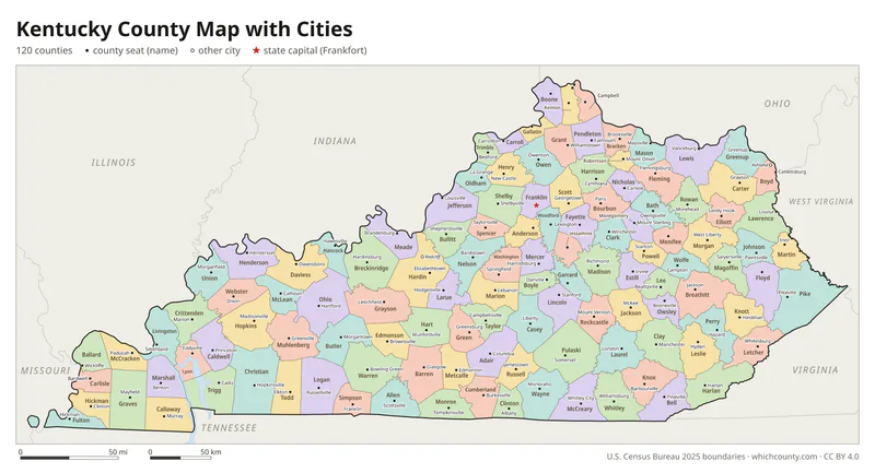
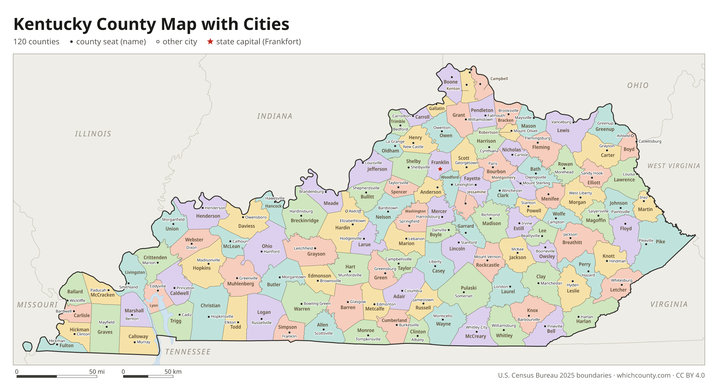
Kentucky county map with cities
The largest cities in Kentucky and the counties they are in. Cities that cross a county line list every county, the main one first. To find any smaller town, use the search box above.
| City | County | Population 2025 |
|---|---|---|
| Louisville | Jefferson County | 641,962 |
| Lexington | Fayette County | 329,751 |
| Bowling Green | Warren County | 78,505 |
| Owensboro | Daviess County | 60,892 |
| Covington | Kenton County | 41,847 |
| Georgetown | Scott County | 40,883 |
| Richmond | Madison County | 40,663 |
| Elizabethtown | Hardin County | 35,448 |
| Florence | Boone County | 34,018 |
| Nicholasville | Jessamine County | 33,857 |
| Hopkinsville | Christian County | 30,411 |
| Independence | Kenton County | 30,198 |
| Jeffersontown | Jefferson County | 29,193 |
| Frankfort | Franklin County | 28,657 |
| Henderson | Henderson County | 27,822 |
| Paducah | McCracken County | 26,730 |
| Radcliff | Hardin County | 22,576 |
| Ashland | Boyd County | 20,996 |
| Erlanger | Kenton and Boone counties | 20,158 |
| Winchester | Clark County | 19,514 |
| Madisonville | Hopkins County | 19,428 |
| Mount Washington | Bullitt County | 18,989 |
| Murray | Calloway County | 18,964 |
| Shelbyville | Shelby County | 18,453 |
| St. Matthews | Jefferson County | 17,868 |
| Danville | Boyle County | 17,736 |
| Fort Thomas | Campbell County | 17,142 |
| Berea | Madison County | 16,662 |
| Shively | Jefferson County | 15,895 |
| Glasgow | Barren County | 15,302 |
Printable Kentucky county maps (free PDF, PNG, SVG)
Every map is free to print and share. The PDFs are vector files with real text, so they stay sharp at any size and you can search them for a county name. Use 11×17 (tabloid) for the most readable labels.
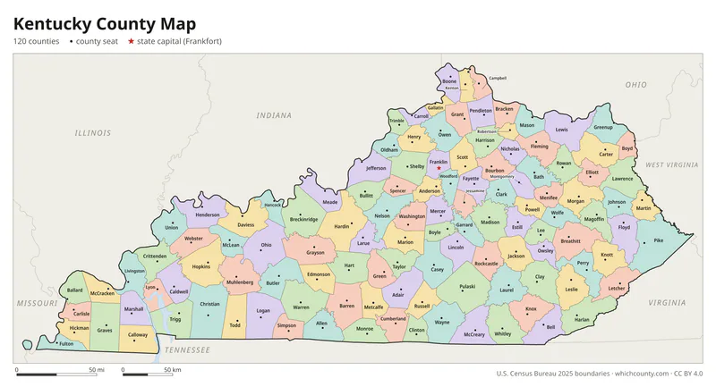
Color map with names
All 120 counties labeled, county seats marked. Letter and 11×17 PDF, high-resolution PNG, editable SVG.
Map with cities
Counties with their county seat towns and major cities.
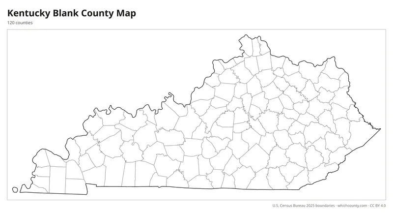
Blank outline map
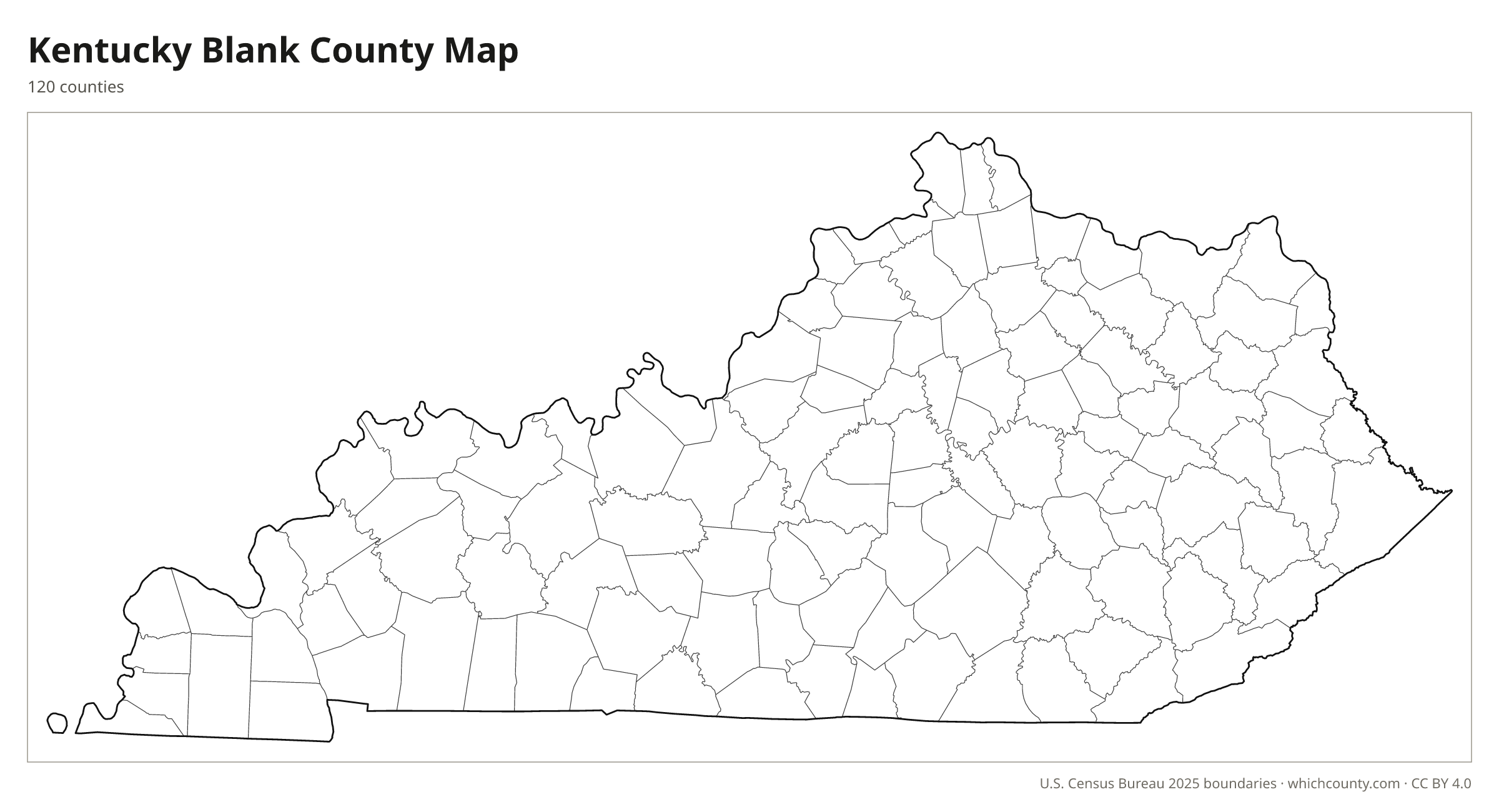
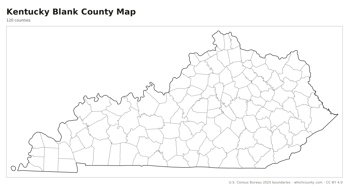
County lines only, no names. For quizzes, coloring and your own notes.
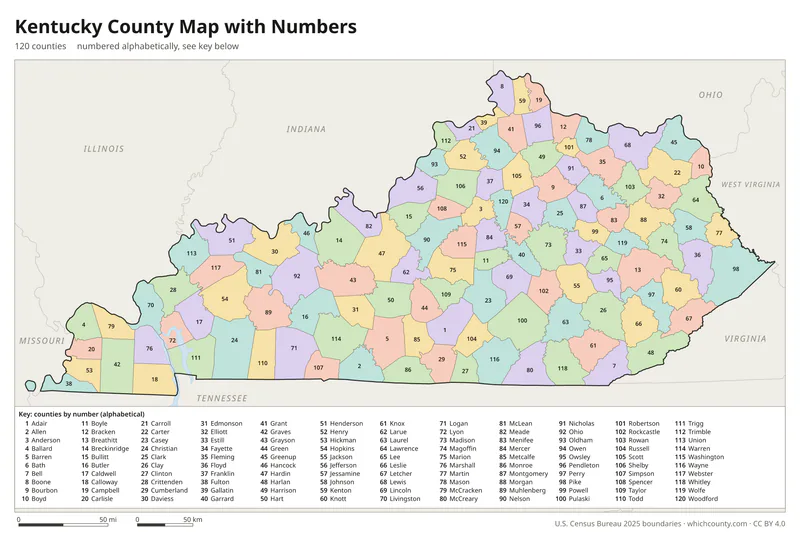
Numbered map with key
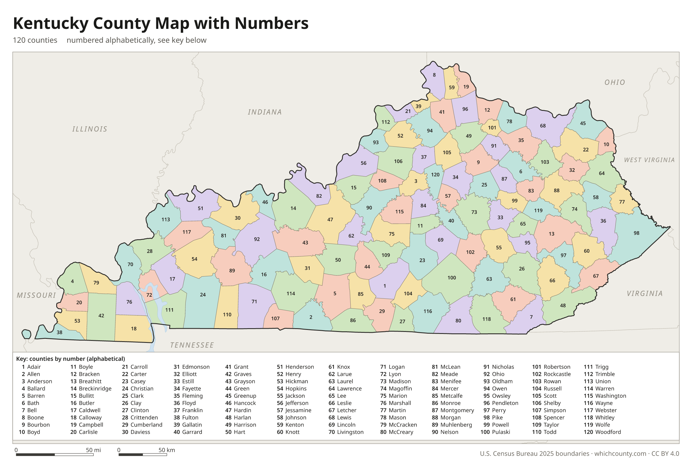
A number in every county with an alphabetical key.
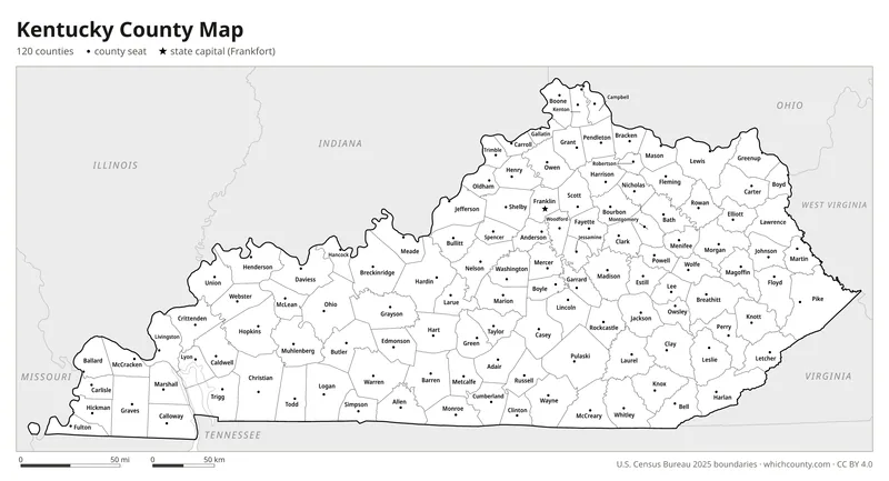
Black and white
Labeled map that prints well on any printer.
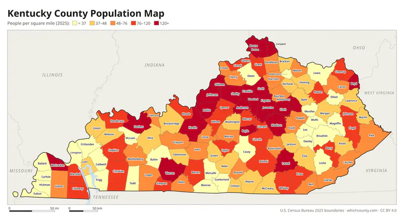
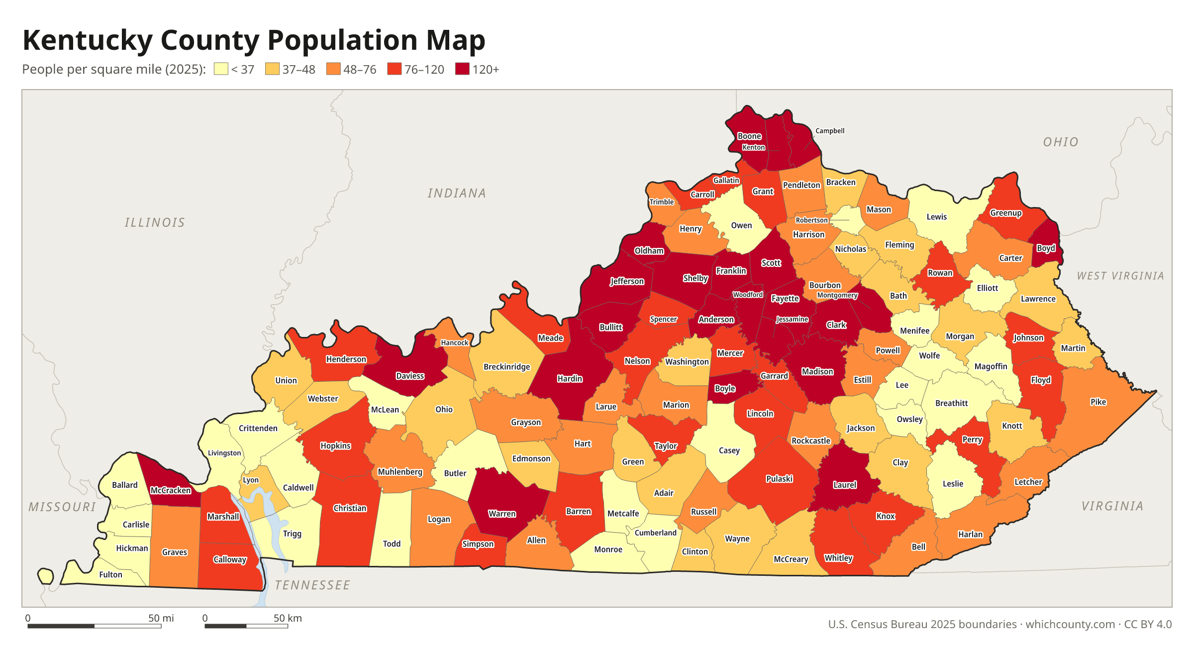
Population map
Counties shaded by population density (2025 estimates).
Data and GIS files
The county table as CSV, and the boundaries as GeoJSON and KML (Google Earth, Google My Maps).
Why does Kentucky have 120 counties?
Kentucky began as a single county of Virginia. In 1780 Virginia split Kentucky County into Fayette, Jefferson and Lincoln, which together covered nearly all of the future state. Settlers lived far from those county seats, and the trip could take days, so the counties kept being divided. Kentucky had nine counties at statehood in 1792 and 42 by 1800. People wanted to live within a day's ride of their county seat, and the population rules for new counties were often ignored. A 1795 law tried to slow the splitting by making a parent county give up a seat in the General Assembly. The Constitution of 1891 set firmer limits: no new county under 400 square miles or 12,000 people, and no new county line within ten miles of an existing county seat. McCreary County, created in 1912, was the last.
County numbers: The state numbers the counties 001–120 in alphabetical order (Mc names filed as Mac) for tax reporting and county road maps.
Regions of Kentucky
Kentucky's counties grouped into the 15 Area Development Districts of Kentucky (source).
Purchase Area Development District
Ballard, Carlisle, Hickman, Fulton, McCracken, Graves, Marshall, Calloway
Pennyrile Area Development District
Livingston, Crittenden, Lyon, Caldwell, Hopkins, Muhlenberg, Trigg, Christian, Todd
Green River Area Development District
Union, Henderson, Webster, McLean, Daviess, Ohio, Hancock
Barren River Area Development District
Logan, Simpson, Butler, Warren, Edmonson, Hart, Barren, Allen, Metcalfe, Monroe
Lincoln Trail Area Development District
Breckinridge, Meade, Grayson, Hardin, Larue, Nelson, Washington, Marion
Jefferson Area Development District (KIPDA)
Bullitt, Henry, Jefferson, Oldham, Shelby, Spencer, Trimble
Northern Kentucky Area Development District
Boone, Kenton, Campbell, Carroll, Gallatin, Owen, Grant, Pendleton
Buffalo Trace Area Development District
Bracken, Mason, Robertson, Fleming, Lewis
Gateway Area Development District
Rowan, Bath, Montgomery, Menifee, Morgan
FIVCO Area Development District
Greenup, Boyd, Carter, Elliott, Lawrence
Big Sandy Area Development District
Johnson, Magoffin, Martin, Floyd, Pike
Kentucky River Area Development District
Wolfe, Owsley, Lee, Breathitt, Leslie, Perry, Knott, Letcher
Cumberland Valley Area Development District
Jackson, Rockcastle, Laurel, Clay, Knox, Whitley, Bell, Harlan
Lake Cumberland Area Development District
Taylor, Adair, Green, Casey, Russell, Pulaski, Clinton, Cumberland, Wayne, McCreary
Bluegrass Area Development District
Anderson, Franklin, Woodford, Mercer, Boyle, Lincoln, Garrard, Jessamine, Fayette, Scott, Harrison, Bourbon, Nicholas, Clark, Madison, Powell, Estill
County maps of neighboring states
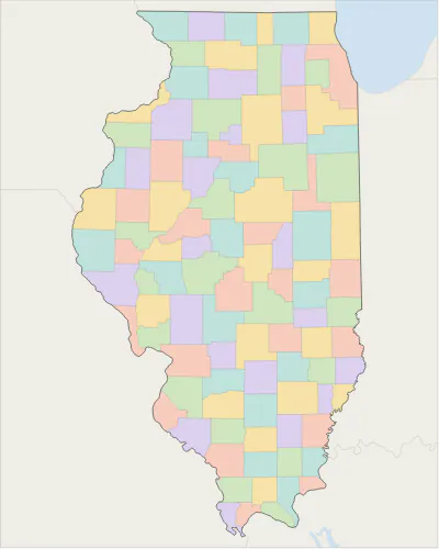 Illinois county map
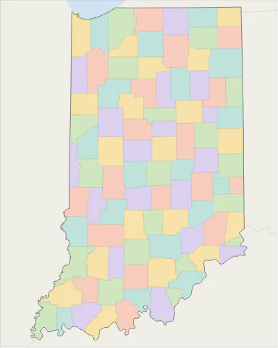 Indiana county map
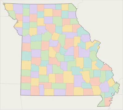 Missouri county map
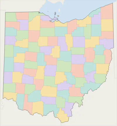 Ohio county map
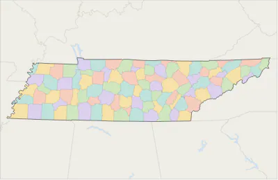 Tennessee county map
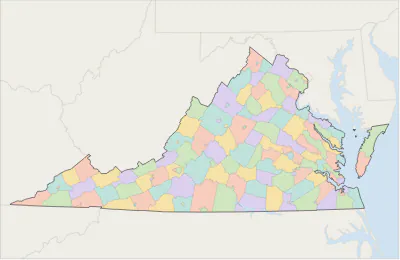 Virginia county map
 West Virginia county map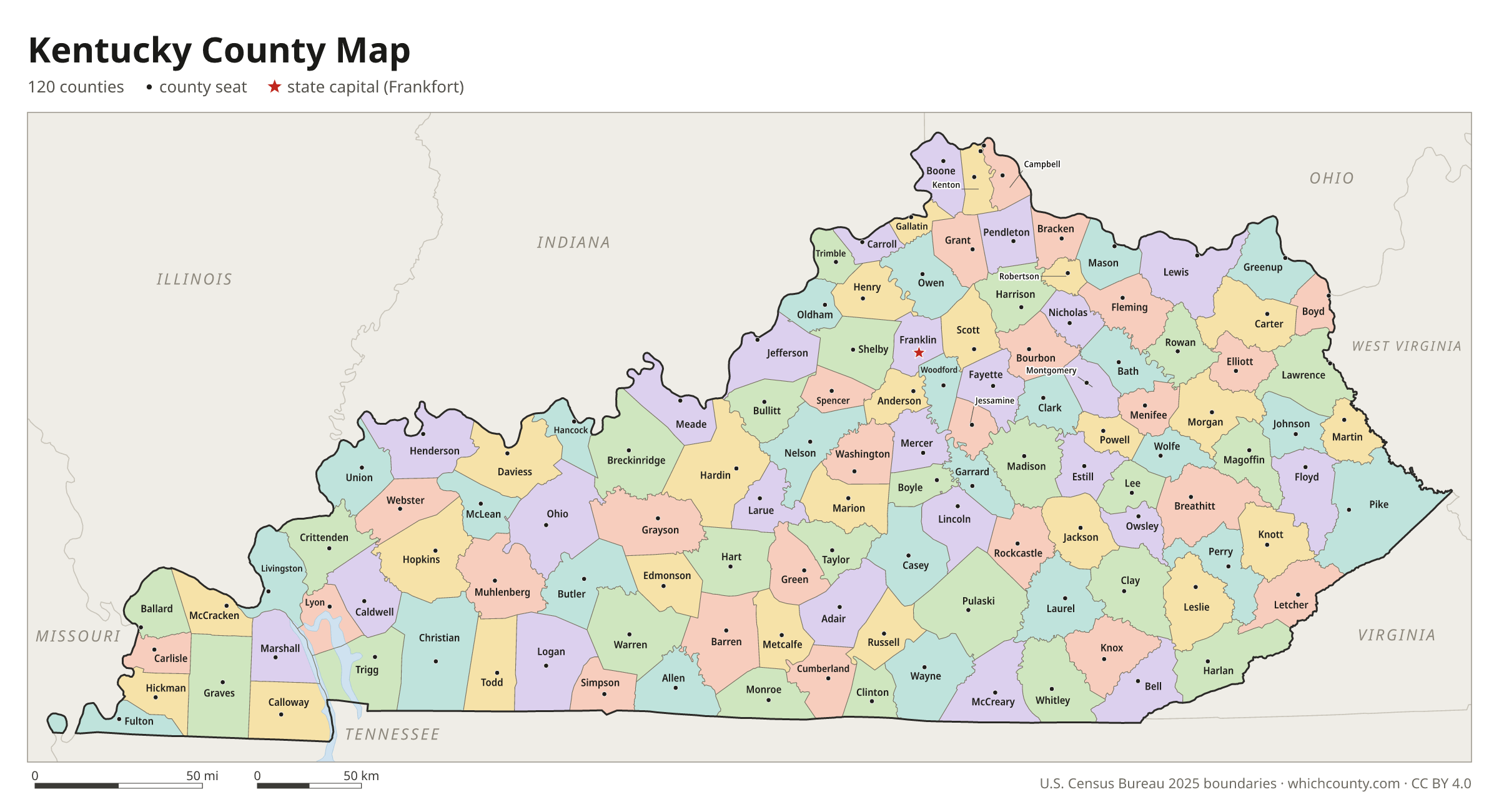
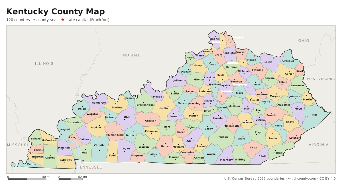
Kentucky counties: questions and answers
- How many counties are in Kentucky?
- Kentucky has 120 counties.
- What is the largest county in Kentucky?
- By land area, Pike County is the largest (786 sq mi). By population, Jefferson County is the largest, with 795,222 people (2025 estimate).
- What is the smallest county in Kentucky?
- Gallatin County is the smallest by land area (98.3 sq mi). Robertson County has the fewest people: 2,325 (2025 estimate).
- What is the wealthiest county in Kentucky?
- By median household income, Oldham County ranks first with $122,497 (American Community Survey 2020–2024). The lowest is Owsley County at $22,188.
- What county is Louisville in?
- Louisville is in Jefferson County.
- What county is Lexington in?
- Lexington is in Fayette County.
- What county is Bowling Green in?
- Bowling Green is in Warren County.
- What county is Frankfort in?
- Frankfort, the state capital, is in Franklin County.
- How can I see county lines on Google Maps?
- Google Maps does not draw county lines. Download the KML file from the printable maps section above and import it into Google My Maps (Create a new map › Import) or open it in Google Earth to see every Kentucky county boundary on top of Google's map.
- Can I use this map for free?
- Yes. The maps and files on this page are free to print, share and use in your own work, including commercial projects, under the CC BY 4.0 licence. Please credit “WhichCounty (whichcounty.com)”.
Use this map on your site
You may copy, print and publish these maps, also commercially, as long as you credit WhichCounty with a link (licence details). Paste this code to embed the map:
Sources and methodology
- Boundaries: U.S. Census Bureau, 2025 Cartographic Boundary Files (1:500,000), simplified for display. Projection: Lambert conformal conic fitted to Kentucky.
- Population: Census Bureau county estimates, Vintage 2025 (July 1, 2025), compared with the April 1, 2020 estimates base.
- Land area: Census Bureau 2026 Gazetteer files. Median household income: American Community Survey 2020–2024 5-year estimates.
- County seats and founding years: Wikidata (CC0), checked against state lists by WhichCounty. Cities: Census Bureau city and town estimates, Vintage 2025.
- What Would Kentucky Be Like Without Its Large Number of Counties (Kentucky Secretary of State, Land Office)
- County Formation Table (Kentucky Secretary of State, Land Office)
- Constitution of Kentucky, Section 63 (Kentucky General Assembly)
- Constitution of Kentucky, Section 64 (Kentucky General Assembly)
Found an error? Tell us. Last data update: October 4, 2026.