Clinton County, Ohio
County seat: Wilmington · Population 42,301 (2025) · 409 sq mi
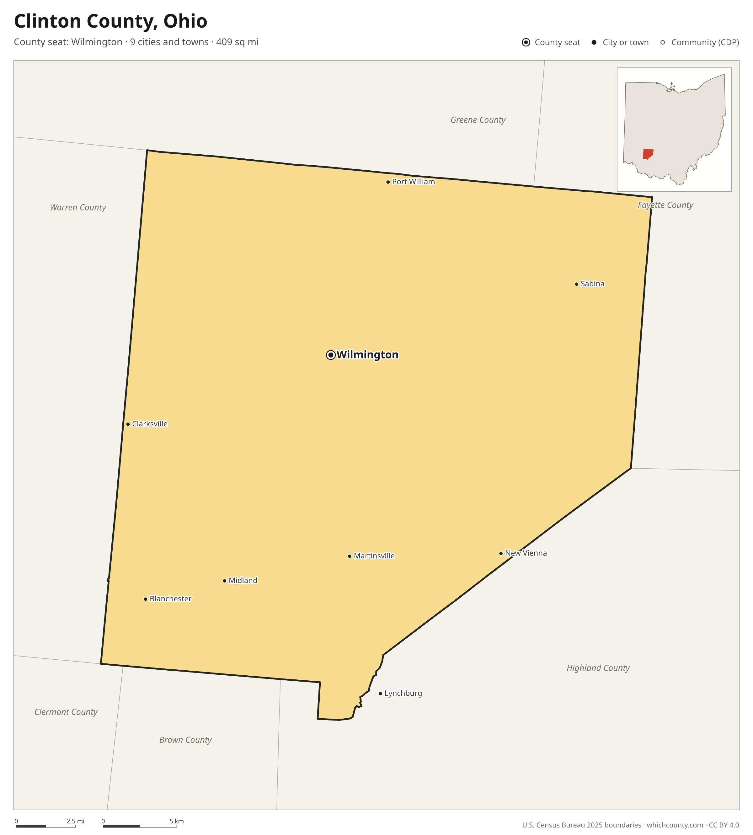
Clinton County is the 58th most populous of Ohio's 88 counties, with 42,301 people (2025 estimate). Its county seat is Wilmington. The map shows its 9 cities and towns and the 6 neighboring counties.

Clinton County facts
- County seat
- Wilmington
- Population (2025 estimate)
- 42,301 +0.7% since 2020
- Land area
- 409 sq mi 64th largest of 88
- Water area
- 4 sq mi
- Population density
- 104 per sq mi
- Established
- 1810
- Named after
- George Clinton vice president of the United States of America from 1805 to 1812 (1739–1812)
- Largest city
- Wilmington 12,802
- Median household income
- $70,407
- Cities and towns
- 9
- ZIP codes
- 13
- Time zone
- Eastern
- FIPS code
- 39027
Cities and towns in Clinton County
Clinton County has 9 incorporated cities, towns and villages. Populations count the people living inside Clinton County; cities that cross a county line also list the other counties.
| Name | Type | Population 2025 | Also in |
|---|---|---|---|
| Wilmington (county seat) | City | 12,802 | |
| Blanchester | Village | 4,250 | Warren County |
| Sabina | Village | 2,437 | |
| New Vienna | Village | 1,106 | |
| Clarksville | Village | 536 | |
| Martinsville | Village | 404 | |
| Midland | Village | 307 | |
| Port William | Village | 219 | |
| Lynchburg | Village | 1 | Highland County |
ZIP codes in Clinton County
13 ZIP codes reach into Clinton County. ZIP codes ignore county lines, so some also cover a neighboring county.
- 45068 also Warren and Greene counties
- 45107 also Warren, Brown and Clermont counties
- 45113 also Warren County
- 45135 also Highland and Fayette counties
- 45142 also Highland and Brown counties
- 45146
- 45148 also Brown County
- 45159 also Highland County
- 45164
- 45166
- 45169 also Fayette and Greene counties
- 45177
- 45335 also Greene and Fayette counties
Population of Clinton County, 2020–2025
Clinton County grew by 275 people (+0.7%) between April 2020 and July 2025: 222 more deaths than births and a net gain of 480 people from migration.
| Year (July 1) | Population |
|---|---|
| 2020 | 42,035 |
| 2021 | 42,142 |
| 2022 | 41,893 |
| 2023 | 42,007 |
| 2024 | 42,046 |
| 2025 | 42,301 |
Neighboring counties
- Warren County west · 257,181 people
- Highland County southeast · 43,823 people
- Fayette County northeast · 28,552 people
- Greene County north · 174,322 people
- Brown County south · 44,397 people
- Clermont County southwest · 216,977 people
Printable Clinton County map
The PDF is a vector file with real text: it prints sharp on Letter paper and you can search it for a town. The PNG is 2400 pixels wide for slides and documents. Both are free to use with a credit to WhichCounty.
- PDF (Letter) (90 KB)
- PNG (2400 px) (78 KB)
Paste this code to embed the map on your site:
Sources
- Boundaries: U.S. Census Bureau, 2025 Cartographic Boundary Files (1:500,000).
- Population: Census Bureau county and city estimates, Vintage 2025. CDP populations: American Community Survey 2020–2024.
- Places and ZIP codes: Census Bureau 2026 Gazetteer and 2020 ZIP Code Tabulation Area relationship files.
- County seat, founding year and name origin: Wikidata (CC0), checked against state sources.
Back to the Ohio county map with all 88 counties. Found an error? Tell us.