Mifflin County, Pennsylvania
County seat: Lewistown · Population 46,127 (2025) · 411 sq mi
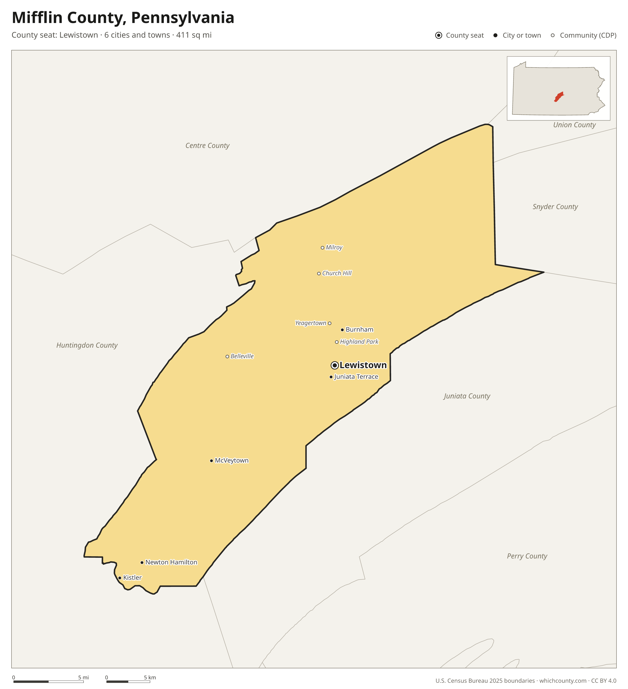
Mifflin County is the 47th most populous of Pennsylvania's 67 counties, with 46,127 people (2025 estimate). Its county seat is Lewistown. It is part of the District 2 region, one of the 11 PennDOT engineering districts. The map shows its 6 cities and towns and the 5 neighboring counties.

Mifflin County facts
- County seat
- Lewistown
- Population (2025 estimate)
- 46,127 −0% since 2020
- Land area
- 411 sq mi 54th largest of 67
- Water area
- 4 sq mi
- Population density
- 112 per sq mi
- Established
- 1789
- Named after
- Thomas Mifflin American politician (1744-1800)
- Largest city
- Lewistown 8,385
- Median household income
- $63,953
- Cities and towns
- 6 plus 20 CDPs
- ZIP codes
- 14
- Time zone
- Eastern
- FIPS code
- 42087
Cities and towns in Mifflin County
Mifflin County has 6 incorporated cities, towns and villages. Populations count the people living inside Mifflin County; cities that cross a county line also list the other counties.
| Name | Type | Population 2025 | Also in |
|---|---|---|---|
| Lewistown (county seat) | Borough | 8,385 | |
| Burnham | Borough | 1,970 | |
| Juniata Terrace | Borough | 550 | |
| McVeytown | Borough | 334 | |
| Kistler | Borough | 291 | |
| Newton Hamilton | Borough | 203 |
Unincorporated communities (CDPs)
Census-designated places are communities without their own city government; the county provides their services.
| Community | Population | Also in |
|---|---|---|
| Belleville | 1,951 | |
| Church Hill | 1,673 | |
| Milroy | 1,577 | |
| Highland Park | 1,177 | |
| Yeagertown | 1,165 | |
| Reedsville | 872 | |
| Strodes Mills | 836 | |
| Granville | 395 | |
| Allensville | 389 | |
| Mattawana | 334 | |
| Barrville | 322 | |
| Maitland | 253 | |
| Siglerville | 191 | |
| Atkinson Mills | 181 | |
| Alfarata | 148 | |
| Cedar Crest | 111 | |
| Longfellow | 110 | |
| Lumber City | 75 | |
| Wagner | 58 | |
| Potlicker Flats | 44 |
ZIP codes in Mifflin County
14 ZIP codes reach into Mifflin County. ZIP codes ignore county lines, so some also cover a neighboring county.
- 17002 also Huntingdon County
- 17004
- 17009
- 17029
- 17044
- 17051
- 17054
- 17060 also Huntingdon County
- 17063 also Snyder County
- 17066 also Huntingdon County
- 17075
- 17084
- 17099
- 17841 also Snyder County
Population of Mifflin County, 2020–2025
Mifflin County shrank by 11 people (−0%) between April 2020 and July 2025: 374 more deaths than births and a net gain of 364 people from migration.
| Year (July 1) | Population |
|---|---|
| 2020 | 46,144 |
| 2021 | 46,188 |
| 2022 | 45,993 |
| 2023 | 45,976 |
| 2024 | 46,023 |
| 2025 | 46,127 |
Neighboring counties
- Huntingdon County southwest · 43,001 people
- Juniata County east · 23,403 people
- Centre County northwest · 157,393 people
- Snyder County east · 39,655 people
- Union County northeast · 42,313 people
Printable Mifflin County map
The PDF is a vector file with real text: it prints sharp on Letter paper and you can search it for a town. The PNG is 2400 pixels wide for slides and documents. Both are free to use with a credit to WhichCounty.
- PDF (Letter) (92 KB)
- PNG (2400 px) (89 KB)
Paste this code to embed the map on your site:
Sources
- Boundaries: U.S. Census Bureau, 2025 Cartographic Boundary Files (1:500,000).
- Population: Census Bureau county and city estimates, Vintage 2025. CDP populations: American Community Survey 2020–2024.
- Places and ZIP codes: Census Bureau 2026 Gazetteer and 2020 ZIP Code Tabulation Area relationship files.
- County seat, founding year and name origin: Wikidata (CC0), checked against state sources.
Back to the Pennsylvania county map with all 67 counties. Found an error? Tell us.