Napa County, California
County seat: Napa · Population 132,949 (2025) · 752 sq mi
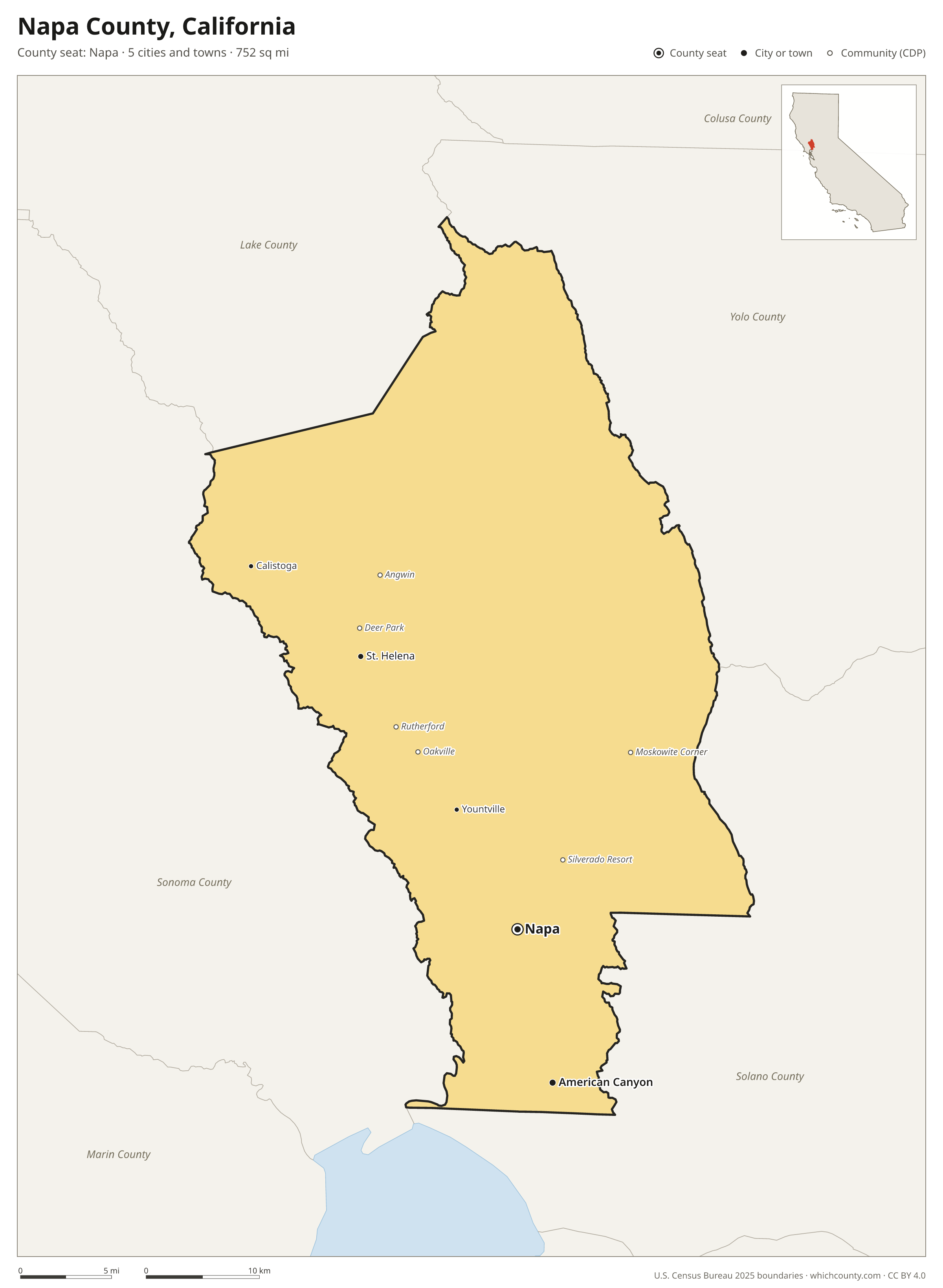
Napa County is the 34th most populous of California's 58 counties, with 132,949 people (2025 estimate). Its county seat is Napa. The map shows its 5 cities and towns and the 4 neighboring counties.

Napa County facts
- County seat
- Napa
- Population (2025 estimate)
- 132,949 −3.7% since 2020
- Land area
- 752 sq mi 48th largest of 58
- Water area
- 40 sq mi
- Population density
- 177 per sq mi
- Established
- 1850
- Named after
- Napa city in Napa County, California, United States
- Largest city
- Napa 76,562
- Median household income
- $111,471
- Cities and towns
- 5 plus 6 CDPs
- ZIP codes
- 13
- Time zone
- Pacific
- FIPS code
- 06055
Cities and towns in Napa County
Napa County has 5 incorporated cities, towns and villages. Populations count the people living inside Napa County; cities that cross a county line also list the other counties.
| Name | Type | Population 2025 | Also in |
|---|---|---|---|
| Napa (county seat) | City | 76,562 | |
| American Canyon | City | 22,773 | |
| St. Helena | City | 5,194 | |
| Calistoga | City | 4,954 | |
| Yountville | City | 3,198 |
Unincorporated communities (CDPs)
Census-designated places are communities without their own city government; the county provides their services.
| Community | Population | Also in |
|---|---|---|
| Angwin | 2,931 | |
| Silverado Resort | 892 | |
| Deer Park | 720 | |
| Moskowite Corner | 225 | |
| Rutherford | 84 | |
| Oakville | 0 |
ZIP codes in Napa County
13 ZIP codes reach into Napa County. ZIP codes ignore county lines, so some also cover a neighboring county.
- 94503 also Solano County
- 94508
- 94515 also Sonoma County
- 94558
- 94559
- 94562
- 94567
- 94573
- 94574 also Sonoma County
- 94576
- 94591 also Solano County
- 94599
- 95476 also Sonoma County
Population of Napa County, 2020–2025
Napa County shrank by 5,074 people (−3.7%) between April 2020 and July 2025: 377 more deaths than births and a net loss of 4,730 people from migration.
| Year (July 1) | Population |
|---|---|
| 2020 | 137,481 |
| 2021 | 136,266 |
| 2022 | 134,499 |
| 2023 | 133,628 |
| 2024 | 133,115 |
| 2025 | 132,949 |
Neighboring counties
- Sonoma County west · 486,444 people
- Solano County southeast · 455,376 people
- Yolo County northeast · 224,410 people
- Lake County northwest · 67,772 people
Printable Napa County map
The PDF is a vector file with real text: it prints sharp on Letter paper and you can search it for a town. The PNG is 2400 pixels wide for slides and documents. Both are free to use with a credit to WhichCounty.
- PDF (Letter) (137 KB)
- PNG (2400 px) (111 KB)
Paste this code to embed the map on your site:
Sources
- Boundaries: U.S. Census Bureau, 2025 Cartographic Boundary Files (1:500,000).
- Population: Census Bureau county and city estimates, Vintage 2025. CDP populations: American Community Survey 2020–2024.
- Places and ZIP codes: Census Bureau 2026 Gazetteer and 2020 ZIP Code Tabulation Area relationship files.
- County seat, founding year and name origin: Wikidata (CC0), checked against state sources.
Back to the California county map with all 58 counties. Found an error? Tell us.