Worcester County, Massachusetts
County seat: Worcester · Population 888,502 (2025) · 1,511 sq mi
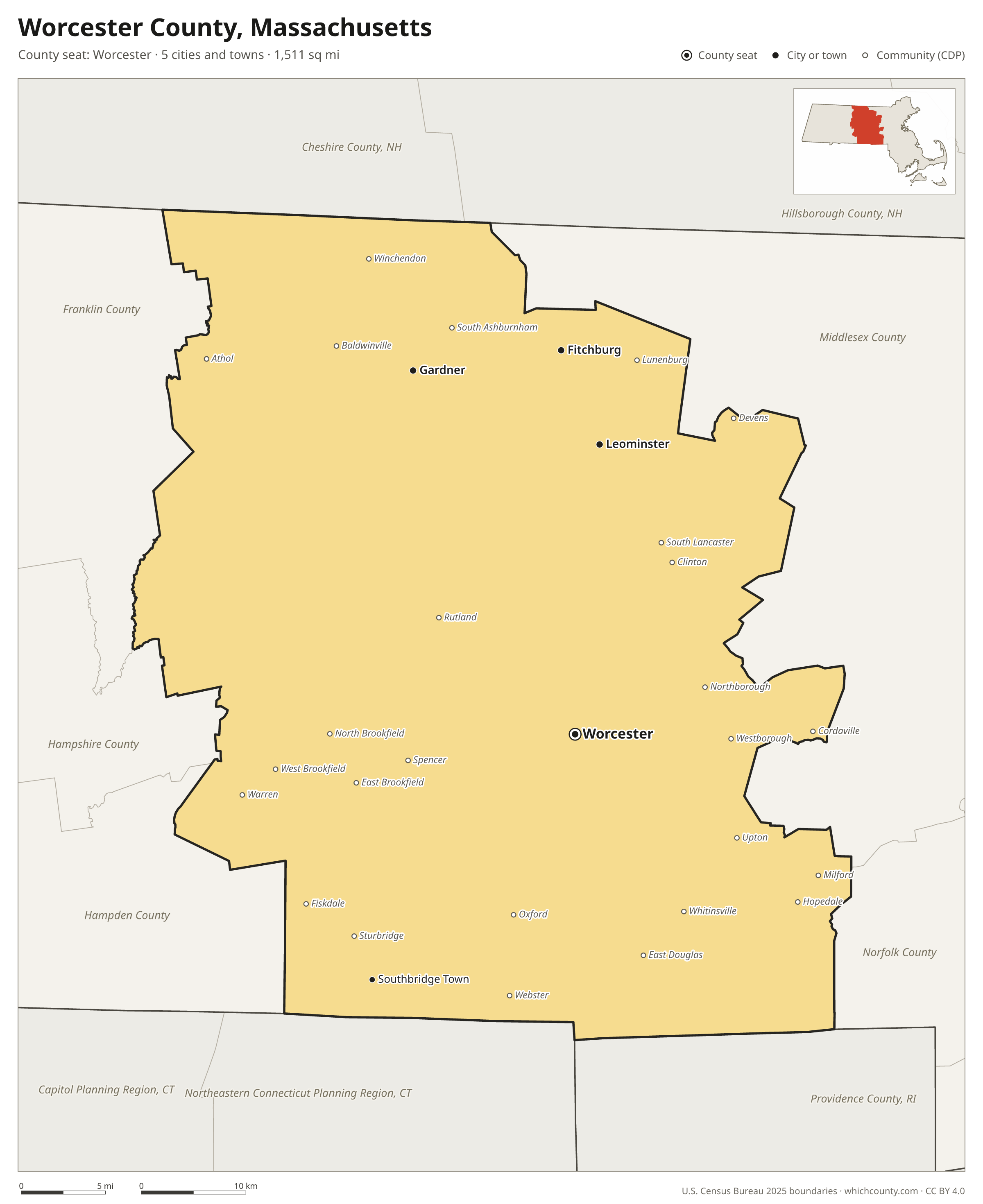
Worcester County is the 2nd most populous of Massachusetts's 14 counties, with 888,502 people (2025 estimate). Its county seat is Worcester. The map shows its 5 cities and towns and the 9 neighboring counties.

Worcester County facts
- County seat
- Worcester
- Population (2025 estimate)
- 888,502 +3.1% since 2020
- Land area
- 1,511 sq mi 1st largest of 14
- Water area
- 69 sq mi
- Population density
- 588 per sq mi
- Established
- 1731
- Named after
- Worcester county seat city in Worcester County, Massachusetts, United States
- Largest city
- Worcester 213,862
- Median household income
- $95,939
- Cities and towns
- 5 plus 30 CDPs
- ZIP codes
- 87
- Time zone
- Eastern
- FIPS code
- 25027
Cities and towns in Worcester County
Worcester County has 5 incorporated cities, towns and villages. Populations count the people living inside Worcester County; cities that cross a county line also list the other counties.
| Name | Type | Population 2025 | Also in |
|---|---|---|---|
| Worcester (county seat) | City | 213,862 | |
| Leominster | City | 44,194 | |
| Fitchburg | City | 42,136 | |
| Gardner | City | 21,483 | |
| Southbridge Town | City | 18,105 |
Unincorporated communities (CDPs)
Census-designated places are communities without their own city government; the county provides their services.
| Community | Population | Also in |
|---|---|---|
| Milford | 27,731 | |
| Webster | 12,228 | |
| Athol | 8,801 | |
| Clinton | 7,658 | |
| Whitinsville | 7,115 | |
| Northborough | 6,392 | |
| Oxford | 5,671 | |
| Spencer | 5,661 | |
| Westborough | 4,699 | |
| Hopedale | 4,360 | |
| Winchendon | 4,331 | |
| Upton | 3,234 | |
| Cordaville | 2,989 | |
| East Douglas | 2,987 | |
| North Brookfield | 2,659 | |
| Baldwinville | 2,528 | |
| Sturbridge | 2,443 | |
| Fiskdale | 2,311 | |
| South Lancaster | 2,177 | |
| Lunenburg | 2,057 | |
| Rutland | 2,019 | |
| West Brookfield | 1,563 | |
| South Ashburnham | 1,500 | |
| East Brookfield | 1,445 | |
| Devens | 1,440 | Middlesex County |
| Warren | 1,426 | |
| Brookfield | 828 | |
| Barre | 673 | |
| West Warren | 613 | |
| Petersham | 312 |
ZIP codes in Worcester County
87 ZIP codes reach into Worcester County. ZIP codes ignore county lines, so some also cover a neighboring county.
- 01005
- 01010 also Hampden County
- 01031
- 01037
- 01068
- 01074
- 01082 also Hampshire and Hampden counties
- 01083
- 01092
- 01094
- 01331 also Franklin County
- 01366
- 01368
- 01420
- 01430
- 01434 also Middlesex County
- 01436
- 01438
- 01440
- 01451
- 01452
- 01453
- 01462
- 01468
- 01473
- 01475
- 01501
- 01503
- 01504
- 01505
- 01506
- 01507
- 01510
- 01515
- 01516
- 01518
- 01519
- 01520
- 01522
- 01523
- 01524
- 01525
- 01527
- 01529
- 01531
- 01532
- 01534
- 01535
- 01536
- 01537
- 01540
- 01541
- 01542
- 01543
- 01545
- 01550
- 01560
- 01561
- 01562
- 01564
- 01566
- 01568
- 01569
- 01570
- 01571
- 01581
- 01583
- 01585
- 01588
- 01590
- 01602
- 01603
- 01604
- 01605
- 01606
- 01607
- 01608
- 01609
- 01610
- 01611
- 01612
- 01740
- 01745
- 01747
- 01756
- 01757
- 01772
Population of Worcester County, 2020–2025
Worcester County grew by 26,409 people (+3.1%) between April 2020 and July 2025: 4,308 more births than deaths and a net gain of 22,797 people from migration.
| Year (July 1) | Population |
|---|---|
| 2020 | 857,028 |
| 2021 | 862,157 |
| 2022 | 866,439 |
| 2023 | 874,225 |
| 2024 | 883,722 |
| 2025 | 888,502 |
Neighboring counties
- Middlesex County northeast · 1,669,979 people
- Franklin County northwest · 70,698 people
- Hampden County west · 464,338 people
- Northeastern Connecticut Planning Region, Connecticut south · 98,096 people
- Cheshire County, New Hampshire north · 78,269 people
- Hampshire County west · 164,065 people
- Providence County, Rhode Island southeast · 678,179 people
- Norfolk County east · 739,749 people
- Hillsborough County, New Hampshire north · 433,415 people
Printable Worcester County map
The PDF is a vector file with real text: it prints sharp on Letter paper and you can search it for a town. The PNG is 2400 pixels wide for slides and documents. Both are free to use with a credit to WhichCounty.
- PDF (Letter) (203 KB)
- PNG (2400 px) (144 KB)
Paste this code to embed the map on your site:
Sources
- Boundaries: U.S. Census Bureau, 2025 Cartographic Boundary Files (1:500,000).
- Population: Census Bureau county and city estimates, Vintage 2025. CDP populations: American Community Survey 2020–2024.
- Places and ZIP codes: Census Bureau 2026 Gazetteer and 2020 ZIP Code Tabulation Area relationship files.
- County seat, founding year and name origin: Wikidata (CC0), checked against state sources.
Back to the Massachusetts county map with all 14 counties. Found an error? Tell us.