Ulster County, New York
County seat: Kingston · Population 183,330 (2025) · 1,124 sq mi
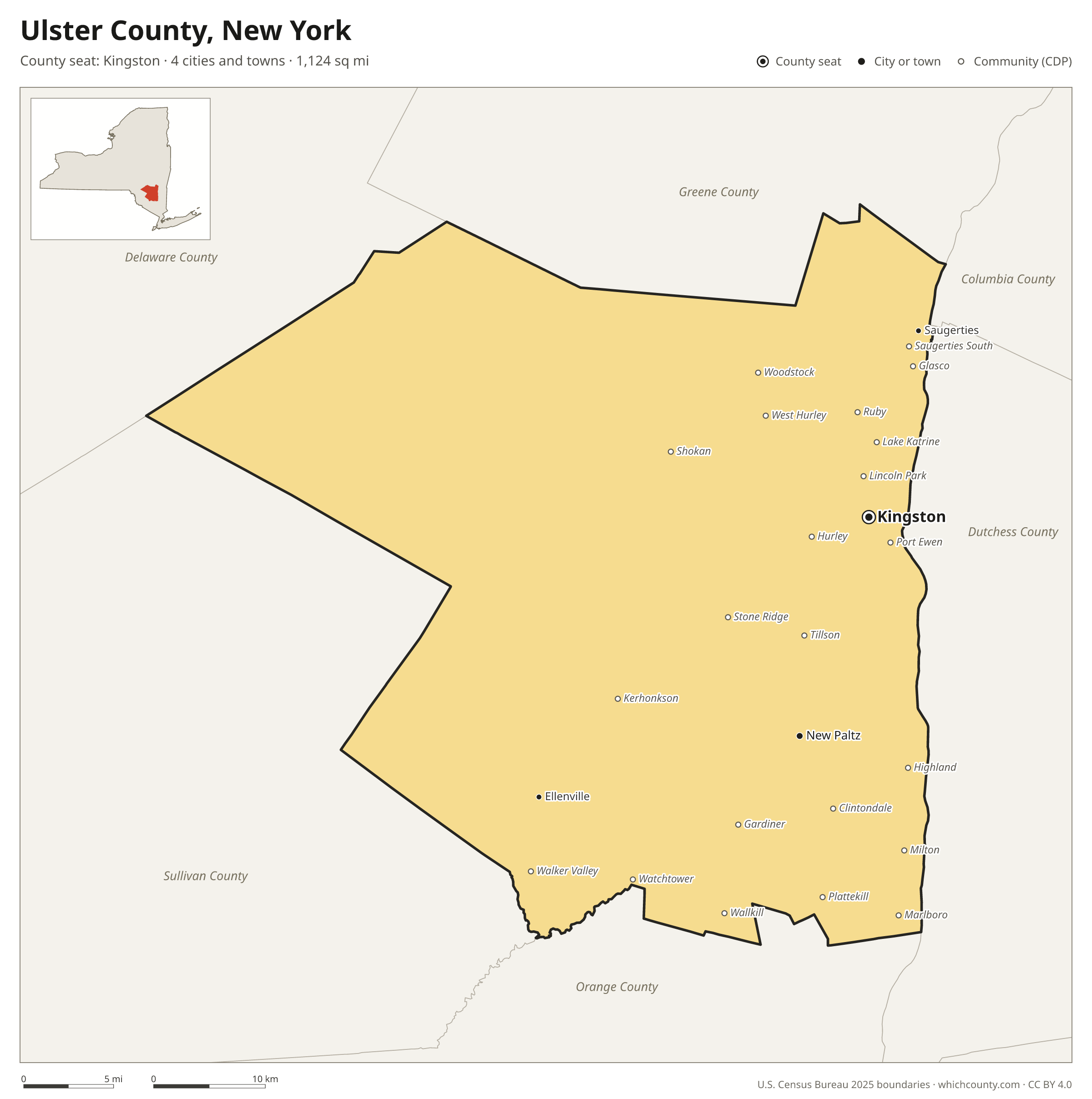
Ulster County is the 20th most populous of New York's 62 counties, with 183,330 people (2025 estimate). Its county seat is Kingston. The map shows its 4 cities and towns and the 6 neighboring counties.

Ulster County facts
- County seat
- Kingston
- Population (2025 estimate)
- 183,330 +0.8% since 2020
- Land area
- 1,124 sq mi 12th largest of 62
- Water area
- 37 sq mi
- Population density
- 163 per sq mi
- Established
- 1683
- Named after
- Ulster province in Ireland
- Largest city
- Kingston 23,942
- Median household income
- $86,271
- Cities and towns
- 4 plus 34 CDPs
- ZIP codes
- 63
- Time zone
- Eastern
- FIPS code
- 36111
Cities and towns in Ulster County
Ulster County has 4 incorporated cities, towns and villages. Populations count the people living inside Ulster County; cities that cross a county line also list the other counties.
| Name | Type | Population 2025 | Also in |
|---|---|---|---|
| Kingston (county seat) | City | 23,942 | |
| New Paltz | Village | 8,689 | |
| Ellenville | Village | 4,201 | |
| Saugerties | Village | 3,853 |
Unincorporated communities (CDPs)
Census-designated places are communities without their own city government; the county provides their services.
| Community | Population | Also in |
|---|---|---|
| Highland | 6,367 | |
| Watchtower | 3,974 | |
| Marlboro | 3,679 | |
| Port Ewen | 3,426 | |
| Hurley | 3,346 | |
| Lincoln Park | 2,431 | |
| Saugerties South | 2,251 | |
| Woodstock | 2,239 | |
| Glasco | 2,210 | |
| Lake Katrine | 2,176 | |
| Stone Ridge | 1,884 | |
| Clintondale | 1,784 | |
| Milton | 1,679 | |
| Kerhonkson | 1,677 | |
| West Hurley | 1,673 | |
| Tillson | 1,530 | |
| Wallkill | 1,355 | |
| Walker Valley | 1,301 | |
| Gardiner | 1,210 | |
| Shokan | 1,196 | |
| Ruby | 1,098 | |
| Plattekill | 1,095 | |
| Zena | 997 | |
| Rosendale | 962 | |
| Hillside | 911 | |
| High Falls | 887 | |
| Napanoch | 776 | |
| Accord | 638 | |
| Rifton | 541 | |
| Cragsmoor | 481 | |
| Pine Hill | 317 | |
| Malden-on-Hudson | 275 | |
| Phoenicia | 271 | |
| East Kingston | 227 |
ZIP codes in Ulster County
63 ZIP codes reach into Ulster County. ZIP codes ignore county lines, so some also cover a neighboring county.
- 12401
- 12404
- 12406 also Delaware County
- 12409
- 12410
- 12411
- 12412
- 12416
- 12417
- 12419
- 12420
- 12428
- 12429
- 12432
- 12433
- 12435
- 12440
- 12441 also Delaware County
- 12443
- 12446
- 12448
- 12449
- 12453
- 12455 also Delaware County
- 12456
- 12457
- 12458 also Sullivan County
- 12461
- 12463 also Greene County
- 12464
- 12465 also Delaware County
- 12466
- 12471
- 12472
- 12475
- 12477
- 12480 also Greene County
- 12481
- 12483 also Sullivan County
- 12484
- 12486
- 12487
- 12489
- 12490
- 12491
- 12493
- 12494
- 12495
- 12498
- 12515
- 12525
- 12528
- 12542 also Orange County
- 12547
- 12548
- 12561
- 12566 also Orange and Sullivan counties
- 12589 also Orange County
- 12725 also Sullivan County
- 12740 also Sullivan County
- 12758 also Sullivan and Delaware counties
- 12763 also Sullivan County
- 12789 also Sullivan County
Population of Ulster County, 2020–2025
Ulster County grew by 1,495 people (+0.8%) between April 2020 and July 2025: 2,548 more deaths than births and a net gain of 4,294 people from migration.
| Year (July 1) | Population |
|---|---|
| 2020 | 181,304 |
| 2021 | 183,636 |
| 2022 | 182,546 |
| 2023 | 182,956 |
| 2024 | 183,095 |
| 2025 | 183,330 |
Neighboring counties
- Sullivan County southwest · 80,586 people
- Dutchess County southeast · 300,708 people
- Greene County north · 47,238 people
- Orange County south · 417,669 people
- Delaware County northwest · 44,305 people
- Columbia County northeast · 60,168 people
Printable Ulster County map
The PDF is a vector file with real text: it prints sharp on Letter paper and you can search it for a town. The PNG is 2400 pixels wide for slides and documents. Both are free to use with a credit to WhichCounty.
- PDF (Letter) (148 KB)
- PNG (2400 px) (105 KB)
Paste this code to embed the map on your site:
Sources
- Boundaries: U.S. Census Bureau, 2025 Cartographic Boundary Files (1:500,000).
- Population: Census Bureau county and city estimates, Vintage 2025. CDP populations: American Community Survey 2020–2024.
- Places and ZIP codes: Census Bureau 2026 Gazetteer and 2020 ZIP Code Tabulation Area relationship files.
- County seat, founding year and name origin: Wikidata (CC0), checked against state sources.
Back to the New York county map with all 62 counties. Found an error? Tell us.