Gray County, Texas
County seat: Pampa · Population 20,919 (2025) · 926 sq mi
Gray County is the 116th most populous of Texas's 254 counties, with 20,919 people (2025 estimate). Its county seat is Pampa. It is part of the High Plains region, one of the 12 Texas Comptroller economic regions. The map shows its 3 cities and towns and the 7 neighboring counties.

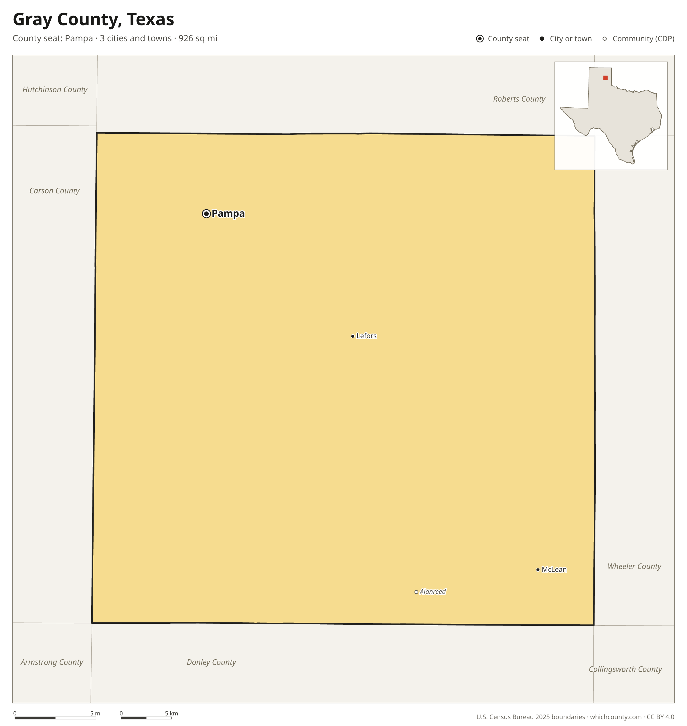
Gray County facts
- County seat
- Pampa
- Population (2025 estimate)
- 20,919 −1.5% since 2020
- Land area
- 926 sq mi 102nd largest of 254
- Water area
- 3 sq mi
- Population density
- 23 per sq mi
- Established
- 1876
- Named after
- Peter W. Gray American lawyer, judge, and legislator from Texas
- Largest city
- Pampa 16,414
- Median household income
- $59,614
- Cities and towns
- 3 plus 1 CDPs
- ZIP codes
- 9
- Time zone
- Central
- FIPS code
- 48179
Cities and towns in Gray County
Gray County has 3 incorporated cities, towns and villages. Populations count the people living inside Gray County; cities that cross a county line also list the other counties.
| Name | Type | Population 2025 | Also in |
|---|---|---|---|
| Pampa (county seat) | City | 16,414 | |
| McLean | Town | 634 | |
| Lefors | Town | 426 |
Unincorporated communities (CDPs)
Census-designated places are communities without their own city government; the county provides their services.
| Community | Population | Also in |
|---|---|---|
| Alanreed | 15 |
ZIP codes in Gray County
9 ZIP codes reach into Gray County. ZIP codes ignore county lines, so some also cover a neighboring county.
- 79002
- 79039 also Carson, Armstrong and Donley counties
- 79054
- 79057 also Donley, Wheeler and Collingsworth counties
- 79059 also Roberts County
- 79061 also Wheeler County
- 79065 also Roberts County
- 79066
- 79097 also Carson County
Population of Gray County, 2020–2025
Gray County shrank by 307 people (−1.5%) between April 2020 and July 2025: 348 more deaths than births and a net gain of 40 people from migration.
| Year (July 1) | Population |
|---|---|
| 2020 | 21,197 |
| 2021 | 21,118 |
| 2022 | 20,951 |
| 2023 | 20,958 |
| 2024 | 20,931 |
| 2025 | 20,919 |
Neighboring counties
- Donley County south · 3,213 people
- Roberts County north · 867 people
- Carson County west · 5,805 people
- Wheeler County east · 4,773 people
- Armstrong County southwest · 1,843 people
- Collingsworth County southeast · 2,487 people
- Hemphill County northeast · 3,083 people
Printable Gray County map
The PDF is a vector file with real text: it prints sharp on Letter paper and you can search it for a town. The PNG is 2400 pixels wide for slides and documents. Both are free to use with a credit to WhichCounty.
- PDF (Letter) (132 KB)
- PNG (2400 px) (56 KB)
Paste this code to embed the map on your site:
Sources
- Boundaries: U.S. Census Bureau, 2025 Cartographic Boundary Files (1:500,000).
- Population: Census Bureau county and city estimates, Vintage 2025. CDP populations: American Community Survey 2020–2024.
- Places and ZIP codes: Census Bureau 2026 Gazetteer and 2020 ZIP Code Tabulation Area relationship files.
- County seat, founding year and name origin: Wikidata (CC0), checked against state sources.
Back to the Texas county map with all 254 counties. Found an error? Tell us.