Baltimore Metro Area Counties
7 counties · 2.9 million people (2025) · 2,601 sq mi
The Baltimore metro area (officially the Baltimore-Columbia-Towson, MD Metropolitan Statistical Area) has 7 counties in Maryland, with 2,857,781 people in 2025. Baltimore County is the most populous.

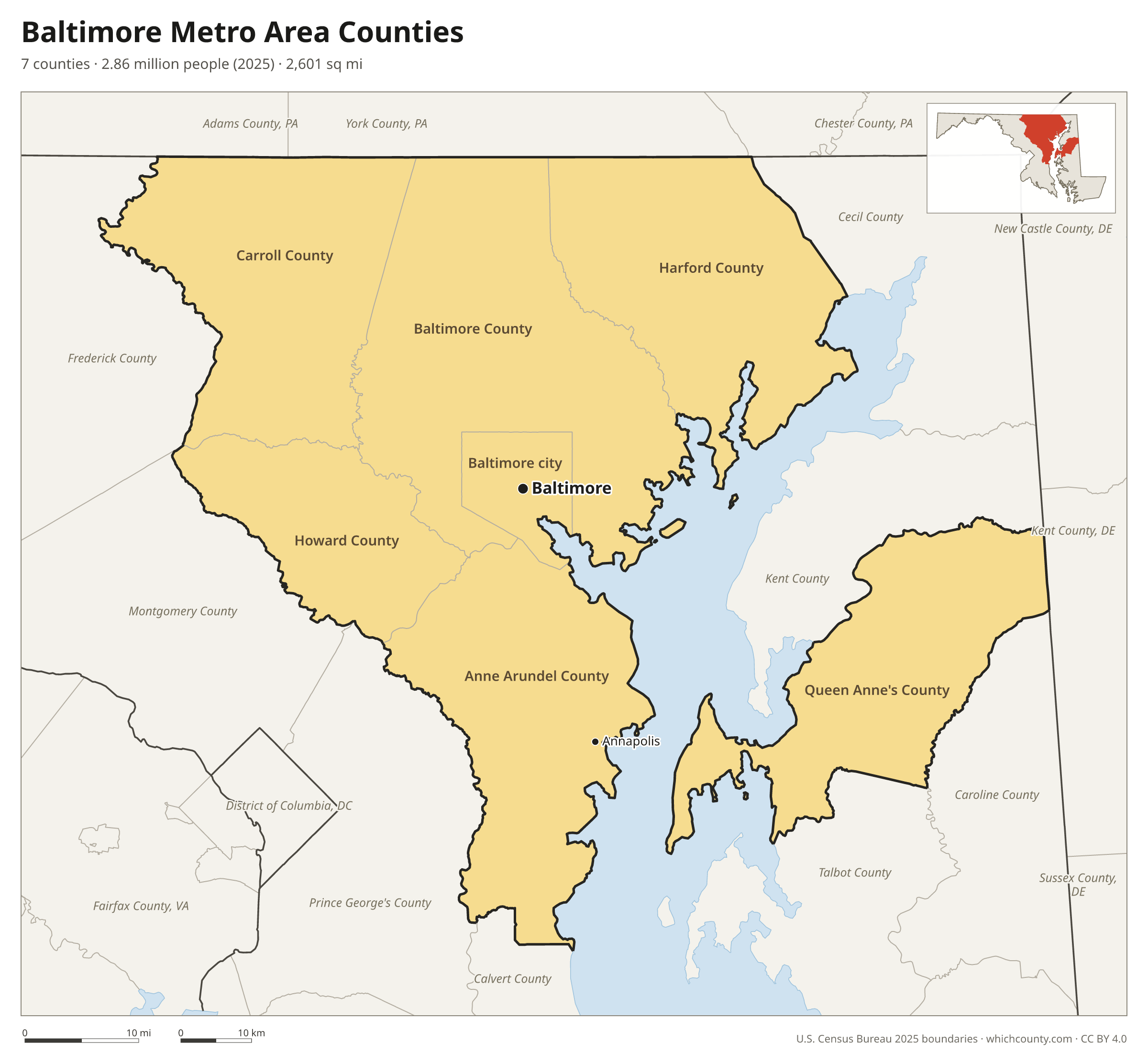
The 7 counties of the Baltimore metro area
Sorted by population. 4 are central counties (the urban core); the others are outlying counties tied to it by commuting.
| County | County seat | Population 2025 | Change since 2020 | Land area (sq mi) | Type |
|---|---|---|---|---|---|
| Baltimore County | Towson | 847,650 | −0.8% | 598 | Central |
| Anne Arundel County | Annapolis | 603,380 | +1.8% | 415 | Central |
| Baltimore city | Baltimore | 569,997 | −2.7% | 81 | Central |
| Howard County | Ellicott City | 339,183 | +2.1% | 251 | Central |
| Harford County | Bel Air | 266,446 | +2.1% | 437 | Outlying |
| Carroll County | Westminster | 176,677 | +2.2% | 448 | Outlying |
| Queen Anne's County | Centreville | 54,448 | +9.2% | 372 | Outlying |
The metro area is part of the larger Washington-Baltimore-Arlington, DC-MD-VA-WV-PA Combined Statistical Area.
Printable map
The PDF is a vector file for Letter paper; the PNG is 2400 pixels wide. Both are free to use with a credit to WhichCounty.
County maps of Maryland
Other metro areas
- New York City Metro Area Counties 22 counties
- Los Angeles Metro Area Counties 2 counties
- Chicago Metro Area Counties 13 counties
- Dallas–Fort Worth Metro Area Counties 11 counties
- Houston Metro Area Counties 10 counties
- Atlanta Metro Area Counties 29 counties
- Washington, D.C. Metro Area Counties 23 counties
- Miami Metro Area Counties 3 counties
- Philadelphia Metro Area Counties 11 counties
- Phoenix Metro Area Counties 2 counties
- Boston Metro Area Counties 7 counties
- Inland Empire Metro Area Counties 2 counties
- San Francisco–Oakland Metro Area Counties 5 counties
- Detroit Metro Area Counties 6 counties
- Seattle Metro Area Counties 3 counties
- Minneapolis–St. Paul Metro Area Counties 15 counties
- Tampa Bay Metro Area Counties 4 counties
- Denver Metro Area Counties 10 counties
- Orlando Metro Area Counties 4 counties
- Charlotte Metro Area Counties 11 counties
- St. Louis Metro Area Counties 15 counties
- San Antonio Metro Area Counties 8 counties
- Austin Metro Area Counties 5 counties
- Portland Metro Area Counties 7 counties
- Cleveland Metro Area Counties 6 counties
- San Francisco Bay Area Counties 9 counties
Sources
- Metro area definition: U.S. Office of Management and Budget, Core Based Statistical Areas, July 2023 delineation (published by the Census Bureau).
- Boundaries: U.S. Census Bureau 2025 cartographic boundary files. Population: Census Bureau estimates, Vintage 2025.